Property Record
1060 S Watson Rd, Buckeye, AZ 85326


NEARBY LISTINGS FOR SALE OR LEASE
-
-
View all Buckeye listings for sale on LoopNet.com
Property Detail
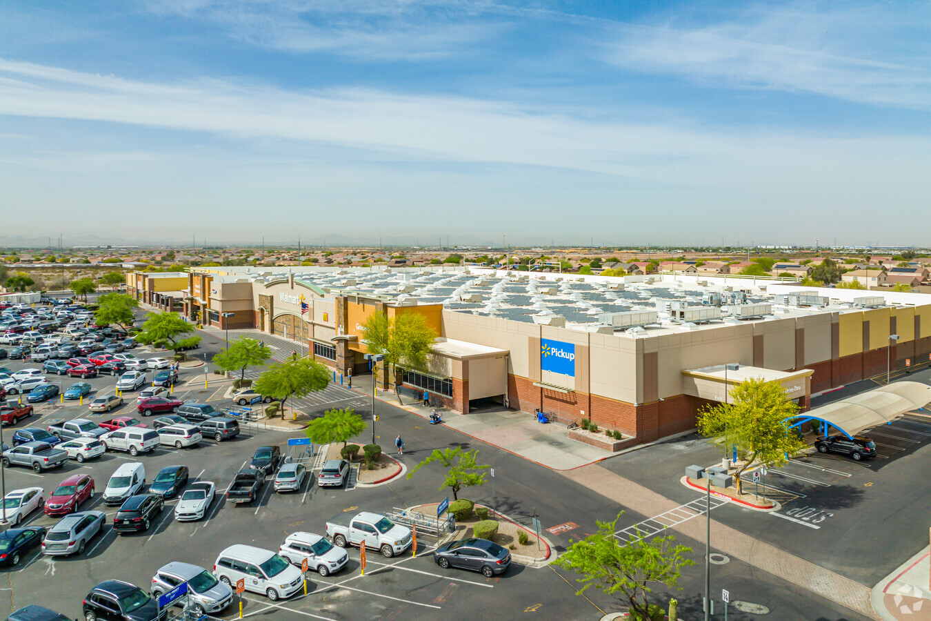
1060 S Watson Rd
Phoenix-Mesa-Scottsdale, AZ
Sundance Towne Center
504-19-953
SUNDANCE TOWNE CENTER MCR 800-38
Regionalshoppingcenterormallwithanchorstore
Maricopa
X
Arizona
04013C2120M
1
2024
23.03 AC
2025
South Buckeye
050615
Phoenix
217,965 SF
DEMOGRAPHICS near 1060 S Watson Rd
1 Mile
3 Mile
5 Mile
2024 Total Population
9,208
39,181
76,741
2029 Population
10,132
42,958
84,206
Pop Growth 2024-2029
+ 10.03%
+ 9.64%
+ 9.73%
Average Age
37
35
35
2024 Total Households
2,916
11,598
23,027
HH Growth 2024-2029
+ 10.19%
+ 9.76%
+ 9.82%
Median Household Inc
$78,768
$81,476
$85,676
Avg Household Size
3.10
3.30
3.30
2024 Avg HH Vehicles
2.00
2.00
2.00
Median Home Value
$285,388
$281,378
$314,639
Median Year Built
2008
2006
2008
Nearby Places
- Restaurants
- Banks
- Shops
- Fitness
- Groceries
Nearby Properties
Address
Land Use
TOTAL SIZE
Lot Size
Zoning
Address
Land Use
TOTAL SIZE
Lot Size
Zoning
862,622 SF
75.39 AC
GC
Address
Land Use
TOTAL SIZE
Lot Size
Zoning
269,665 SF
54.66 AC
PC
Address
Land Use
TOTAL SIZE
Lot Size
Zoning
326,103 SF
21.54 AC
Address
Land Use
TOTAL SIZE
Lot Size
Zoning
1.98 AC
PAD
Address
Land Use
TOTAL SIZE
Lot Size
Zoning
93,337 SF
15.37 AC
PC
Address
Land Use
TOTAL SIZE
Lot Size
Zoning
78,774 SF
7.57 AC
PUD
Address
Land Use
TOTAL SIZE
Lot Size
Zoning
108,818 SF
10.65 AC
C-C
Address
Land Use
TOTAL SIZE
Lot Size
Zoning
78,165 SF
15.81 AC
PUD
Address
Land Use
TOTAL SIZE
Lot Size
Zoning
858,000 SF
69.08 AC
GC
Address
Land Use
TOTAL SIZE
Lot Size
Zoning
73,130 SF
3.68 AC
PAD
Address
Land Use
TOTAL SIZE
Lot Size
Zoning
138,134 SF
13.14 AC
PAD
Address
Land Use
TOTAL SIZE
Lot Size
Zoning
72,254 SF
13.66 AC
PAD
Address
Land Use
TOTAL SIZE
Lot Size
Zoning
75,026 SF
14.07 AC
PAD
Address
Land Use
TOTAL SIZE
Lot Size
Zoning
57,950 SF
9.89 AC
PAD
Address
Land Use
TOTAL SIZE
Lot Size
Zoning
85,712 SF
15.18 AC
PR
Address
Land Use
TOTAL SIZE
Lot Size
Zoning
102,640 SF
3.73 AC
PC
Address
Land Use
TOTAL SIZE
Lot Size
Zoning
40,104 SF
4.74 AC
PAD
Address
Land Use
TOTAL SIZE
Lot Size
Zoning
55,485 SF
2.10 AC
PC
Address
Land Use
TOTAL SIZE
Lot Size
Zoning
188,937 SF
20.87 AC
Address
Land Use
TOTAL SIZE
Lot Size
Zoning
50,445 SF
2.04 AC
PAD
Address
Land Use
TOTAL SIZE
Lot Size
Zoning
38,620 SF
20.86 AC
C-G
Address
Land Use
TOTAL SIZE
Lot Size
Zoning
48,556 SF
7.68 AC
Address
Land Use
TOTAL SIZE
Lot Size
Zoning
26,239 SF
6.26 AC
RR
Address
Land Use
TOTAL SIZE
Lot Size
Zoning
30,320 SF
13.80 AC
PAD
Address
Land Use
TOTAL SIZE
Lot Size
Zoning
106,305 SF
9.11 AC
C-G
Address
Land Use
TOTAL SIZE
Lot Size
Zoning
65,023 SF
12.52 AC
C-C
Address
Land Use
TOTAL SIZE
Lot Size
Zoning
31,400 SF
8.42 AC
R-43
Address
Land Use
TOTAL SIZE
Lot Size
Zoning
58,500 SF
10.58 AC
C2
Address
Land Use
TOTAL SIZE
Lot Size
Zoning
29,836 SF
1.66 AC
PC
The World's #1 Commercial Real Estate Marketplace
Connect with us
© 2025 CoStar Group
The information above has been obtained from sources believed reliable. While we do not doubt its accuracy we have not verified it and make no guarantee, warranty or representation about it. It is your responsibility to independently confirm its accuracy and completeness. Any projections, opinions, assumptions, or estimates used are for example only and do not represent the current or future performance of the property. The value of this transaction to you depends on tax and other factors which should be evaluated by your tax, financial, and legal advisors. You and your advisors should conduct a careful, independent investigation of the property to determine to your satisfaction the suitability of the property for your needs.