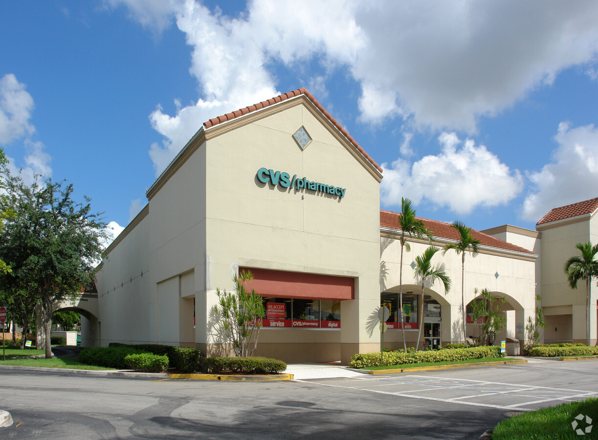
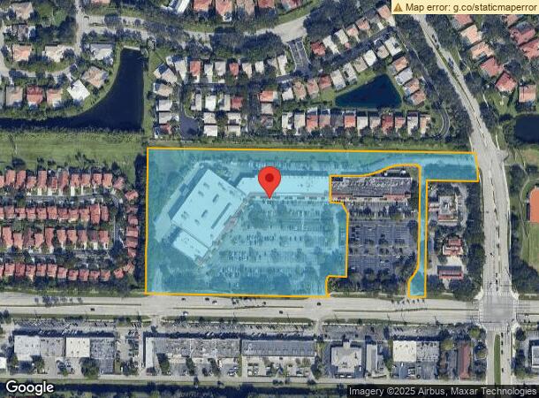
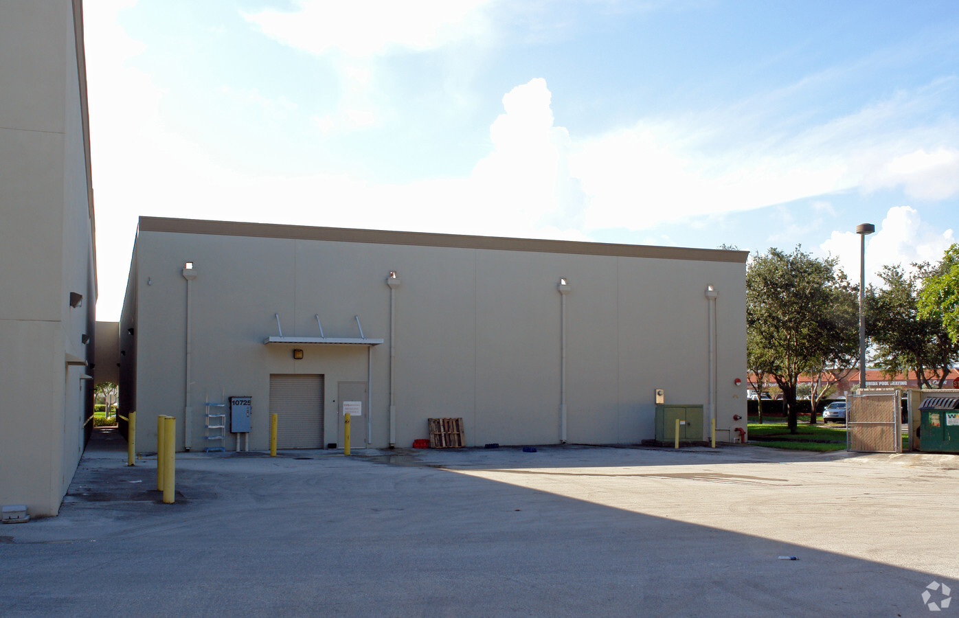
Property Record
10633 Wiles Rd, Coral Springs, FL 33076
NEARBY LISTINGS FOR SALE OR LEASE
Property Detail
10633 Wiles Rd
48-41-08-04-0020
Brookside Square 147-5 B
Regionalshoppingcenterormallwithanchorstore
BROOKSIDE SQUARE 147-5 B POR OF PAR A DESC AS BEG AT SW COR SAID PAR A;N 577,E 1298.86 SELY 38.35,SE 73.40,W 203.19,S 462,W 66,NE 40.32,NELY 43.93, NELY & NLY 70.86,NE 356.26,NW & WLY 31.42,W 30.40,WLY ARC DIST 101.47,SWLY & WLY ARC DIST 113.2 NW 97.
AE
Broward
12099C1150F
Florida
2024
11.66 AC
2025
NW Broward/Coral Springs
010611
South Florida
86,119 SF
Fort Lauderdale-Pompano Beach-Deerfield Beach, FL
DEMOGRAPHICS near 10633 Wiles Rd
1 Mile
3 Mile
5 Mile
2024 Total Population
16,701
101,651
239,469
2029 Population
16,304
99,707
236,451
Pop Growth 2024-2029
(2.38%)
(1.91%)
(1.26%)
Average Age
37
38
40
2024 Total Households
5,027
33,515
83,678
HH Growth 2024-2029
(3.04%)
(2.49%)
(1.74%)
Median Household Inc
$96,964
$87,144
$83,529
Avg Household Size
3.10
2.90
2.70
2024 Avg HH Vehicles
2.00
2.00
2.00
Median Home Value
$460,514
$451,820
$395,653
Median Year Built
1990
1986
1987
Nearby Places
- Restaurants
- Banks
- Shops
- Fitness
- Groceries
PUBLIC TRANSPORTATION
COMMUTER RAIL
Pompano Beach (Tri-County Commuter - South Florida Regional Transportation Authority (Tri-Rail))
DRIVE
WALK
Distance
Pompano Beach (Tri-County Commuter - South Florida Regional Transportation Authority (Tri-Rail))
19 min
9.6 mi
AIRPORT
Fort Lauderdale/Hollywood International
DRIVE
WALK
Distance
Fort Lauderdale/Hollywood International
41 min
21.2 mi
Palm Beach International
DRIVE
WALK
Distance
Palm Beach International
52 min
38.9 mi
Freight Ports
Port Everglades
DRIVE
WALK
Distance
Port Everglades
40 min
22.7 mi
SALE & LEASE HISTORY
LISTING DATE
SALE/LEASE

Sep 25, 2016
For Lease
Nearby Properties
Address
Land Use
TOTAL SIZE
Lot Size
Zoning
Address
Land Use
TOTAL SIZE
Lot Size
Zoning
447,756 SF
45.30 AC
BCRM-5
Address
Land Use
TOTAL SIZE
Lot Size
Zoning
457,406 SF
21.26 AC
MC
Address
Land Use
TOTAL SIZE
Lot Size
Zoning
640,399 SF
2.41 AC
Address
Land Use
TOTAL SIZE
Lot Size
Zoning
572,683 SF
38.41 AC
IRD
Address
Land Use
TOTAL SIZE
Lot Size
Zoning
354,535 SF
33.95 AC
RM-15
Address
Land Use
TOTAL SIZE
Lot Size
Zoning
345,189 SF
9.66 AC
RM-30
Address
Land Use
TOTAL SIZE
Lot Size
Zoning
421,001 SF
44.62 AC
CF
Address
Land Use
TOTAL SIZE
Lot Size
Zoning
345,021 SF
13.79 AC
RM-20
Address
Land Use
TOTAL SIZE
Lot Size
Zoning
293,096 SF
11.84 AC
RM-20
Address
Land Use
TOTAL SIZE
Lot Size
Zoning
260,897 SF
12.62 AC
RM-20
Address
Land Use
TOTAL SIZE
Lot Size
Zoning
401,920 SF
16.93 AC
RM-15
Address
Land Use
TOTAL SIZE
Lot Size
Zoning
440,886 SF
23.17 AC
IRD
Address
Land Use
TOTAL SIZE
Lot Size
Zoning
271,043 SF
19.02 AC
RM-20
Address
Land Use
TOTAL SIZE
Lot Size
Zoning
349,250 SF
19.90 AC
CF
Address
Land Use
TOTAL SIZE
Lot Size
Zoning
304,837 SF
32.08 AC
CF-E
Address
Land Use
TOTAL SIZE
Lot Size
Zoning
123,317 SF
10.48 AC
B-2
Address
Land Use
TOTAL SIZE
Lot Size
Zoning
209,123 SF
15.26 AC
RM-20
Address
Land Use
TOTAL SIZE
Lot Size
Zoning
22.25 AC
IRD
Address
Land Use
TOTAL SIZE
Lot Size
Zoning
182,867 SF
17.91 AC
RM-15
Address
Land Use
TOTAL SIZE
Lot Size
Zoning
293,533 SF
10.04 AC
RM-20
Address
Land Use
TOTAL SIZE
Lot Size
Zoning
150,273 SF
12.20 AC
DT-MU
Address
Land Use
TOTAL SIZE
Lot Size
Zoning
202,844 SF
20.37 AC
CF-E
Address
Land Use
TOTAL SIZE
Lot Size
Zoning
300,376 SF
6.04 AC
RM-15
Address
Land Use
TOTAL SIZE
Lot Size
Zoning
144,985 SF
6.95 AC
RM-20
Address
Land Use
TOTAL SIZE
Lot Size
Zoning
195,330 SF
24.21 AC
CF
Address
Land Use
TOTAL SIZE
Lot Size
Zoning
244,413 SF
5.72 AC
DT-MU
Address
Land Use
TOTAL SIZE
Lot Size
Zoning
127,577 SF
14.98 AC
B-2
Address
Land Use
TOTAL SIZE
Lot Size
Zoning
203,426 SF
21 AC
CF-E
Address
Land Use
TOTAL SIZE
Lot Size
Zoning
181,120 SF
69.34 AC
P
Address
Land Use
TOTAL SIZE
Lot Size
Zoning
190,622 SF
7.65 AC
RM-30
The World's #1 Commercial Real Estate Marketplace
Connect with us
© 2025 CoStar Group
The information above has been obtained from sources believed reliable. While we do not doubt its accuracy we have not verified it and make no guarantee, warranty or representation about it. It is your responsibility to independently confirm its accuracy and completeness. Any projections, opinions, assumptions, or estimates used are for example only and do not represent the current or future performance of the property. The value of this transaction to you depends on tax and other factors which should be evaluated by your tax, financial, and legal advisors. You and your advisors should conduct a careful, independent investigation of the property to determine to your satisfaction the suitability of the property for your needs.