Property Record
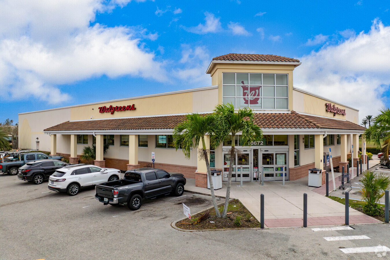
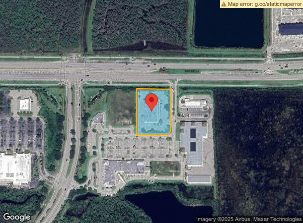
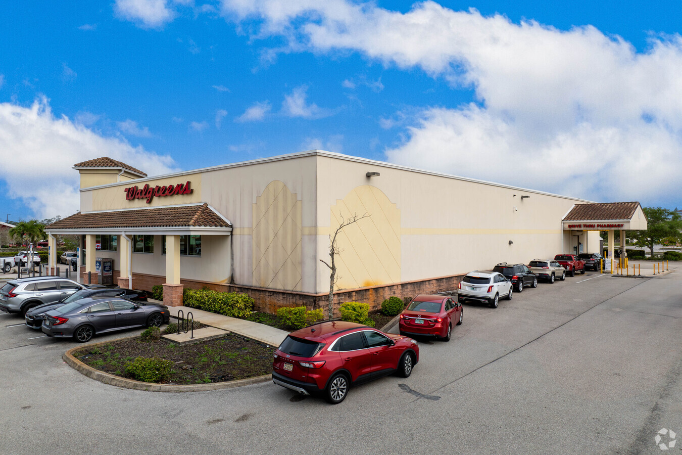
10672 Colonial Blvd, Fort Myers, FL 33913

NEARBY LISTINGS FOR SALE OR LEASE
Property Detail
10672 Colonial Blvd
35-44-25-P2-00001.0060
Colonial - Sr 82 E Of I-75
Storemultistory
PARCEL IN NE 1/4 DESC IN INST#2007-182273
AE
Lee
12071C0432F
Florida
2023
1.74 AC
2024
S Ft Myers/San Carlos
040128
Southwest Florida
16,236 SF
Cape Coral-Fort Myers, FL
DEMOGRAPHICS near 10672 Colonial Blvd
1 Mile
3 Mile
5 Mile
2024 Total Population
2,643
45,163
123,574
2029 Population
3,207
53,999
147,291
Pop Growth 2024-2029
+ 21.34%
+ 19.56%
+ 19.19%
Average Age
57
44
41
2024 Total Households
1,233
17,975
46,311
HH Growth 2024-2029
+ 21.09%
+ 19.92%
+ 19.22%
Median Household Inc
$81,650
$74,352
$65,124
Avg Household Size
2.00
2.30
2.50
2024 Avg HH Vehicles
1.00
2.00
2.00
Median Home Value
$360,899
$317,220
$287,792
Median Year Built
2009
2007
2004
Nearby Places
- Restaurants
- Banks
- Shops
- Fitness
- Groceries
PUBLIC TRANSPORTATION
AIRPORT
Southwest Florida International
DRIVE
WALK
Distance
Southwest Florida International
14 min
7.5 mi
Punta Gorda
DRIVE
WALK
Distance
Punta Gorda
35 min
28.4 mi
Freight Ports
Port Manatee
DRIVE
WALK
Distance
Port Manatee
115 min
100.1 mi
Nearby Properties
Address
Land Use
TOTAL SIZE
Lot Size
Zoning
Address
Land Use
TOTAL SIZE
Lot Size
Zoning
608,522 SF
38.57 AC
CG
Address
Land Use
TOTAL SIZE
Lot Size
Zoning
438,839 SF
66.95 AC
MU
Address
Land Use
TOTAL SIZE
Lot Size
Zoning
362,391 SF
12.80 AC
SDA
Address
Land Use
TOTAL SIZE
Lot Size
Zoning
475,045 SF
30.22 AC
PUD
Address
Land Use
TOTAL SIZE
Lot Size
Zoning
432,890 SF
18.88 AC
SDA
Address
Land Use
TOTAL SIZE
Lot Size
Zoning
77.79 AC
PUD
Address
Land Use
TOTAL SIZE
Lot Size
Zoning
425,658 SF
25.61 AC
CG
Address
Land Use
TOTAL SIZE
Lot Size
Zoning
16.13 AC
Address
Land Use
TOTAL SIZE
Lot Size
Zoning
286,629 SF
13.01 AC
SDA
Address
Land Use
TOTAL SIZE
Lot Size
Zoning
260,320 SF
8.81 AC
SDA
Address
Land Use
TOTAL SIZE
Lot Size
Zoning
261,340 SF
9.07 AC
CG
Address
Land Use
TOTAL SIZE
Lot Size
Zoning
580,121 SF
61.83 AC
IL
Address
Land Use
TOTAL SIZE
Lot Size
Zoning
324,346 SF
20 AC
C1
Address
Land Use
TOTAL SIZE
Lot Size
Zoning
333,614 SF
294.30 AC
AG-2
Address
Land Use
TOTAL SIZE
Lot Size
Zoning
154,653 SF
11.77 AC
SDA
Address
Land Use
TOTAL SIZE
Lot Size
Zoning
288,358 SF
23.15 AC
CG
Address
Land Use
TOTAL SIZE
Lot Size
Zoning
482,282 SF
20 AC
CG
Address
Land Use
TOTAL SIZE
Lot Size
Zoning
231,360 SF
17.08 AC
PUD
Address
Land Use
TOTAL SIZE
Lot Size
Zoning
174,647 SF
21.56 AC
CG
Address
Land Use
TOTAL SIZE
Lot Size
Zoning
45,040 SF
14.03 AC
CG
Address
Land Use
TOTAL SIZE
Lot Size
Zoning
52.12 AC
PUD
Address
Land Use
TOTAL SIZE
Lot Size
Zoning
151,246 SF
8.47 AC
CG
Address
Land Use
TOTAL SIZE
Lot Size
Zoning
395,421 SF
14.72 AC
CG
Address
Land Use
TOTAL SIZE
Lot Size
Zoning
127,637 SF
6.50 AC
SDA
Address
Land Use
TOTAL SIZE
Lot Size
Zoning
110,431 SF
28.81 AC
CG
Address
Land Use
TOTAL SIZE
Lot Size
Zoning
123,378 SF
13.59 AC
SDA
Address
Land Use
TOTAL SIZE
Lot Size
Zoning
10.16 AC
MDP-3
Address
Land Use
TOTAL SIZE
Lot Size
Zoning
86,370 SF
9.69 AC
CG
Address
Land Use
TOTAL SIZE
Lot Size
Zoning
95,220 SF
3.23 AC
SDA
Address
Land Use
TOTAL SIZE
Lot Size
Zoning
103,801 SF
2.63 AC
SDA
The World's #1 Commercial Real Estate Marketplace
Connect with us
© 2025 CoStar Group
The information above has been obtained from sources believed reliable. While we do not doubt its accuracy we have not verified it and make no guarantee, warranty or representation about it. It is your responsibility to independently confirm its accuracy and completeness. Any projections, opinions, assumptions, or estimates used are for example only and do not represent the current or future performance of the property. The value of this transaction to you depends on tax and other factors which should be evaluated by your tax, financial, and legal advisors. You and your advisors should conduct a careful, independent investigation of the property to determine to your satisfaction the suitability of the property for your needs.