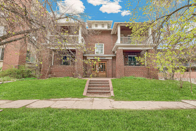
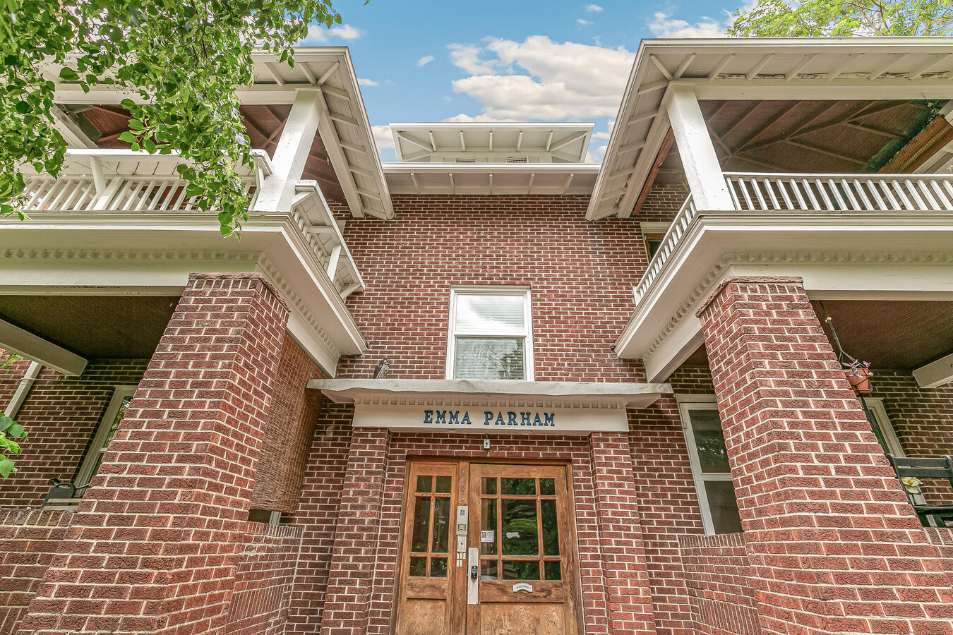
Property Record
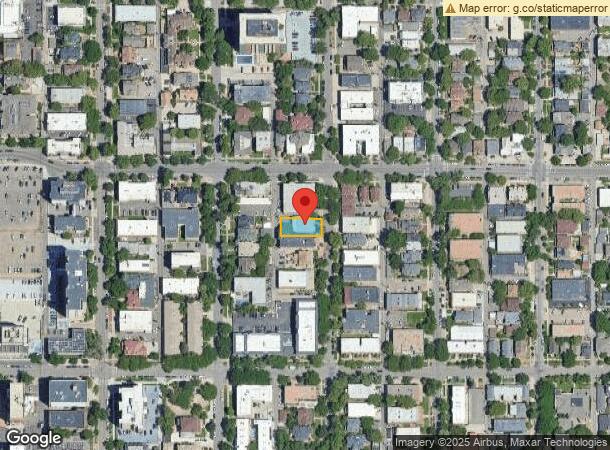
1069 N Pearl St, Denver, CO 80203

NEARBY LISTINGS FOR SALE OR LEASE
Property Detail
1069 N Pearl St
Denver-Aurora-Lakewood, CO
Porters Add
5038-03-017
L 5 & 6 BLK 86 PORTERS ADD
Multifamilydwelling
Denver
X
Colorado
0800460201H
5,6
2023
0.15 AC
2023
Capitol Hill
002705
Denver
4,610 SF
DEMOGRAPHICS near 1069 N Pearl St
1 Mile
3 Mile
5 Mile
2024 Total Population
52,248
242,368
520,914
2029 Population
53,377
247,147
527,692
Pop Growth 2024-2029
+ 2.16%
+ 1.97%
+ 1.30%
Average Age
38
38
38
2024 Total Households
32,761
129,417
244,762
HH Growth 2024-2029
+ 2.07%
+ 2.01%
+ 1.38%
Median Household Inc
$73,262
$89,137
$83,444
Avg Household Size
1.50
1.80
2.00
2024 Avg HH Vehicles
1.00
1.00
2.00
Median Home Value
$618,278
$735,672
$646,918
Median Year Built
1966
1973
1966
Nearby Places
- Restaurants
- Banks
- Shops
- Fitness
- Groceries
PUBLIC TRANSPORTATION
COMMUTER RAIL
Denver (California Zephyr - Amtrak)
DRIVE
WALK
Distance
Denver (California Zephyr - Amtrak)
6 min
2.1 mi
Union Station: Lodo-Coors Field-16Th Street Mall (C Line - Denver Regional Transportation District Light Rail (TheRide), E Line - Denver Regional Transportation District Light Rail (TheRide), W Line - Denver Regional Transportation District Light Rail (TheRide))
DRIVE
WALK
Distance
Union Station: Lodo-Coors Field-16Th Street Mall (C Line - Denver Regional Transportation District Light Rail (TheRide), E Line - Denver Regional Transportation District Light Rail (TheRide), W Line - Denver Regional Transportation District Light Rail (TheRide))
6 min
2.2 mi
AIRPORT
Denver International
DRIVE
WALK
Distance
Denver International
37 min
24.7 mi
Freight Ports
Tulsa Port Of Catoosa
DRIVE
WALK
Distance
Tulsa Port Of Catoosa
734 min
710.2 mi
SALE & LEASE HISTORY
LISTING DATE
SALE/LEASE

May 17, 2024
For Sale
Nearby Properties
Address
Land Use
TOTAL SIZE
Lot Size
Zoning
Address
Land Use
TOTAL SIZE
Lot Size
Zoning
2,424,680 SF
21.15 AC
D-TD
Address
Land Use
TOTAL SIZE
Lot Size
Zoning
1,721,086 SF
21.34 AC
C-MU-30
Address
Land Use
TOTAL SIZE
Lot Size
Zoning
859,638 SF
10.04 AC
B-3
Address
Land Use
TOTAL SIZE
Lot Size
Zoning
1,323,471 SF
10.26 AC
CMP-H
Address
Land Use
TOTAL SIZE
Lot Size
Zoning
1,248,868 SF
0.90 AC
D-TD
Address
Land Use
TOTAL SIZE
Lot Size
Zoning
1,661,628 SF
1.56 AC
D-C
Address
Land Use
TOTAL SIZE
Lot Size
Zoning
1,567,575 SF
1.40 AC
D-C
Address
Land Use
TOTAL SIZE
Lot Size
Zoning
1,399,487 SF
16.14 AC
CMP-H
Address
Land Use
TOTAL SIZE
Lot Size
Zoning
1,312,939 SF
1.15 AC
D-C
Address
Land Use
TOTAL SIZE
Lot Size
Zoning
1,286,459 SF
2.44 AC
PUD
Address
Land Use
TOTAL SIZE
Lot Size
Zoning
784,978 SF
1.15 AC
D-C
Address
Land Use
TOTAL SIZE
Lot Size
Zoning
697,516 SF
3.05 AC
D-CV
Address
Land Use
TOTAL SIZE
Lot Size
Zoning
1,097,914 SF
0.23 AC
D-C
Address
Land Use
TOTAL SIZE
Lot Size
Zoning
688,230 SF
0.94 AC
PUD
Address
Land Use
TOTAL SIZE
Lot Size
Zoning
150,202 SF
13.24 AC
T-MU-30
Address
Land Use
TOTAL SIZE
Lot Size
Zoning
513,131 SF
0.57 AC
D-C
Address
Land Use
TOTAL SIZE
Lot Size
Zoning
1,563,630 SF
2.53 AC
D-C
Address
Land Use
TOTAL SIZE
Lot Size
Zoning
1,027,206 SF
2.44 AC
D-C
Address
Land Use
TOTAL SIZE
Lot Size
Zoning
892,018 SF
2.42 AC
D-C
Address
Land Use
TOTAL SIZE
Lot Size
Zoning
321,759 SF
0.88 AC
PUD
Address
Land Use
TOTAL SIZE
Lot Size
Zoning
405,974 SF
1.78 AC
PUD
Address
Land Use
TOTAL SIZE
Lot Size
Zoning
1,375,437 SF
2.46 AC
D-C
Address
Land Use
TOTAL SIZE
Lot Size
Zoning
492,926 SF
1.16 AC
PUD
Address
Land Use
TOTAL SIZE
Lot Size
Zoning
1,024,471 SF
2.45 AC
D-C
Address
Land Use
TOTAL SIZE
Lot Size
Zoning
1,114,003 SF
2.45 AC
D-C
Address
Land Use
TOTAL SIZE
Lot Size
Zoning
618,768 SF
1.23 AC
D-C
Address
Land Use
TOTAL SIZE
Lot Size
Zoning
778,340 SF
0.61 AC
D-C
Address
Land Use
TOTAL SIZE
Lot Size
Zoning
515,064 SF
1.25 AC
D-LD
Address
Land Use
TOTAL SIZE
Lot Size
Zoning
764,724 SF
1 AC
D-C
Address
Land Use
TOTAL SIZE
Lot Size
Zoning
937,062 SF
1.95 AC
D-C
The World's #1 Commercial Real Estate Marketplace
Connect with us
© 2025 CoStar Group
The information above has been obtained from sources believed reliable. While we do not doubt its accuracy we have not verified it and make no guarantee, warranty or representation about it. It is your responsibility to independently confirm its accuracy and completeness. Any projections, opinions, assumptions, or estimates used are for example only and do not represent the current or future performance of the property. The value of this transaction to you depends on tax and other factors which should be evaluated by your tax, financial, and legal advisors. You and your advisors should conduct a careful, independent investigation of the property to determine to your satisfaction the suitability of the property for your needs.