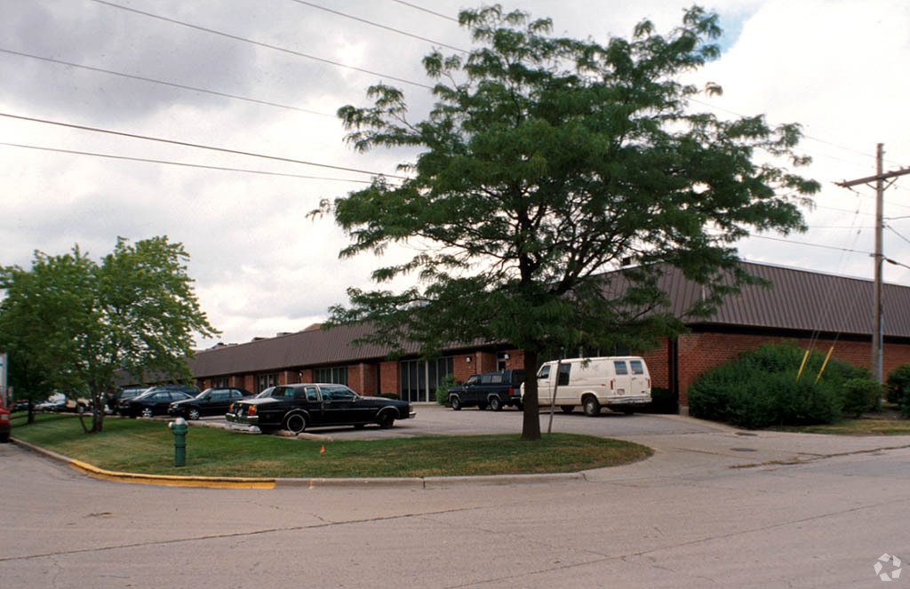
Property Record
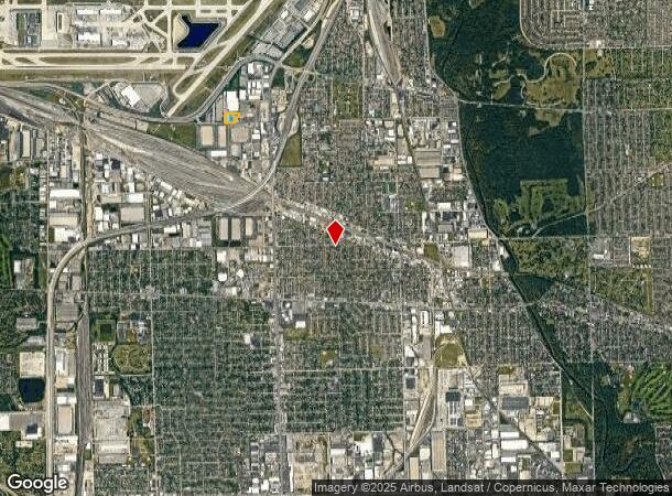
3901 Fleetwood Dr, Franklin Park, IL 60131
NEARBY LISTINGS FOR SALE OR LEASE
Property Detail
3901 Fleetwood Dr
Industrialgeneral
Cook
X
Illinois
17031C0359J
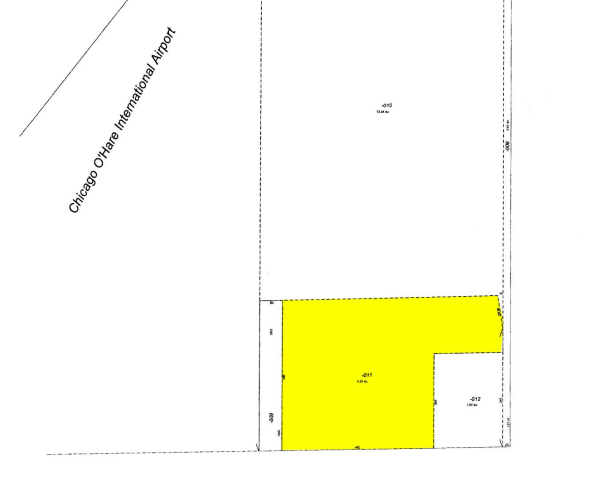
4.28 AC
2022
O'Hare
2024
Chicago
811401
Chicago-Naperville-Elgin, IL-IN-WI
100,191 SF
12-17-400-011-0000
DEMOGRAPHICS near 3901 Fleetwood Dr
1 Mile
3 Mile
5 Mile
2024 Total Population
4,717
77,218
320,264
2029 Population
4,559
75,158
310,259
Pop Growth 2024-2029
(3.35%)
(2.67%)
(3.12%)
Average Age
40
40
41
2024 Total Households
1,689
27,519
114,497
HH Growth 2024-2029
(3.61%)
(2.94%)
(3.39%)
Median Household Inc
$66,524
$67,082
$76,195
Avg Household Size
2.70
2.70
2.70
2024 Avg HH Vehicles
2.00
2.00
2.00
Median Home Value
$238,668
$247,938
$292,326
Median Year Built
1961
1962
1959
Nearby Places
- Restaurants
- Banks
- Shops
- Fitness
- Groceries
PUBLIC TRANSPORTATION
COMMUTER RAIL
Franklin Park Station (Md-W) (Milwaukee District West Line - Northeast Illinois Regional Commuter Railroad (Metra))
DRIVE
WALK
Distance
Franklin Park Station (Md-W) (Milwaukee District West Line - Northeast Illinois Regional Commuter Railroad (Metra))
2 min
10 min
0.6 mi
Mannheim Station (Milwaukee District West Line - Northeast Illinois Regional Commuter Railroad (Metra))
DRIVE
WALK
Distance
Mannheim Station (Milwaukee District West Line - Northeast Illinois Regional Commuter Railroad (Metra))
2 min
13 min
0.7 mi
AIRPORT
Chicago O'Hare International
DRIVE
WALK
Distance
Chicago O'Hare International
11 min
5.8 mi
Chicago Midway International
DRIVE
WALK
Distance
Chicago Midway International
28 min
17.5 mi
Freight Ports
Port Milwaukee
DRIVE
WALK
Distance
Port Milwaukee
95 min
79.3 mi
Nearby Properties
Address
Land Use
TOTAL SIZE
Lot Size
Zoning
Address
Land Use
TOTAL SIZE
Lot Size
Zoning
Address
Land Use
TOTAL SIZE
Lot Size
Zoning
733,433 SF
10.92 AC
Address
Land Use
TOTAL SIZE
Lot Size
Zoning
1,089,750 SF
59.83 AC
I
Address
Land Use
TOTAL SIZE
Lot Size
Zoning
86.63 AC
Address
Land Use
TOTAL SIZE
Lot Size
Zoning
820,106 SF
14.78 AC
Address
Land Use
TOTAL SIZE
Lot Size
Zoning
422,063 SF
18.88 AC
Address
Land Use
TOTAL SIZE
Lot Size
Zoning
595,800 SF
9.40 AC
Address
Land Use
TOTAL SIZE
Lot Size
Zoning
969,696 SF
44.30 AC
Address
Land Use
TOTAL SIZE
Lot Size
Zoning
2.62 AC
Address
Land Use
TOTAL SIZE
Lot Size
Zoning
372,935 SF
7.34 AC
Address
Land Use
TOTAL SIZE
Lot Size
Zoning
1,160,629 SF
Address
Land Use
TOTAL SIZE
Lot Size
Zoning
396,650 SF
19.12 AC
Address
Land Use
TOTAL SIZE
Lot Size
Zoning
Address
Land Use
TOTAL SIZE
Lot Size
Zoning
Address
Land Use
TOTAL SIZE
Lot Size
Zoning
121,117 SF
3.09 AC
Address
Land Use
TOTAL SIZE
Lot Size
Zoning
20.09 AC
Address
Land Use
TOTAL SIZE
Lot Size
Zoning
6.26 AC
Address
Land Use
TOTAL SIZE
Lot Size
Zoning
194,219 SF
17.26 AC
Address
Land Use
TOTAL SIZE
Lot Size
Zoning
250,870 SF
19.23 AC
Address
Land Use
TOTAL SIZE
Lot Size
Zoning
10.94 AC
Address
Land Use
TOTAL SIZE
Lot Size
Zoning
548,206 SF
21.13 AC
Address
Land Use
TOTAL SIZE
Lot Size
Zoning
276,458 SF
16.14 AC
Address
Land Use
TOTAL SIZE
Lot Size
Zoning
588,533 SF
30.52 AC
Address
Land Use
TOTAL SIZE
Lot Size
Zoning
325,045 SF
13.79 AC
Address
Land Use
TOTAL SIZE
Lot Size
Zoning
403,815 SF
0.76 AC
Address
Land Use
TOTAL SIZE
Lot Size
Zoning
248,880 SF
23.80 AC
C
Address
Land Use
TOTAL SIZE
Lot Size
Zoning
318,305 SF
12.71 AC
Address
Land Use
TOTAL SIZE
Lot Size
Zoning
Address
Land Use
TOTAL SIZE
Lot Size
Zoning
479,130 SF
15.80 AC
Address
Land Use
TOTAL SIZE
Lot Size
Zoning
321,181 SF
0.65 AC
The World's #1 Commercial Real Estate Marketplace
Connect with us
© 2025 CoStar Group
The information above has been obtained from sources believed reliable. While we do not doubt its accuracy we have not verified it and make no guarantee, warranty or representation about it. It is your responsibility to independently confirm its accuracy and completeness. Any projections, opinions, assumptions, or estimates used are for example only and do not represent the current or future performance of the property. The value of this transaction to you depends on tax and other factors which should be evaluated by your tax, financial, and legal advisors. You and your advisors should conduct a careful, independent investigation of the property to determine to your satisfaction the suitability of the property for your needs.