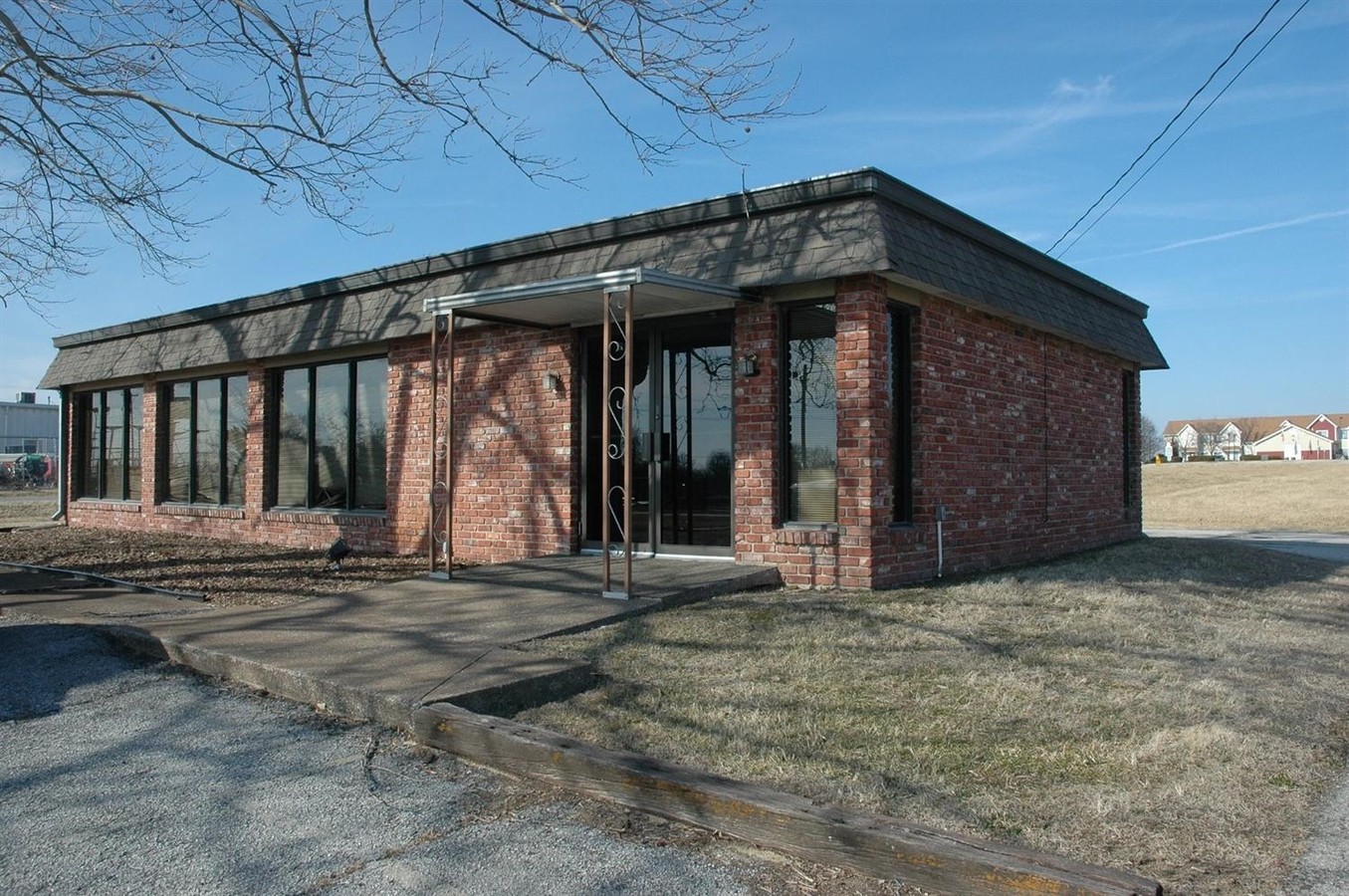
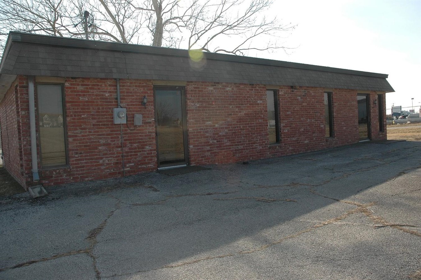
Property Record
107 Main St, Parsons, KS 67357
NEARBY LISTINGS FOR SALE OR LEASE
-
-
View all Parsons listings for sale on LoopNet.com
Property Detail
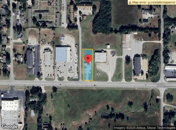
107 Main St
024-17-0-40-11-013.00-0
Reinhart Sub A
Officebuilding
REINHART SUB A, S17, T31, R20, ACRES 0.92, BEG 55'S SE/C TR B N337.8' W108.3' S337.8' E TO POB INCL VAC ST
X
Labette
20099C0203D
Kansas
2023
0.92 AC
2024
Kansas Area
9501002118
Other Market Areas
1,326 SF
Parsons, KS
DEMOGRAPHICS near 107 Main St
1 Mile
3 Mile
5 Mile
2024 Total Population
587
9,509
11,254
2029 Population
572
9,424
11,119
Pop Growth 2024-2029
(2.56%)
(0.89%)
(1.20%)
Average Age
44
40
40
2024 Total Households
255
3,963
4,674
HH Growth 2024-2029
(2.75%)
(0.96%)
(1.26%)
Median Household Inc
$57,499
$47,736
$51,162
Avg Household Size
2.20
2.20
2.30
2024 Avg HH Vehicles
2.00
2.00
2.00
Median Home Value
$134,285
$77,428
$89,229
Median Year Built
1978
1952
1956
Nearby Places
- Restaurants
- Banks
- Shops
- Fitness
- Groceries
SALE & LEASE HISTORY
LISTING DATE
SALE/LEASE

Sep 23, 2016
For Sale
Feb 07, 2019
For Sale
Nearby Properties
Address
Land Use
TOTAL SIZE
Lot Size
Zoning
Address
Land Use
TOTAL SIZE
Lot Size
Zoning
249,188 SF
20.34 AC
Address
Land Use
TOTAL SIZE
Lot Size
Zoning
53,440 SF
3.91 AC
Address
Land Use
TOTAL SIZE
Lot Size
Zoning
28,478 SF
2.27 AC
Address
Land Use
TOTAL SIZE
Lot Size
Zoning
170,251 SF
11 AC
Address
Land Use
TOTAL SIZE
Lot Size
Zoning
131,269 SF
4.49 AC
Address
Land Use
TOTAL SIZE
Lot Size
Zoning
47,730 SF
0.31 AC
Address
Land Use
TOTAL SIZE
Lot Size
Zoning
155,100 SF
28.72 AC
Address
Land Use
TOTAL SIZE
Lot Size
Zoning
66,556 SF
3.19 AC
Address
Land Use
TOTAL SIZE
Lot Size
Zoning
15,080 SF
4.60 AC
Address
Land Use
TOTAL SIZE
Lot Size
Zoning
39,701 SF
7.10 AC
Address
Land Use
TOTAL SIZE
Lot Size
Zoning
35,700 SF
1.29 AC
Address
Land Use
TOTAL SIZE
Lot Size
Zoning
25,184 SF
0.42 AC
Address
Land Use
TOTAL SIZE
Lot Size
Zoning
32,041 SF
2.58 AC
Address
Land Use
TOTAL SIZE
Lot Size
Zoning
35,857 SF
2.91 AC
Address
Land Use
TOTAL SIZE
Lot Size
Zoning
29,156 SF
23 AC
Address
Land Use
TOTAL SIZE
Lot Size
Zoning
48,387 SF
2.87 AC
Address
Land Use
TOTAL SIZE
Lot Size
Zoning
24,900 SF
1.72 AC
Address
Land Use
TOTAL SIZE
Lot Size
Zoning
71,734 SF
6.10 AC
Address
Land Use
TOTAL SIZE
Lot Size
Zoning
17,298 SF
0.41 AC
Address
Land Use
TOTAL SIZE
Lot Size
Zoning
27,787 SF
6.20 AC
Address
Land Use
TOTAL SIZE
Lot Size
Zoning
3,315 SF
2.31 AC
Address
Land Use
TOTAL SIZE
Lot Size
Zoning
15,876 SF
13 AC
Address
Land Use
TOTAL SIZE
Lot Size
Zoning
23,187 SF
4.70 AC
Address
Land Use
TOTAL SIZE
Lot Size
Zoning
7,982 SF
0.41 AC
Address
Land Use
TOTAL SIZE
Lot Size
Zoning
80,920 SF
20.77 AC
Address
Land Use
TOTAL SIZE
Lot Size
Zoning
6,943 SF
1.13 AC
Address
Land Use
TOTAL SIZE
Lot Size
Zoning
11,480 SF
0.99 AC
Address
Land Use
TOTAL SIZE
Lot Size
Zoning
4,860 SF
3.40 AC
Address
Land Use
TOTAL SIZE
Lot Size
Zoning
10,320 SF
0.69 AC
Address
Land Use
TOTAL SIZE
Lot Size
Zoning
23,702 SF
4.67 AC
The World's #1 Commercial Real Estate Marketplace
Connect with us
© 2025 CoStar Group
The information above has been obtained from sources believed reliable. While we do not doubt its accuracy we have not verified it and make no guarantee, warranty or representation about it. It is your responsibility to independently confirm its accuracy and completeness. Any projections, opinions, assumptions, or estimates used are for example only and do not represent the current or future performance of the property. The value of this transaction to you depends on tax and other factors which should be evaluated by your tax, financial, and legal advisors. You and your advisors should conduct a careful, independent investigation of the property to determine to your satisfaction the suitability of the property for your needs.