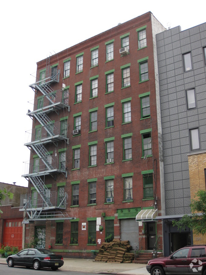
Property Record
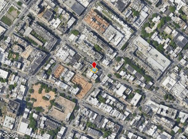
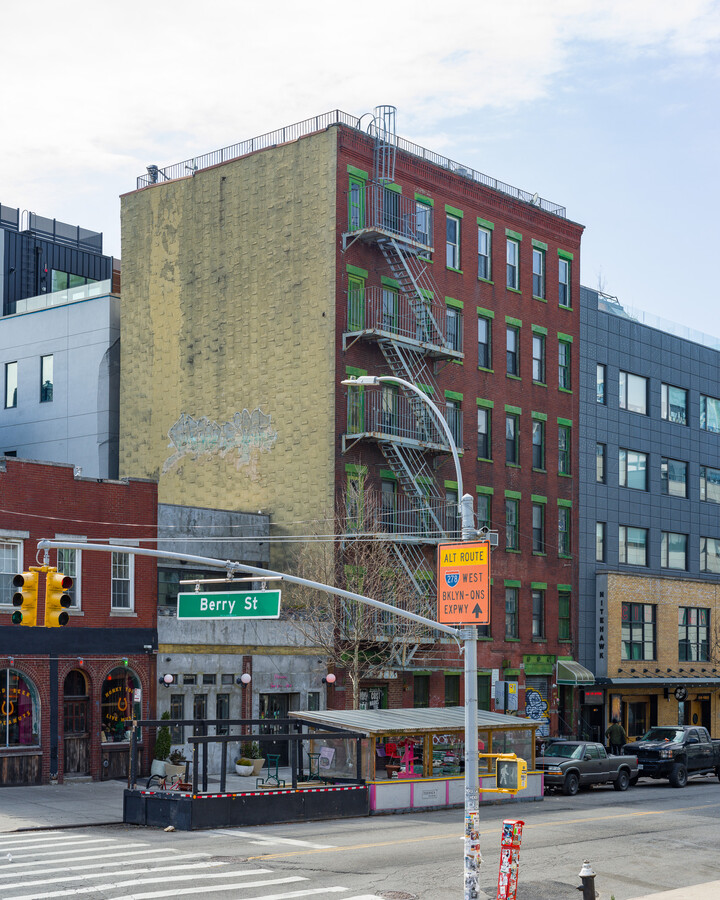
140 Metropolitan Ave, Brooklyn, NY 11249

NEARBY LISTINGS FOR SALE OR LEASE
Property Detail
140 Metropolitan Ave
02364-0019
DOCID-2019052400582004
Industrialgeneral
Kings
X
New York
3604970204F
19
2024
0.04 AC
2024
Williamsburg
055500
Long Island (New York)
11,899 SF
New York-Jersey City-White Plains, NY-NJ
DEMOGRAPHICS near 140 Metropolitan Ave
1 Mile
3 Mile
5 Mile
2024 Total Population
145,655
1,333,115
3,045,413
2029 Population
139,118
1,258,640
2,869,367
Pop Growth 2024-2029
(4.49%)
(5.59%)
(5.78%)
Average Age
36
38
39
2024 Total Households
60,892
605,692
1,336,943
HH Growth 2024-2029
(4.93%)
(6.00%)
(6.13%)
Median Household Inc
$85,550
$98,772
$92,244
Avg Household Size
2.30
2.10
2.20
2024 Avg HH Vehicles
.00
.00
.00
Median Home Value
$1,000,065
$986,735
$910,589
Median Year Built
1960
1952
1952
Nearby Places
- Restaurants
- Banks
- Shops
- Fitness
- Groceries
PUBLIC TRANSPORTATION
TRANSIT/SUBWAY
Bedford Avenue (L - New York MTA Subway (The Subway))
DRIVE
WALK
Distance
Bedford Avenue (L - New York MTA Subway (The Subway))
1 min
7 min
0.4 mi
Metropolitan Avenue (G - New York MTA Subway (The Subway))
DRIVE
WALK
Distance
Metropolitan Avenue (G - New York MTA Subway (The Subway))
1 min
13 min
0.7 mi
Lorimer Street (L Line) (L - New York MTA Subway (The Subway))
DRIVE
WALK
Distance
Lorimer Street (L Line) (L - New York MTA Subway (The Subway))
1 min
13 min
0.7 mi
Marcy Avenue (J - New York MTA Subway (The Subway), M - New York MTA Subway (The Subway), Z - New York MTA Subway (The Subway))
DRIVE
WALK
Distance
Marcy Avenue (J - New York MTA Subway (The Subway), M - New York MTA Subway (The Subway), Z - New York MTA Subway (The Subway))
2 min
15 min
0.8 mi
Hewes Street (J - New York MTA Subway (The Subway), M - New York MTA Subway (The Subway))
DRIVE
WALK
Distance
Hewes Street (J - New York MTA Subway (The Subway), M - New York MTA Subway (The Subway))
2 min
20 min
1.1 mi
COMMUTER RAIL
Hunterspoint Avenue Station (Hempstead Branch - Long Island Rail Road, Oyster Bay Branch - Long Island Rail Road)
DRIVE
WALK
Distance
Hunterspoint Avenue Station (Hempstead Branch - Long Island Rail Road, Oyster Bay Branch - Long Island Rail Road)
8 min
2.5 mi
Long Island City Station (Hempstead Branch - Long Island Rail Road)
DRIVE
WALK
Distance
Long Island City Station (Hempstead Branch - Long Island Rail Road)
8 min
2.8 mi
AIRPORT
Laguardia
DRIVE
WALK
Distance
Laguardia
16 min
7.4 mi
John F Kennedy International
DRIVE
WALK
Distance
John F Kennedy International
25 min
13.5 mi
Newark Liberty International
DRIVE
WALK
Distance
Newark Liberty International
26 min
14.9 mi
Freight Ports
NY - Red Hook Container Terminal
DRIVE
WALK
Distance
NY - Red Hook Container Terminal
9 min
5.0 mi
SALE & LEASE HISTORY
LISTING DATE
SALE/LEASE

Sep 21, 2018
For Sale
May 18, 2020
For Lease
Jun 28, 2019
For Lease
Jul 11, 2024
For Sale
Nearby Properties
Address
Land Use
TOTAL SIZE
Lot Size
Zoning
Address
Land Use
TOTAL SIZE
Lot Size
Zoning
8,966,500 SF
19.14 AC
C6-4
Address
Land Use
TOTAL SIZE
Lot Size
Zoning
2,245,112 SF
2.02 AC
C6-6
Address
Land Use
TOTAL SIZE
Lot Size
Zoning
8,462,176 SF
61.41 AC
R7-2
Address
Land Use
TOTAL SIZE
Lot Size
Zoning
2,161,994 SF
3.79 AC
M1-5
Address
Land Use
TOTAL SIZE
Lot Size
Zoning
2,354,289 SF
3.96 AC
C6-4
Address
Land Use
TOTAL SIZE
Lot Size
Zoning
1,678,135 SF
1.01 AC
C5-3
Address
Land Use
TOTAL SIZE
Lot Size
Zoning
1,897,491 SF
2.06 AC
C52.5
Address
Land Use
TOTAL SIZE
Lot Size
Zoning
2,812,739 SF
2.10 AC
C5-3
Address
Land Use
TOTAL SIZE
Lot Size
Zoning
1,586,876 SF
1.87 AC
C5-3
Address
Land Use
TOTAL SIZE
Lot Size
Zoning
1,048,620 SF
5.67 AC
C6-4
Address
Land Use
TOTAL SIZE
Lot Size
Zoning
2,535,958 SF
2.94 AC
C6-4
Address
Land Use
TOTAL SIZE
Lot Size
Zoning
2,157,862 SF
2.23 AC
BPC
Address
Land Use
TOTAL SIZE
Lot Size
Zoning
1,448,897 SF
1.56 AC
C6-6
Address
Land Use
TOTAL SIZE
Lot Size
Zoning
2,255,659 SF
4.58 AC
BPC
Address
Land Use
TOTAL SIZE
Lot Size
Zoning
2,400,000 SF
15.14 AC
C5-2
Address
Land Use
TOTAL SIZE
Lot Size
Zoning
2,124,441 SF
17.29 AC
R8
Address
Land Use
TOTAL SIZE
Lot Size
Zoning
1,160,500 SF
1.62 AC
C6-6
Address
Land Use
TOTAL SIZE
Lot Size
Zoning
2,344,406 SF
1.84 AC
C5-3
Address
Land Use
TOTAL SIZE
Lot Size
Zoning
2,233,692 SF
1.90 AC
BPC
Address
Land Use
TOTAL SIZE
Lot Size
Zoning
554,180 SF
0.60 AC
C6-6
Address
Land Use
TOTAL SIZE
Lot Size
Zoning
1,134,017 SF
1.05 AC
C5-3
Address
Land Use
TOTAL SIZE
Lot Size
Zoning
822,014 SF
1.38 AC
C52.5
Address
Land Use
TOTAL SIZE
Lot Size
Zoning
1,636,000 SF
1.08 AC
C6-4
Address
Land Use
TOTAL SIZE
Lot Size
Zoning
916,553 SF
1.39 AC
C5-3
Address
Land Use
TOTAL SIZE
Lot Size
Zoning
1,104,505 SF
2.32 AC
C4-7
Address
Land Use
TOTAL SIZE
Lot Size
Zoning
1,909,502 SF
2.37 AC
BPC
Address
Land Use
TOTAL SIZE
Lot Size
Zoning
1,174,988 SF
0.99 AC
C5-3
Address
Land Use
TOTAL SIZE
Lot Size
Zoning
984,485 SF
1.03 AC
C6-6
Address
Land Use
TOTAL SIZE
Lot Size
Zoning
1,233,394 SF
1.78 AC
C5-3
Address
Land Use
TOTAL SIZE
Lot Size
Zoning
1,050,990 SF
1.21 AC
C52.5
The World's #1 Commercial Real Estate Marketplace
Connect with us
© 2025 CoStar Group
The information above has been obtained from sources believed reliable. While we do not doubt its accuracy we have not verified it and make no guarantee, warranty or representation about it. It is your responsibility to independently confirm its accuracy and completeness. Any projections, opinions, assumptions, or estimates used are for example only and do not represent the current or future performance of the property. The value of this transaction to you depends on tax and other factors which should be evaluated by your tax, financial, and legal advisors. You and your advisors should conduct a careful, independent investigation of the property to determine to your satisfaction the suitability of the property for your needs.