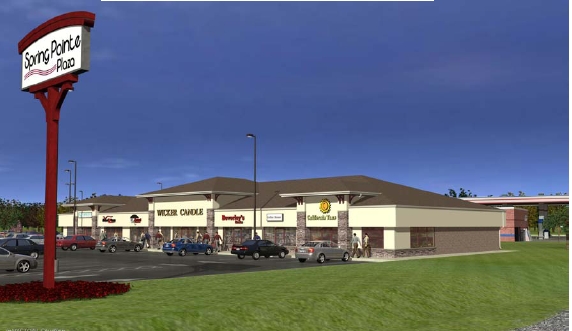
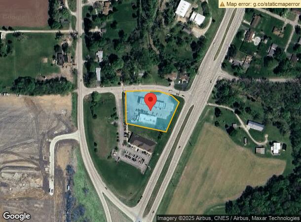
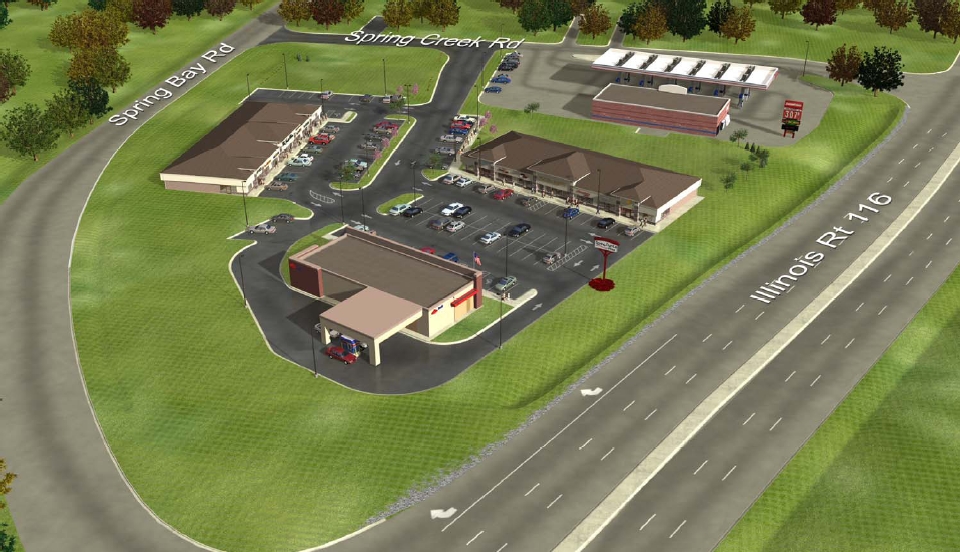
Property Record
107 W Spring Creek Rd, East Peoria, IL 61611
NEARBY LISTINGS FOR SALE OR LEASE
Property Detail
107 W Spring Creek Rd
01-01-12-100-001
SEC 12 T26N R4W PARCEL D OF NW 1/4 & ADJ TRACT NW 1/4 1.36 AC
Storebuilding
Tazewell
X
Illinois
17179C0035E
1.36 AC
2023
Outlying Tazewell County
2023
Peoria
021201
Peoria, IL
4,830 SF
DEMOGRAPHICS near 107 W Spring Creek Rd
1 Mile
3 Mile
5 Mile
2024 Total Population
626
15,592
78,159
2029 Population
627
15,473
77,061
Pop Growth 2024-2029
+ 0.16%
(0.76%)
(1.40%)
Average Age
42
42
40
2024 Total Households
245
6,566
32,848
HH Growth 2024-2029
0.00%
(0.96%)
(1.58%)
Median Household Inc
$78,977
$62,808
$56,196
Avg Household Size
2.60
2.30
2.30
2024 Avg HH Vehicles
2.00
2.00
2.00
Median Home Value
$245,161
$159,934
$144,728
Median Year Built
1993
1970
1959
Nearby Places
- Restaurants
- Banks
- Shops
- Fitness
- Groceries
PUBLIC TRANSPORTATION
AIRPORT
General Downing - Peoria International
DRIVE
WALK
Distance
General Downing - Peoria International
22 min
13.2 mi
Freight Ports
Port Milwaukee
DRIVE
WALK
Distance
Port Milwaukee
261 min
215.8 mi
Nearby Properties
Address
Land Use
TOTAL SIZE
Lot Size
Zoning
Address
Land Use
TOTAL SIZE
Lot Size
Zoning
322,258 SF
1,319.75 AC
Address
Land Use
TOTAL SIZE
Lot Size
Zoning
80,102 SF
2 AC
Address
Land Use
TOTAL SIZE
Lot Size
Zoning
21,320 SF
6.54 AC
Address
Land Use
TOTAL SIZE
Lot Size
Zoning
21.34 AC
Address
Land Use
TOTAL SIZE
Lot Size
Zoning
69,113 SF
9.83 AC
Address
Land Use
TOTAL SIZE
Lot Size
Zoning
283,737 SF
23.37 AC
Address
Land Use
TOTAL SIZE
Lot Size
Zoning
17.42 AC
Address
Land Use
TOTAL SIZE
Lot Size
Zoning
69,777 SF
2.92 AC
Address
Land Use
TOTAL SIZE
Lot Size
Zoning
47,352 SF
Address
Land Use
TOTAL SIZE
Lot Size
Zoning
Address
Land Use
TOTAL SIZE
Lot Size
Zoning
18.67 AC
Address
Land Use
TOTAL SIZE
Lot Size
Zoning
Address
Land Use
TOTAL SIZE
Lot Size
Zoning
26.62 AC
Address
Land Use
TOTAL SIZE
Lot Size
Zoning
66,584 SF
15.23 AC
Address
Land Use
TOTAL SIZE
Lot Size
Zoning
36,214 SF
3.68 AC
Address
Land Use
TOTAL SIZE
Lot Size
Zoning
23,558 SF
1.85 AC
Address
Land Use
TOTAL SIZE
Lot Size
Zoning
20,316 SF
3.52 AC
Address
Land Use
TOTAL SIZE
Lot Size
Zoning
Address
Land Use
TOTAL SIZE
Lot Size
Zoning
0.70 AC
Address
Land Use
TOTAL SIZE
Lot Size
Zoning
Address
Land Use
TOTAL SIZE
Lot Size
Zoning
Address
Land Use
TOTAL SIZE
Lot Size
Zoning
41,606 SF
6.96 AC
Address
Land Use
TOTAL SIZE
Lot Size
Zoning
96,800 SF
6.64 AC
Address
Land Use
TOTAL SIZE
Lot Size
Zoning
1.01 AC
Address
Land Use
TOTAL SIZE
Lot Size
Zoning
42,640 SF
4.48 AC
Address
Land Use
TOTAL SIZE
Lot Size
Zoning
Address
Land Use
TOTAL SIZE
Lot Size
Zoning
47,600 SF
2.32 AC
Address
Land Use
TOTAL SIZE
Lot Size
Zoning
104,180 SF
7.34 AC
Address
Land Use
TOTAL SIZE
Lot Size
Zoning
29.42 AC
The World's #1 Commercial Real Estate Marketplace
Connect with us
© 2025 CoStar Group
The information above has been obtained from sources believed reliable. While we do not doubt its accuracy we have not verified it and make no guarantee, warranty or representation about it. It is your responsibility to independently confirm its accuracy and completeness. Any projections, opinions, assumptions, or estimates used are for example only and do not represent the current or future performance of the property. The value of this transaction to you depends on tax and other factors which should be evaluated by your tax, financial, and legal advisors. You and your advisors should conduct a careful, independent investigation of the property to determine to your satisfaction the suitability of the property for your needs.