Property Record
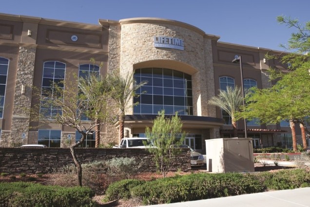
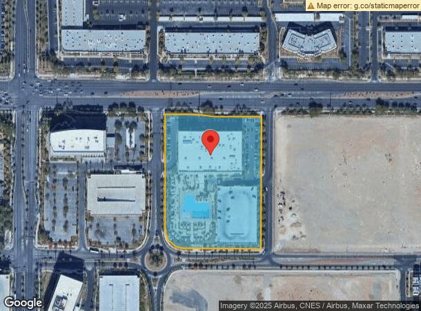
10721 W Charleston Blvd, Las Vegas, NV 89135

NEARBY LISTINGS FOR SALE OR LEASE
Property Detail
10721 W Charleston Blvd
Las Vegas-Henderson-Paradise, NV
Corporate Pointe South At Summerlin
164-01-110-008
CORPORATE POINTE SOUTH AT SUMMERLIN PLAT BOOK 97 PAGE 13 PT LOT 1
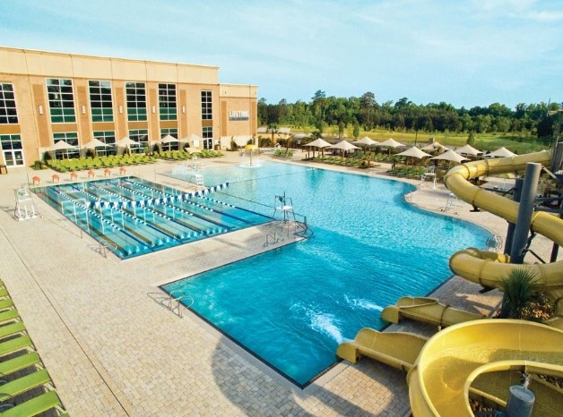
Recreationalentertainmentgeneral
Clark
X
Nevada
32003C2150E
1
2024
6.09 AC
2024
West Las Vegas
005843
Las Vegas
242,467 SF
DEMOGRAPHICS near 10721 W Charleston Blvd
1 Mile
3 Mile
5 Mile
2024 Total Population
14,804
124,388
290,173
2029 Population
15,956
134,664
312,835
Pop Growth 2024-2029
+ 7.78%
+ 8.26%
+ 7.81%
Average Age
42
42
43
2024 Total Households
6,310
50,798
119,321
HH Growth 2024-2029
+ 7.81%
+ 8.08%
+ 7.72%
Median Household Inc
$101,961
$90,184
$74,357
Avg Household Size
2.30
2.40
2.40
2024 Avg HH Vehicles
2.00
2.00
2.00
Median Home Value
$463,093
$509,257
$432,837
Median Year Built
2003
1999
1996
Nearby Places
- Restaurants
- Banks
- Shops
- Fitness
- Groceries
PUBLIC TRANSPORTATION
AIRPORT
Harry Reid International
DRIVE
WALK
Distance
Harry Reid International
24 min
18.4 mi
Boulder City Municipal
DRIVE
WALK
Distance
Boulder City Municipal
49 min
37.7 mi
Freight Ports
Port of Long Beach
DRIVE
WALK
Distance
Port of Long Beach
326 min
290.1 mi
SALE & LEASE HISTORY
LISTING DATE
SALE/LEASE

Jun 03, 2019
For Sale
Aug 27, 2019
For Sale
Nearby Properties
Address
Land Use
TOTAL SIZE
Lot Size
Zoning
Address
Land Use
TOTAL SIZE
Lot Size
Zoning
421,874 SF
59.43 AC
H1
Address
Land Use
TOTAL SIZE
Lot Size
Zoning
336,142 SF
39.99 AC
PC
Address
Land Use
TOTAL SIZE
Lot Size
Zoning
338,051 SF
49.13 AC
C1
Address
Land Use
TOTAL SIZE
Lot Size
Zoning
157,011 SF
31.41 AC
Address
Land Use
TOTAL SIZE
Lot Size
Zoning
974,131 SF
19.93 AC
Address
Land Use
TOTAL SIZE
Lot Size
Zoning
42.15 AC
PF
Address
Land Use
TOTAL SIZE
Lot Size
Zoning
100.61 AC
Address
Land Use
TOTAL SIZE
Lot Size
Zoning
29,374 SF
7.06 AC
Address
Land Use
TOTAL SIZE
Lot Size
Zoning
40.55 AC
PC
Address
Land Use
TOTAL SIZE
Lot Size
Zoning
38.56 AC
PF
Address
Land Use
TOTAL SIZE
Lot Size
Zoning
408,908 SF
15.60 AC
Address
Land Use
TOTAL SIZE
Lot Size
Zoning
52,690 SF
17.65 AC
RU
Address
Land Use
TOTAL SIZE
Lot Size
Zoning
280,968 SF
1.45 AC
Address
Land Use
TOTAL SIZE
Lot Size
Zoning
41,331 SF
1.59 AC
Address
Land Use
TOTAL SIZE
Lot Size
Zoning
Address
Land Use
TOTAL SIZE
Lot Size
Zoning
7,292 SF
24.24 AC
R3
Address
Land Use
TOTAL SIZE
Lot Size
Zoning
33.24 AC
C1
Address
Land Use
TOTAL SIZE
Lot Size
Zoning
3,520 SF
28.42 AC
R3
Address
Land Use
TOTAL SIZE
Lot Size
Zoning
6,825 SF
9.11 AC
Address
Land Use
TOTAL SIZE
Lot Size
Zoning
15,405 SF
16.74 AC
Address
Land Use
TOTAL SIZE
Lot Size
Zoning
5,427 SF
17.57 AC
Address
Land Use
TOTAL SIZE
Lot Size
Zoning
485,241 SF
13.77 AC
R3
Address
Land Use
TOTAL SIZE
Lot Size
Zoning
259,832 SF
3.79 AC
Address
Land Use
TOTAL SIZE
Lot Size
Zoning
2,754 SF
17.17 AC
RPD20
Address
Land Use
TOTAL SIZE
Lot Size
Zoning
223,030 SF
18.11 AC
C1
Address
Land Use
TOTAL SIZE
Lot Size
Zoning
246,947 SF
6.56 AC
RU
Address
Land Use
TOTAL SIZE
Lot Size
Zoning
3,895 SF
15.40 AC
PC
Address
Land Use
TOTAL SIZE
Lot Size
Zoning
12,031 SF
17.45 AC
PC
Address
Land Use
TOTAL SIZE
Lot Size
Zoning
184,152 SF
12.49 AC
Address
Land Use
TOTAL SIZE
Lot Size
Zoning
7,408 SF
10.99 AC
R4
The World's #1 Commercial Real Estate Marketplace
Connect with us
© 2025 CoStar Group
The information above has been obtained from sources believed reliable. While we do not doubt its accuracy we have not verified it and make no guarantee, warranty or representation about it. It is your responsibility to independently confirm its accuracy and completeness. Any projections, opinions, assumptions, or estimates used are for example only and do not represent the current or future performance of the property. The value of this transaction to you depends on tax and other factors which should be evaluated by your tax, financial, and legal advisors. You and your advisors should conduct a careful, independent investigation of the property to determine to your satisfaction the suitability of the property for your needs.