Property Record
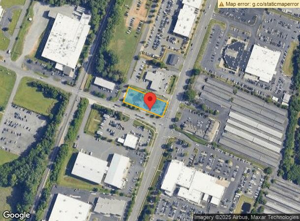
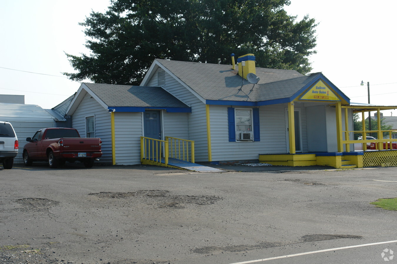
10725 Industrial Dr, Pineville, NC 28134


NEARBY LISTINGS FOR SALE OR LEASE
Property Detail
10725 Industrial Dr
Charlotte-Concord-Gastonia, NC-SC
Mecklenburg
205-091-01
L49-60 BC M3-117
Commercialnec
Mecklenburg
X
North Carolina
3710443900L
49-60
2023
0.62 AC
2023
Outer Southeast
005824
Charlotte
1,646 SF
DEMOGRAPHICS near 10725 Industrial Dr
1 Mile
3 Mile
5 Mile
2024 Total Population
3,222
64,762
188,729
2029 Population
3,423
69,344
201,516
Pop Growth 2024-2029
+ 6.24%
+ 7.08%
+ 6.78%
Average Age
39
38
38
2024 Total Households
1,430
27,034
77,773
HH Growth 2024-2029
+ 6.22%
+ 6.78%
+ 6.67%
Median Household Inc
$67,587
$68,851
$85,880
Avg Household Size
2.20
2.30
2.40
2024 Avg HH Vehicles
2.00
2.00
2.00
Median Home Value
$363,243
$329,805
$388,032
Median Year Built
1989
1989
1993
Nearby Places
- Restaurants
- Banks
- Shops
- Fitness
- Groceries
PUBLIC TRANSPORTATION
AIRPORT
Charlotte/Douglas International
DRIVE
WALK
Distance
Charlotte/Douglas International
19 min
10.8 mi
Concord-Padgett Regional
DRIVE
WALK
Distance
Concord-Padgett Regional
41 min
33.7 mi
Freight Ports
North Charleston Terminal
DRIVE
WALK
Distance
North Charleston Terminal
217 min
191.2 mi
Nearby Properties
Address
Land Use
TOTAL SIZE
Lot Size
Zoning
Address
Land Use
TOTAL SIZE
Lot Size
Zoning
1,053,669 SF
27.56 AC
INSTCD
Address
Land Use
TOTAL SIZE
Lot Size
Zoning
922,476 SF
49.91 AC
BP
Address
Land Use
TOTAL SIZE
Lot Size
Zoning
605,542 SF
586.46 AC
Address
Land Use
TOTAL SIZE
Lot Size
Zoning
605,976 SF
46.31 AC
R17MF
Address
Land Use
TOTAL SIZE
Lot Size
Zoning
654,693 SF
51.50 AC
O1
Address
Land Use
TOTAL SIZE
Lot Size
Zoning
244,692 SF
264.29 AC
I2
Address
Land Use
TOTAL SIZE
Lot Size
Zoning
646,209 SF
74.21 AC
CC
Address
Land Use
TOTAL SIZE
Lot Size
Zoning
430,352 SF
40.09 AC
R12MFCD
Address
Land Use
TOTAL SIZE
Lot Size
Zoning
326,013 SF
25.59 AC
RMF
Address
Land Use
TOTAL SIZE
Lot Size
Zoning
305,449 SF
17.90 AC
R17MFCD
Address
Land Use
TOTAL SIZE
Lot Size
Zoning
381,729 SF
22.37 AC
R17MF
Address
Land Use
TOTAL SIZE
Lot Size
Zoning
452,964 SF
9.19 AC
OCCD
Address
Land Use
TOTAL SIZE
Lot Size
Zoning
324,998 SF
16.60 AC
OICD
Address
Land Use
TOTAL SIZE
Lot Size
Zoning
279,674 SF
18.28 AC
CC
Address
Land Use
TOTAL SIZE
Lot Size
Zoning
429,918 SF
13.50 AC
O1
Address
Land Use
TOTAL SIZE
Lot Size
Zoning
226,768 SF
19.59 AC
RMF
Address
Land Use
TOTAL SIZE
Lot Size
Zoning
176,576 SF
18.66 AC
R20MF
Address
Land Use
TOTAL SIZE
Lot Size
Zoning
236,862 SF
30.19 AC
CC
Address
Land Use
TOTAL SIZE
Lot Size
Zoning
301,671 SF
14.81 AC
Address
Land Use
TOTAL SIZE
Lot Size
Zoning
221,152 SF
15.87 AC
MX2
Address
Land Use
TOTAL SIZE
Lot Size
Zoning
212,904 SF
58.09 AC
INST
Address
Land Use
TOTAL SIZE
Lot Size
Zoning
294,045 SF
24.30 AC
B4
Address
Land Use
TOTAL SIZE
Lot Size
Zoning
216,222 SF
21.81 AC
RMF
Address
Land Use
TOTAL SIZE
Lot Size
Zoning
241,548 SF
29.87 AC
R12MFCD
Address
Land Use
TOTAL SIZE
Lot Size
Zoning
190,262 SF
15.94 AC
RMF
Address
Land Use
TOTAL SIZE
Lot Size
Zoning
262,246 SF
51.99 AC
R3
Address
Land Use
TOTAL SIZE
Lot Size
Zoning
141,117 SF
21.75 AC
B1SCD
Address
Land Use
TOTAL SIZE
Lot Size
Zoning
227,264 SF
21.77 AC
RMF
Address
Land Use
TOTAL SIZE
Lot Size
Zoning
174,381 SF
31.15 AC
R17MF
Address
Land Use
TOTAL SIZE
Lot Size
Zoning
196,886 SF
18.60 AC
R17MF
The World's #1 Commercial Real Estate Marketplace
Connect with us
© 2025 CoStar Group
The information above has been obtained from sources believed reliable. While we do not doubt its accuracy we have not verified it and make no guarantee, warranty or representation about it. It is your responsibility to independently confirm its accuracy and completeness. Any projections, opinions, assumptions, or estimates used are for example only and do not represent the current or future performance of the property. The value of this transaction to you depends on tax and other factors which should be evaluated by your tax, financial, and legal advisors. You and your advisors should conduct a careful, independent investigation of the property to determine to your satisfaction the suitability of the property for your needs.