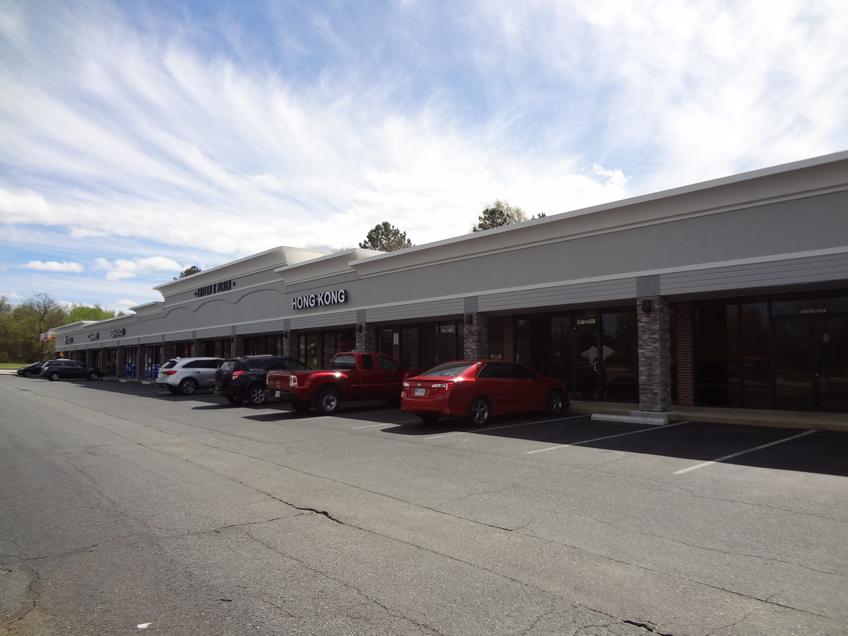
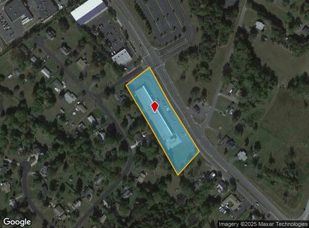
Property Record
1075 Garrisonville Rd, Stafford, VA 22556


NEARBY LISTINGS FOR SALE OR LEASE
Property Detail
1075 Garrisonville Rd
Washington-Arlington-Alexandria, DC-VA-MD-WV
Garrisonville Estates Sec 1
19A-1-42
LOT 42 SEC 1 2.4724 AC GARRISONVILLE ESTATES (AKA PATTON K PLAZA)
Storebuilding
Stafford
X
Virginia
51179C0126F
42
2024
2.47 AC
2024
Stafford County
010205
Washington, DC
20,400 SF
DEMOGRAPHICS near 1075 Garrisonville Rd
1 Mile
3 Mile
5 Mile
2024 Total Population
5,124
38,225
79,964
2029 Population
5,676
42,434
88,699
Pop Growth 2024-2029
+ 10.77%
+ 11.01%
+ 10.92%
Average Age
37
36
35
2024 Total Households
1,530
11,601
24,636
HH Growth 2024-2029
+ 10.78%
+ 11.07%
+ 11.09%
Median Household Inc
$139,396
$133,777
$125,178
Avg Household Size
3.30
3.20
3.10
2024 Avg HH Vehicles
3.00
3.00
2.00
Median Home Value
$388,663
$412,671
$407,423
Median Year Built
1992
1995
1996
Nearby Places
- Restaurants
- Banks
- Shops
- Fitness
- Groceries
SALE & LEASE HISTORY
LISTING DATE
SALE/LEASE

Sep 25, 2016
For Lease
Sep 24, 2016
For Sale
Oct 15, 2018
For Lease
May 04, 2022
For Lease
Jul 26, 2017
For Lease
Apr 16, 2019
For Lease
Apr 11, 2019
For Lease
Nearby Properties
Address
Land Use
TOTAL SIZE
Lot Size
Zoning
Address
Land Use
TOTAL SIZE
Lot Size
Zoning
175,700 SF
128.43 AC
R3
Address
Land Use
TOTAL SIZE
Lot Size
Zoning
Address
Land Use
TOTAL SIZE
Lot Size
Zoning
295,187 SF
88.50 AC
A1
Address
Land Use
TOTAL SIZE
Lot Size
Zoning
180 SF
9.43 AC
R3
Address
Land Use
TOTAL SIZE
Lot Size
Zoning
244,617 SF
61.73 AC
R3
Address
Land Use
TOTAL SIZE
Lot Size
Zoning
151,015 SF
36.62 AC
A1
Address
Land Use
TOTAL SIZE
Lot Size
Zoning
175,990 SF
50.21 AC
A1
Address
Land Use
TOTAL SIZE
Lot Size
Zoning
97,882 SF
9.26 AC
B2
Address
Land Use
TOTAL SIZE
Lot Size
Zoning
103,560 SF
21.68 AC
B3
Address
Land Use
TOTAL SIZE
Lot Size
Zoning
168,780 SF
7.23 AC
R3
Address
Land Use
TOTAL SIZE
Lot Size
Zoning
116,700 SF
7.49 AC
B2
Address
Land Use
TOTAL SIZE
Lot Size
Zoning
97,516 SF
26.25 AC
A1
Address
Land Use
TOTAL SIZE
Lot Size
Zoning
160,130 SF
18.67 AC
B2
Address
Land Use
TOTAL SIZE
Lot Size
Zoning
146,710 SF
43.68 AC
R1
Address
Land Use
TOTAL SIZE
Lot Size
Zoning
125,365 SF
7.01 AC
B2
Address
Land Use
TOTAL SIZE
Lot Size
Zoning
87,891 SF
20.51 AC
A1
Address
Land Use
TOTAL SIZE
Lot Size
Zoning
75,159 SF
10 AC
R1
Address
Land Use
TOTAL SIZE
Lot Size
Zoning
80,533 SF
9.95 AC
B2
Address
Land Use
TOTAL SIZE
Lot Size
Zoning
84,974 SF
18.76 AC
R1
Address
Land Use
TOTAL SIZE
Lot Size
Zoning
95,535 SF
7.08 AC
B3
Address
Land Use
TOTAL SIZE
Lot Size
Zoning
76,187 SF
23.38 AC
A1
Address
Land Use
TOTAL SIZE
Lot Size
Zoning
116,325 SF
11.61 AC
B2
Address
Land Use
TOTAL SIZE
Lot Size
Zoning
82,543 SF
20.89 AC
A1
Address
Land Use
TOTAL SIZE
Lot Size
Zoning
75,936 SF
20 AC
PD1
Address
Land Use
TOTAL SIZE
Lot Size
Zoning
71,987 SF
6.70 AC
B2
Address
Land Use
TOTAL SIZE
Lot Size
Zoning
127,035 SF
2.90 AC
B2
Address
Land Use
TOTAL SIZE
Lot Size
Zoning
39,078 SF
21.15 AC
B2
Address
Land Use
TOTAL SIZE
Lot Size
Zoning
64,814 SF
5.47 AC
B2
Address
Land Use
TOTAL SIZE
Lot Size
Zoning
55,000 SF
4.27 AC
B2
Address
Land Use
TOTAL SIZE
Lot Size
Zoning
57,066 SF
7.59 AC
PD2
The World's #1 Commercial Real Estate Marketplace
Connect with us
© 2025 CoStar Group
The information above has been obtained from sources believed reliable. While we do not doubt its accuracy we have not verified it and make no guarantee, warranty or representation about it. It is your responsibility to independently confirm its accuracy and completeness. Any projections, opinions, assumptions, or estimates used are for example only and do not represent the current or future performance of the property. The value of this transaction to you depends on tax and other factors which should be evaluated by your tax, financial, and legal advisors. You and your advisors should conduct a careful, independent investigation of the property to determine to your satisfaction the suitability of the property for your needs.