Property Record
108 E Shore Pky, La Porte, IN 46350
NEARBY LISTINGS FOR SALE OR LEASE
Property Detail
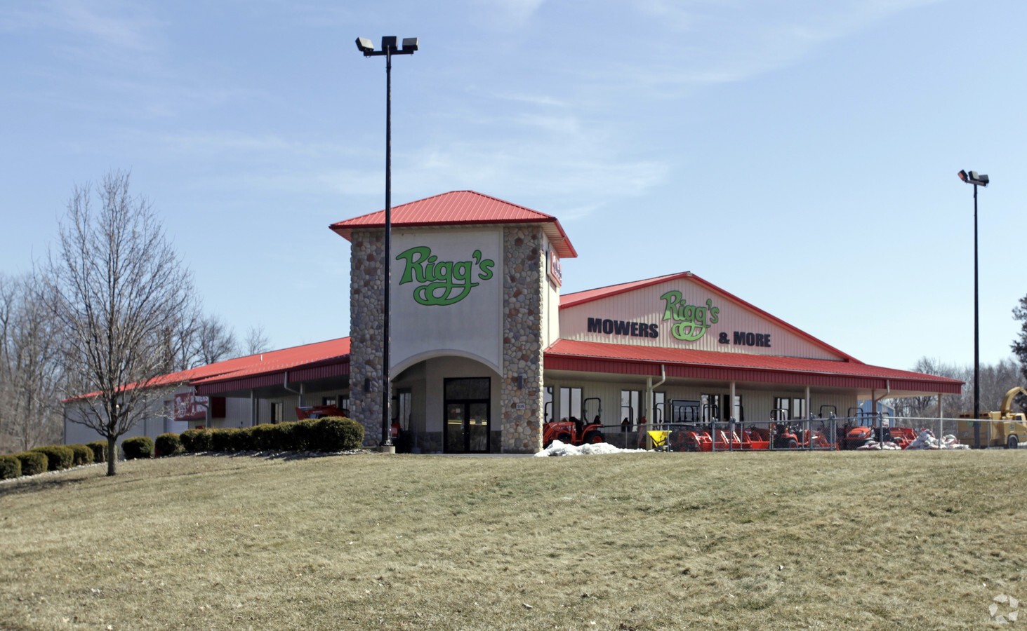
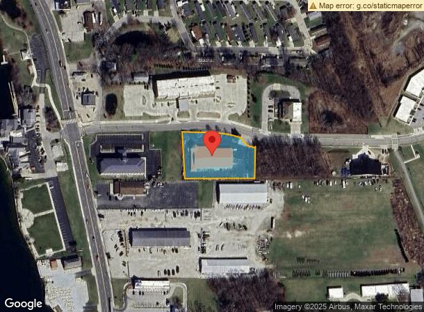
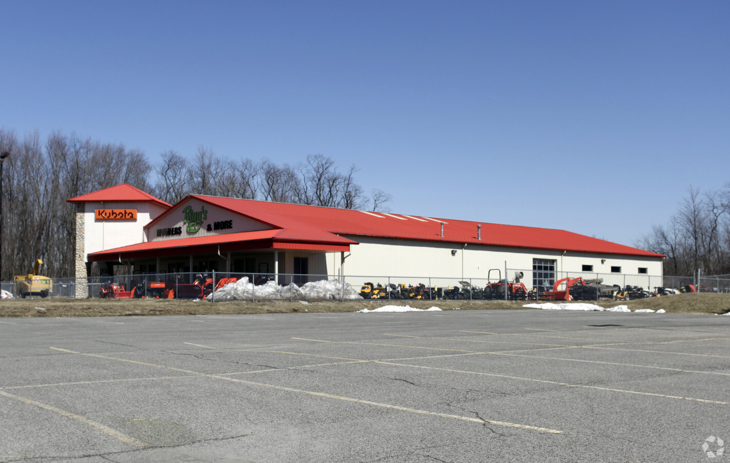
108 E Shore Pky
Michigan City-La Porte, IN
East Shore Plaza
46-06-26-153-035.000-043
05-06-26-153-035 PCE MID PT S 1/2 W 1/2 NW 1/4 S26 T37 R3 1.331 AC
Storebuilding
La Porte
X
Indiana
18091C0165D
4
2023
1.33 AC
2024
South Bend/Elkhart
042500
Other Market Areas
12,928 SF
DEMOGRAPHICS near 108 E Shore Pky
1 Mile
3 Mile
5 Mile
2024 Total Population
2,284
25,178
34,485
2029 Population
2,299
24,875
34,022
Pop Growth 2024-2029
+ 0.66%
(1.20%)
(1.34%)
Average Age
42
40
41
2024 Total Households
918
10,048
13,666
HH Growth 2024-2029
+ 0.54%
(1.39%)
(1.54%)
Median Household Inc
$47,785
$56,060
$62,702
Avg Household Size
2.50
2.40
2.40
2024 Avg HH Vehicles
2.00
2.00
2.00
Median Home Value
$213,397
$161,754
$178,294
Median Year Built
1980
1957
1962
Nearby Places
- Restaurants
- Banks
- Shops
- Fitness
- Groceries
PUBLIC TRANSPORTATION
COMMUTER RAIL
Carroll Avenue (Michigan City) Station (South Shore Line - Northern Indiana Commuter Transportation District (South Shore Line))
DRIVE
WALK
Distance
Carroll Avenue (Michigan City) Station (South Shore Line - Northern Indiana Commuter Transportation District (South Shore Line))
16 min
9.8 mi
AIRPORT
South Bend International
DRIVE
WALK
Distance
South Bend International
46 min
31.5 mi
Freight Ports
Port Milwaukee
DRIVE
WALK
Distance
Port Milwaukee
187 min
152.8 mi
Nearby Properties
Address
Land Use
TOTAL SIZE
Lot Size
Zoning
Address
Land Use
TOTAL SIZE
Lot Size
Zoning
222,443 SF
5.25 AC
Address
Land Use
TOTAL SIZE
Lot Size
Zoning
225,592 SF
3.72 AC
Address
Land Use
TOTAL SIZE
Lot Size
Zoning
14,274 SF
10.51 AC
Address
Land Use
TOTAL SIZE
Lot Size
Zoning
482,301 SF
49.97 AC
Address
Land Use
TOTAL SIZE
Lot Size
Zoning
104,166 SF
6 AC
Address
Land Use
TOTAL SIZE
Lot Size
Zoning
294,600 SF
22.86 AC
Address
Land Use
TOTAL SIZE
Lot Size
Zoning
289,954 SF
15.78 AC
Address
Land Use
TOTAL SIZE
Lot Size
Zoning
102,386 SF
4.44 AC
Address
Land Use
TOTAL SIZE
Lot Size
Zoning
237,466 SF
19.13 AC
Address
Land Use
TOTAL SIZE
Lot Size
Zoning
53,665 SF
8.02 AC
Address
Land Use
TOTAL SIZE
Lot Size
Zoning
603,796 SF
18.96 AC
Address
Land Use
TOTAL SIZE
Lot Size
Zoning
221,703 SF
16.87 AC
Address
Land Use
TOTAL SIZE
Lot Size
Zoning
78,490 SF
5.71 AC
Address
Land Use
TOTAL SIZE
Lot Size
Zoning
18,620 SF
6.87 AC
Address
Land Use
TOTAL SIZE
Lot Size
Zoning
150,364 SF
14.26 AC
Address
Land Use
TOTAL SIZE
Lot Size
Zoning
44,853 SF
5.14 AC
Address
Land Use
TOTAL SIZE
Lot Size
Zoning
185,774 SF
4.89 AC
Address
Land Use
TOTAL SIZE
Lot Size
Zoning
56,034 SF
3.04 AC
Address
Land Use
TOTAL SIZE
Lot Size
Zoning
194,458 SF
17.50 AC
Address
Land Use
TOTAL SIZE
Lot Size
Zoning
50,562 SF
11.99 AC
Address
Land Use
TOTAL SIZE
Lot Size
Zoning
28,154 SF
2.68 AC
Address
Land Use
TOTAL SIZE
Lot Size
Zoning
84,600 SF
52.12 AC
Address
Land Use
TOTAL SIZE
Lot Size
Zoning
1,800 SF
5.92 AC
Address
Land Use
TOTAL SIZE
Lot Size
Zoning
36,179 SF
6.15 AC
Address
Land Use
TOTAL SIZE
Lot Size
Zoning
52,830 SF
0.32 AC
Address
Land Use
TOTAL SIZE
Lot Size
Zoning
30,505 SF
1.59 AC
Address
Land Use
TOTAL SIZE
Lot Size
Zoning
84,695 SF
37.29 AC
Address
Land Use
TOTAL SIZE
Lot Size
Zoning
19,230 SF
2.32 AC
Address
Land Use
TOTAL SIZE
Lot Size
Zoning
54,262 SF
6.43 AC
Address
Land Use
TOTAL SIZE
Lot Size
Zoning
120,354 SF
11.46 AC
The World's #1 Commercial Real Estate Marketplace
Connect with us
© 2025 CoStar Group
The information above has been obtained from sources believed reliable. While we do not doubt its accuracy we have not verified it and make no guarantee, warranty or representation about it. It is your responsibility to independently confirm its accuracy and completeness. Any projections, opinions, assumptions, or estimates used are for example only and do not represent the current or future performance of the property. The value of this transaction to you depends on tax and other factors which should be evaluated by your tax, financial, and legal advisors. You and your advisors should conduct a careful, independent investigation of the property to determine to your satisfaction the suitability of the property for your needs.