Property Record
1080 Main St S, Woodbury, CT 06798


NEARBY LISTINGS FOR SALE OR LEASE
Property Detail
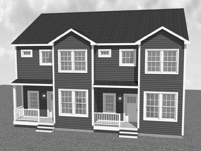
1080 Main St S
Torrington, CT
Cornerstone Prof Park
WOOD-000032-000000-000006
Litchfield
Officebuilding
Connecticut
2025
5.76 AC
2025
New Milford/SW Litchfield
362101
Hartford
3,537 SF
DEMOGRAPHICS near 1080 Main St S
1 Mile
3 Mile
5 Mile
2024 Total Population
1,002
15,162
29,078
2029 Population
991
14,997
28,937
Pop Growth 2024-2029
(1.10%)
(1.09%)
(0.48%)
Average Age
46
51
48
2024 Total Households
438
7,077
12,416
HH Growth 2024-2029
(1.37%)
(1.40%)
(0.79%)
Median Household Inc
$89,015
$86,782
$105,423
Avg Household Size
2.30
2.10
2.30
2024 Avg HH Vehicles
2.00
2.00
2.00
Median Home Value
$421,739
$370,631
$396,492
Median Year Built
1976
1975
1976
Nearby Places
Map Layers
Map Styles
 Street
 Aerial
- Restaurants
- Banks
- Shops
- Fitness
- Groceries
PUBLIC TRANSPORTATION
AIRPORT
Tweed/New Haven
DRIVE
WALK
Distance
Tweed/New Haven
51 min
28.9 mi
Freight Ports
Port of New Haven
DRIVE
WALK
Distance
Port of New Haven
46 min
26.1 mi
SALE & LEASE HISTORY
LISTING DATE
SALE/LEASE

Jan 27, 2023
For Sale
Jan 26, 2023
For Sale
Nearby Properties
Address
Land Use
TOTAL SIZE
Lot Size
Zoning
Address
Land Use
TOTAL SIZE
Lot Size
Zoning
207,001 SF
60.66 AC
M-2
Address
Land Use
TOTAL SIZE
Lot Size
Zoning
23.58 AC
B-3A
Address
Land Use
TOTAL SIZE
Lot Size
Zoning
55.79 AC
R-30A
Address
Land Use
TOTAL SIZE
Lot Size
Zoning
185,641 SF
22.35 AC
PDD
Address
Land Use
TOTAL SIZE
Lot Size
Zoning
102,487 SF
22 AC
R40
Address
Land Use
TOTAL SIZE
Lot Size
Zoning
36.62 AC
L200
Address
Land Use
TOTAL SIZE
Lot Size
Zoning
3,744 SF
23.33 AC
OS60
Address
Land Use
TOTAL SIZE
Lot Size
Zoning
1,832 SF
77.04 AC
L200
Address
Land Use
TOTAL SIZE
Lot Size
Zoning
48,796 SF
13.53 AC
PDD
Address
Land Use
TOTAL SIZE
Lot Size
Zoning
227.23 AC
EE
Address
Land Use
TOTAL SIZE
Lot Size
Zoning
59,250 SF
9.30 AC
R40
Address
Land Use
TOTAL SIZE
Lot Size
Zoning
36,353 SF
5.13 AC
R-30
Address
Land Use
TOTAL SIZE
Lot Size
Zoning
32,428 SF
8 AC
R-30
Address
Land Use
TOTAL SIZE
Lot Size
Zoning
2,520 SF
92.96 AC
EE
Address
Land Use
TOTAL SIZE
Lot Size
Zoning
142,146 SF
6.63 AC
B-2
Address
Land Use
TOTAL SIZE
Lot Size
Zoning
5.51 AC
MSD
Address
Land Use
TOTAL SIZE
Lot Size
Zoning
68,970 SF
10.50 AC
R-60
Address
Land Use
TOTAL SIZE
Lot Size
Zoning
32,264 SF
15.92 AC
R-60
Address
Land Use
TOTAL SIZE
Lot Size
Zoning
3.59 AC
B-2D
Address
Land Use
TOTAL SIZE
Lot Size
Zoning
21,762 SF
1.76 AC
MSD
Address
Land Use
TOTAL SIZE
Lot Size
Zoning
86,000 SF
7.19 AC
B-3
Address
Land Use
TOTAL SIZE
Lot Size
Zoning
5.51 AC
R40
Address
Land Use
TOTAL SIZE
Lot Size
Zoning
3.73 AC
R-60
Address
Land Use
TOTAL SIZE
Lot Size
Zoning
12.31 AC
GA
Address
Land Use
TOTAL SIZE
Lot Size
Zoning
13,578 SF
2.38 AC
B-2A
Address
Land Use
TOTAL SIZE
Lot Size
Zoning
14,110 SF
1.40 AC
B-2D
Address
Land Use
TOTAL SIZE
Lot Size
Zoning
6.81 AC
MSD
Address
Land Use
TOTAL SIZE
Lot Size
Zoning
13,217 SF
2.03 AC
B2-C
Address
Land Use
TOTAL SIZE
Lot Size
Zoning
50,937 SF
7.25 AC
GI40
Address
Land Use
TOTAL SIZE
Lot Size
Zoning
7.18 AC
PDD17
The World's #1 Commercial Real Estate Marketplace
Connect with us
© 2025 CoStar Group
The information above has been obtained from sources believed reliable. While we do not doubt its accuracy we have not verified it and make no guarantee, warranty or representation about it. It is your responsibility to independently confirm its accuracy and completeness. Any projections, opinions, assumptions, or estimates used are for example only and do not represent the current or future performance of the property. The value of this transaction to you depends on tax and other factors which should be evaluated by your tax, financial, and legal advisors. You and your advisors should conduct a careful, independent investigation of the property to determine to your satisfaction the suitability of the property for your needs.