Property Record
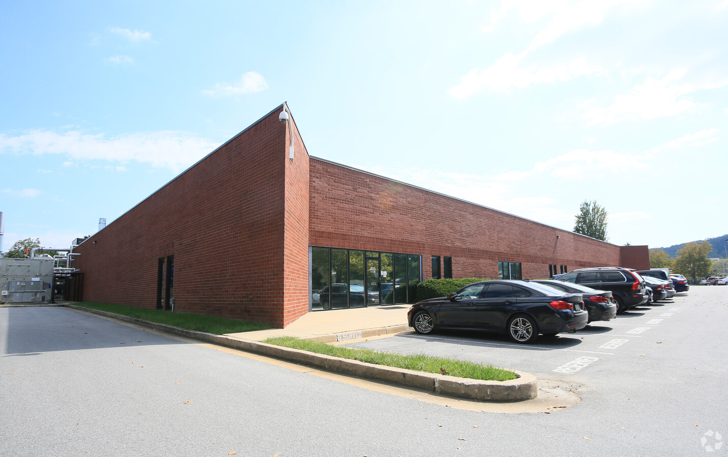
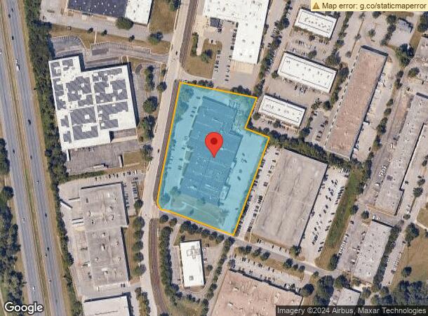
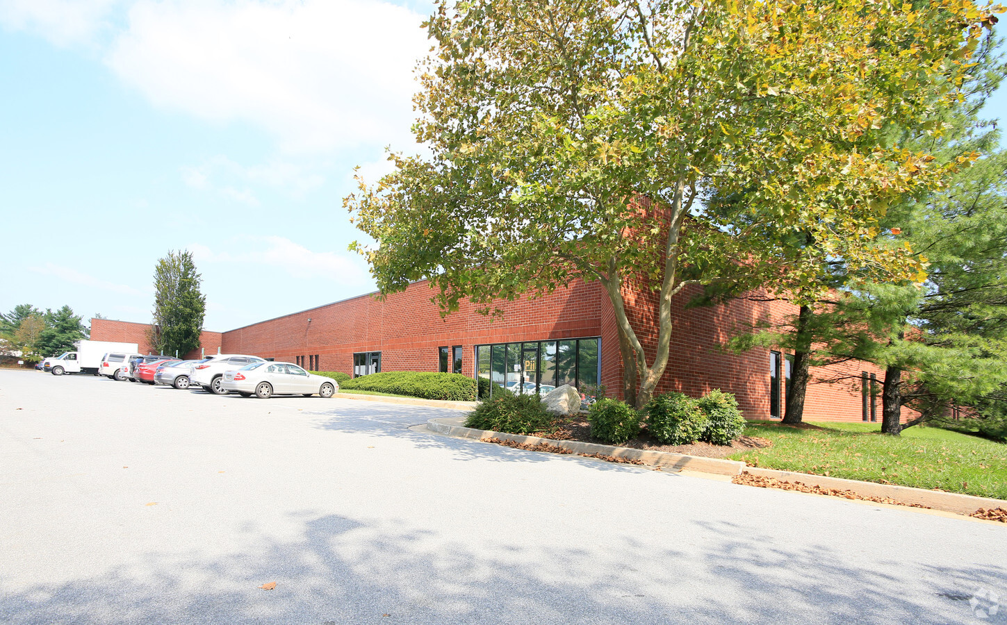
10819 Gilroy Rd, Hunt Valley, MD 21031

NEARBY LISTINGS FOR SALE OR LEASE
Property Detail
10819 Gilroy Rd
Baltimore-Columbia-Towson, MD
Plat 10 Hunt Valley Business Community
08-1800013675
4.8866 AC PT LOT 70 10819 GILROY RD HUNT VALLEY BUS CO
Scientificpharmaceuticalmedicalresearchfacility
Baltimore
X
Maryland
2400100235G
70
2024
4.88 AC
2024
Rt 83 Corridor North
408400
Baltimore
72,947 SF
DEMOGRAPHICS near 10819 Gilroy Rd
1 Mile
3 Mile
5 Mile
2024 Total Population
791
37,865
77,285
2029 Population
784
37,371
76,288
Pop Growth 2024-2029
(0.88%)
(1.30%)
(1.29%)
Average Age
46
42
43
2024 Total Households
300
16,462
31,287
HH Growth 2024-2029
(0.67%)
(1.37%)
(1.34%)
Median Household Inc
$141,499
$92,838
$108,730
Avg Household Size
2.50
2.20
2.40
2024 Avg HH Vehicles
2.00
2.00
2.00
Median Home Value
$790,948
$406,796
$454,177
Median Year Built
1995
1982
1978
Nearby Places
- Restaurants
- Banks
- Shops
- Fitness
- Groceries
PUBLIC TRANSPORTATION
TRANSIT/SUBWAY
Gilroy Road (Hunt Valley & BWI Marshall - Maryland Transit Administration Light Rail (Baltimore Light Rail))
Drive
Walk
Distance
Gilroy Road (Hunt Valley & BWI Marshall - Maryland Transit Administration Light Rail (Baltimore Light Rail))
1 min
7 min
0.4 mi
Mccormick Road (Hunt Valley & BWI Marshall - Maryland Transit Administration Light Rail (Baltimore Light Rail))
Drive
Walk
Distance
Mccormick Road (Hunt Valley & BWI Marshall - Maryland Transit Administration Light Rail (Baltimore Light Rail))
4 min
19 min
1.0 mi
AIRPORT
Baltimore/Washington International Thurgood Marshall
Drive
Walk
Distance
Baltimore/Washington International Thurgood Marshall
44 min
28.3 mi
Freight Ports
Port of Baltimore
Drive
Walk
Distance
Port of Baltimore
37 min
20.0 mi
Nearby Properties
Address
Land Use
TOTAL SIZE
Lot Size
Zoning
Address
Land Use
TOTAL SIZE
Lot Size
Zoning
6297
55.49 AC
BM
Address
Land Use
TOTAL SIZE
Lot Size
Zoning
343606
19.65 AC
Address
Land Use
TOTAL SIZE
Lot Size
Zoning
435039
5.73 AC
Address
Land Use
TOTAL SIZE
Lot Size
Zoning
38.89 AC
DR16
Address
Land Use
TOTAL SIZE
Lot Size
Zoning
13468
32.08 AC
DR16
Address
Land Use
TOTAL SIZE
Lot Size
Zoning
28.74 AC
DR16
Address
Land Use
TOTAL SIZE
Lot Size
Zoning
38400
88.84 AC
MR
Address
Land Use
TOTAL SIZE
Lot Size
Zoning
4455
84.32 AC
RC4
Address
Land Use
TOTAL SIZE
Lot Size
Zoning
237800
1.28 AC
BM
Address
Land Use
TOTAL SIZE
Lot Size
Zoning
26.73 AC
DR16
Address
Land Use
TOTAL SIZE
Lot Size
Zoning
11340
14.81 AC
ML-IM
Address
Land Use
TOTAL SIZE
Lot Size
Zoning
88600
185.60 AC
Address
Land Use
TOTAL SIZE
Lot Size
Zoning
176584
31.78 AC
Address
Land Use
TOTAL SIZE
Lot Size
Zoning
138000
3.09 AC
Address
Land Use
TOTAL SIZE
Lot Size
Zoning
206429
14.11 AC
01
Address
Land Use
TOTAL SIZE
Lot Size
Zoning
131360
7.31 AC
ML
Address
Land Use
TOTAL SIZE
Lot Size
Zoning
236460
9.28 AC
ML-IM
Address
Land Use
TOTAL SIZE
Lot Size
Zoning
149571
5.35 AC
ML-IM
Address
Land Use
TOTAL SIZE
Lot Size
Zoning
216462
22.60 AC
ML
Address
Land Use
TOTAL SIZE
Lot Size
Zoning
18.07 AC
DR3.5
Address
Land Use
TOTAL SIZE
Lot Size
Zoning
14.49 AC
DR16
Address
Land Use
TOTAL SIZE
Lot Size
Zoning
204329
25.45 AC
ML
Address
Land Use
TOTAL SIZE
Lot Size
Zoning
18.68 AC
DR3.5
Address
Land Use
TOTAL SIZE
Lot Size
Zoning
13.46 AC
DR16
Address
Land Use
TOTAL SIZE
Lot Size
Zoning
4000
23.97 AC
DR3.5
Address
Land Use
TOTAL SIZE
Lot Size
Zoning
102553
38.53 AC
ML
Address
Land Use
TOTAL SIZE
Lot Size
Zoning
349806
16.09 AC
MLIM
Address
Land Use
TOTAL SIZE
Lot Size
Zoning
90173
10.06 AC
Address
Land Use
TOTAL SIZE
Lot Size
Zoning
142000
48.59 AC
MLIM
Address
Land Use
TOTAL SIZE
Lot Size
Zoning
139510
5.70 AC
OT
Start a new search to find other properties for sale or lease
Connect with us
© 2024 CoStar Group
The information above has been obtained from sources believed reliable. While we do not doubt its accuracy we have not verified it and make no guarantee, warranty or representation about it. It is your responsibility to independently confirm its accuracy and completeness. Any projections, opinions, assumptions, or estimates used are for example only and do not represent the current or future performance of the property. The value of this transaction to you depends on tax and other factors which should be evaluated by your tax, financial, and legal advisors. You and your advisors should conduct a careful, independent investigation of the property to determine to your satisfaction the suitability of the property for your needs.