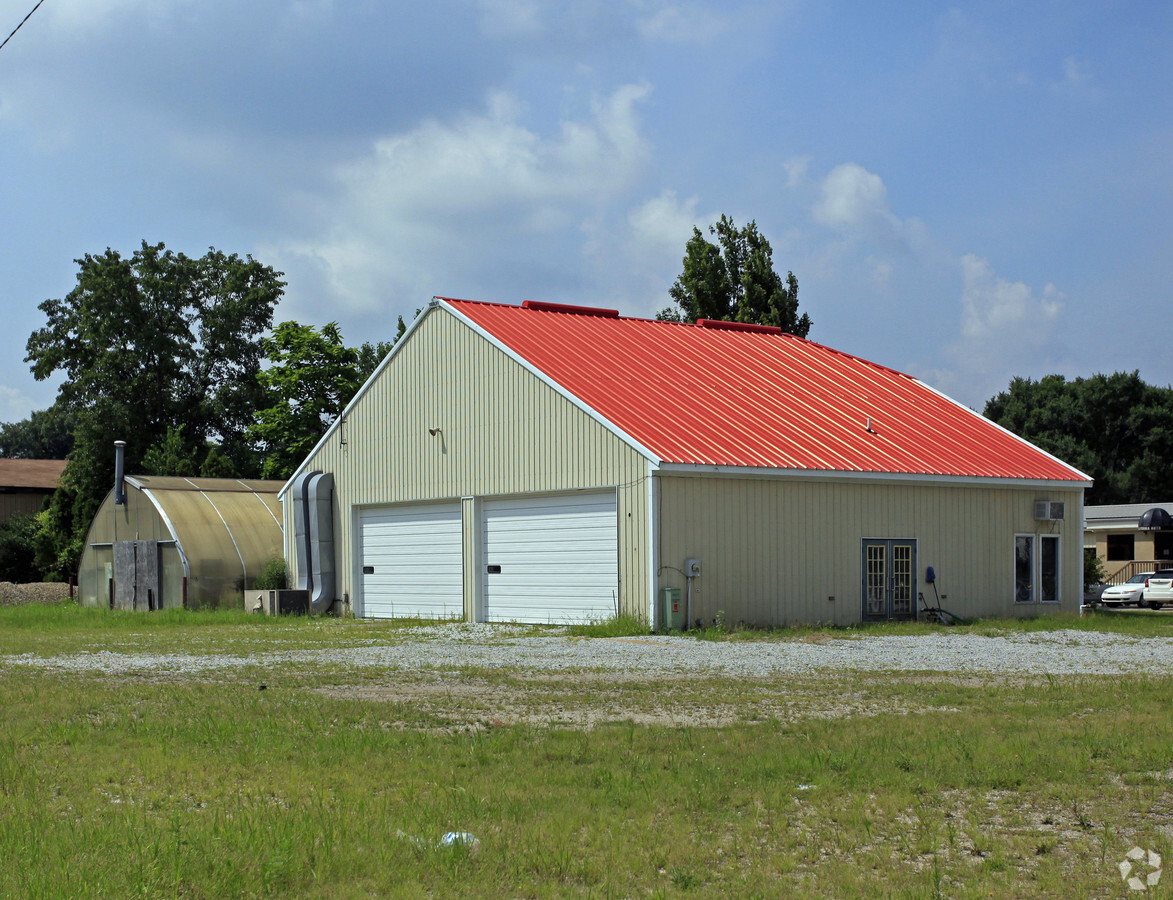
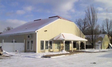
Property Record
10880 Mckinley Hwy, Osceola, IN 46561
NEARBY LISTINGS FOR SALE OR LEASE
Property Detail
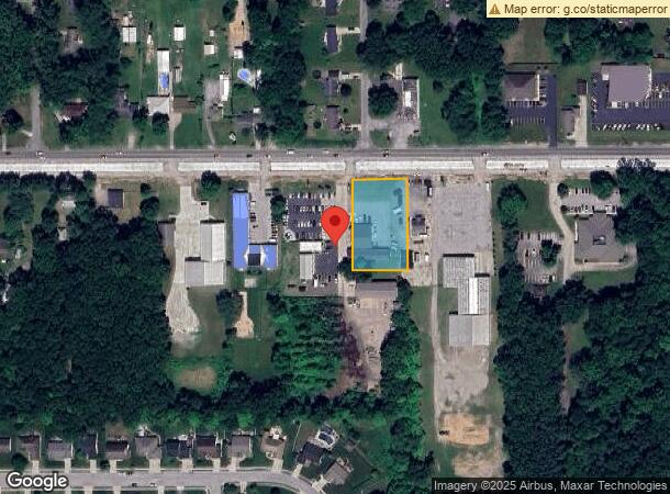
10880 Mckinley Hwy
South Bend-Mishawaka, IN-MI
K&S Minor Sub
71-10-04-301-006.000-031
LOT 1 K&S MINOR SUB NP # 25 3/02/06
Storebuilding
St Joseph
X
Indiana
18039C0125D
1
2022
0.81 AC
2023
Outlying St Joseph County
011603
South Bend/Mishawaka
5,678 SF
DEMOGRAPHICS near 10880 Mckinley Hwy
1 Mile
3 Mile
5 Mile
2024 Total Population
5,316
27,759
73,418
2029 Population
5,232
27,485
72,870
Pop Growth 2024-2029
(1.58%)
(0.99%)
(0.75%)
Average Age
40
40
39
2024 Total Households
1,922
10,260
27,411
HH Growth 2024-2029
(1.66%)
(1.06%)
(0.81%)
Median Household Inc
$88,705
$74,255
$68,892
Avg Household Size
2.70
2.70
2.60
2024 Avg HH Vehicles
2.00
2.00
2.00
Median Home Value
$177,315
$180,171
$180,121
Median Year Built
1977
1977
1975
Nearby Places
- Restaurants
- Banks
- Shops
- Fitness
- Groceries
PUBLIC TRANSPORTATION
COMMUTER RAIL
Elkhart Amtrak Station (Capitol Limited - Amtrak, Lake Shore Limited - Amtrak)
DRIVE
WALK
Distance
Elkhart Amtrak Station (Capitol Limited - Amtrak, Lake Shore Limited - Amtrak)
10 min
5.9 mi
AIRPORT
South Bend International
DRIVE
WALK
Distance
South Bend International
33 min
15.2 mi
Freight Ports
Port Milwaukee
DRIVE
WALK
Distance
Port Milwaukee
228 min
190.7 mi
Nearby Properties
Address
Land Use
TOTAL SIZE
Lot Size
Zoning
Address
Land Use
TOTAL SIZE
Lot Size
Zoning
653,141 SF
32.18 AC
Address
Land Use
TOTAL SIZE
Lot Size
Zoning
377,169 SF
23.85 AC
ZO01
Address
Land Use
TOTAL SIZE
Lot Size
Zoning
184,212 SF
23.71 AC
ZO01
Address
Land Use
TOTAL SIZE
Lot Size
Zoning
36,851 SF
22.72 AC
Address
Land Use
TOTAL SIZE
Lot Size
Zoning
83,856 SF
54.56 AC
ZO01
Address
Land Use
TOTAL SIZE
Lot Size
Zoning
623,232 SF
74.18 AC
Address
Land Use
TOTAL SIZE
Lot Size
Zoning
316,658 SF
27.46 AC
Address
Land Use
TOTAL SIZE
Lot Size
Zoning
270,962 SF
27.20 AC
Address
Land Use
TOTAL SIZE
Lot Size
Zoning
188,176 SF
13.90 AC
ZO01
Address
Land Use
TOTAL SIZE
Lot Size
Zoning
120,513 SF
7.92 AC
Address
Land Use
TOTAL SIZE
Lot Size
Zoning
261,621 SF
23.42 AC
Address
Land Use
TOTAL SIZE
Lot Size
Zoning
295,683 SF
21.32 AC
Address
Land Use
TOTAL SIZE
Lot Size
Zoning
226,496 SF
25.73 AC
Address
Land Use
TOTAL SIZE
Lot Size
Zoning
159,677 SF
6.67 AC
Address
Land Use
TOTAL SIZE
Lot Size
Zoning
182,018 SF
30.91 AC
ZO01
Address
Land Use
TOTAL SIZE
Lot Size
Zoning
57,293 SF
15 AC
Address
Land Use
TOTAL SIZE
Lot Size
Zoning
46,080 SF
2.64 AC
Address
Land Use
TOTAL SIZE
Lot Size
Zoning
47,240 SF
6.66 AC
Address
Land Use
TOTAL SIZE
Lot Size
Zoning
30,470 SF
20 AC
Address
Land Use
TOTAL SIZE
Lot Size
Zoning
42,500 SF
1.93 AC
Address
Land Use
TOTAL SIZE
Lot Size
Zoning
69,518 SF
33.38 AC
ZO01
Address
Land Use
TOTAL SIZE
Lot Size
Zoning
50,057 SF
10 AC
ZO01
Address
Land Use
TOTAL SIZE
Lot Size
Zoning
113,890 SF
22 AC
ZO01
Address
Land Use
TOTAL SIZE
Lot Size
Zoning
30,344 SF
7.94 AC
Address
Land Use
TOTAL SIZE
Lot Size
Zoning
95,400 SF
5.26 AC
ZO01
Address
Land Use
TOTAL SIZE
Lot Size
Zoning
53,663 SF
1.79 AC
ZO01
Address
Land Use
TOTAL SIZE
Lot Size
Zoning
32,756 SF
4.93 AC
Address
Land Use
TOTAL SIZE
Lot Size
Zoning
3,080 SF
1.08 AC
Address
Land Use
TOTAL SIZE
Lot Size
Zoning
33,330 SF
4.27 AC
Address
Land Use
TOTAL SIZE
Lot Size
Zoning
71,166 SF
4.27 AC
The World's #1 Commercial Real Estate Marketplace
Connect with us
© 2025 CoStar Group
The information above has been obtained from sources believed reliable. While we do not doubt its accuracy we have not verified it and make no guarantee, warranty or representation about it. It is your responsibility to independently confirm its accuracy and completeness. Any projections, opinions, assumptions, or estimates used are for example only and do not represent the current or future performance of the property. The value of this transaction to you depends on tax and other factors which should be evaluated by your tax, financial, and legal advisors. You and your advisors should conduct a careful, independent investigation of the property to determine to your satisfaction the suitability of the property for your needs.