Property Record
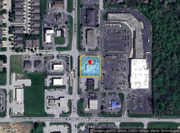
10885 Randolph St, Crown Point, IN 46307
NEARBY LISTINGS FOR SALE OR LEASE
-
-
View all Crown Point listings for sale on LoopNet.com
Property Detail
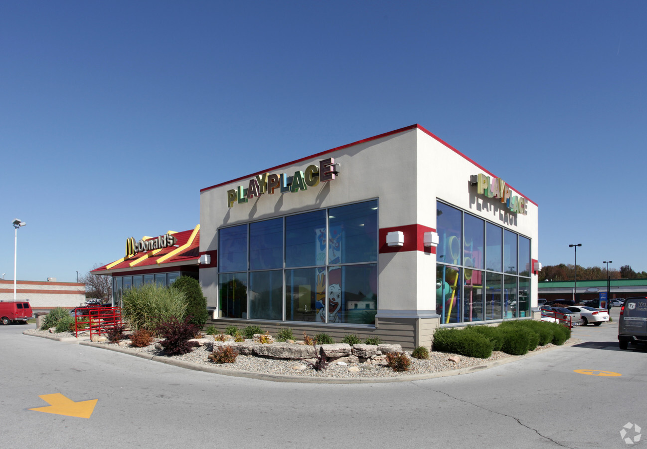
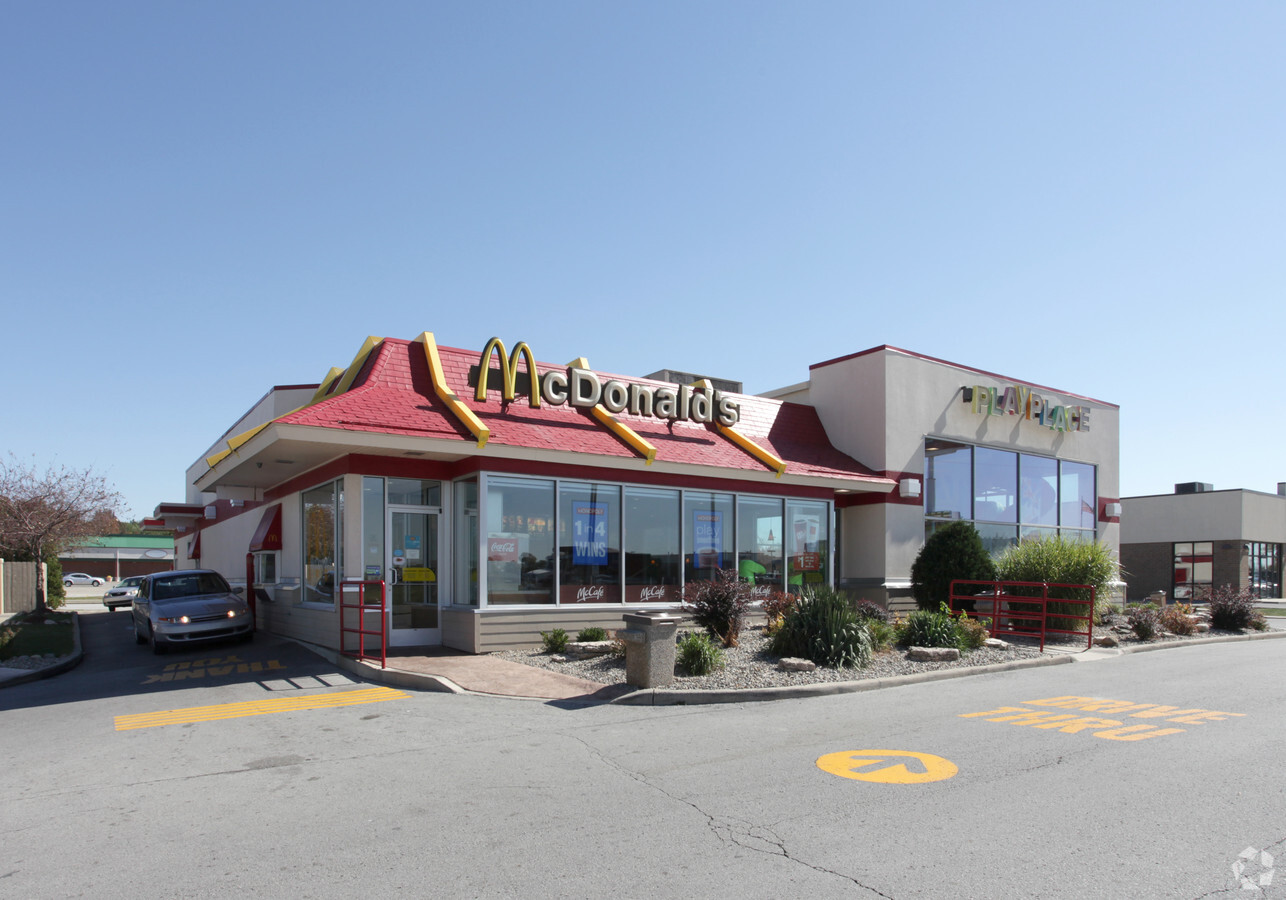
10885 Randolph St
45-17-04-351-007.000-047
PT OF SW1/4 SW1/4 SW1/4 S.4 T.34 R.7 PT N.207FT OF S.635FT 0.949AC
Restaurantdrivein
Lake
X
Indiana
18127C0190D
1
2023
0.95 AC
2024
Indiana
043301
Chicago
5,494 SF
Chicago-Naperville-Elgin, IL-IN-WI
DEMOGRAPHICS near 10885 Randolph St
1 Mile
3 Mile
5 Mile
2024 Total Population
5,917
18,994
31,096
2029 Population
5,974
19,259
31,490
Pop Growth 2024-2029
+ 0.96%
+ 1.40%
+ 1.27%
Average Age
40
41
41
2024 Total Households
2,022
6,664
11,405
HH Growth 2024-2029
+ 1.04%
+ 1.44%
+ 1.25%
Median Household Inc
$114,323
$112,092
$105,697
Avg Household Size
2.90
2.80
2.70
2024 Avg HH Vehicles
2.00
2.00
2.00
Median Home Value
$307,243
$296,977
$287,270
Median Year Built
1996
1992
1993
Nearby Places
- Restaurants
- Banks
- Shops
- Fitness
- Groceries
Nearby Properties
Address
Land Use
TOTAL SIZE
Lot Size
Zoning
Address
Land Use
TOTAL SIZE
Lot Size
Zoning
176,880 SF
63.73 AC
Address
Land Use
TOTAL SIZE
Lot Size
Zoning
40,026 SF
63.27 AC
Address
Land Use
TOTAL SIZE
Lot Size
Zoning
34,931 SF
23 AC
Address
Land Use
TOTAL SIZE
Lot Size
Zoning
40,026 SF
77.32 AC
Address
Land Use
TOTAL SIZE
Lot Size
Zoning
15,302 SF
8.76 AC
R3
Address
Land Use
TOTAL SIZE
Lot Size
Zoning
27,061 SF
13 AC
Address
Land Use
TOTAL SIZE
Lot Size
Zoning
29,730 SF
9.66 AC
Address
Land Use
TOTAL SIZE
Lot Size
Zoning
50,777 SF
1.27 AC
R3
Address
Land Use
TOTAL SIZE
Lot Size
Zoning
51,614 SF
1.49 AC
R3
Address
Land Use
TOTAL SIZE
Lot Size
Zoning
8,100 SF
0.97 AC
Address
Land Use
TOTAL SIZE
Lot Size
Zoning
12,276 SF
2.55 AC
Address
Land Use
TOTAL SIZE
Lot Size
Zoning
13,833 SF
2 AC
R3
Address
Land Use
TOTAL SIZE
Lot Size
Zoning
14,492 SF
16.67 AC
Address
Land Use
TOTAL SIZE
Lot Size
Zoning
9,110 SF
8.95 AC
Address
Land Use
TOTAL SIZE
Lot Size
Zoning
13,547 SF
10 AC
Address
Land Use
TOTAL SIZE
Lot Size
Zoning
3,767 SF
0.74 AC
R33
Address
Land Use
TOTAL SIZE
Lot Size
Zoning
16,274 SF
5.30 AC
Address
Land Use
TOTAL SIZE
Lot Size
Zoning
10,300 SF
1.39 AC
R33
Address
Land Use
TOTAL SIZE
Lot Size
Zoning
10,090 SF
0.71 AC
Address
Land Use
TOTAL SIZE
Lot Size
Zoning
11,851 SF
34.93 AC
Address
Land Use
TOTAL SIZE
Lot Size
Zoning
4,520 SF
1.40 AC
Address
Land Use
TOTAL SIZE
Lot Size
Zoning
14,873 SF
2.76 AC
Address
Land Use
TOTAL SIZE
Lot Size
Zoning
9,722 SF
10 AC
Address
Land Use
TOTAL SIZE
Lot Size
Zoning
8,064 SF
1.40 AC
R3
Address
Land Use
TOTAL SIZE
Lot Size
Zoning
2,636 SF
22.63 AC
Address
Land Use
TOTAL SIZE
Lot Size
Zoning
14.08 AC
R3
Address
Land Use
TOTAL SIZE
Lot Size
Zoning
4,512 SF
2.27 AC
Address
Land Use
TOTAL SIZE
Lot Size
Zoning
9,476 SF
0.84 AC
Address
Land Use
TOTAL SIZE
Lot Size
Zoning
20,364 SF
8.24 AC
The World's #1 Commercial Real Estate Marketplace
Connect with us
© 2025 CoStar Group
The information above has been obtained from sources believed reliable. While we do not doubt its accuracy we have not verified it and make no guarantee, warranty or representation about it. It is your responsibility to independently confirm its accuracy and completeness. Any projections, opinions, assumptions, or estimates used are for example only and do not represent the current or future performance of the property. The value of this transaction to you depends on tax and other factors which should be evaluated by your tax, financial, and legal advisors. You and your advisors should conduct a careful, independent investigation of the property to determine to your satisfaction the suitability of the property for your needs.