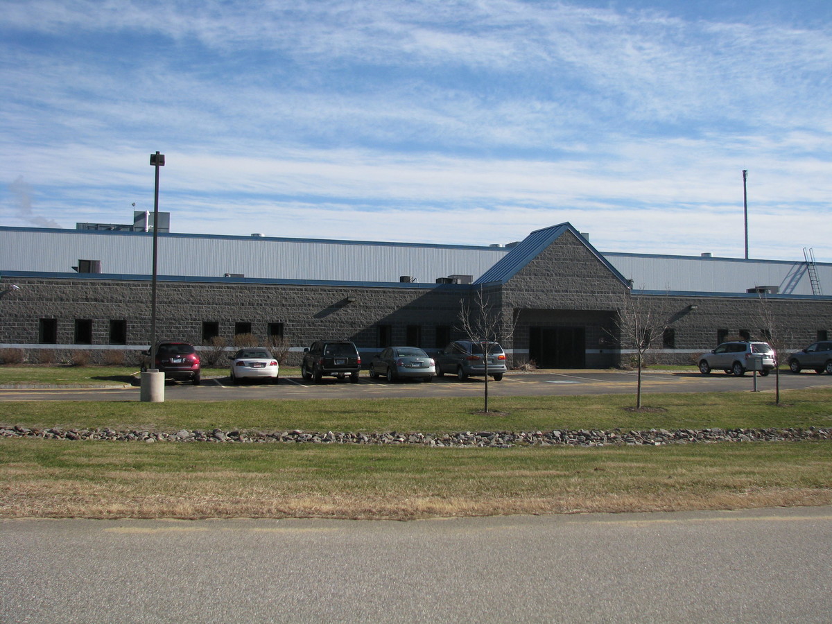
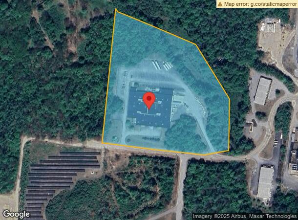
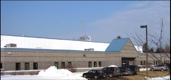
Property Record
109 Industrial Park Dr, Franklin, NH 03235
NEARBY LISTINGS FOR SALE OR LEASE
-
-
View all Franklin listings for sale on LoopNet.com
Property Detail
109 Industrial Park Dr
FRKN-000082-000009-000002
M:082 B:009 L:2; MANUFACTURNG
Commercialbuilding
Merrimack
X
New Hampshire
33013C0166E
2
2023
10.14 AC
2023
Other Market Areas
043001
Concord, NH
54,751 SF
DEMOGRAPHICS near 109 Industrial Park Dr
1 Mile
3 Mile
5 Mile
2024 Total Population
515
10,087
17,578
2029 Population
548
10,721
18,554
Pop Growth 2024-2029
+ 6.41%
+ 6.29%
+ 5.55%
Average Age
42
42
43
2024 Total Households
199
4,123
7,103
HH Growth 2024-2029
+ 6.53%
+ 6.21%
+ 5.45%
Median Household Inc
$76,531
$64,412
$65,133
Avg Household Size
2.40
2.40
2.40
2024 Avg HH Vehicles
2.00
2.00
2.00
Median Home Value
$203,333
$231,052
$239,036
Median Year Built
1966
1964
1969
Nearby Places
- Restaurants
- Banks
- Shops
- Fitness
- Groceries
Nearby Properties
Address
Land Use
TOTAL SIZE
Lot Size
Zoning
Address
Land Use
TOTAL SIZE
Lot Size
Zoning
64,666 SF
8.65 AC
RSW&S
Address
Land Use
TOTAL SIZE
Lot Size
Zoning
Address
Land Use
TOTAL SIZE
Lot Size
Zoning
16,833 SF
2.39 AC
B1W&S
Address
Land Use
TOTAL SIZE
Lot Size
Zoning
93,102 SF
8.21 AC
GENERA
Address
Land Use
TOTAL SIZE
Lot Size
Zoning
83,283 SF
16.81 AC
RSW&S
Address
Land Use
TOTAL SIZE
Lot Size
Zoning
94,330 SF
14.70 AC
B1W&S
Address
Land Use
TOTAL SIZE
Lot Size
Zoning
215,790 SF
18 AC
I1
Address
Land Use
TOTAL SIZE
Lot Size
Zoning
2,032 SF
59.56 AC
MEDIUM
Address
Land Use
TOTAL SIZE
Lot Size
Zoning
53,092 SF
B1W&S
Address
Land Use
TOTAL SIZE
Lot Size
Zoning
6.75 AC
GENERA
Address
Land Use
TOTAL SIZE
Lot Size
Zoning
44,129 SF
13.23 AC
RSW&S
Address
Land Use
TOTAL SIZE
Lot Size
Zoning
4,832 SF
1.37 AC
R3W&S
Address
Land Use
TOTAL SIZE
Lot Size
Zoning
65,308 SF
2.27 AC
B2
Address
Land Use
TOTAL SIZE
Lot Size
Zoning
31,620 SF
8.12 AC
RSW&S
Address
Land Use
TOTAL SIZE
Lot Size
Zoning
141,138 SF
25.99 AC
I1W&S
Address
Land Use
TOTAL SIZE
Lot Size
Zoning
44,955 SF
5.22 AC
B1W&S
Address
Land Use
TOTAL SIZE
Lot Size
Zoning
8,234 SF
5.70 AC
R2W&S
Address
Land Use
TOTAL SIZE
Lot Size
Zoning
40,321 SF
11.20 AC
R2W&S
Address
Land Use
TOTAL SIZE
Lot Size
Zoning
25,274 SF
1.40 AC
B2
Address
Land Use
TOTAL SIZE
Lot Size
Zoning
44,678 SF
1.40 AC
B2
Address
Land Use
TOTAL SIZE
Lot Size
Zoning
9,321 SF
3.50 AC
R2W&S
Address
Land Use
TOTAL SIZE
Lot Size
Zoning
16,647 SF
1.20 AC
B2
Address
Land Use
TOTAL SIZE
Lot Size
Zoning
74,989 SF
14.90 AC
I1W&S
Address
Land Use
TOTAL SIZE
Lot Size
Zoning
1,980 SF
48.93 AC
R1W&S
Address
Land Use
TOTAL SIZE
Lot Size
Zoning
5,356 SF
5.17 AC
C
Address
Land Use
TOTAL SIZE
Lot Size
Zoning
119,862 SF
4.51 AC
B2
Address
Land Use
TOTAL SIZE
Lot Size
Zoning
26,237 SF
0.93 AC
B2
Address
Land Use
TOTAL SIZE
Lot Size
Zoning
26,705 SF
11.70 AC
RSW&S
Address
Land Use
TOTAL SIZE
Lot Size
Zoning
6,209 SF
8.70 AC
R3W&S
Address
Land Use
TOTAL SIZE
Lot Size
Zoning
13,545 SF
1.80 AC
B1W&S
The World's #1 Commercial Real Estate Marketplace
Connect with us
© 2025 CoStar Group
The information above has been obtained from sources believed reliable. While we do not doubt its accuracy we have not verified it and make no guarantee, warranty or representation about it. It is your responsibility to independently confirm its accuracy and completeness. Any projections, opinions, assumptions, or estimates used are for example only and do not represent the current or future performance of the property. The value of this transaction to you depends on tax and other factors which should be evaluated by your tax, financial, and legal advisors. You and your advisors should conduct a careful, independent investigation of the property to determine to your satisfaction the suitability of the property for your needs.