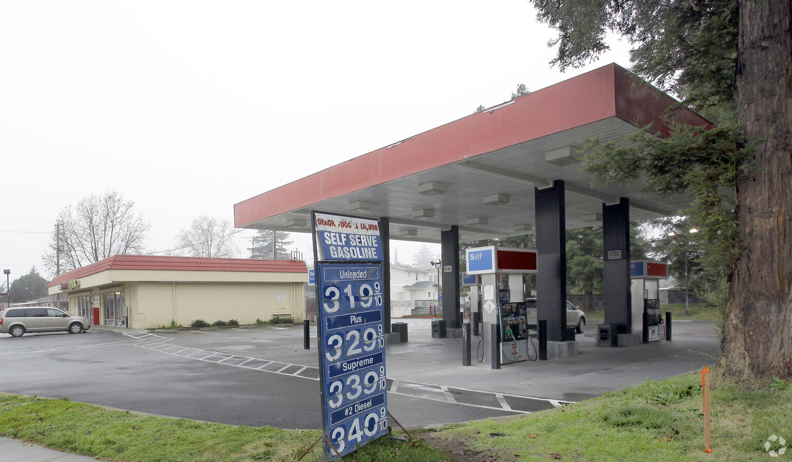
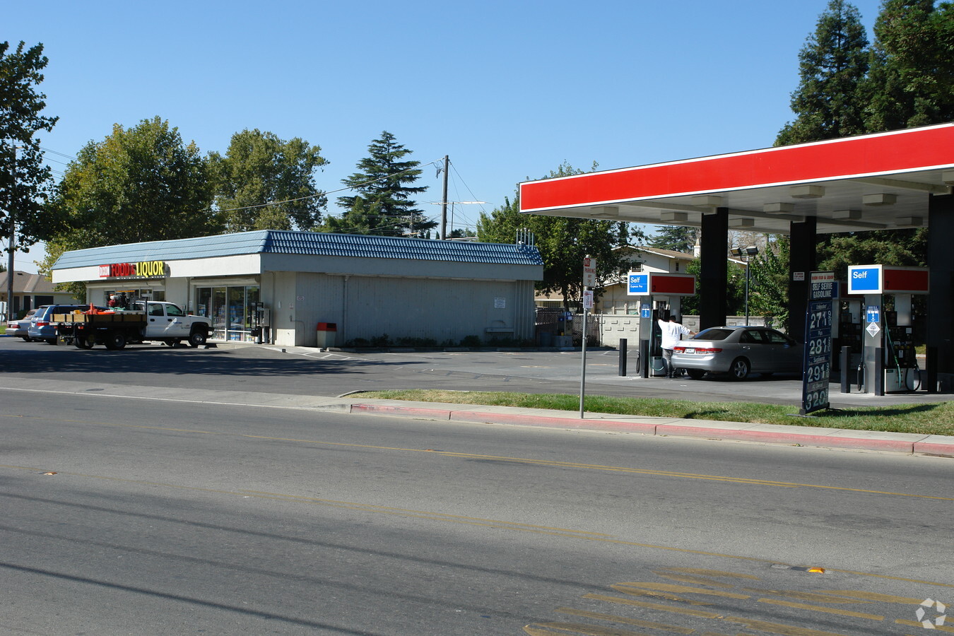
Property Record
109 N Adams St, Dixon, CA 95620
NEARBY LISTINGS FOR SALE OR LEASE
Property Detail
109 N Adams St
Vallejo-Fairfield, CA
Map Of Dixon
0113-052-120
LOT A
Servicestation
Solano
X
California
06095C0200F
a
2023
0.75 AC
2023
Vacaville
253402
North Bay/Santa Rosa
5,880 SF
DEMOGRAPHICS near 109 N Adams St
1 Mile
3 Mile
5 Mile
2024 Total Population
14,718
19,724
20,609
2029 Population
14,589
19,500
20,342
Pop Growth 2024-2029
(0.88%)
(1.14%)
(1.30%)
Average Age
39
39
39
2024 Total Households
4,931
6,618
6,919
HH Growth 2024-2029
(0.91%)
(1.18%)
(1.34%)
Median Household Inc
$85,637
$88,963
$88,881
Avg Household Size
2.90
2.90
2.90
2024 Avg HH Vehicles
2.00
2.00
2.00
Median Home Value
$522,478
$530,977
$547,641
Median Year Built
1982
1987
1987
Nearby Places
- Restaurants
- Banks
- Shops
- Fitness
- Groceries
PUBLIC TRANSPORTATION
COMMUTER RAIL
Davis (California Zephyr - Capitol Corridor Joint Powers Authority, Capitol Corridor - Capitol Corridor Joint Powers Authority, Coast Starlight - Capitol Corridor Joint Powers Authority)
DRIVE
WALK
Distance
Davis (California Zephyr - Capitol Corridor Joint Powers Authority, Capitol Corridor - Capitol Corridor Joint Powers Authority, Coast Starlight - Capitol Corridor Joint Powers Authority)
14 min
9.6 mi
AIRPORT
Sacramento International
DRIVE
WALK
Distance
Sacramento International
37 min
28.0 mi
Freight Ports
Port of Stockton
DRIVE
WALK
Distance
Port of Stockton
78 min
55.2 mi
Nearby Properties
Address
Land Use
TOTAL SIZE
Lot Size
Zoning
Address
Land Use
TOTAL SIZE
Lot Size
Zoning
6.50 AC
INDUSTRIAL
Address
Land Use
TOTAL SIZE
Lot Size
Zoning
56,534 SF
29.18 AC
Address
Land Use
TOTAL SIZE
Lot Size
Zoning
22.98 AC
Address
Land Use
TOTAL SIZE
Lot Size
Zoning
446,089 SF
20.95 AC
Address
Land Use
TOTAL SIZE
Lot Size
Zoning
4.13 AC
Address
Land Use
TOTAL SIZE
Lot Size
Zoning
138,773 SF
69.74 AC
A-40
Address
Land Use
TOTAL SIZE
Lot Size
Zoning
192,770 SF
20.56 AC
Address
Land Use
TOTAL SIZE
Lot Size
Zoning
44,410 SF
40.45 AC
Address
Land Use
TOTAL SIZE
Lot Size
Zoning
22,650 SF
4.07 AC
MH
Address
Land Use
TOTAL SIZE
Lot Size
Zoning
92,186 SF
4.73 AC
Address
Land Use
TOTAL SIZE
Lot Size
Zoning
330,554 SF
22.56 AC
INDUSTRIAL
Address
Land Use
TOTAL SIZE
Lot Size
Zoning
0.12 AC
Address
Land Use
TOTAL SIZE
Lot Size
Zoning
0.11 AC
Address
Land Use
TOTAL SIZE
Lot Size
Zoning
0.12 AC
Address
Land Use
TOTAL SIZE
Lot Size
Zoning
0.12 AC
Address
Land Use
TOTAL SIZE
Lot Size
Zoning
0.12 AC
Address
Land Use
TOTAL SIZE
Lot Size
Zoning
0.12 AC
Address
Land Use
TOTAL SIZE
Lot Size
Zoning
0.13 AC
Address
Land Use
TOTAL SIZE
Lot Size
Zoning
0.17 AC
Address
Land Use
TOTAL SIZE
Lot Size
Zoning
0.11 AC
Address
Land Use
TOTAL SIZE
Lot Size
Zoning
0.11 AC
Address
Land Use
TOTAL SIZE
Lot Size
Zoning
0.11 AC
Address
Land Use
TOTAL SIZE
Lot Size
Zoning
0.11 AC
Address
Land Use
TOTAL SIZE
Lot Size
Zoning
0.13 AC
Address
Land Use
TOTAL SIZE
Lot Size
Zoning
0.12 AC
Address
Land Use
TOTAL SIZE
Lot Size
Zoning
0.11 AC
Address
Land Use
TOTAL SIZE
Lot Size
Zoning
0.19 AC
Address
Land Use
TOTAL SIZE
Lot Size
Zoning
0.13 AC
Address
Land Use
TOTAL SIZE
Lot Size
Zoning
0.11 AC
The World's #1 Commercial Real Estate Marketplace
Connect with us
© 2025 CoStar Group
The information above has been obtained from sources believed reliable. While we do not doubt its accuracy we have not verified it and make no guarantee, warranty or representation about it. It is your responsibility to independently confirm its accuracy and completeness. Any projections, opinions, assumptions, or estimates used are for example only and do not represent the current or future performance of the property. The value of this transaction to you depends on tax and other factors which should be evaluated by your tax, financial, and legal advisors. You and your advisors should conduct a careful, independent investigation of the property to determine to your satisfaction the suitability of the property for your needs.