Property Record
109 Village Way, King, NC 27021
NEARBY LISTINGS FOR SALE OR LEASE
-
-
View all King listings for sale on LoopNet.com
Property Detail
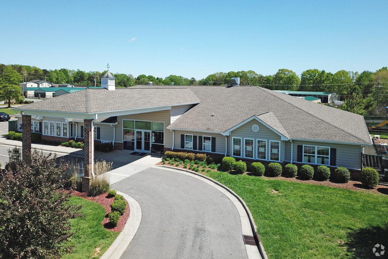
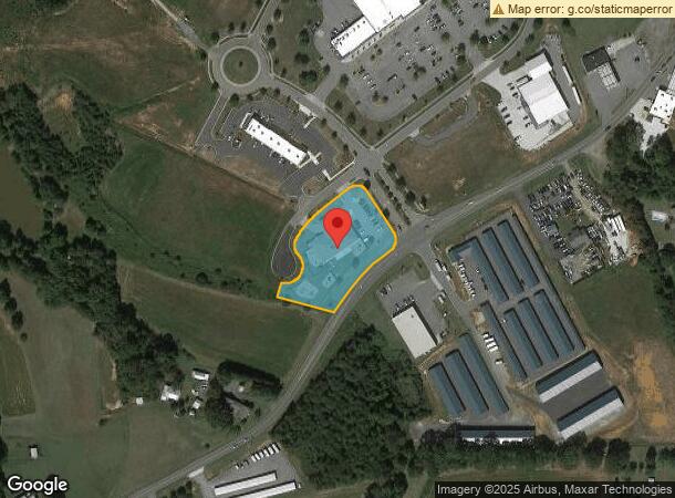
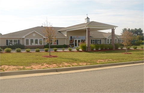
109 Village Way
Winston-Salem, NC
Walter Ridge
690304704538
LO7 PL8-111
Daycare
Stokes
X
North Carolina
3710690300J
7
2024
1.56 AC
2024
Stokes County
0705032017
Greensboro/Winston-Salem
7,453 SF
DEMOGRAPHICS near 109 Village Way
1 Mile
3 Mile
5 Mile
2024 Total Population
1,961
12,849
21,815
2029 Population
2,019
13,208
22,490
Pop Growth 2024-2029
+ 2.96%
+ 2.79%
+ 3.09%
Average Age
43
43
44
2024 Total Households
780
5,260
9,089
HH Growth 2024-2029
+ 2.95%
+ 2.76%
+ 3.06%
Median Household Inc
$58,285
$59,927
$60,291
Avg Household Size
2.50
2.40
2.40
2024 Avg HH Vehicles
2.00
2.00
2.00
Median Home Value
$182,746
$177,365
$177,317
Median Year Built
1984
1985
1984
Nearby Places
- Restaurants
- Banks
- Shops
- Fitness
- Groceries
PUBLIC TRANSPORTATION
AIRPORT
Piedmont Triad International
DRIVE
WALK
Distance
Piedmont Triad International
51 min
33.4 mi
Freight Ports
Virginia Port Authority - Richmond
DRIVE
WALK
Distance
Virginia Port Authority - Richmond
277 min
237.0 mi
Nearby Properties
Address
Land Use
TOTAL SIZE
Lot Size
Zoning
Address
Land Use
TOTAL SIZE
Lot Size
Zoning
70,969 SF
63.74 AC
R-20
Address
Land Use
TOTAL SIZE
Lot Size
Zoning
17,714 SF
5.39 AC
R-15
Address
Land Use
TOTAL SIZE
Lot Size
Zoning
80,634 SF
8.59 AC
B-2
Address
Land Use
TOTAL SIZE
Lot Size
Zoning
56,034 SF
8.61 AC
B-2
Address
Land Use
TOTAL SIZE
Lot Size
Zoning
30,836 SF
9.33 AC
L-I
Address
Land Use
TOTAL SIZE
Lot Size
Zoning
43,423 SF
9.86 AC
B-2-CU
Address
Land Use
TOTAL SIZE
Lot Size
Zoning
34,510 SF
13.74 AC
B-2
Address
Land Use
TOTAL SIZE
Lot Size
Zoning
33,170 SF
4.76 AC
R-R
Address
Land Use
TOTAL SIZE
Lot Size
Zoning
39,330 SF
6.44 AC
R-MF
Address
Land Use
TOTAL SIZE
Lot Size
Zoning
48,042 SF
14.98 AC
R-20
Address
Land Use
TOTAL SIZE
Lot Size
Zoning
18,930 SF
2.20 AC
L-I
Address
Land Use
TOTAL SIZE
Lot Size
Zoning
32,160 SF
8.30 AC
O-I
Address
Land Use
TOTAL SIZE
Lot Size
Zoning
29,553 SF
14.80 AC
R-15
Address
Land Use
TOTAL SIZE
Lot Size
Zoning
26,334 SF
22 AC
R-20
Address
Land Use
TOTAL SIZE
Lot Size
Zoning
9,930 SF
1.65 AC
B-2
Address
Land Use
TOTAL SIZE
Lot Size
Zoning
12,244 SF
18.58 AC
B-2
Address
Land Use
TOTAL SIZE
Lot Size
Zoning
126.47 AC
R-A
Address
Land Use
TOTAL SIZE
Lot Size
Zoning
9,312 SF
3 AC
L-I
Address
Land Use
TOTAL SIZE
Lot Size
Zoning
12,523 SF
2 AC
R-15
Address
Land Use
TOTAL SIZE
Lot Size
Zoning
656 SF
5.70 AC
B-2
Address
Land Use
TOTAL SIZE
Lot Size
Zoning
9,236 SF
2.50 AC
B-2
Address
Land Use
TOTAL SIZE
Lot Size
Zoning
8,943 SF
1.59 AC
B-2
Address
Land Use
TOTAL SIZE
Lot Size
Zoning
13,516 SF
16.65 AC
R-A
Address
Land Use
TOTAL SIZE
Lot Size
Zoning
44,744 SF
1.81 AC
B-2
Address
Land Use
TOTAL SIZE
Lot Size
Zoning
14.09 AC
L-I
Address
Land Use
TOTAL SIZE
Lot Size
Zoning
5,982 SF
2.09 AC
B-2
Address
Land Use
TOTAL SIZE
Lot Size
Zoning
37,604 SF
4.82 AC
R-MF
Address
Land Use
TOTAL SIZE
Lot Size
Zoning
21.98 AC
R-15
Address
Land Use
TOTAL SIZE
Lot Size
Zoning
4,414 SF
1.89 AC
B-2
The World's #1 Commercial Real Estate Marketplace
Connect with us
© 2025 CoStar Group
The information above has been obtained from sources believed reliable. While we do not doubt its accuracy we have not verified it and make no guarantee, warranty or representation about it. It is your responsibility to independently confirm its accuracy and completeness. Any projections, opinions, assumptions, or estimates used are for example only and do not represent the current or future performance of the property. The value of this transaction to you depends on tax and other factors which should be evaluated by your tax, financial, and legal advisors. You and your advisors should conduct a careful, independent investigation of the property to determine to your satisfaction the suitability of the property for your needs.