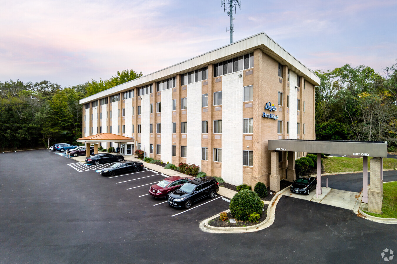
Property Record
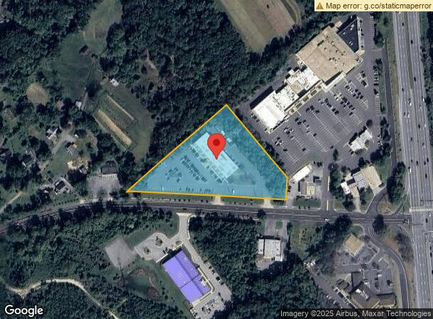
10905 Fort Washington Rd, Fort Washington, MD 20744
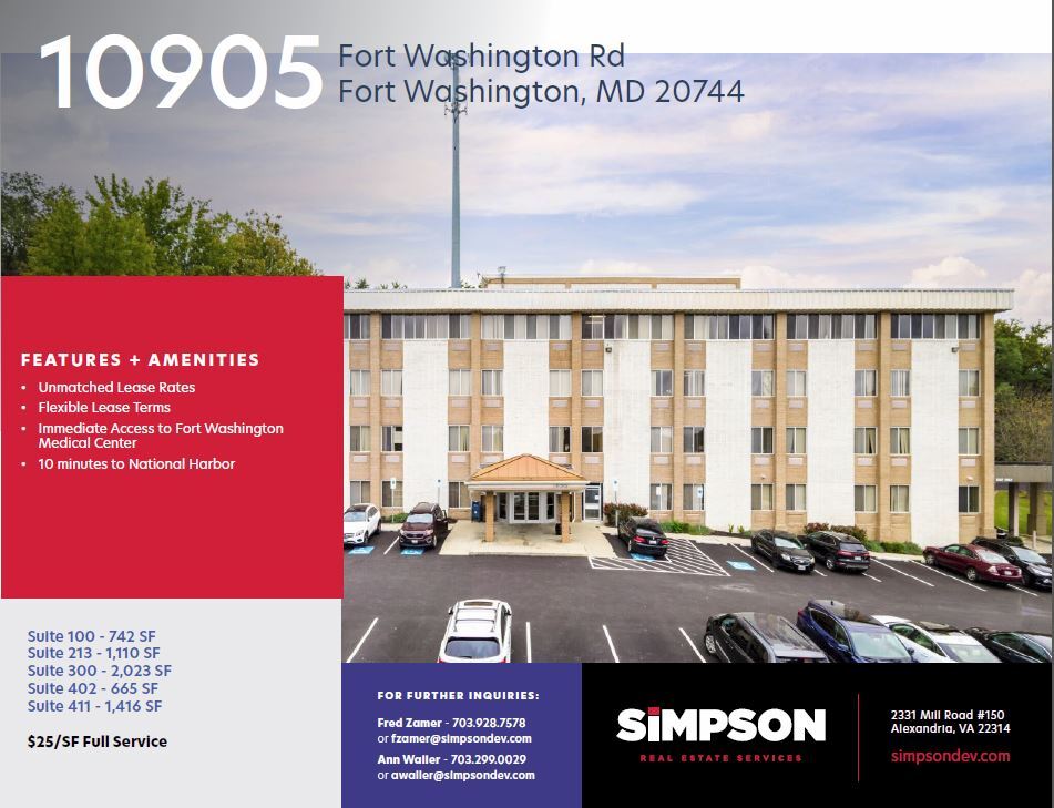
Current Lease Availabilities
NEARBY LISTINGS FOR SALE OR LEASE
Property Detail
10905 Fort Washington Rd
05-0338681
Fort Washington Shopping Center
Officebuilding
PARCEL B & PT PAR A EQ 3.4633 ACR S
X
Prince George's
24033C0330E
Maryland
2024
3.46 AC
2024
NatHbr/OxnHill/FtWash
801307
Washington, DC
52,000 SF
Washington-Arlington-Alexandria, DC-VA-MD-WV
DEMOGRAPHICS near 10905 Fort Washington Rd
1 Mile
3 Mile
5 Mile
2024 Total Population
3,151
40,868
140,264
2029 Population
3,060
39,822
137,322
Pop Growth 2024-2029
(2.89%)
(2.56%)
(2.10%)
Average Age
47
45
42
2024 Total Households
1,168
14,953
53,547
HH Growth 2024-2029
(3.00%)
(2.61%)
(2.14%)
Median Household Inc
$135,264
$123,810
$113,487
Avg Household Size
2.60
2.70
2.60
2024 Avg HH Vehicles
2.00
2.00
2.00
Median Home Value
$456,439
$429,909
$454,633
Median Year Built
1989
1980
1974
Nearby Places
- Restaurants
- Banks
- Shops
- Fitness
- Groceries
PUBLIC TRANSPORTATION
COMMUTER RAIL
Alexandria (Fredericksburg Line - Virginia Railway Express, Manassas Line - Virginia Railway Express)
DRIVE
WALK
Distance
Alexandria (Fredericksburg Line - Virginia Railway Express, Manassas Line - Virginia Railway Express)
16 min
9.0 mi
AIRPORT
Ronald Reagan Washington Ntl
DRIVE
WALK
Distance
Ronald Reagan Washington Ntl
27 min
12.9 mi
Washington Dulles International
DRIVE
WALK
Distance
Washington Dulles International
61 min
40.2 mi
Freight Ports
Port of Baltimore
DRIVE
WALK
Distance
Port of Baltimore
73 min
46.9 mi
Nearby Properties
Address
Land Use
TOTAL SIZE
Lot Size
Zoning
Address
Land Use
TOTAL SIZE
Lot Size
Zoning
2,308,874 SF
22.78 AC
RR
Address
Land Use
TOTAL SIZE
Lot Size
Zoning
587,628 SF
3.18 AC
RTOLC
Address
Land Use
TOTAL SIZE
Lot Size
Zoning
380 SF
17.44 AC
RMF20
Address
Land Use
TOTAL SIZE
Lot Size
Zoning
500,595 SF
18.90 AC
RR
Address
Land Use
TOTAL SIZE
Lot Size
Zoning
126,588 SF
0.71 AC
RTOLC
Address
Land Use
TOTAL SIZE
Lot Size
Zoning
127,484 SF
0.51 AC
RTOLC
Address
Land Use
TOTAL SIZE
Lot Size
Zoning
116 SF
10.37 AC
RMF20
Address
Land Use
TOTAL SIZE
Lot Size
Zoning
419,783 SF
1.98 AC
MXT
Address
Land Use
TOTAL SIZE
Lot Size
Zoning
529,667 SF
2.10 AC
MXT
Address
Land Use
TOTAL SIZE
Lot Size
Zoning
434,910 SF
0.46 AC
RR
Address
Land Use
TOTAL SIZE
Lot Size
Zoning
8.02 AC
RMF20
Address
Land Use
TOTAL SIZE
Lot Size
Zoning
15,393 SF
27.58 AC
R-2
Address
Land Use
TOTAL SIZE
Lot Size
Zoning
89,089 SF
4.78 AC
CGO
Address
Land Use
TOTAL SIZE
Lot Size
Zoning
1,217 SF
8.94 AC
RMF20
Address
Land Use
TOTAL SIZE
Lot Size
Zoning
72,550 SF
15.97 AC
RR
Address
Land Use
TOTAL SIZE
Lot Size
Zoning
66 AC
ROS
Address
Land Use
TOTAL SIZE
Lot Size
Zoning
86,600 SF
1.68 AC
CS
Address
Land Use
TOTAL SIZE
Lot Size
Zoning
120,986 SF
16.42 AC
RR
Address
Land Use
TOTAL SIZE
Lot Size
Zoning
68,960 SF
7.03 AC
CGO
Address
Land Use
TOTAL SIZE
Lot Size
Zoning
79,090 SF
0.37 AC
MXT
Address
Land Use
TOTAL SIZE
Lot Size
Zoning
42,264 SF
3.76 AC
CGO
Address
Land Use
TOTAL SIZE
Lot Size
Zoning
15,200 SF
2.01 AC
CGO
Address
Land Use
TOTAL SIZE
Lot Size
Zoning
59,816 SF
6.86 AC
CGO
Address
Land Use
TOTAL SIZE
Lot Size
Zoning
43,543 SF
4.15 AC
CS
Address
Land Use
TOTAL SIZE
Lot Size
Zoning
21,582 SF
0.36 AC
MXT
Address
Land Use
TOTAL SIZE
Lot Size
Zoning
82,350 SF
7.70 AC
CGO
Address
Land Use
TOTAL SIZE
Lot Size
Zoning
192,850 SF
28.85 AC
RR
Address
Land Use
TOTAL SIZE
Lot Size
Zoning
17.17 AC
RTOLE
Address
Land Use
TOTAL SIZE
Lot Size
Zoning
24.28 AC
RTOLE
Address
Land Use
TOTAL SIZE
Lot Size
Zoning
14,186 SF
0.12 AC
MXT
The World's #1 Commercial Real Estate Marketplace
Connect with us
© 2025 CoStar Group
The information above has been obtained from sources believed reliable. While we do not doubt its accuracy we have not verified it and make no guarantee, warranty or representation about it. It is your responsibility to independently confirm its accuracy and completeness. Any projections, opinions, assumptions, or estimates used are for example only and do not represent the current or future performance of the property. The value of this transaction to you depends on tax and other factors which should be evaluated by your tax, financial, and legal advisors. You and your advisors should conduct a careful, independent investigation of the property to determine to your satisfaction the suitability of the property for your needs.