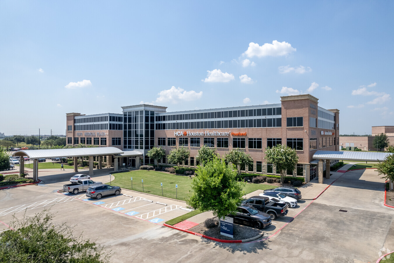
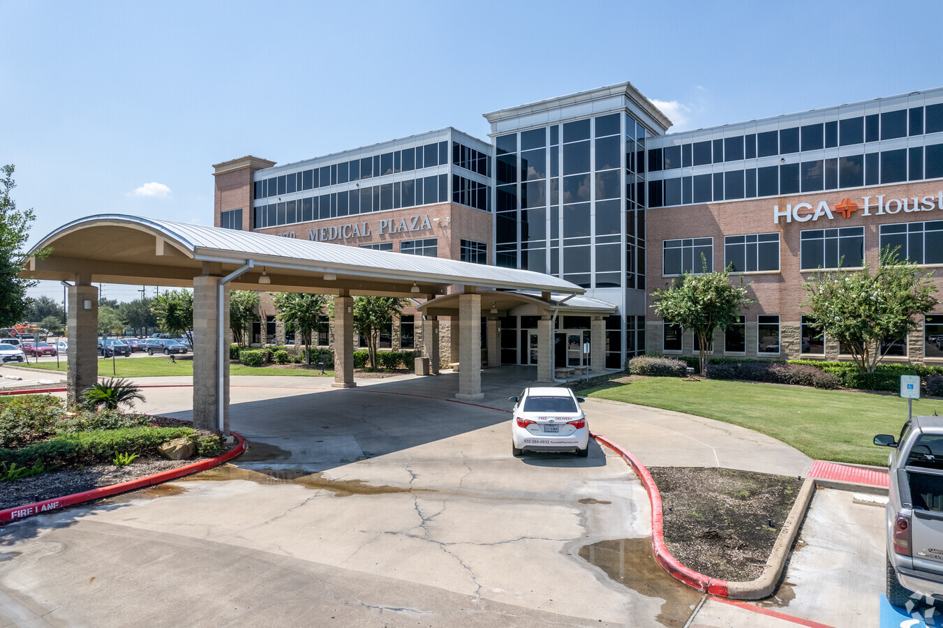
Property Record
10970 Shadow Creek Pkwy, Pearland, TX 77584
Current Lease Availabilities
NEARBY LISTINGS FOR SALE OR LEASE
Property Detail
10970 Shadow Creek Pkwy
Houston-The Woodlands-Sugar Land, TX
Hca Pearland Medical Campus S/D (Pearlan
4537-0001-004
HCA PEARLAND MEDICAL CAMPUS S/D (PEARLAND), BLOCK 1, LOT A1, ACRES 2.6003
Commercialnec
Brazoria
AE
Texas
48039C0010K
a1
2023
2.60 AC
2023
South
6606022010
Houston
81,912 SF
DEMOGRAPHICS near 10970 Shadow Creek Pkwy
1 Mile
3 Mile
5 Mile
2024 Total Population
9,236
77,456
200,642
2029 Population
10,124
84,280
217,232
Pop Growth 2024-2029
+ 9.61%
+ 8.81%
+ 8.27%
Average Age
37
36
36
2024 Total Households
3,882
26,432
66,290
HH Growth 2024-2029
+ 9.69%
+ 9.01%
+ 8.36%
Median Household Inc
$82,881
$100,687
$80,724
Avg Household Size
2.30
2.90
3.00
2024 Avg HH Vehicles
2.00
2.00
2.00
Median Home Value
$290,410
$304,955
$251,246
Median Year Built
2006
2005
2002
Nearby Places
- Restaurants
- Banks
- Shops
- Fitness
- Groceries
PUBLIC TRANSPORTATION
AIRPORT
William P Hobby
DRIVE
WALK
Distance
William P Hobby
23 min
11.2 mi
George Bush Intcntl/Houston
DRIVE
WALK
Distance
George Bush Intcntl/Houston
43 min
31.8 mi
Freight Ports
Port of Houston
DRIVE
WALK
Distance
Port of Houston
28 min
18.0 mi
Nearby Properties
Address
Land Use
TOTAL SIZE
Lot Size
Zoning
Address
Land Use
TOTAL SIZE
Lot Size
Zoning
60.11 AC
Address
Land Use
TOTAL SIZE
Lot Size
Zoning
66.85 AC
0047
Address
Land Use
TOTAL SIZE
Lot Size
Zoning
148,775 SF
37.92 AC
Address
Land Use
TOTAL SIZE
Lot Size
Zoning
367,766 SF
43.71 AC
Address
Land Use
TOTAL SIZE
Lot Size
Zoning
346,870 SF
Address
Land Use
TOTAL SIZE
Lot Size
Zoning
42,360 SF
13.01 AC
Address
Land Use
TOTAL SIZE
Lot Size
Zoning
679,822 SF
27.54 AC
Address
Land Use
TOTAL SIZE
Lot Size
Zoning
321,409 SF
13.90 AC
Address
Land Use
TOTAL SIZE
Lot Size
Zoning
181,341 SF
16.73 AC
Address
Land Use
TOTAL SIZE
Lot Size
Zoning
318,524 SF
20.44 AC
Address
Land Use
TOTAL SIZE
Lot Size
Zoning
400,696 SF
18.88 AC
Address
Land Use
TOTAL SIZE
Lot Size
Zoning
372,209 SF
17.91 AC
Address
Land Use
TOTAL SIZE
Lot Size
Zoning
319,173 SF
7.67 AC
Address
Land Use
TOTAL SIZE
Lot Size
Zoning
372,280 SF
14.70 AC
0021
Address
Land Use
TOTAL SIZE
Lot Size
Zoning
373,654 SF
16.34 AC
Address
Land Use
TOTAL SIZE
Lot Size
Zoning
460,711 SF
18.98 AC
Address
Land Use
TOTAL SIZE
Lot Size
Zoning
412,375 SF
22.57 AC
Address
Land Use
TOTAL SIZE
Lot Size
Zoning
354,686 SF
15.85 AC
Address
Land Use
TOTAL SIZE
Lot Size
Zoning
447,956 SF
18.42 AC
Address
Land Use
TOTAL SIZE
Lot Size
Zoning
699,823 SF
5.82 AC
Address
Land Use
TOTAL SIZE
Lot Size
Zoning
428,639 SF
16.96 AC
Address
Land Use
TOTAL SIZE
Lot Size
Zoning
323,168 SF
12.80 AC
Address
Land Use
TOTAL SIZE
Lot Size
Zoning
369,539 SF
30.71 AC
Address
Land Use
TOTAL SIZE
Lot Size
Zoning
202,500 SF
30.60 AC
Address
Land Use
TOTAL SIZE
Lot Size
Zoning
225,854 SF
10.44 AC
Address
Land Use
TOTAL SIZE
Lot Size
Zoning
240,616 SF
10.01 AC
Address
Land Use
TOTAL SIZE
Lot Size
Zoning
228,288 SF
10.32 AC
Address
Land Use
TOTAL SIZE
Lot Size
Zoning
350,128 SF
16.98 AC
Address
Land Use
TOTAL SIZE
Lot Size
Zoning
130,498 SF
93.44 AC
Address
Land Use
TOTAL SIZE
Lot Size
Zoning
387,389 SF
21.40 AC
The World's #1 Commercial Real Estate Marketplace
Connect with us
© 2025 CoStar Group
The information above has been obtained from sources believed reliable. While we do not doubt its accuracy we have not verified it and make no guarantee, warranty or representation about it. It is your responsibility to independently confirm its accuracy and completeness. Any projections, opinions, assumptions, or estimates used are for example only and do not represent the current or future performance of the property. The value of this transaction to you depends on tax and other factors which should be evaluated by your tax, financial, and legal advisors. You and your advisors should conduct a careful, independent investigation of the property to determine to your satisfaction the suitability of the property for your needs.