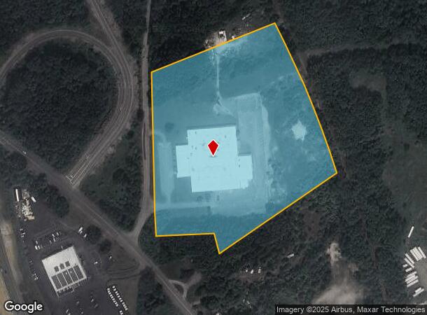
Property Record
11 Danco Rd, Putnam, CT 06260

NEARBY LISTINGS FOR SALE OR LEASE
Property Detail
11 Danco Rd
Worcester, MA-CT
Windham
PUTN-000037-000000-000045
Connecticut
Industrialgeneral
45
2024
11.25 AC
2024
Windham County
903200
Hartford
65,380 SF
DEMOGRAPHICS near 11 Danco Rd
1 Mile
3 Mile
5 Mile
2024 Total Population
1,362
12,989
22,548
2029 Population
1,356
12,993
22,452
Pop Growth 2024-2029
(0.44%)
+ 0.03%
(0.43%)
Average Age
40
41
42
2024 Total Households
568
5,415
9,233
HH Growth 2024-2029
(0.35%)
+ 0.13%
(0.35%)
Median Household Inc
$69,350
$73,841
$76,738
Avg Household Size
2.30
2.30
2.30
2024 Avg HH Vehicles
2.00
2.00
2.00
Median Home Value
$193,298
$226,076
$250,561
Median Year Built
1954
1962
1967
Nearby Places
- Restaurants
- Banks
- Shops
- Fitness
- Groceries
PUBLIC TRANSPORTATION
AIRPORT
Worcester Regional
DRIVE
WALK
Distance
Worcester Regional
43 min
29.4 mi
Rhode Island Tf Green International
DRIVE
WALK
Distance
Rhode Island Tf Green International
52 min
39.5 mi
Freight Ports
Port of Davisville, RI
DRIVE
WALK
Distance
Port of Davisville, RI
64 min
48.7 mi
Nearby Properties
Address
Land Use
TOTAL SIZE
Lot Size
Zoning
Address
Land Use
TOTAL SIZE
Lot Size
Zoning
141.59 AC
RD
Address
Land Use
TOTAL SIZE
Lot Size
Zoning
13.76 AC
Address
Land Use
TOTAL SIZE
Lot Size
Zoning
Address
Land Use
TOTAL SIZE
Lot Size
Zoning
199,059 SF
31.65 AC
Address
Land Use
TOTAL SIZE
Lot Size
Zoning
460,362 SF
32.08 AC
I
Address
Land Use
TOTAL SIZE
Lot Size
Zoning
17.41 AC
Address
Land Use
TOTAL SIZE
Lot Size
Zoning
307,955 SF
52 AC
I
Address
Land Use
TOTAL SIZE
Lot Size
Zoning
29.78 AC
I
Address
Land Use
TOTAL SIZE
Lot Size
Zoning
169.79 AC
ALZ.L
Address
Land Use
TOTAL SIZE
Lot Size
Zoning
104,330 SF
15 AC
Address
Land Use
TOTAL SIZE
Lot Size
Zoning
142,599 SF
17.59 AC
Address
Land Use
TOTAL SIZE
Lot Size
Zoning
219,244 SF
20.74 AC
I
Address
Land Use
TOTAL SIZE
Lot Size
Zoning
37,203 SF
7.21 AC
Address
Land Use
TOTAL SIZE
Lot Size
Zoning
20,644 SF
80.30 AC
Address
Land Use
TOTAL SIZE
Lot Size
Zoning
68,227 SF
55 AC
Address
Land Use
TOTAL SIZE
Lot Size
Zoning
30,036 SF
5.82 AC
RD
Address
Land Use
TOTAL SIZE
Lot Size
Zoning
4,212 SF
8.25 AC
Address
Land Use
TOTAL SIZE
Lot Size
Zoning
9.09 AC
I
Address
Land Use
TOTAL SIZE
Lot Size
Zoning
7,009 SF
15.70 AC
RA80
Address
Land Use
TOTAL SIZE
Lot Size
Zoning
92,080 SF
7.10 AC
Address
Land Use
TOTAL SIZE
Lot Size
Zoning
112,693 SF
6.71 AC
LD
Address
Land Use
TOTAL SIZE
Lot Size
Zoning
40,240 SF
1.84 AC
GC
Address
Land Use
TOTAL SIZE
Lot Size
Zoning
131,792 SF
18.69 AC
Address
Land Use
TOTAL SIZE
Lot Size
Zoning
70,608 SF
5.70 AC
Address
Land Use
TOTAL SIZE
Lot Size
Zoning
101,136 SF
15.07 AC
Address
Land Use
TOTAL SIZE
Lot Size
Zoning
10.08 AC
Address
Land Use
TOTAL SIZE
Lot Size
Zoning
85,301 SF
47.97 AC
I
Address
Land Use
TOTAL SIZE
Lot Size
Zoning
49,445 SF
8.57 AC
Address
Land Use
TOTAL SIZE
Lot Size
Zoning
38.20 AC
RA80
Address
Land Use
TOTAL SIZE
Lot Size
Zoning
74,072 SF
8 AC
I
The World's #1 Commercial Real Estate Marketplace
Connect with us
© 2025 CoStar Group
The information above has been obtained from sources believed reliable. While we do not doubt its accuracy we have not verified it and make no guarantee, warranty or representation about it. It is your responsibility to independently confirm its accuracy and completeness. Any projections, opinions, assumptions, or estimates used are for example only and do not represent the current or future performance of the property. The value of this transaction to you depends on tax and other factors which should be evaluated by your tax, financial, and legal advisors. You and your advisors should conduct a careful, independent investigation of the property to determine to your satisfaction the suitability of the property for your needs.