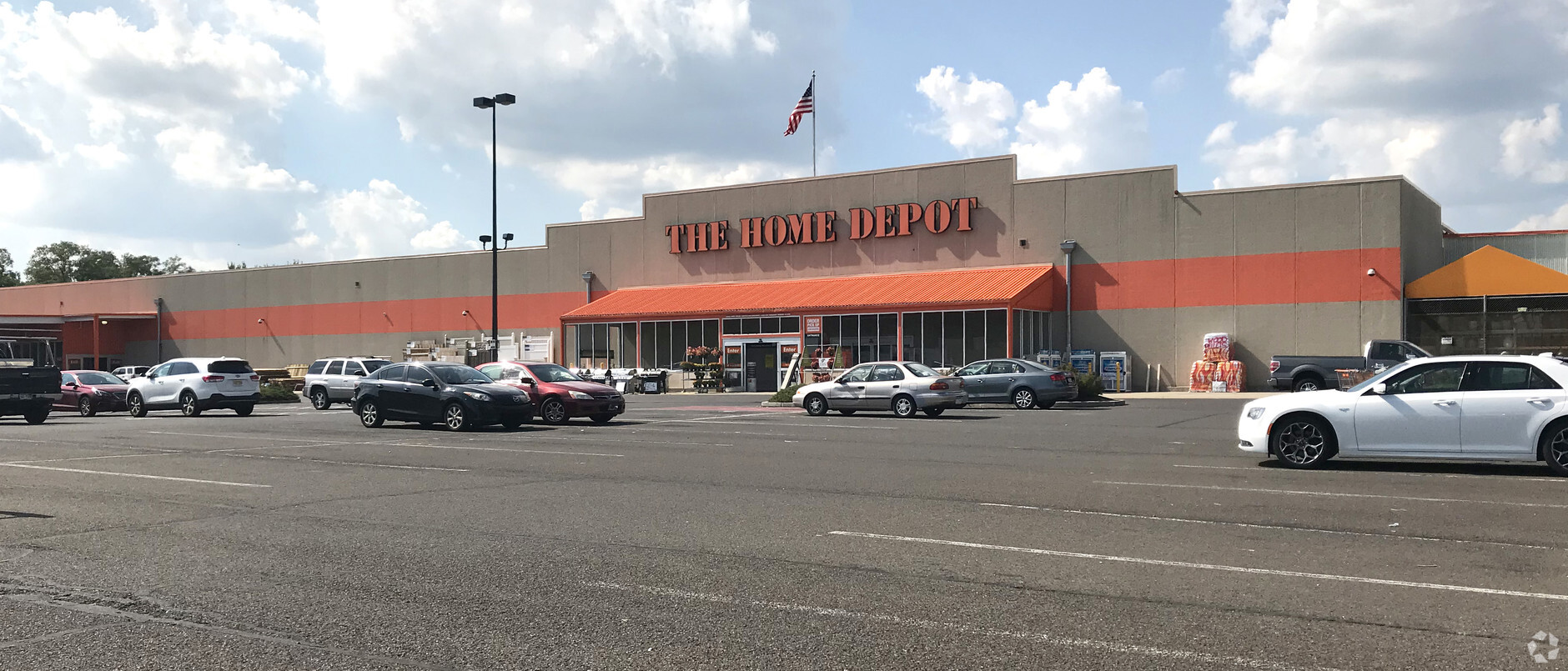
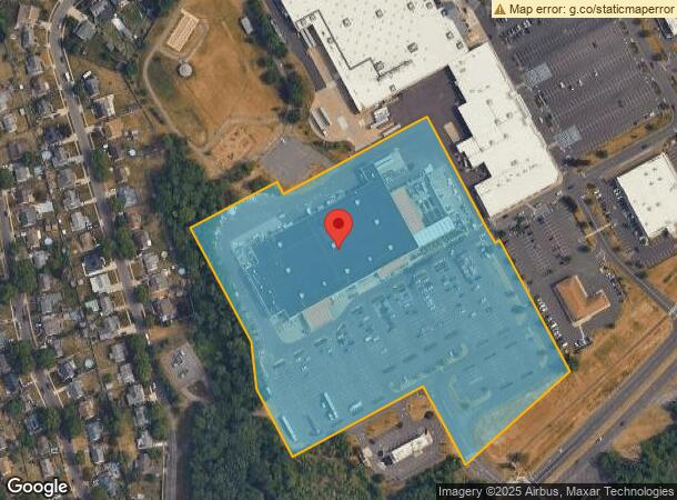
Property Record
145 Levittown Pky, Levittown, PA 19055

NEARBY LISTINGS FOR SALE OR LEASE
Property Detail
145 Levittown Pky
46-006-027
Levittown Town
Storebuilding
12.43AC LEVITTOWN TOWN CE NTER HOME DEPOT TRACT
X
Bucks
34005C0014F
Pennsylvania
2024
12.43 AC
2024
Lower Bucks County
105900
Philadelphia
95,060 SF
Philadelphia-Camden-Wilmington, PA-NJ-DE-MD
DEMOGRAPHICS near 145 Levittown Pky
1 Mile
3 Mile
5 Mile
2024 Total Population
8,803
74,696
166,280
2029 Population
8,742
74,535
166,181
Pop Growth 2024-2029
(0.69%)
(0.22%)
(0.06%)
Average Age
42
41
41
2024 Total Households
3,324
27,936
62,971
HH Growth 2024-2029
(0.81%)
(0.24%)
(0.07%)
Median Household Inc
$82,309
$87,224
$87,638
Avg Household Size
2.60
2.60
2.60
2024 Avg HH Vehicles
2.00
2.00
2.00
Median Home Value
$242,451
$250,809
$274,135
Median Year Built
1955
1956
1958
Nearby Places
- Restaurants
- Banks
- Shops
- Fitness
- Groceries
PUBLIC TRANSPORTATION
COMMUTER RAIL
Levittown (R7 - Southeastern Pennsylvania Transportation Authority Regional Rail (SEPTA Regional Rail))
DRIVE
WALK
Distance
Levittown (R7 - Southeastern Pennsylvania Transportation Authority Regional Rail (SEPTA Regional Rail))
2 min
0.5 mi
Bristol (R7 - Southeastern Pennsylvania Transportation Authority Regional Rail (SEPTA Regional Rail))
DRIVE
WALK
Distance
Bristol (R7 - Southeastern Pennsylvania Transportation Authority Regional Rail (SEPTA Regional Rail))
8 min
3.4 mi
AIRPORT
Trenton Mercer
DRIVE
WALK
Distance
Trenton Mercer
22 min
12.3 mi
Philadelphia International
DRIVE
WALK
Distance
Philadelphia International
53 min
35.1 mi
Freight Ports
Port of Philadelphia
DRIVE
WALK
Distance
Port of Philadelphia
33 min
21.4 mi
Nearby Properties
Address
Land Use
TOTAL SIZE
Lot Size
Zoning
Address
Land Use
TOTAL SIZE
Lot Size
Zoning
65.99 AC
Address
Land Use
TOTAL SIZE
Lot Size
Zoning
22,300 SF
59.13 AC
Address
Land Use
TOTAL SIZE
Lot Size
Zoning
16,960 SF
107.84 AC
Address
Land Use
TOTAL SIZE
Lot Size
Zoning
Address
Land Use
TOTAL SIZE
Lot Size
Zoning
77.35 AC
I-2
Address
Land Use
TOTAL SIZE
Lot Size
Zoning
486,812 SF
44.42 AC
Address
Land Use
TOTAL SIZE
Lot Size
Zoning
Address
Land Use
TOTAL SIZE
Lot Size
Zoning
Address
Land Use
TOTAL SIZE
Lot Size
Zoning
Address
Land Use
TOTAL SIZE
Lot Size
Zoning
Address
Land Use
TOTAL SIZE
Lot Size
Zoning
23.38 AC
Address
Land Use
TOTAL SIZE
Lot Size
Zoning
Address
Land Use
TOTAL SIZE
Lot Size
Zoning
27.99 AC
Address
Land Use
TOTAL SIZE
Lot Size
Zoning
37.98 AC
I-2
Address
Land Use
TOTAL SIZE
Lot Size
Zoning
Address
Land Use
TOTAL SIZE
Lot Size
Zoning
300,700 SF
30.82 AC
Address
Land Use
TOTAL SIZE
Lot Size
Zoning
Address
Land Use
TOTAL SIZE
Lot Size
Zoning
6.08 AC
Address
Land Use
TOTAL SIZE
Lot Size
Zoning
131,702 SF
10.21 AC
Address
Land Use
TOTAL SIZE
Lot Size
Zoning
29 AC
I-2
Address
Land Use
TOTAL SIZE
Lot Size
Zoning
24,328 SF
16.99 AC
I-2
Address
Land Use
TOTAL SIZE
Lot Size
Zoning
13.67 AC
I-2
Address
Land Use
TOTAL SIZE
Lot Size
Zoning
102,000 SF
17.50 AC
Address
Land Use
TOTAL SIZE
Lot Size
Zoning
12.13 AC
Address
Land Use
TOTAL SIZE
Lot Size
Zoning
1,176 SF
7.78 AC
Address
Land Use
TOTAL SIZE
Lot Size
Zoning
35.37 AC
I-2
Address
Land Use
TOTAL SIZE
Lot Size
Zoning
32.60 AC
Address
Land Use
TOTAL SIZE
Lot Size
Zoning
Address
Land Use
TOTAL SIZE
Lot Size
Zoning
1.15 AC
Address
Land Use
TOTAL SIZE
Lot Size
Zoning
The World's #1 Commercial Real Estate Marketplace
Connect with us
© 2025 CoStar Group
The information above has been obtained from sources believed reliable. While we do not doubt its accuracy we have not verified it and make no guarantee, warranty or representation about it. It is your responsibility to independently confirm its accuracy and completeness. Any projections, opinions, assumptions, or estimates used are for example only and do not represent the current or future performance of the property. The value of this transaction to you depends on tax and other factors which should be evaluated by your tax, financial, and legal advisors. You and your advisors should conduct a careful, independent investigation of the property to determine to your satisfaction the suitability of the property for your needs.