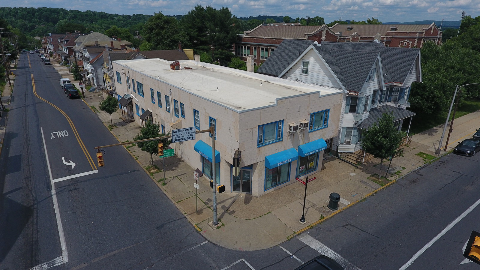
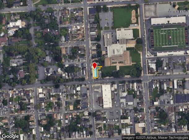
Property Record
11 N 13Th St, Easton, PA 18042
NEARBY LISTINGS FOR SALE OR LEASE
Property Detail
11 N 13Th St
L9SW2B-16-2-0310
Land/Anna M Freyermuth
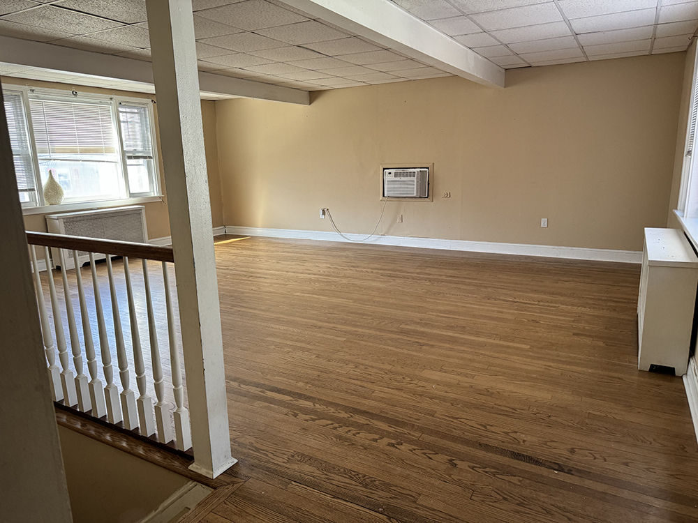
Apartment
Northampton
X
Pennsylvania
42095C0278E
0.11 AC
2024
West Ward
2024
Philadelphia
014200
Allentown-Bethlehem-Easton, PA-NJ
7,528 SF
DEMOGRAPHICS near 11 N 13Th St
1 Mile
3 Mile
5 Mile
2024 Total Population
22,901
92,262
130,736
2029 Population
22,966
93,200
132,353
Pop Growth 2024-2029
+ 0.28%
+ 1.02%
+ 1.24%
Average Age
37
40
41
2024 Total Households
8,181
34,644
49,544
HH Growth 2024-2029
+ 0.13%
+ 1.06%
+ 1.32%
Median Household Inc
$58,989
$75,819
$82,569
Avg Household Size
2.40
2.50
2.50
2024 Avg HH Vehicles
1.00
2.00
2.00
Median Home Value
$156,314
$233,401
$256,394
Median Year Built
1946
1958
1968
Nearby Places
- Restaurants
- Banks
- Shops
- Fitness
- Groceries
PUBLIC TRANSPORTATION
AIRPORT
Lehigh Valley International
DRIVE
WALK
Distance
Lehigh Valley International
21 min
13.3 mi
Freight Ports
Port of Philadelphia
DRIVE
WALK
Distance
Port of Philadelphia
100 min
62.5 mi
SALE & LEASE HISTORY
LISTING DATE
SALE/LEASE

Nov 08, 2024
For Sale
Jun 26, 2018
For Lease
Jun 26, 2018
For Sale
Feb 22, 2019
For Sale
Nearby Properties
Address
Land Use
TOTAL SIZE
Lot Size
Zoning
Address
Land Use
TOTAL SIZE
Lot Size
Zoning
330,000 SF
121.88 AC
R150
Address
Land Use
TOTAL SIZE
Lot Size
Zoning
48.27 AC
I2RA
Address
Land Use
TOTAL SIZE
Lot Size
Zoning
9.80 AC
B-1
Address
Land Use
TOTAL SIZE
Lot Size
Zoning
87,508 SF
40.79 AC
CCE
Address
Land Use
TOTAL SIZE
Lot Size
Zoning
14.60 AC
RA-7
Address
Land Use
TOTAL SIZE
Lot Size
Zoning
13,916 SF
9.47 AC
RLD
Address
Land Use
TOTAL SIZE
Lot Size
Zoning
17.06 AC
R-75
Address
Land Use
TOTAL SIZE
Lot Size
Zoning
17.65 AC
I-1
Address
Land Use
TOTAL SIZE
Lot Size
Zoning
127,731 SF
56.29 AC
R12
Address
Land Use
TOTAL SIZE
Lot Size
Zoning
7.43 AC
R-50
Address
Land Use
TOTAL SIZE
Lot Size
Zoning
6,966 SF
8.86 AC
RMD
Address
Land Use
TOTAL SIZE
Lot Size
Zoning
20.75 AC
B-1
Address
Land Use
TOTAL SIZE
Lot Size
Zoning
84,805 SF
12.20 AC
CHDD
Address
Land Use
TOTAL SIZE
Lot Size
Zoning
2.67 AC
R-75
Address
Land Use
TOTAL SIZE
Lot Size
Zoning
5.77 AC
B-2
Address
Land Use
TOTAL SIZE
Lot Size
Zoning
15.20 AC
B2R5
Address
Land Use
TOTAL SIZE
Lot Size
Zoning
2.55 AC
R-50
Address
Land Use
TOTAL SIZE
Lot Size
Zoning
176,397 SF
45.38 AC
HI
Address
Land Use
TOTAL SIZE
Lot Size
Zoning
0.56 AC
B-1
Address
Land Use
TOTAL SIZE
Lot Size
Zoning
26,714 SF
33.71 AC
RI
Address
Land Use
TOTAL SIZE
Lot Size
Zoning
10.40 AC
R-50
Address
Land Use
TOTAL SIZE
Lot Size
Zoning
27,160 SF
16.26 AC
HDR
Address
Land Use
TOTAL SIZE
Lot Size
Zoning
6.28 AC
B-2
Address
Land Use
TOTAL SIZE
Lot Size
Zoning
254,848 SF
19.50 AC
PO/IP
Address
Land Use
TOTAL SIZE
Lot Size
Zoning
21.80 AC
I-1
Address
Land Use
TOTAL SIZE
Lot Size
Zoning
107,028 SF
3.31 AC
R2
Address
Land Use
TOTAL SIZE
Lot Size
Zoning
6.35 AC
R-75
Address
Land Use
TOTAL SIZE
Lot Size
Zoning
319,578 SF
27.91 AC
I
Address
Land Use
TOTAL SIZE
Lot Size
Zoning
2.40 AC
B-2
Address
Land Use
TOTAL SIZE
Lot Size
Zoning
11.73 AC
I-1
The World's #1 Commercial Real Estate Marketplace
Connect with us
© 2025 CoStar Group
The information above has been obtained from sources believed reliable. While we do not doubt its accuracy we have not verified it and make no guarantee, warranty or representation about it. It is your responsibility to independently confirm its accuracy and completeness. Any projections, opinions, assumptions, or estimates used are for example only and do not represent the current or future performance of the property. The value of this transaction to you depends on tax and other factors which should be evaluated by your tax, financial, and legal advisors. You and your advisors should conduct a careful, independent investigation of the property to determine to your satisfaction the suitability of the property for your needs.