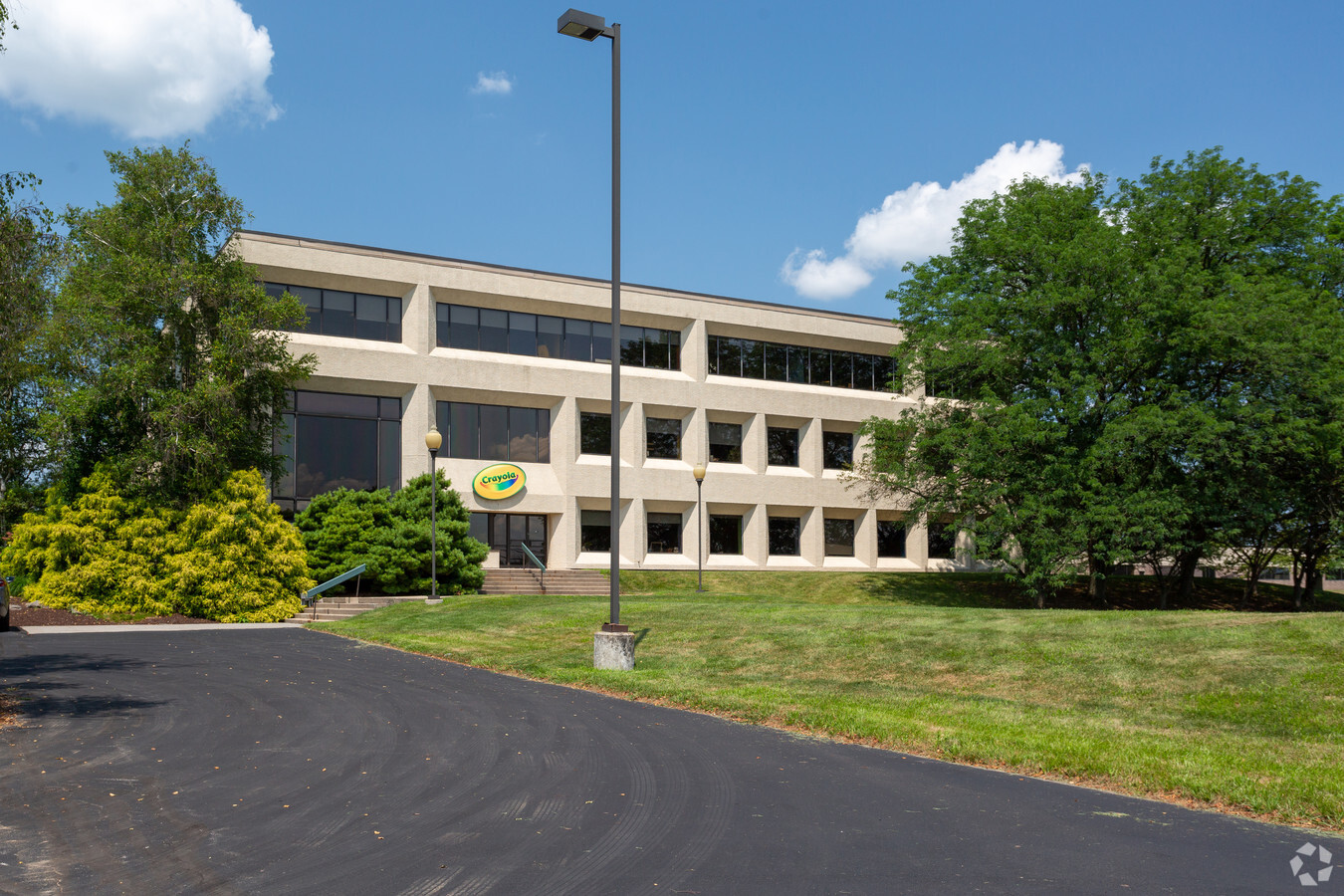
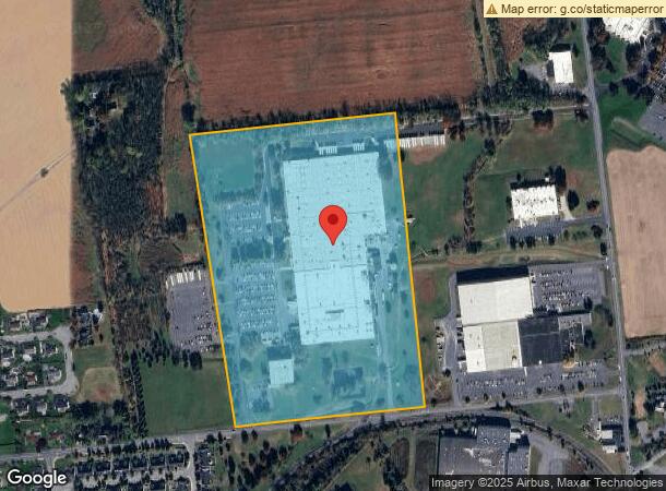
Property Record
1100 Church Ln, Easton, PA 18040
NEARBY LISTINGS FOR SALE OR LEASE
Property Detail
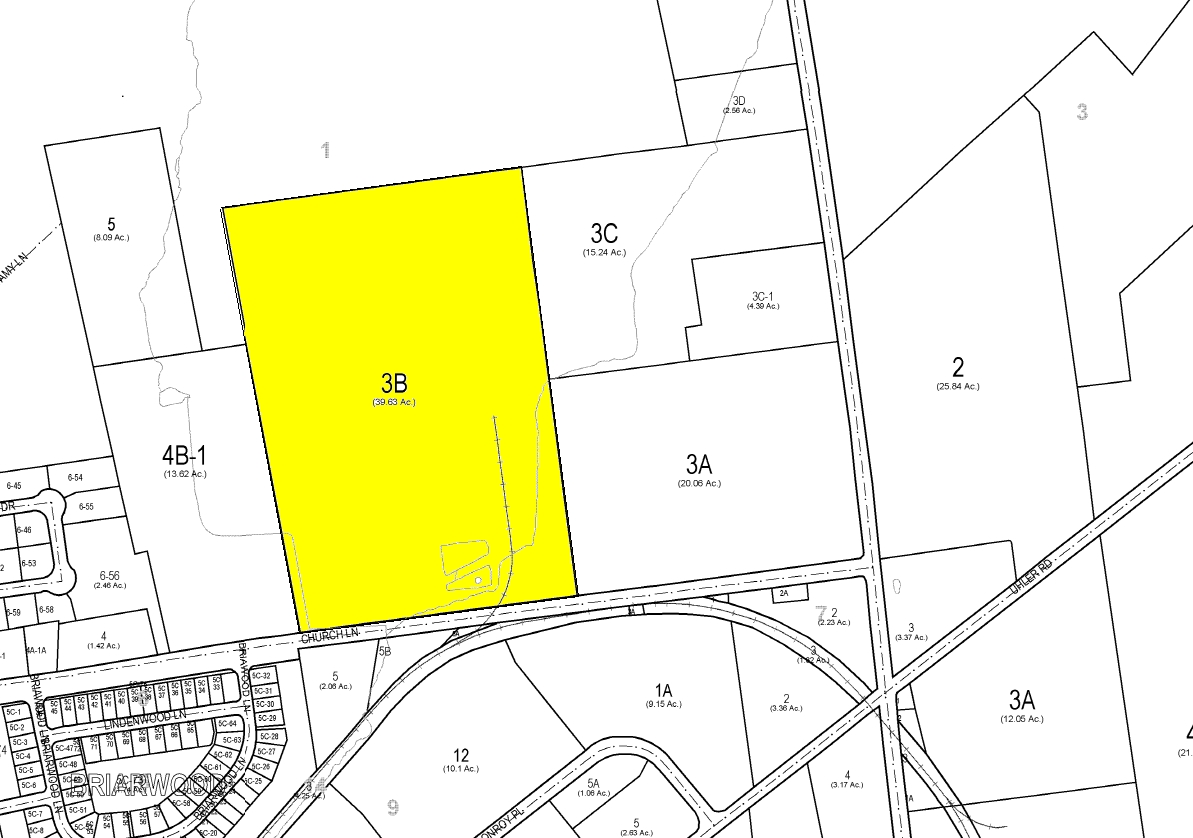
1100 Church Ln
Industrialpark
Northampton
X
Pennsylvania
42095C0165E
38.72 AC
2024
Lehigh Valley
2024
Philadelphia
017104
Allentown-Bethlehem-Easton, PA-NJ
160,000 SF
J9-1-3B-0311
DEMOGRAPHICS near 1100 Church Ln
1 Mile
3 Mile
5 Mile
2024 Total Population
1,877
23,249
89,540
2029 Population
1,918
23,471
90,399
Pop Growth 2024-2029
+ 2.18%
+ 0.95%
+ 0.96%
Average Age
47
43
41
2024 Total Households
707
8,643
33,633
HH Growth 2024-2029
+ 2.12%
+ 1.03%
+ 0.99%
Median Household Inc
$104,730
$109,509
$82,612
Avg Household Size
2.50
2.60
2.50
2024 Avg HH Vehicles
2.00
2.00
2.00
Median Home Value
$284,848
$301,903
$269,555
Median Year Built
2004
1998
1963
Nearby Places
- Restaurants
- Banks
- Shops
- Fitness
- Groceries
PUBLIC TRANSPORTATION
AIRPORT
Lehigh Valley International
DRIVE
WALK
Distance
Lehigh Valley International
27 min
16.2 mi
Freight Ports
Port of Philadelphia
DRIVE
WALK
Distance
Port of Philadelphia
106 min
66.1 mi
Nearby Properties
Address
Land Use
TOTAL SIZE
Lot Size
Zoning
Address
Land Use
TOTAL SIZE
Lot Size
Zoning
491,371 SF
32.30 AC
GI
Address
Land Use
TOTAL SIZE
Lot Size
Zoning
1,107,596 SF
62.46 AC
RA
Address
Land Use
TOTAL SIZE
Lot Size
Zoning
1,020,930 SF
73.10 AC
RA
Address
Land Use
TOTAL SIZE
Lot Size
Zoning
90.58 AC
RA
Address
Land Use
TOTAL SIZE
Lot Size
Zoning
654,480 SF
43.28 AC
RA
Address
Land Use
TOTAL SIZE
Lot Size
Zoning
358,875 SF
39.99 AC
PO/IP
Address
Land Use
TOTAL SIZE
Lot Size
Zoning
503,770 SF
36.05 AC
LI
Address
Land Use
TOTAL SIZE
Lot Size
Zoning
49.45 AC
RA
Address
Land Use
TOTAL SIZE
Lot Size
Zoning
35.05 AC
RA
Address
Land Use
TOTAL SIZE
Lot Size
Zoning
247,226 SF
33.68 AC
DP/IP
Address
Land Use
TOTAL SIZE
Lot Size
Zoning
159,194 SF
42.07 AC
I1
Address
Land Use
TOTAL SIZE
Lot Size
Zoning
242,206 SF
23.01 AC
LI
Address
Land Use
TOTAL SIZE
Lot Size
Zoning
342,820 SF
26.20 AC
RA
Address
Land Use
TOTAL SIZE
Lot Size
Zoning
93,785 SF
76.54 AC
RR
Address
Land Use
TOTAL SIZE
Lot Size
Zoning
281,400 SF
19.80 AC
PO/IP
Address
Land Use
TOTAL SIZE
Lot Size
Zoning
359,742 SF
12.64 AC
LI
Address
Land Use
TOTAL SIZE
Lot Size
Zoning
254,848 SF
19.50 AC
PO/IP
Address
Land Use
TOTAL SIZE
Lot Size
Zoning
261,176 SF
22.56 AC
LI
Address
Land Use
TOTAL SIZE
Lot Size
Zoning
215,200 SF
12.46 AC
G1
Address
Land Use
TOTAL SIZE
Lot Size
Zoning
130,433 SF
31 AC
RR
Address
Land Use
TOTAL SIZE
Lot Size
Zoning
189,046 SF
13.15 AC
PO/IP
Address
Land Use
TOTAL SIZE
Lot Size
Zoning
200,803 SF
13.71 AC
PO/IP
Address
Land Use
TOTAL SIZE
Lot Size
Zoning
182,000 SF
12.55 AC
PO/IP
Address
Land Use
TOTAL SIZE
Lot Size
Zoning
93,011 SF
21.14 AC
GI
Address
Land Use
TOTAL SIZE
Lot Size
Zoning
244,370 SF
15.53 AC
PO/IP
Address
Land Use
TOTAL SIZE
Lot Size
Zoning
193,460 SF
18.26 AC
IBP
Address
Land Use
TOTAL SIZE
Lot Size
Zoning
312,437 SF
35.59 AC
GI
Address
Land Use
TOTAL SIZE
Lot Size
Zoning
146,787 SF
10.67 AC
GI
Address
Land Use
TOTAL SIZE
Lot Size
Zoning
183,320 SF
15 AC
GI
The World's #1 Commercial Real Estate Marketplace
Connect with us
© 2025 CoStar Group
The information above has been obtained from sources believed reliable. While we do not doubt its accuracy we have not verified it and make no guarantee, warranty or representation about it. It is your responsibility to independently confirm its accuracy and completeness. Any projections, opinions, assumptions, or estimates used are for example only and do not represent the current or future performance of the property. The value of this transaction to you depends on tax and other factors which should be evaluated by your tax, financial, and legal advisors. You and your advisors should conduct a careful, independent investigation of the property to determine to your satisfaction the suitability of the property for your needs.