Property Record
1100 E State St, Alliance, OH 44601
NEARBY LISTINGS FOR SALE OR LEASE
Property Detail
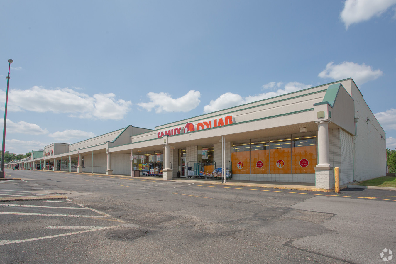
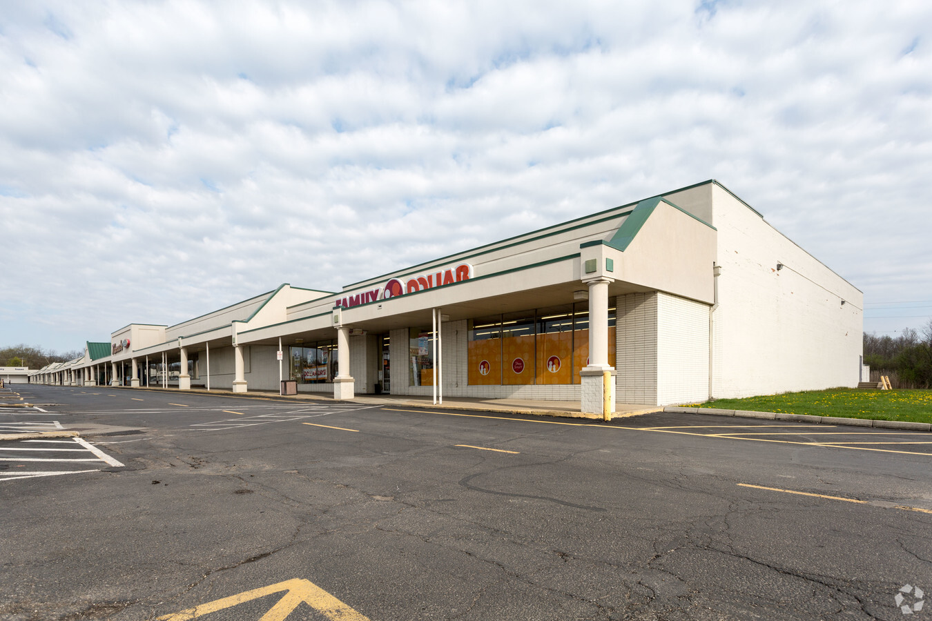
1100 E State St
00101996
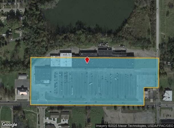
OL 301 14.37A
Regionalshoppingcenterormallwithanchorstore
Stark
X
Ohio
39029C0025E
14.37 AC
0
Stark County
2024
Cleveland
710500
Canton-Massillon, OH
154,537 SF
DEMOGRAPHICS near 1100 E State St
1 Mile
3 Mile
5 Mile
2024 Total Population
6,479
27,263
38,203
2029 Population
6,488
27,213
38,002
Pop Growth 2024-2029
+ 0.14%
(0.18%)
(0.53%)
Average Age
40
40
42
2024 Total Households
2,661
10,957
15,686
HH Growth 2024-2029
+ 0.15%
(0.17%)
(0.50%)
Median Household Inc
$45,425
$50,603
$50,789
Avg Household Size
2.30
2.30
2.30
2024 Avg HH Vehicles
2.00
2.00
2.00
Median Home Value
$69,265
$115,254
$125,518
Median Year Built
1948
1952
1954
Nearby Places
- Restaurants
- Banks
- Shops
- Fitness
- Groceries
PUBLIC TRANSPORTATION
AIRPORT
Akron-Canton Regional
DRIVE
WALK
Distance
Akron-Canton Regional
34 min
25.1 mi
Freight Ports
Port of Baltimore
DRIVE
WALK
Distance
Port of Baltimore
1 min
263.0 mi
SALE & LEASE HISTORY
LISTING DATE
SALE/LEASE

Dec 21, 2018
For Lease
Nearby Properties
Address
Land Use
TOTAL SIZE
Lot Size
Zoning
Address
Land Use
TOTAL SIZE
Lot Size
Zoning
1,015,253 SF
83.25 AC
Address
Land Use
TOTAL SIZE
Lot Size
Zoning
294,532 SF
7.73 AC
Address
Land Use
TOTAL SIZE
Lot Size
Zoning
121,669 SF
27.80 AC
Address
Land Use
TOTAL SIZE
Lot Size
Zoning
275,422 SF
10 AC
Address
Land Use
TOTAL SIZE
Lot Size
Zoning
402,113 SF
25.10 AC
Address
Land Use
TOTAL SIZE
Lot Size
Zoning
93,477 SF
9.34 AC
Address
Land Use
TOTAL SIZE
Lot Size
Zoning
79,700 SF
1.80 AC
Address
Land Use
TOTAL SIZE
Lot Size
Zoning
120,552 SF
10.37 AC
Address
Land Use
TOTAL SIZE
Lot Size
Zoning
65,124 SF
18.25 AC
Address
Land Use
TOTAL SIZE
Lot Size
Zoning
398,637 SF
60.59 AC
Address
Land Use
TOTAL SIZE
Lot Size
Zoning
60,318 SF
6.38 AC
Address
Land Use
TOTAL SIZE
Lot Size
Zoning
73,853 SF
3.83 AC
Address
Land Use
TOTAL SIZE
Lot Size
Zoning
75,318 SF
4.59 AC
Address
Land Use
TOTAL SIZE
Lot Size
Zoning
134,368 SF
10.30 AC
Address
Land Use
TOTAL SIZE
Lot Size
Zoning
73,764 SF
1.52 AC
Address
Land Use
TOTAL SIZE
Lot Size
Zoning
50,334 SF
6.37 AC
Address
Land Use
TOTAL SIZE
Lot Size
Zoning
29,455 SF
8 AC
Address
Land Use
TOTAL SIZE
Lot Size
Zoning
62,767 SF
2.85 AC
Address
Land Use
TOTAL SIZE
Lot Size
Zoning
130,339 SF
10.28 AC
Address
Land Use
TOTAL SIZE
Lot Size
Zoning
53,959 SF
3.58 AC
Address
Land Use
TOTAL SIZE
Lot Size
Zoning
49,226 SF
10.57 AC
Address
Land Use
TOTAL SIZE
Lot Size
Zoning
52,644 SF
1.03 AC
Address
Land Use
TOTAL SIZE
Lot Size
Zoning
10,800 SF
6.60 AC
Address
Land Use
TOTAL SIZE
Lot Size
Zoning
29,283 SF
1.53 AC
Address
Land Use
TOTAL SIZE
Lot Size
Zoning
56,696 SF
9.80 AC
Address
Land Use
TOTAL SIZE
Lot Size
Zoning
626,234 SF
25.15 AC
Address
Land Use
TOTAL SIZE
Lot Size
Zoning
80,552 SF
68.27 AC
Address
Land Use
TOTAL SIZE
Lot Size
Zoning
135,928 SF
6.62 AC
Address
Land Use
TOTAL SIZE
Lot Size
Zoning
80,078 SF
28.72 AC
The World's #1 Commercial Real Estate Marketplace
Connect with us
© 2025 CoStar Group
The information above has been obtained from sources believed reliable. While we do not doubt its accuracy we have not verified it and make no guarantee, warranty or representation about it. It is your responsibility to independently confirm its accuracy and completeness. Any projections, opinions, assumptions, or estimates used are for example only and do not represent the current or future performance of the property. The value of this transaction to you depends on tax and other factors which should be evaluated by your tax, financial, and legal advisors. You and your advisors should conduct a careful, independent investigation of the property to determine to your satisfaction the suitability of the property for your needs.