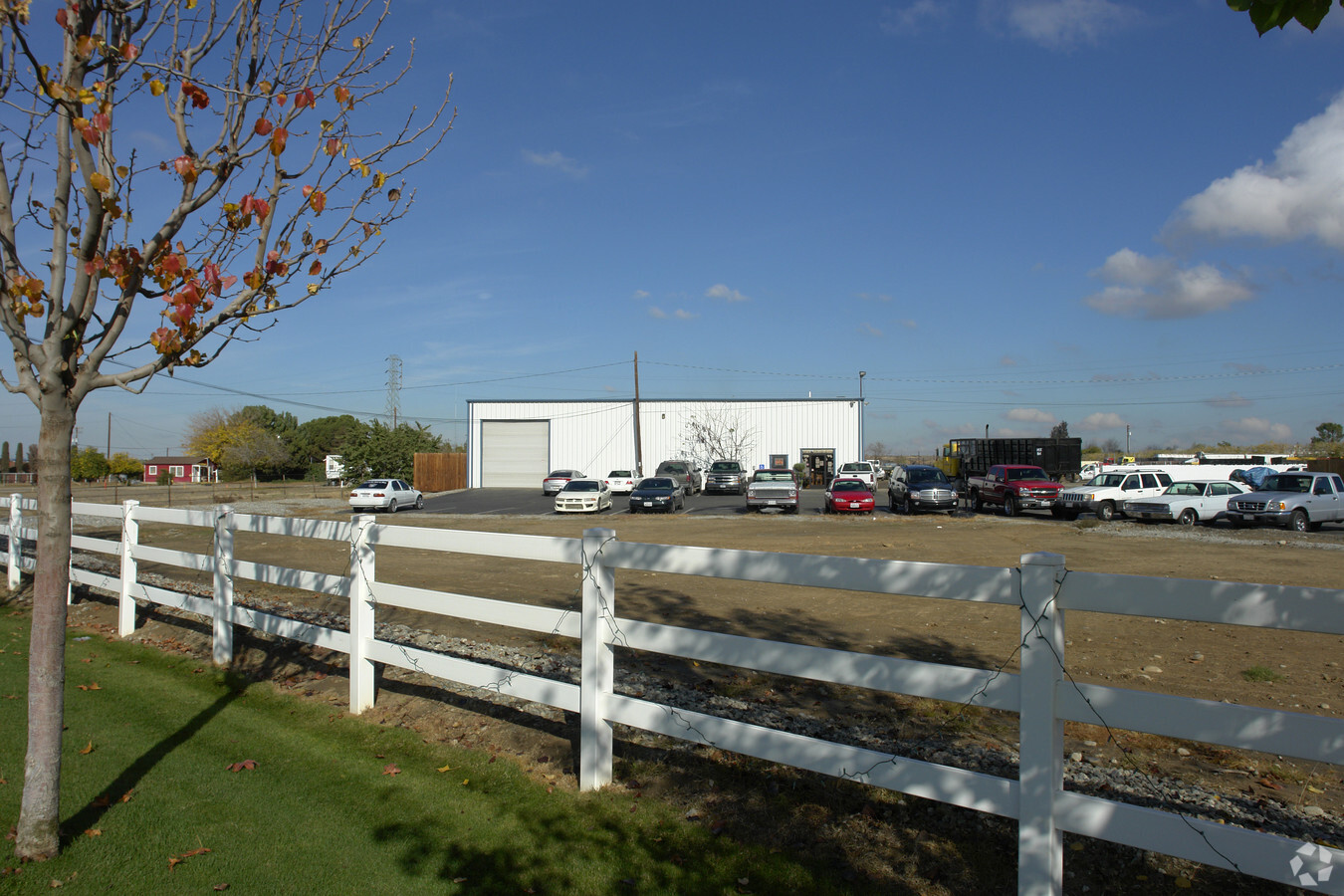
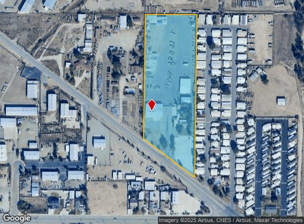
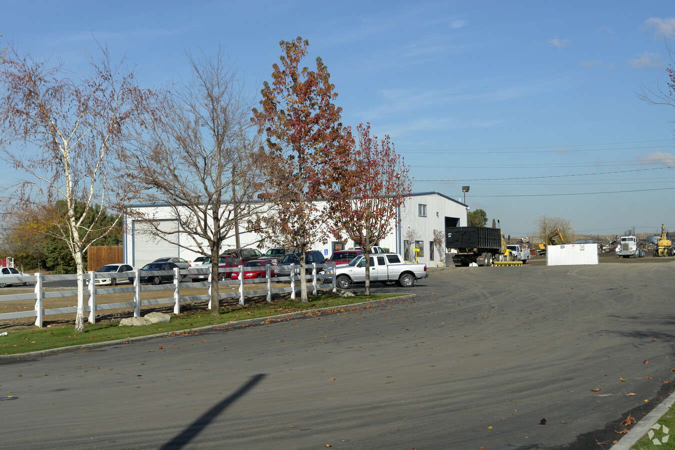
Property Record
1100 James Rd, Bakersfield, CA 93308
NEARBY LISTINGS FOR SALE OR LEASE
Property Detail
1100 James Rd
483-030-08-00-4
SECTION 35 , TOWNSHIP 28 , RANGE 27 , QUARTER
Commercialnec
Kern
X
California
06029C1825F
7 AC
2023
North Bakersfield
2024
Bakersfield
005103
Bakersfield, CA
6,300 SF
DEMOGRAPHICS near 1100 James Rd
1 Mile
3 Mile
5 Mile
2024 Total Population
5,779
35,018
94,375
2029 Population
5,799
35,139
94,573
Pop Growth 2024-2029
+ 0.35%
+ 0.35%
+ 0.21%
Average Age
36
35
36
2024 Total Households
2,034
12,695
33,102
HH Growth 2024-2029
+ 0.20%
+ 0.28%
+ 0.19%
Median Household Inc
$58,024
$42,722
$49,007
Avg Household Size
2.80
2.70
2.80
2024 Avg HH Vehicles
2.00
2.00
2.00
Median Home Value
$247,052
$223,438
$299,190
Median Year Built
1987
1971
1976
Nearby Places
- Restaurants
- Banks
- Shops
- Fitness
- Groceries
PUBLIC TRANSPORTATION
COMMUTER RAIL
Bakersfield (San Joaquins - Amtrak)
DRIVE
WALK
Distance
Bakersfield (San Joaquins - Amtrak)
12 min
6.7 mi
AIRPORT
Meadows Field
DRIVE
WALK
Distance
Meadows Field
13 min
5.1 mi
Freight Ports
The Port of Hueneme
DRIVE
WALK
Distance
The Port of Hueneme
160 min
127.7 mi
Nearby Properties
Address
Land Use
TOTAL SIZE
Lot Size
Zoning
Address
Land Use
TOTAL SIZE
Lot Size
Zoning
2,645,250 SF
64.24 AC
M-2 PD H
Address
Land Use
TOTAL SIZE
Lot Size
Zoning
16.04 AC
NR
Address
Land Use
TOTAL SIZE
Lot Size
Zoning
30,326 SF
19 AC
M3
Address
Land Use
TOTAL SIZE
Lot Size
Zoning
10,064 SF
13.44 AC
R3
Address
Land Use
TOTAL SIZE
Lot Size
Zoning
Address
Land Use
TOTAL SIZE
Lot Size
Zoning
2,129 SF
11.42 AC
M-2
Address
Land Use
TOTAL SIZE
Lot Size
Zoning
54,960 SF
15.83 AC
M-2
Address
Land Use
TOTAL SIZE
Lot Size
Zoning
3,383 SF
19.40 AC
M-2
Address
Land Use
TOTAL SIZE
Lot Size
Zoning
8 AC
M-3
Address
Land Use
TOTAL SIZE
Lot Size
Zoning
151,797 SF
4.42 AC
R3
Address
Land Use
TOTAL SIZE
Lot Size
Zoning
72,726 SF
13.15 AC
M2
Address
Land Use
TOTAL SIZE
Lot Size
Zoning
168,559 SF
5.34 AC
M-2
Address
Land Use
TOTAL SIZE
Lot Size
Zoning
12,000 SF
11.90 AC
M-2 PD
Address
Land Use
TOTAL SIZE
Lot Size
Zoning
357,609 SF
21.80 AC
M2
Address
Land Use
TOTAL SIZE
Lot Size
Zoning
8.58 AC
M-3
Address
Land Use
TOTAL SIZE
Lot Size
Zoning
226,463 SF
11.01 AC
R3
Address
Land Use
TOTAL SIZE
Lot Size
Zoning
2,740 SF
7.08 AC
M-2
Address
Land Use
TOTAL SIZE
Lot Size
Zoning
22,572 SF
44.92 AC
M-2 PD
Address
Land Use
TOTAL SIZE
Lot Size
Zoning
55,042 SF
0.49 AC
M1
Address
Land Use
TOTAL SIZE
Lot Size
Zoning
62,536 SF
2.11 AC
M2
Address
Land Use
TOTAL SIZE
Lot Size
Zoning
7,196 SF
2.24 AC
Address
Land Use
TOTAL SIZE
Lot Size
Zoning
132,096 SF
8.93 AC
C-2
Address
Land Use
TOTAL SIZE
Lot Size
Zoning
144,439 SF
10.04 AC
M-2
Address
Land Use
TOTAL SIZE
Lot Size
Zoning
163,159 SF
1.59 AC
C2
Address
Land Use
TOTAL SIZE
Lot Size
Zoning
43,088 SF
2.07 AC
M2
Address
Land Use
TOTAL SIZE
Lot Size
Zoning
49,911 SF
2.20 AC
M-2
Address
Land Use
TOTAL SIZE
Lot Size
Zoning
36,642 SF
1.72 AC
M-2
Address
Land Use
TOTAL SIZE
Lot Size
Zoning
49,953 SF
3.99 AC
M-2-AA
Address
Land Use
TOTAL SIZE
Lot Size
Zoning
66,354 SF
4.57 AC
M2
Address
Land Use
TOTAL SIZE
Lot Size
Zoning
24,600 SF
3.79 AC
M-2-AA
The World's #1 Commercial Real Estate Marketplace
Connect with us
© 2025 CoStar Group
The information above has been obtained from sources believed reliable. While we do not doubt its accuracy we have not verified it and make no guarantee, warranty or representation about it. It is your responsibility to independently confirm its accuracy and completeness. Any projections, opinions, assumptions, or estimates used are for example only and do not represent the current or future performance of the property. The value of this transaction to you depends on tax and other factors which should be evaluated by your tax, financial, and legal advisors. You and your advisors should conduct a careful, independent investigation of the property to determine to your satisfaction the suitability of the property for your needs.