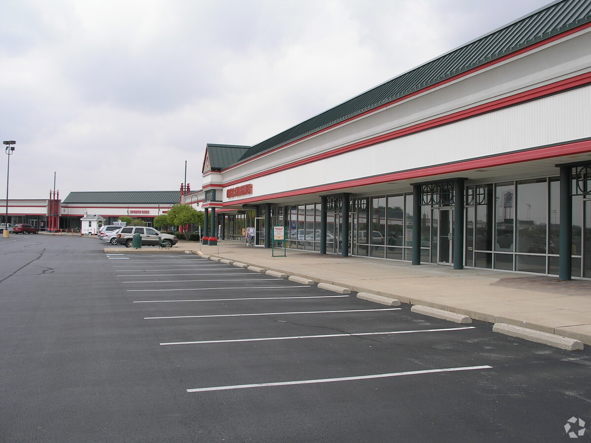
Property Record
1100 Mcarthur Rd, Jeffersonville, OH 43128
NEARBY LISTINGS FOR SALE OR LEASE
-
-
View all Jeffersonville listings for lease on LoopNet.com
Property Detail
1100 Mcarthur Rd
Washington Court House, OH
Virginia Military Survey #7040
080-009-000-023-00
PHASE 2 OUTLET MALL SURVEY 7040
Communitycenter
Fayette
2023
Ohio
2023
22.31 AC
925900
Other Market Areas
132,745 SF
DEMOGRAPHICS near 1100 Mcarthur Rd
1 Mile
3 Mile
5 Mile
2024 Total Population
41
1,756
2,651
2029 Population
41
1,739
2,620
Pop Growth 2024-2029
0.00%
(0.97%)
(1.17%)
Average Age
39
40
40
2024 Total Households
17
736
1,081
HH Growth 2024-2029
0.00%
(0.82%)
(1.11%)
Median Household Inc
$42,500
$43,714
$47,666
Avg Household Size
2.30
2.40
2.40
2024 Avg HH Vehicles
2.00
2.00
2.00
Median Home Value
$125,000
$127,597
$146,481
Median Year Built
1964
1967
1969
Nearby Places
- Restaurants
- Banks
- Shops
- Fitness
- Groceries
SALE & LEASE HISTORY
LISTING DATE
SALE/LEASE

Sep 25, 2016
For Lease
Mar 31, 2017
For Lease
Jan 03, 2017
For Lease
Dec 27, 2016
For Lease
Nearby Properties
Address
Land Use
TOTAL SIZE
Lot Size
Zoning
Address
Land Use
TOTAL SIZE
Lot Size
Zoning
Address
Land Use
TOTAL SIZE
Lot Size
Zoning
54,198 SF
150.52 AC
Address
Land Use
TOTAL SIZE
Lot Size
Zoning
Address
Land Use
TOTAL SIZE
Lot Size
Zoning
49,373 SF
53.79 AC
Address
Land Use
TOTAL SIZE
Lot Size
Zoning
383,550 SF
43 AC
Address
Land Use
TOTAL SIZE
Lot Size
Zoning
14,928 SF
17.20 AC
Address
Land Use
TOTAL SIZE
Lot Size
Zoning
2,056 SF
365.62 AC
Address
Land Use
TOTAL SIZE
Lot Size
Zoning
110.89 AC
Address
Land Use
TOTAL SIZE
Lot Size
Zoning
Address
Land Use
TOTAL SIZE
Lot Size
Zoning
Address
Land Use
TOTAL SIZE
Lot Size
Zoning
Address
Land Use
TOTAL SIZE
Lot Size
Zoning
Address
Land Use
TOTAL SIZE
Lot Size
Zoning
2,280 SF
231.96 AC
Address
Land Use
TOTAL SIZE
Lot Size
Zoning
Address
Land Use
TOTAL SIZE
Lot Size
Zoning
Address
Land Use
TOTAL SIZE
Lot Size
Zoning
Address
Land Use
TOTAL SIZE
Lot Size
Zoning
200.68 AC
Address
Land Use
TOTAL SIZE
Lot Size
Zoning
1,746 SF
51.98 AC
Address
Land Use
TOTAL SIZE
Lot Size
Zoning
Address
Land Use
TOTAL SIZE
Lot Size
Zoning
Address
Land Use
TOTAL SIZE
Lot Size
Zoning
Address
Land Use
TOTAL SIZE
Lot Size
Zoning
Address
Land Use
TOTAL SIZE
Lot Size
Zoning
Address
Land Use
TOTAL SIZE
Lot Size
Zoning
Address
Land Use
TOTAL SIZE
Lot Size
Zoning
Address
Land Use
TOTAL SIZE
Lot Size
Zoning
6,640 SF
8.77 AC
Address
Land Use
TOTAL SIZE
Lot Size
Zoning
1,650 SF
54.61 AC
Address
Land Use
TOTAL SIZE
Lot Size
Zoning
3,149 SF
144.93 AC
Address
Land Use
TOTAL SIZE
Lot Size
Zoning
1,439 SF
50.73 AC
The World's #1 Commercial Real Estate Marketplace
Connect with us
© 2025 CoStar Group
The information above has been obtained from sources believed reliable. While we do not doubt its accuracy we have not verified it and make no guarantee, warranty or representation about it. It is your responsibility to independently confirm its accuracy and completeness. Any projections, opinions, assumptions, or estimates used are for example only and do not represent the current or future performance of the property. The value of this transaction to you depends on tax and other factors which should be evaluated by your tax, financial, and legal advisors. You and your advisors should conduct a careful, independent investigation of the property to determine to your satisfaction the suitability of the property for your needs.