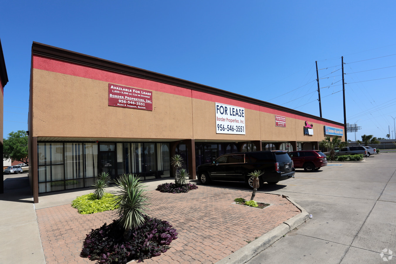
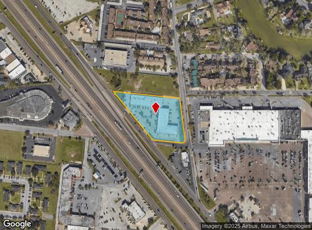
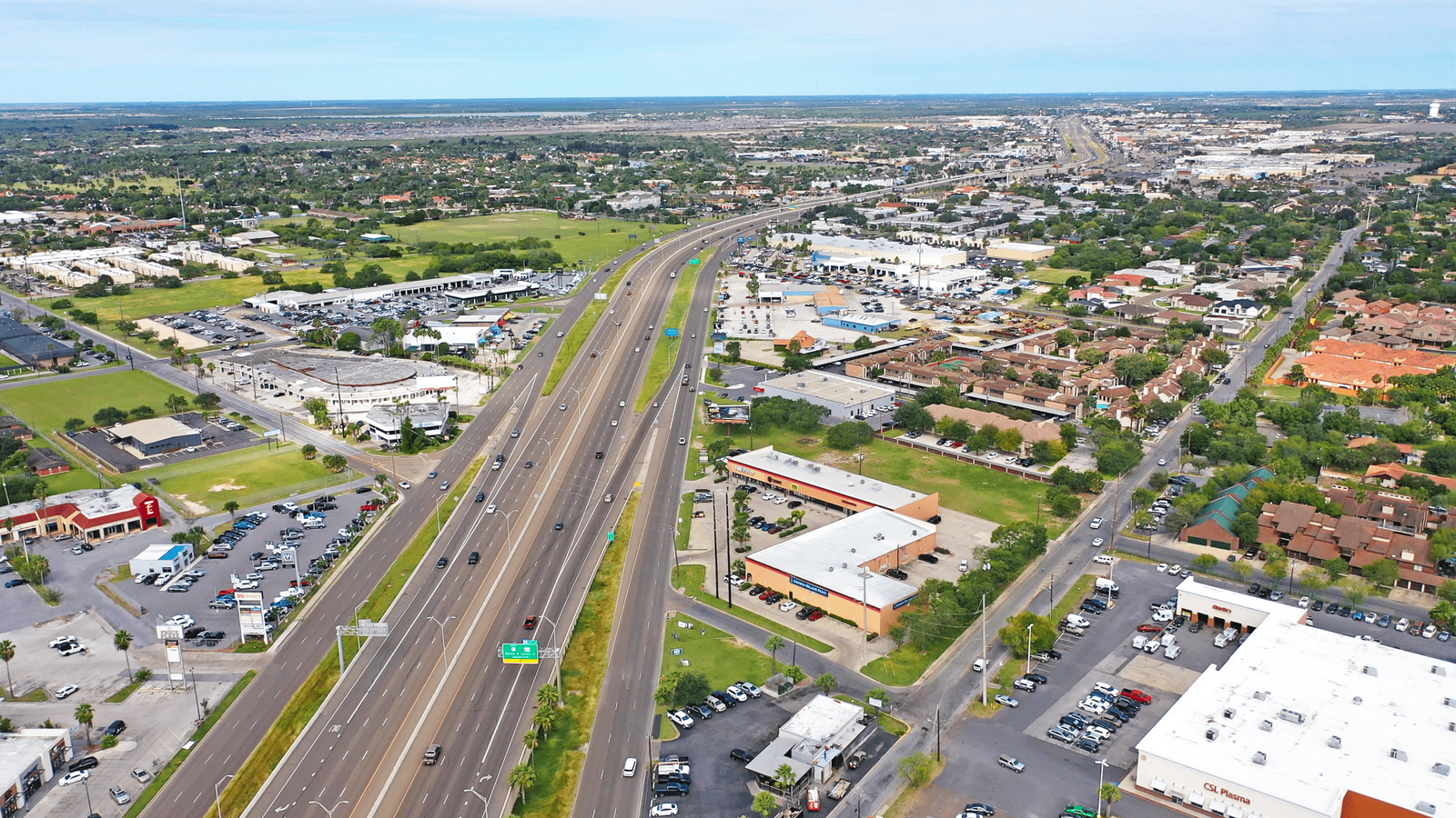
Property Record
1100 N Expressway, Brownsville, TX 78521
NEARBY LISTINGS FOR SALE OR LEASE
Property Detail
1100 N Expressway
Brownsville-Harlingen, TX
Brownsville Land & Imp Co Subd
019330-1130-001000
BROWNSVILLE LAND & IMP CO SUBD PT LOT 1 BLK MM, 2.4070 ACRES
Commercialnec
Cameron
AH
Texas
48061C0580F
1
2023
2.41 AC
2024
Greater Brownsville
013002
Brownsville/Harlingen
23,400 SF
DEMOGRAPHICS near 1100 N Expressway
1 Mile
3 Mile
5 Mile
2024 Total Population
11,567
115,119
176,757
2029 Population
11,779
117,333
181,004
Pop Growth 2024-2029
+ 1.83%
+ 1.92%
+ 2.40%
Average Age
38
36
36
2024 Total Households
4,409
36,978
55,132
HH Growth 2024-2029
+ 1.88%
+ 1.96%
+ 2.42%
Median Household Inc
$39,416
$48,242
$47,026
Avg Household Size
2.60
3.00
3.10
2024 Avg HH Vehicles
2.00
2.00
2.00
Median Home Value
$124,926
$108,697
$100,254
Median Year Built
1977
1990
1991
Nearby Places
- Restaurants
- Banks
- Shops
- Fitness
- Groceries
PUBLIC TRANSPORTATION
AIRPORT
Brownsville/South Padre Island International
DRIVE
WALK
Distance
Brownsville/South Padre Island International
13 min
7.1 mi
Valley International
DRIVE
WALK
Distance
Valley International
32 min
25.0 mi
Freight Ports
Port of Brownsville
DRIVE
WALK
Distance
Port of Brownsville
12 min
6.9 mi
SALE & LEASE HISTORY
LISTING DATE
SALE/LEASE

Oct 08, 2021
For Sale
Dec 08, 2022
For Lease
Nearby Properties
Address
Land Use
TOTAL SIZE
Lot Size
Zoning
Address
Land Use
TOTAL SIZE
Lot Size
Zoning
591,279 SF
49.02 AC
Address
Land Use
TOTAL SIZE
Lot Size
Zoning
319,798 SF
46.28 AC
Address
Land Use
TOTAL SIZE
Lot Size
Zoning
452,559 SF
13.79 AC
C
Address
Land Use
TOTAL SIZE
Lot Size
Zoning
232,467 SF
25.82 AC
C
Address
Land Use
TOTAL SIZE
Lot Size
Zoning
302,902 SF
6.61 AC
C
Address
Land Use
TOTAL SIZE
Lot Size
Zoning
196,847 SF
19.62 AC
Address
Land Use
TOTAL SIZE
Lot Size
Zoning
112,834 SF
16.70 AC
C
Address
Land Use
TOTAL SIZE
Lot Size
Zoning
277,742 SF
31.28 AC
Address
Land Use
TOTAL SIZE
Lot Size
Zoning
135,686 SF
19.05 AC
C
Address
Land Use
TOTAL SIZE
Lot Size
Zoning
72,436 SF
22.08 AC
Address
Land Use
TOTAL SIZE
Lot Size
Zoning
56,804 SF
1.83 AC
Address
Land Use
TOTAL SIZE
Lot Size
Zoning
176,990 SF
18.31 AC
C
Address
Land Use
TOTAL SIZE
Lot Size
Zoning
73,090 SF
3.08 AC
C
Address
Land Use
TOTAL SIZE
Lot Size
Zoning
100,491 SF
14 AC
C
Address
Land Use
TOTAL SIZE
Lot Size
Zoning
132,197 SF
10.70 AC
Address
Land Use
TOTAL SIZE
Lot Size
Zoning
60,747 SF
2.59 AC
C
Address
Land Use
TOTAL SIZE
Lot Size
Zoning
167,653 SF
5.10 AC
Address
Land Use
TOTAL SIZE
Lot Size
Zoning
66,340 SF
3.85 AC
C
Address
Land Use
TOTAL SIZE
Lot Size
Zoning
148,781 SF
10.28 AC
B
Address
Land Use
TOTAL SIZE
Lot Size
Zoning
131,240 SF
9.94 AC
C
Address
Land Use
TOTAL SIZE
Lot Size
Zoning
131,240 SF
9.94 AC
C
Address
Land Use
TOTAL SIZE
Lot Size
Zoning
213,521 SF
38.75 AC
Address
Land Use
TOTAL SIZE
Lot Size
Zoning
78,583 SF
5 AC
C
Address
Land Use
TOTAL SIZE
Lot Size
Zoning
98,006 SF
20.30 AC
Address
Land Use
TOTAL SIZE
Lot Size
Zoning
62,344 SF
2.92 AC
Address
Land Use
TOTAL SIZE
Lot Size
Zoning
205,001 SF
20.13 AC
C
Address
Land Use
TOTAL SIZE
Lot Size
Zoning
142,385 SF
0.50 AC
Address
Land Use
TOTAL SIZE
Lot Size
Zoning
102,042 SF
8.68 AC
C
Address
Land Use
TOTAL SIZE
Lot Size
Zoning
133,476 SF
8.14 AC
The World's #1 Commercial Real Estate Marketplace
Connect with us
© 2025 CoStar Group
The information above has been obtained from sources believed reliable. While we do not doubt its accuracy we have not verified it and make no guarantee, warranty or representation about it. It is your responsibility to independently confirm its accuracy and completeness. Any projections, opinions, assumptions, or estimates used are for example only and do not represent the current or future performance of the property. The value of this transaction to you depends on tax and other factors which should be evaluated by your tax, financial, and legal advisors. You and your advisors should conduct a careful, independent investigation of the property to determine to your satisfaction the suitability of the property for your needs.