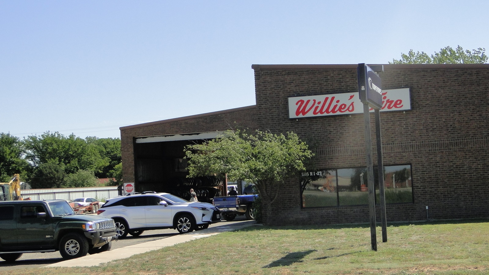
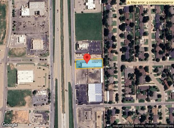
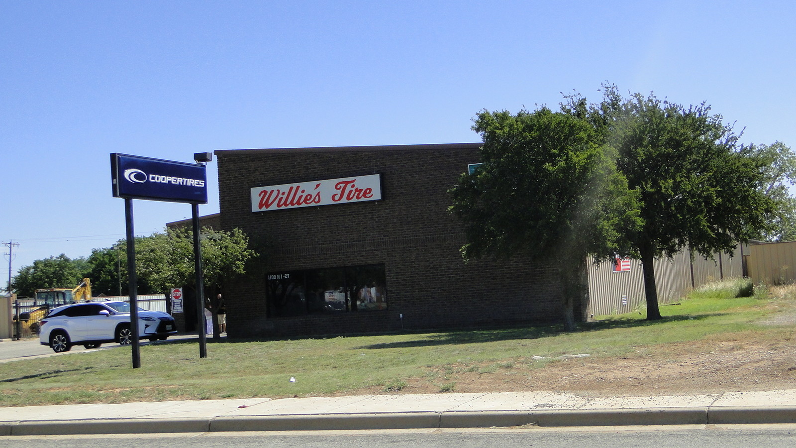
Property Record
1100 N Interstate 27, Plainview, TX 79072
NEARBY LISTINGS FOR SALE OR LEASE
Property Detail
1100 N Interstate 27
11343
West End Add Un No 2 Plainview
Commercialnec
WEST END PLV UNIT 2 LOTS 3-4
X
Hale
48189C0205D
Texas
2023
3,4
2024
1.06 AC
950300
Other Market Areas
19,321 SF
Plainview, TX
DEMOGRAPHICS near 1100 N Interstate 27
1 Mile
3 Mile
5 Mile
2024 Total Population
4,399
19,066
24,059
2029 Population
4,238
18,704
23,674
Pop Growth 2024-2029
(3.66%)
(1.90%)
(1.60%)
Average Age
40
37
38
2024 Total Households
1,695
6,933
8,557
HH Growth 2024-2029
(3.72%)
(1.95%)
(1.62%)
Median Household Inc
$56,622
$47,207
$47,256
Avg Household Size
2.50
2.60
2.60
2024 Avg HH Vehicles
2.00
2.00
2.00
Median Home Value
$151,424
$88,291
$82,406
Median Year Built
1966
1967
1967
Nearby Places
- Restaurants
- Banks
- Shops
- Fitness
- Groceries
SALE & LEASE HISTORY
LISTING DATE
SALE/LEASE

Aug 27, 2018
For Sale
Nearby Properties
Address
Land Use
TOTAL SIZE
Lot Size
Zoning
Address
Land Use
TOTAL SIZE
Lot Size
Zoning
290,304 SF
98.06 AC
Address
Land Use
TOTAL SIZE
Lot Size
Zoning
Address
Land Use
TOTAL SIZE
Lot Size
Zoning
625,835 SF
22.98 AC
Address
Land Use
TOTAL SIZE
Lot Size
Zoning
142,098 SF
28.62 AC
Address
Land Use
TOTAL SIZE
Lot Size
Zoning
52,370 SF
12.26 AC
Address
Land Use
TOTAL SIZE
Lot Size
Zoning
7,532 SF
10.83 AC
Address
Land Use
TOTAL SIZE
Lot Size
Zoning
149,000 SF
27.30 AC
Address
Land Use
TOTAL SIZE
Lot Size
Zoning
180,520 SF
26.52 AC
Address
Land Use
TOTAL SIZE
Lot Size
Zoning
105,109 SF
11.19 AC
Address
Land Use
TOTAL SIZE
Lot Size
Zoning
177,376 SF
15.73 AC
Address
Land Use
TOTAL SIZE
Lot Size
Zoning
Address
Land Use
TOTAL SIZE
Lot Size
Zoning
79,335 SF
1.84 AC
Address
Land Use
TOTAL SIZE
Lot Size
Zoning
377,650 SF
8.63 AC
Address
Land Use
TOTAL SIZE
Lot Size
Zoning
93,784 SF
8.15 AC
Address
Land Use
TOTAL SIZE
Lot Size
Zoning
60,973 SF
3.86 AC
Address
Land Use
TOTAL SIZE
Lot Size
Zoning
80,443 SF
2.57 AC
Address
Land Use
TOTAL SIZE
Lot Size
Zoning
56,104 SF
1.58 AC
Address
Land Use
TOTAL SIZE
Lot Size
Zoning
83,501 SF
1.96 AC
Address
Land Use
TOTAL SIZE
Lot Size
Zoning
30,978 SF
3.89 AC
Address
Land Use
TOTAL SIZE
Lot Size
Zoning
321,292 SF
8.42 AC
Address
Land Use
TOTAL SIZE
Lot Size
Zoning
79,406 SF
4.26 AC
Address
Land Use
TOTAL SIZE
Lot Size
Zoning
201,087 SF
4.95 AC
Address
Land Use
TOTAL SIZE
Lot Size
Zoning
31,907 SF
1.41 AC
Address
Land Use
TOTAL SIZE
Lot Size
Zoning
42,286 SF
6.67 AC
Address
Land Use
TOTAL SIZE
Lot Size
Zoning
371,468 SF
8 AC
Address
Land Use
TOTAL SIZE
Lot Size
Zoning
40,458 SF
1.90 AC
Address
Land Use
TOTAL SIZE
Lot Size
Zoning
172,558 SF
4.46 AC
Address
Land Use
TOTAL SIZE
Lot Size
Zoning
87,693 SF
4.97 AC
Address
Land Use
TOTAL SIZE
Lot Size
Zoning
The World's #1 Commercial Real Estate Marketplace
Connect with us
© 2025 CoStar Group
The information above has been obtained from sources believed reliable. While we do not doubt its accuracy we have not verified it and make no guarantee, warranty or representation about it. It is your responsibility to independently confirm its accuracy and completeness. Any projections, opinions, assumptions, or estimates used are for example only and do not represent the current or future performance of the property. The value of this transaction to you depends on tax and other factors which should be evaluated by your tax, financial, and legal advisors. You and your advisors should conduct a careful, independent investigation of the property to determine to your satisfaction the suitability of the property for your needs.