Property Record
300 W Mississippi Ave, Denver, CO 80223

NEARBY LISTINGS FOR SALE OR LEASE
Property Detail
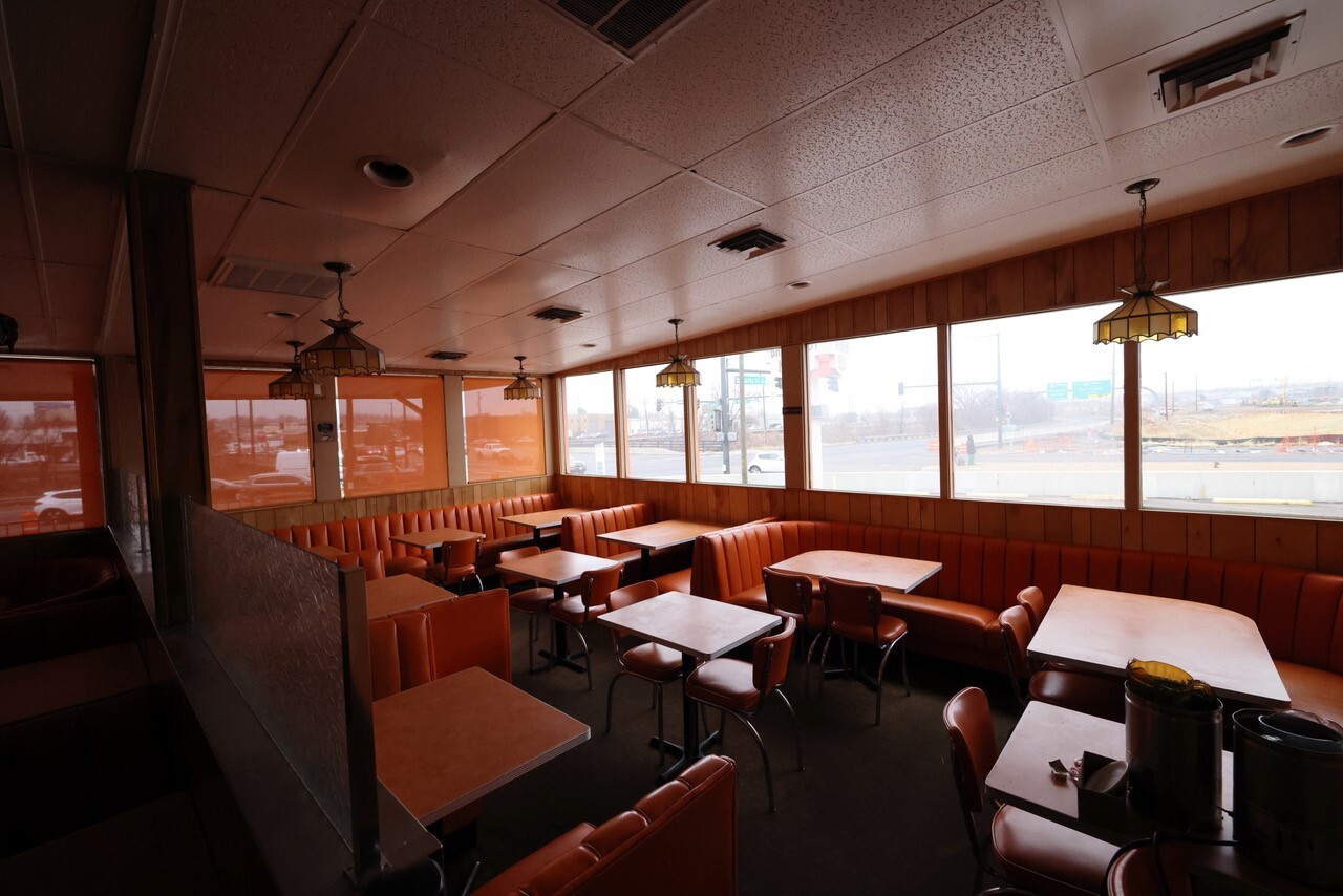
300 W Mississippi Ave
Denver-Aurora-Lakewood, CO
West Broadway Add
5223-03-036
WEST BROADWAY ADD B2 L18 TO 24 & E/2 VAC ALY ADJ EXC BEG NE COR L24 TH S 16.7FT NW 19.93FT CV/L 6.43FT WLY 42.47FT CV/L 21.04FT N 9.13FT E 82.9FT TO POB
Miscellaneous
Denver
X
Colorado
0800460203K
18
2023
0.33 AC
2023
Central
0014031004
Denver
2,722 SF
DEMOGRAPHICS near 300 W Mississippi Ave
1 Mile
3 Mile
5 Mile
2024 Total Population
16,018
192,482
517,944
2029 Population
16,009
194,289
523,731
Pop Growth 2024-2029
(0.06%)
+ 0.94%
+ 1.12%
Average Age
37
38
38
2024 Total Households
7,389
89,424
244,870
HH Growth 2024-2029
(0.41%)
+ 1.05%
+ 1.26%
Median Household Inc
$96,208
$79,620
$80,472
Avg Household Size
2.10
2.00
2.00
2024 Avg HH Vehicles
2.00
2.00
2.00
Median Home Value
$723,758
$637,191
$613,712
Median Year Built
1953
1961
1969
Nearby Places
- Restaurants
- Banks
- Shops
- Fitness
- Groceries
PUBLIC TRANSPORTATION
TRANSIT/SUBWAY
I-25-Broadway (C Line - Denver Regional Transportation District Light Rail (TheRide), D Line - Denver Regional Transportation District Light Rail (TheRide), E Line - Denver Regional Transportation District Light Rail (TheRide), F Line - Denver Regional Transportation District Light Rail (TheRide), H Line - Denver Regional Transportation District Light Rail (TheRide))
DRIVE
WALK
Distance
I-25-Broadway (C Line - Denver Regional Transportation District Light Rail (TheRide), D Line - Denver Regional Transportation District Light Rail (TheRide), E Line - Denver Regional Transportation District Light Rail (TheRide), F Line - Denver Regional Transportation District Light Rail (TheRide), H Line - Denver Regional Transportation District Light Rail (TheRide))
2 min
12 min
0.7 mi
Louisiana-Pearl (E Line - Denver Regional Transportation District Light Rail (TheRide), F Line - Denver Regional Transportation District Light Rail (TheRide), H Line - Denver Regional Transportation District Light Rail (TheRide))
DRIVE
WALK
Distance
Louisiana-Pearl (E Line - Denver Regional Transportation District Light Rail (TheRide), F Line - Denver Regional Transportation District Light Rail (TheRide), H Line - Denver Regional Transportation District Light Rail (TheRide))
2 min
16 min
0.9 mi
COMMUTER RAIL
Union Station: Lodo-Coors Field-16Th Street Mall (C Line - Denver Regional Transportation District Light Rail (TheRide), E Line - Denver Regional Transportation District Light Rail (TheRide), W Line - Denver Regional Transportation District Light Rail (TheRide))
DRIVE
WALK
Distance
Union Station: Lodo-Coors Field-16Th Street Mall (C Line - Denver Regional Transportation District Light Rail (TheRide), E Line - Denver Regional Transportation District Light Rail (TheRide), W Line - Denver Regional Transportation District Light Rail (TheRide))
9 min
4.9 mi
Denver (California Zephyr - Amtrak)
DRIVE
WALK
Distance
Denver (California Zephyr - Amtrak)
10 min
5.1 mi
AIRPORT
Denver International
DRIVE
WALK
Distance
Denver International
39 min
29.2 mi
Freight Ports
Tulsa Port Of Catoosa
DRIVE
WALK
Distance
Tulsa Port Of Catoosa
736 min
714.7 mi
SALE & LEASE HISTORY
LISTING DATE
SALE/LEASE

Mar 22, 2023
For Lease
Mar 22, 2023
For Sale
Mar 14, 2022
For Lease
Aug 19, 2019
For Sale
Nearby Properties
Address
Land Use
TOTAL SIZE
Lot Size
Zoning
Address
Land Use
TOTAL SIZE
Lot Size
Zoning
859,638 SF
10.04 AC
B-3
Address
Land Use
TOTAL SIZE
Lot Size
Zoning
1,399,487 SF
16.14 AC
CMP-H
Address
Land Use
TOTAL SIZE
Lot Size
Zoning
1,360,162 SF
6.27 AC
Address
Land Use
TOTAL SIZE
Lot Size
Zoning
697,516 SF
3.05 AC
D-CV
Address
Land Use
TOTAL SIZE
Lot Size
Zoning
1,611,942 SF
35.49 AC
CMP-EI
Address
Land Use
TOTAL SIZE
Lot Size
Zoning
252,992 SF
11.76 AC
B-3
Address
Land Use
TOTAL SIZE
Lot Size
Zoning
497,777 SF
3.70 AC
D-CV
Address
Land Use
TOTAL SIZE
Lot Size
Zoning
363,451 SF
3.45 AC
PUD
Address
Land Use
TOTAL SIZE
Lot Size
Zoning
488,638 SF
2.44 AC
D-CV
Address
Land Use
TOTAL SIZE
Lot Size
Zoning
796,150 SF
5.16 AC
CMP-H
Address
Land Use
TOTAL SIZE
Lot Size
Zoning
665,799 SF
9.79 AC
H-1-B
Address
Land Use
TOTAL SIZE
Lot Size
Zoning
494,776 SF
3.43 AC
PUD
Address
Land Use
TOTAL SIZE
Lot Size
Zoning
816,252 SF
13.25 AC
CMP-EI
Address
Land Use
TOTAL SIZE
Lot Size
Zoning
118,077 SF
9.60 AC
I-B
Address
Land Use
TOTAL SIZE
Lot Size
Zoning
285,478 SF
0.56 AC
C-CCN-5
Address
Land Use
TOTAL SIZE
Lot Size
Zoning
584,643 SF
13.43 AC
CMP-EI
Address
Land Use
TOTAL SIZE
Lot Size
Zoning
466,097 SF
3.36 AC
D-GT
Address
Land Use
TOTAL SIZE
Lot Size
Zoning
477,026 SF
29.84 AC
I-B
Address
Land Use
TOTAL SIZE
Lot Size
Zoning
210,214 SF
2.48 AC
B-8-G
Address
Land Use
TOTAL SIZE
Lot Size
Zoning
318,560 SF
0.99 AC
C-MX-16
Address
Land Use
TOTAL SIZE
Lot Size
Zoning
349,226 SF
1.09 AC
C-CCN-12
Address
Land Use
TOTAL SIZE
Lot Size
Zoning
869,166 SF
5.44 AC
B-4
Address
Land Use
TOTAL SIZE
Lot Size
Zoning
686,647 SF
5.20 AC
C-MX-20
Address
Land Use
TOTAL SIZE
Lot Size
Zoning
505,731 SF
2.46 AC
G-MU-20
Address
Land Use
TOTAL SIZE
Lot Size
Zoning
306,584 SF
2.25 AC
D-CV
Address
Land Use
TOTAL SIZE
Lot Size
Zoning
267,087 SF
36.55 AC
R-5
Address
Land Use
TOTAL SIZE
Lot Size
Zoning
185,689 SF
2.50 AC
C-CCN-8
Address
Land Use
TOTAL SIZE
Lot Size
Zoning
103,096 SF
0.42 AC
C-CCN-7
Address
Land Use
TOTAL SIZE
Lot Size
Zoning
944,320 SF
3.51 AC
D-GT
Address
Land Use
TOTAL SIZE
Lot Size
Zoning
174,244 SF
17.26 AC
E-SU-DX
The World's #1 Commercial Real Estate Marketplace
Connect with us
© 2025 CoStar Group
The information above has been obtained from sources believed reliable. While we do not doubt its accuracy we have not verified it and make no guarantee, warranty or representation about it. It is your responsibility to independently confirm its accuracy and completeness. Any projections, opinions, assumptions, or estimates used are for example only and do not represent the current or future performance of the property. The value of this transaction to you depends on tax and other factors which should be evaluated by your tax, financial, and legal advisors. You and your advisors should conduct a careful, independent investigation of the property to determine to your satisfaction the suitability of the property for your needs.