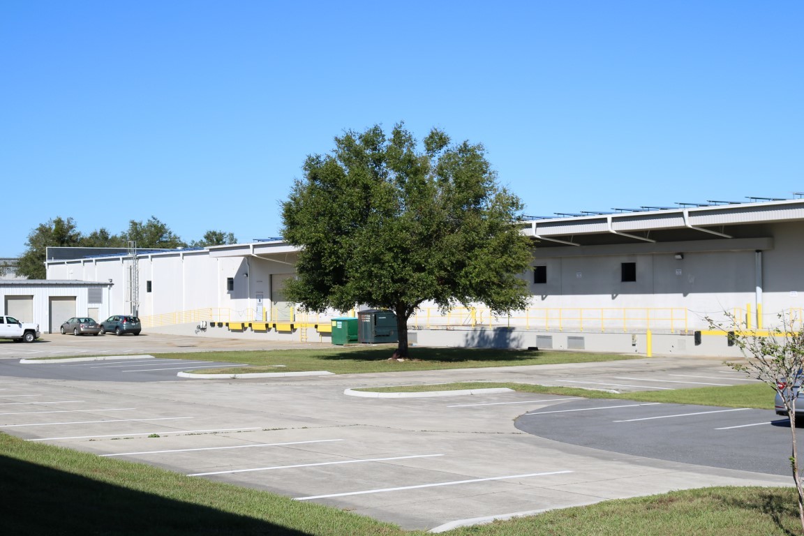
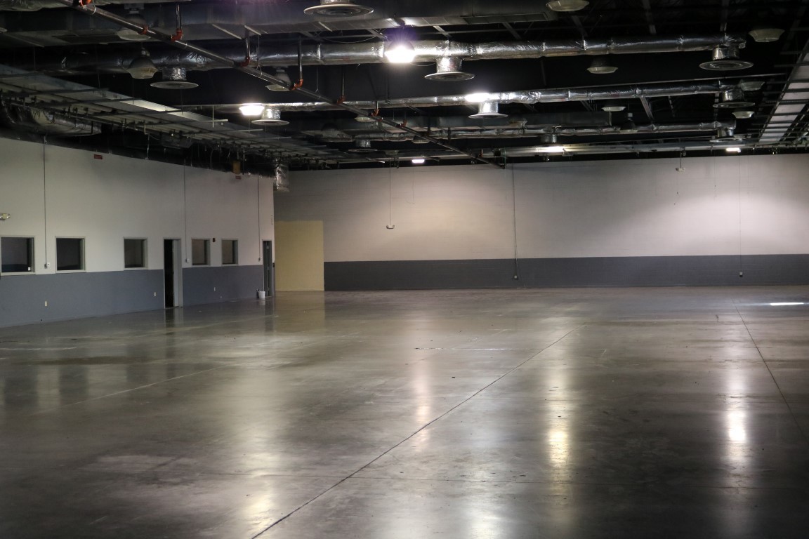
Property Record
1100 Sw 38Th Ave, Ocala, FL 34474
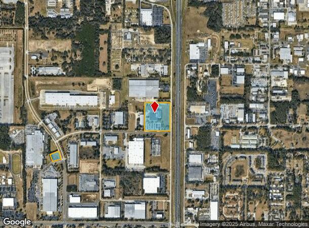
NEARBY LISTINGS FOR SALE OR LEASE
Property Detail
1100 Sw 38Th Ave
23322-000-02
SEC 22 TWP 15 RGE 21 THE EAST 687.79 FT OF THE DESCRIBED PARCEL: COM AT THE NE COR TH S 00-34-29 W ALONG THE E BDY OF THENE 1/4 681.19 FT TH N 89-25-31 W 33 FT TO AN INTERSECTION WITH THE WLY ROW LINE OF SW 38TH AVE AND THE POB TH S 00-34-29 W ALONG
Lightindustrial
Marion
AE
Florida
12083C0516E
12 AC
2023
Greater Ocala
2023
Ocala
002504
Ocala, FL
99,298 SF
DEMOGRAPHICS near 1100 Sw 38Th Ave
1 Mile
3 Mile
5 Mile
2024 Total Population
3,807
32,143
69,251
2029 Population
4,278
36,376
78,280
Pop Growth 2024-2029
+ 12.37%
+ 13.17%
+ 13.04%
Average Age
39
41
42
2024 Total Households
1,041
12,811
28,359
HH Growth 2024-2029
+ 14.02%
+ 13.28%
+ 13.09%
Median Household Inc
$51,654
$46,770
$51,300
Avg Household Size
2.30
2.30
2.30
2024 Avg HH Vehicles
1.00
1.00
2.00
Median Home Value
$144,285
$195,595
$212,649
Median Year Built
1986
1989
1986
Nearby Places
- Restaurants
- Banks
- Shops
- Fitness
- Groceries
SALE & LEASE HISTORY
LISTING DATE
SALE/LEASE

Oct 26, 2017
For Lease
Nearby Properties
Address
Land Use
TOTAL SIZE
Lot Size
Zoning
Address
Land Use
TOTAL SIZE
Lot Size
Zoning
207,950 SF
14.08 AC
INST
Address
Land Use
TOTAL SIZE
Lot Size
Zoning
2,015,469 SF
169.30 AC
M1
Address
Land Use
TOTAL SIZE
Lot Size
Zoning
704,765 SF
71.04 AC
GU
Address
Land Use
TOTAL SIZE
Lot Size
Zoning
156,201 SF
36.77 AC
INST
Address
Land Use
TOTAL SIZE
Lot Size
Zoning
493,261 SF
126.01 AC
R3
Address
Land Use
TOTAL SIZE
Lot Size
Zoning
283,913 SF
24.22 AC
B2
Address
Land Use
TOTAL SIZE
Lot Size
Zoning
446,764 SF
138.06 AC
GU
Address
Land Use
TOTAL SIZE
Lot Size
Zoning
612,196 SF
50.06 AC
M1
Address
Land Use
TOTAL SIZE
Lot Size
Zoning
195,992 SF
5.72 AC
FBC
Address
Land Use
TOTAL SIZE
Lot Size
Zoning
164,363 SF
16.51 AC
R3
Address
Land Use
TOTAL SIZE
Lot Size
Zoning
422,264 SF
40.87 AC
SC
Address
Land Use
TOTAL SIZE
Lot Size
Zoning
441,040 SF
150.01 AC
M1
Address
Land Use
TOTAL SIZE
Lot Size
Zoning
324,262 SF
48.94 AC
SC
Address
Land Use
TOTAL SIZE
Lot Size
Zoning
154,675 SF
23.62 AC
PD09
Address
Land Use
TOTAL SIZE
Lot Size
Zoning
178,015 SF
18.28 AC
PD07
Address
Land Use
TOTAL SIZE
Lot Size
Zoning
444,381 SF
60 AC
M1
Address
Land Use
TOTAL SIZE
Lot Size
Zoning
152,355 SF
973.50 AC
GU
Address
Land Use
TOTAL SIZE
Lot Size
Zoning
403,023 SF
47.47 AC
M1
Address
Land Use
TOTAL SIZE
Lot Size
Zoning
110,226 SF
19.56 AC
PD09
Address
Land Use
TOTAL SIZE
Lot Size
Zoning
111,644 SF
19 AC
PD09
Address
Land Use
TOTAL SIZE
Lot Size
Zoning
222,210 SF
22.14 AC
SC
Address
Land Use
TOTAL SIZE
Lot Size
Zoning
421,243 SF
51.48 AC
M2
Address
Land Use
TOTAL SIZE
Lot Size
Zoning
92,049 SF
15.75 AC
R3
Address
Land Use
TOTAL SIZE
Lot Size
Zoning
266,503 SF
25.48 AC
SC
Address
Land Use
TOTAL SIZE
Lot Size
Zoning
604,920 SF
42.92 AC
M1
Address
Land Use
TOTAL SIZE
Lot Size
Zoning
59,706 SF
10.01 AC
PD
Address
Land Use
TOTAL SIZE
Lot Size
Zoning
194,275 SF
13.43 AC
M1
Address
Land Use
TOTAL SIZE
Lot Size
Zoning
43,905 SF
6.29 AC
B2
Address
Land Use
TOTAL SIZE
Lot Size
Zoning
80,532 SF
53.56 AC
INST
Address
Land Use
TOTAL SIZE
Lot Size
Zoning
186,474 SF
18.52 AC
SC
The World's #1 Commercial Real Estate Marketplace
Connect with us
© 2025 CoStar Group
The information above has been obtained from sources believed reliable. While we do not doubt its accuracy we have not verified it and make no guarantee, warranty or representation about it. It is your responsibility to independently confirm its accuracy and completeness. Any projections, opinions, assumptions, or estimates used are for example only and do not represent the current or future performance of the property. The value of this transaction to you depends on tax and other factors which should be evaluated by your tax, financial, and legal advisors. You and your advisors should conduct a careful, independent investigation of the property to determine to your satisfaction the suitability of the property for your needs.