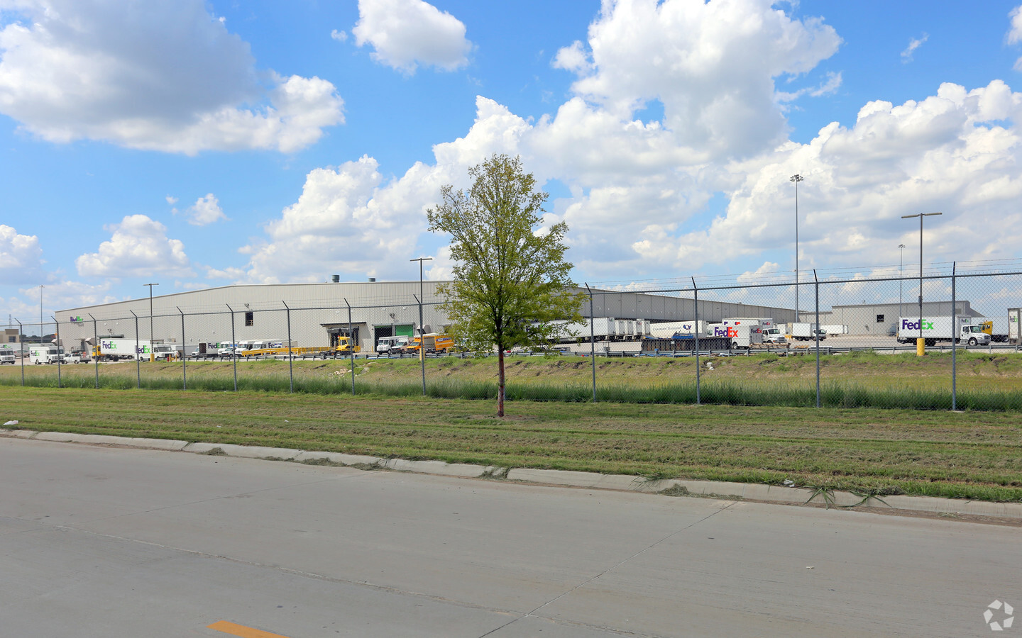
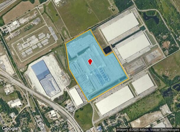
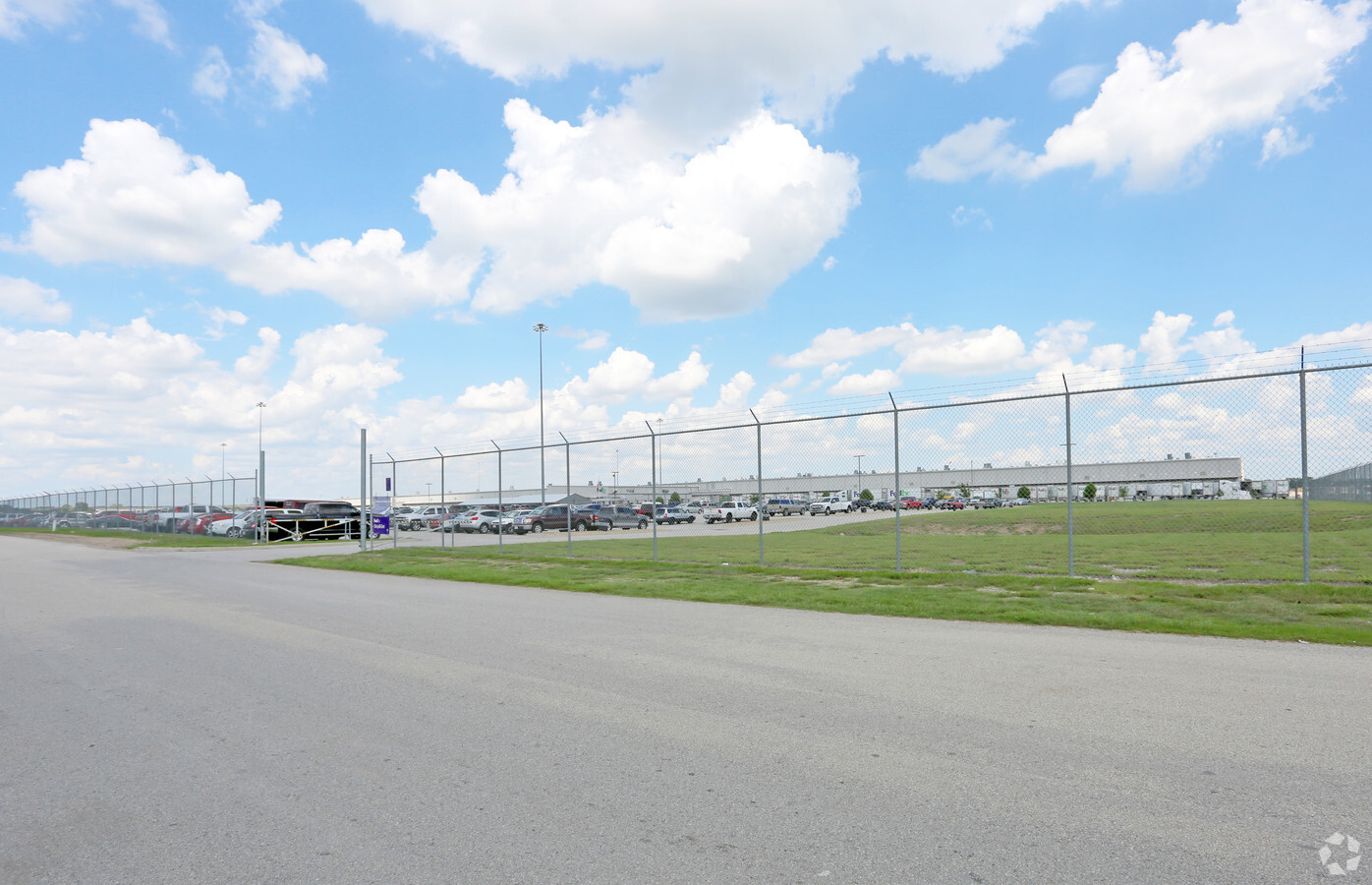
Property Record
1101 E Cleveland St, Hutchins, TX 75141
NEARBY LISTINGS FOR SALE OR LEASE
Property Detail
1101 E Cleveland St
Dallas-Fort Worth-Arlington, TX
Fedex
30251000010010000
FEDEX BLK 1 LT 1 ACS 115.282 VOL2003164/66 DD08212003 CO-DC 0984260102100 4CU09842601
Truckterminal
Dallas
X
Texas
48113C0512L
1
2023
115.28 AC
2023
SE Dallas/I-45
016902
Dallas/Ft Worth
483,458 SF
DEMOGRAPHICS near 1101 E Cleveland St
1 Mile
3 Mile
5 Mile
2024 Total Population
2,939
13,381
86,194
2029 Population
2,946
13,500
86,514
Pop Growth 2024-2029
+ 0.24%
+ 0.89%
+ 0.37%
Average Age
37
35
34
2024 Total Households
260
3,436
25,175
HH Growth 2024-2029
+ 0.38%
+ 0.81%
+ 0.25%
Median Household Inc
$35,555
$40,385
$36,848
Avg Household Size
3.30
3.20
3.20
2024 Avg HH Vehicles
2.00
2.00
2.00
Median Home Value
$88,635
$117,428
$125,584
Median Year Built
1991
1985
1973
Nearby Places
- Restaurants
- Banks
- Shops
- Fitness
- Groceries
PUBLIC TRANSPORTATION
AIRPORT
Dallas Love Field
DRIVE
WALK
Distance
Dallas Love Field
30 min
17.3 mi
Dallas-Fort Worth International
DRIVE
WALK
Distance
Dallas-Fort Worth International
45 min
33.2 mi
Freight Ports
Port of Shreveport
DRIVE
WALK
Distance
Port of Shreveport
210 min
193.2 mi
Nearby Properties
Address
Land Use
TOTAL SIZE
Lot Size
Zoning
Address
Land Use
TOTAL SIZE
Lot Size
Zoning
1,044,647 SF
65.80 AC
Z239
Address
Land Use
TOTAL SIZE
Lot Size
Zoning
1,004,674 SF
63.47 AC
Z123
Address
Land Use
TOTAL SIZE
Lot Size
Zoning
999,728 SF
48.44 AC
Z319
Address
Land Use
TOTAL SIZE
Lot Size
Zoning
1,013,833 SF
54.39 AC
Z102
Address
Land Use
TOTAL SIZE
Lot Size
Zoning
362,767 SF
101.01 AC
Z115
Address
Land Use
TOTAL SIZE
Lot Size
Zoning
800,737 SF
45.33 AC
Z123
Address
Land Use
TOTAL SIZE
Lot Size
Zoning
754,897 SF
42.75 AC
Z123
Address
Land Use
TOTAL SIZE
Lot Size
Zoning
309,110 SF
68.88 AC
Z31
Address
Land Use
TOTAL SIZE
Lot Size
Zoning
648,960 SF
52.22 AC
Z06
Address
Land Use
TOTAL SIZE
Lot Size
Zoning
588,500 SF
32.61 AC
Z123
Address
Land Use
TOTAL SIZE
Lot Size
Zoning
696,622 SF
37.80 AC
Z116
Address
Land Use
TOTAL SIZE
Lot Size
Zoning
626,100 SF
30.45 AC
Z398
Address
Land Use
TOTAL SIZE
Lot Size
Zoning
571,880 SF
19.42 AC
Z123
Address
Land Use
TOTAL SIZE
Lot Size
Zoning
571,880 SF
19.42 AC
Z123
Address
Land Use
TOTAL SIZE
Lot Size
Zoning
540,000 SF
40.02 AC
Z67
Address
Land Use
TOTAL SIZE
Lot Size
Zoning
410,800 SF
30.01 AC
Z06
Address
Land Use
TOTAL SIZE
Lot Size
Zoning
502,000 SF
79.24 AC
Z239
Address
Land Use
TOTAL SIZE
Lot Size
Zoning
500,380 SF
32.56 AC
Z319
Address
Land Use
TOTAL SIZE
Lot Size
Zoning
486,720 SF
41.74 AC
Z06
Address
Land Use
TOTAL SIZE
Lot Size
Zoning
450,000 SF
48.14 AC
Z123
Address
Land Use
TOTAL SIZE
Lot Size
Zoning
307,008 SF
16.09 AC
Z321
Address
Land Use
TOTAL SIZE
Lot Size
Zoning
253,985 SF
15.09 AC
Address
Land Use
TOTAL SIZE
Lot Size
Zoning
403,200 SF
29.07 AC
Z248
Address
Land Use
TOTAL SIZE
Lot Size
Zoning
1.28 AC
Z31
Address
Land Use
TOTAL SIZE
Lot Size
Zoning
249,600 SF
13.89 AC
Z123
Address
Land Use
TOTAL SIZE
Lot Size
Zoning
200,308 SF
23.27 AC
Z248
Address
Land Use
TOTAL SIZE
Lot Size
Zoning
230 SF
33.13 AC
Z398
Address
Land Use
TOTAL SIZE
Lot Size
Zoning
200,981 SF
17.52 AC
Z239
Address
Land Use
TOTAL SIZE
Lot Size
Zoning
137,270 SF
49.85 AC
Z116
The World's #1 Commercial Real Estate Marketplace
Connect with us
© 2025 CoStar Group
The information above has been obtained from sources believed reliable. While we do not doubt its accuracy we have not verified it and make no guarantee, warranty or representation about it. It is your responsibility to independently confirm its accuracy and completeness. Any projections, opinions, assumptions, or estimates used are for example only and do not represent the current or future performance of the property. The value of this transaction to you depends on tax and other factors which should be evaluated by your tax, financial, and legal advisors. You and your advisors should conduct a careful, independent investigation of the property to determine to your satisfaction the suitability of the property for your needs.