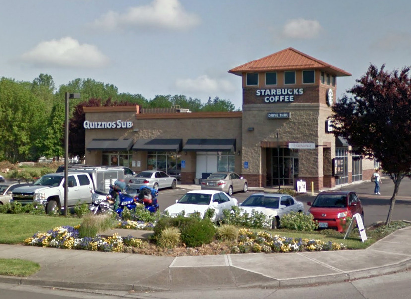
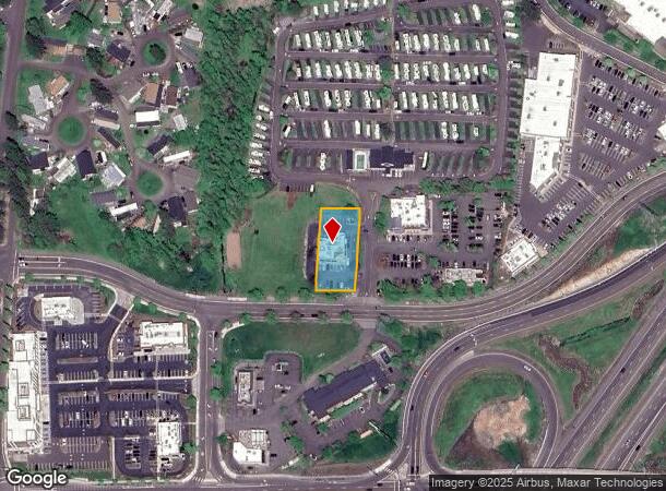
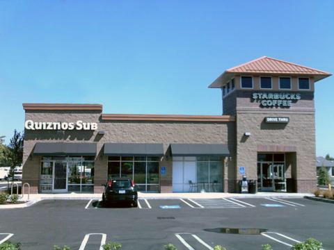
Property Record
111 Arney Rd, Woodburn, OR 97071
NEARBY LISTINGS FOR SALE OR LEASE
Property Detail
111 Arney Rd
Salem, OR
Pp 2004-062
514721
PP 2004-062 LOT 1 ACRES .47
Officebuilding
Marion
X
Oregon
41071C0475D
1
2023
0.47 AC
2024
Marion County
010307
Portland
3,374 SF
DEMOGRAPHICS near 111 Arney Rd
1 Mile
3 Mile
5 Mile
2024 Total Population
9,608
29,996
38,239
2029 Population
9,820
30,460
38,759
Pop Growth 2024-2029
+ 2.21%
+ 1.55%
+ 1.36%
Average Age
43
38
38
2024 Total Households
3,623
9,364
11,790
HH Growth 2024-2029
+ 2.18%
+ 1.60%
+ 1.42%
Median Household Inc
$49,907
$54,382
$58,084
Avg Household Size
2.60
3.10
3.10
2024 Avg HH Vehicles
2.00
2.00
2.00
Median Home Value
$286,718
$327,068
$344,604
Median Year Built
1977
1975
1976
Nearby Places
- Restaurants
- Banks
- Shops
- Fitness
- Groceries
Nearby Properties
Address
Land Use
TOTAL SIZE
Lot Size
Zoning
Address
Land Use
TOTAL SIZE
Lot Size
Zoning
3,486,458 SF
82.43 AC
IL
Address
Land Use
TOTAL SIZE
Lot Size
Zoning
60,057 SF
37.80 AC
CG
Address
Land Use
TOTAL SIZE
Lot Size
Zoning
80.18 AC
IL
Address
Land Use
TOTAL SIZE
Lot Size
Zoning
26,283 SF
56.26 AC
P/SP
Address
Land Use
TOTAL SIZE
Lot Size
Zoning
41.57 AC
IL
Address
Land Use
TOTAL SIZE
Lot Size
Zoning
Address
Land Use
TOTAL SIZE
Lot Size
Zoning
42,561 SF
9.01 AC
P/SP
Address
Land Use
TOTAL SIZE
Lot Size
Zoning
6,853 SF
75.96 AC
IH-LU; MUV
Address
Land Use
TOTAL SIZE
Lot Size
Zoning
198,139 SF
8.60 AC
CG
Address
Land Use
TOTAL SIZE
Lot Size
Zoning
391,539 SF
28.02 AC
IL
Address
Land Use
TOTAL SIZE
Lot Size
Zoning
82,150 SF
7.05 AC
CG
Address
Land Use
TOTAL SIZE
Lot Size
Zoning
246,258 SF
10.44 AC
RMN
Address
Land Use
TOTAL SIZE
Lot Size
Zoning
10 SF
23.27 AC
RM; RS
Address
Land Use
TOTAL SIZE
Lot Size
Zoning
170,895 SF
7.34 AC
RM
Address
Land Use
TOTAL SIZE
Lot Size
Zoning
72,935 SF
9.73 AC
CG
Address
Land Use
TOTAL SIZE
Lot Size
Zoning
219,424 SF
11.91 AC
CG
Address
Land Use
TOTAL SIZE
Lot Size
Zoning
129,578 SF
6.12 AC
RMN
Address
Land Use
TOTAL SIZE
Lot Size
Zoning
107,208 SF
5.81 AC
RMN
Address
Land Use
TOTAL SIZE
Lot Size
Zoning
100,645 SF
3.24 AC
CG
Address
Land Use
TOTAL SIZE
Lot Size
Zoning
20.51 AC
IL; EFU; I
Address
Land Use
TOTAL SIZE
Lot Size
Zoning
90,582 SF
3.39 AC
CG
Address
Land Use
TOTAL SIZE
Lot Size
Zoning
123,691 SF
3.94 AC
RM
Address
Land Use
TOTAL SIZE
Lot Size
Zoning
27,204 SF
9.16 AC
P/SP
Address
Land Use
TOTAL SIZE
Lot Size
Zoning
99,924 SF
8.50 AC
CG
Address
Land Use
TOTAL SIZE
Lot Size
Zoning
57,356 SF
3.52 AC
RM
Address
Land Use
TOTAL SIZE
Lot Size
Zoning
152,390 SF
20.40 AC
IP
Address
Land Use
TOTAL SIZE
Lot Size
Zoning
10 SF
7.11 AC
CG
Address
Land Use
TOTAL SIZE
Lot Size
Zoning
3.59 AC
CG
Address
Land Use
TOTAL SIZE
Lot Size
Zoning
The World's #1 Commercial Real Estate Marketplace
Connect with us
© 2025 CoStar Group
The information above has been obtained from sources believed reliable. While we do not doubt its accuracy we have not verified it and make no guarantee, warranty or representation about it. It is your responsibility to independently confirm its accuracy and completeness. Any projections, opinions, assumptions, or estimates used are for example only and do not represent the current or future performance of the property. The value of this transaction to you depends on tax and other factors which should be evaluated by your tax, financial, and legal advisors. You and your advisors should conduct a careful, independent investigation of the property to determine to your satisfaction the suitability of the property for your needs.