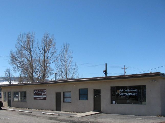
Property Record
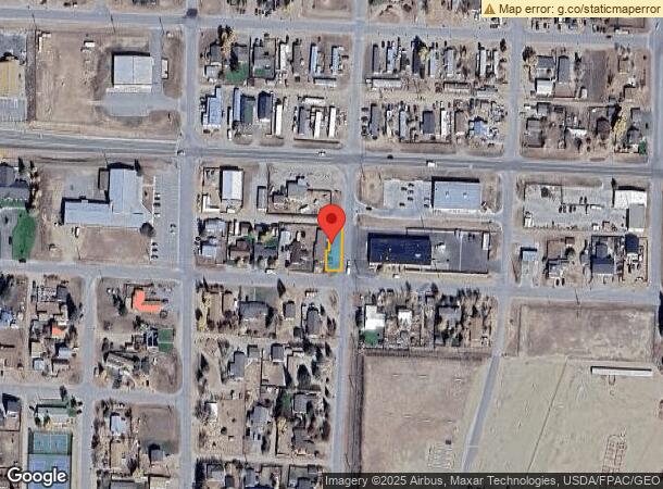
111 N 10Th St, Kremmling, CO 80459
NEARBY LISTINGS FOR SALE OR LEASE
-
-
View all Kremmling listings for sale on LoopNet.com
Property Detail
111 N 10Th St
R023760
Gore City Addition To Kremmling
Officecondo
SUBD: GORE CITY ADDITION TO KREMMLING LOT: 19 - 20 BLOCK: 10 A TRACT 39.98 FT BY 5 FT IN LOT 19
D
Grand
08049C0650C
Colorado
2024
19-20
2024
0.10 AC
000100
Colorado Northwest Area
1,760 SF
Other Market Areas
DEMOGRAPHICS near 111 N 10Th St
1 Mile
3 Mile
5 Mile
2024 Total Population
1,365
1,389
1,424
2029 Population
1,310
1,334
1,368
Pop Growth 2024-2029
(4.03%)
(3.96%)
(3.93%)
Average Age
39
39
39
2024 Total Households
550
559
573
HH Growth 2024-2029
(4.73%)
(4.65%)
(4.71%)
Median Household Inc
$54,411
$54,779
$55,217
Avg Household Size
2.40
2.40
2.40
2024 Avg HH Vehicles
2.00
2.00
2.00
Median Home Value
$250,438
$253,478
$258,189
Median Year Built
1978
1978
1979
Nearby Places
- Restaurants
- Banks
- Shops
- Fitness
- Groceries
SALE & LEASE HISTORY
LISTING DATE
SALE/LEASE

Oct 16, 2020
For Sale
Nearby Properties
Address
Land Use
TOTAL SIZE
Lot Size
Zoning
Address
Land Use
TOTAL SIZE
Lot Size
Zoning
1,960 SF
14.91 AC
33
Address
Land Use
TOTAL SIZE
Lot Size
Zoning
25,270 SF
1.77 AC
Address
Land Use
TOTAL SIZE
Lot Size
Zoning
14,525 SF
0.33 AC
33
Address
Land Use
TOTAL SIZE
Lot Size
Zoning
20,420 SF
8.70 AC
Address
Land Use
TOTAL SIZE
Lot Size
Zoning
8,990 SF
0.96 AC
33
Address
Land Use
TOTAL SIZE
Lot Size
Zoning
8,400 SF
3.68 AC
4
Address
Land Use
TOTAL SIZE
Lot Size
Zoning
22,100 SF
0.96 AC
33
Address
Land Use
TOTAL SIZE
Lot Size
Zoning
13,614 SF
0.73 AC
33
Address
Land Use
TOTAL SIZE
Lot Size
Zoning
18,980 SF
6.57 AC
30
Address
Land Use
TOTAL SIZE
Lot Size
Zoning
9,635 SF
2 AC
43
Address
Land Use
TOTAL SIZE
Lot Size
Zoning
8,100 SF
1.35 AC
33
Address
Land Use
TOTAL SIZE
Lot Size
Zoning
2,293 SF
794.64 AC
Address
Land Use
TOTAL SIZE
Lot Size
Zoning
1,110 SF
29.59 AC
33
Address
Land Use
TOTAL SIZE
Lot Size
Zoning
10,000 SF
0.48 AC
Address
Land Use
TOTAL SIZE
Lot Size
Zoning
3,431 SF
0.37 AC
33
Address
Land Use
TOTAL SIZE
Lot Size
Zoning
525 SF
15.56 AC
Address
Land Use
TOTAL SIZE
Lot Size
Zoning
14,169 SF
2.25 AC
Address
Land Use
TOTAL SIZE
Lot Size
Zoning
5,926 SF
810.35 AC
Address
Land Use
TOTAL SIZE
Lot Size
Zoning
7,200 SF
1.86 AC
43
Address
Land Use
TOTAL SIZE
Lot Size
Zoning
13,760 SF
2.95 AC
43
Address
Land Use
TOTAL SIZE
Lot Size
Zoning
1.56 AC
Address
Land Use
TOTAL SIZE
Lot Size
Zoning
7,000 SF
0.16 AC
43
Address
Land Use
TOTAL SIZE
Lot Size
Zoning
1,872 SF
1.41 AC
33
Address
Land Use
TOTAL SIZE
Lot Size
Zoning
29,307 SF
1.30 AC
Address
Land Use
TOTAL SIZE
Lot Size
Zoning
336 SF
35.13 AC
Address
Land Use
TOTAL SIZE
Lot Size
Zoning
2,304 SF
0.25 AC
33
Address
Land Use
TOTAL SIZE
Lot Size
Zoning
3,400 SF
0.61 AC
33
Address
Land Use
TOTAL SIZE
Lot Size
Zoning
5.98 AC
30
Address
Land Use
TOTAL SIZE
Lot Size
Zoning
6,660 SF
0.93 AC
33
Address
Land Use
TOTAL SIZE
Lot Size
Zoning
6,400 SF
0.22 AC
The World's #1 Commercial Real Estate Marketplace
Connect with us
© 2025 CoStar Group
The information above has been obtained from sources believed reliable. While we do not doubt its accuracy we have not verified it and make no guarantee, warranty or representation about it. It is your responsibility to independently confirm its accuracy and completeness. Any projections, opinions, assumptions, or estimates used are for example only and do not represent the current or future performance of the property. The value of this transaction to you depends on tax and other factors which should be evaluated by your tax, financial, and legal advisors. You and your advisors should conduct a careful, independent investigation of the property to determine to your satisfaction the suitability of the property for your needs.