Property Record
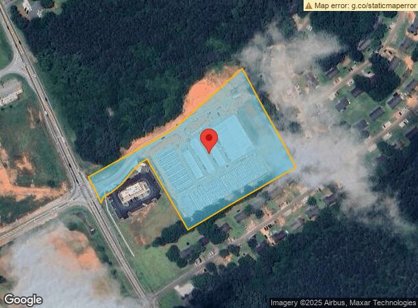
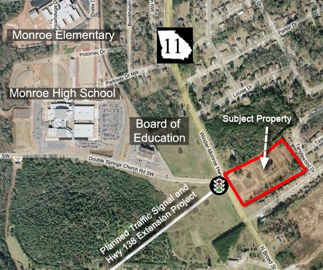
1110 N Broad St, Monroe, GA 30656

NEARBY LISTINGS FOR SALE OR LEASE
Property Detail
1110 N Broad St
Atlanta-Sandy Springs-Roswell, GA
09115-Sf-Monroe Secondary/Spot
M004000000001000
TR#3 7.24AC
Commercialnec
Walton
X
Georgia
13297C0130F
62
2024
7.24 AC
2024
Walton County
110400
Atlanta
21,600 SF
DEMOGRAPHICS near 1110 N Broad St
1 Mile
3 Mile
5 Mile
2024 Total Population
1,995
20,069
37,189
2029 Population
2,307
23,271
43,169
Pop Growth 2024-2029
+ 15.64%
+ 15.95%
+ 16.08%
Average Age
40
39
40
2024 Total Households
690
7,619
13,685
HH Growth 2024-2029
+ 15.94%
+ 16.33%
+ 16.46%
Median Household Inc
$38,842
$39,928
$59,950
Avg Household Size
2.70
2.60
2.70
2024 Avg HH Vehicles
2.00
2.00
2.00
Median Home Value
$181,064
$190,412
$250,129
Median Year Built
1985
1983
1992
Nearby Places
- Restaurants
- Banks
- Shops
- Fitness
- Groceries
SALE & LEASE HISTORY
LISTING DATE
SALE/LEASE

Sep 24, 2016
For Sale
Nov 16, 2016
For Sale
Jun 11, 2018
For Sale
Nearby Properties
Address
Land Use
TOTAL SIZE
Lot Size
Zoning
Address
Land Use
TOTAL SIZE
Lot Size
Zoning
117,471 SF
65.68 AC
B3
Address
Land Use
TOTAL SIZE
Lot Size
Zoning
375,544 SF
128.40 AC
M1
Address
Land Use
TOTAL SIZE
Lot Size
Zoning
35,900 SF
44.30 AC
B3
Address
Land Use
TOTAL SIZE
Lot Size
Zoning
174,303 SF
26.22 AC
PCD
Address
Land Use
TOTAL SIZE
Lot Size
Zoning
122,949 SF
28.37 AC
R1 P
Address
Land Use
TOTAL SIZE
Lot Size
Zoning
319.22 AC
B3 R1
Address
Land Use
TOTAL SIZE
Lot Size
Zoning
2,736 SF
8.96 AC
P
Address
Land Use
TOTAL SIZE
Lot Size
Zoning
188,663 SF
25.40 AC
B3
Address
Land Use
TOTAL SIZE
Lot Size
Zoning
16,880 SF
55.23 AC
M1
Address
Land Use
TOTAL SIZE
Lot Size
Zoning
96,107 SF
58.49 AC
R1
Address
Land Use
TOTAL SIZE
Lot Size
Zoning
268,431 SF
14.74 AC
M1
Address
Land Use
TOTAL SIZE
Lot Size
Zoning
29,161 SF
42.44 AC
B2 R1 R2
Address
Land Use
TOTAL SIZE
Lot Size
Zoning
72,434 SF
14.12 AC
B3
Address
Land Use
TOTAL SIZE
Lot Size
Zoning
78,644 SF
9.90 AC
B3
Address
Land Use
TOTAL SIZE
Lot Size
Zoning
4,319 SF
12.16 AC
PRD
Address
Land Use
TOTAL SIZE
Lot Size
Zoning
58,980 SF
8.84 AC
PCD
Address
Land Use
TOTAL SIZE
Lot Size
Zoning
104,716 SF
11.70 AC
B3
Address
Land Use
TOTAL SIZE
Lot Size
Zoning
2,640 SF
64.81 AC
R1A
Address
Land Use
TOTAL SIZE
Lot Size
Zoning
52,185 SF
3.64 AC
PCD
Address
Land Use
TOTAL SIZE
Lot Size
Zoning
27,300 SF
8 AC
PCD
Address
Land Use
TOTAL SIZE
Lot Size
Zoning
11,215 SF
7.46 AC
B1
Address
Land Use
TOTAL SIZE
Lot Size
Zoning
25,192 SF
20.20 AC
A2
Address
Land Use
TOTAL SIZE
Lot Size
Zoning
45,428 SF
8.11 AC
B3
Address
Land Use
TOTAL SIZE
Lot Size
Zoning
90,557 SF
11.46 AC
B3
Address
Land Use
TOTAL SIZE
Lot Size
Zoning
104,104 SF
17.55 AC
R1A
Address
Land Use
TOTAL SIZE
Lot Size
Zoning
37,600 SF
5.96 AC
B2
Address
Land Use
TOTAL SIZE
Lot Size
Zoning
24,553 SF
5.32 AC
P
Address
Land Use
TOTAL SIZE
Lot Size
Zoning
30,722 SF
2.54 AC
B2
Address
Land Use
TOTAL SIZE
Lot Size
Zoning
4,830 SF
9.65 AC
PCD
Address
Land Use
TOTAL SIZE
Lot Size
Zoning
12,240 SF
7.16 AC
B3
The World's #1 Commercial Real Estate Marketplace
Connect with us
© 2025 CoStar Group
The information above has been obtained from sources believed reliable. While we do not doubt its accuracy we have not verified it and make no guarantee, warranty or representation about it. It is your responsibility to independently confirm its accuracy and completeness. Any projections, opinions, assumptions, or estimates used are for example only and do not represent the current or future performance of the property. The value of this transaction to you depends on tax and other factors which should be evaluated by your tax, financial, and legal advisors. You and your advisors should conduct a careful, independent investigation of the property to determine to your satisfaction the suitability of the property for your needs.