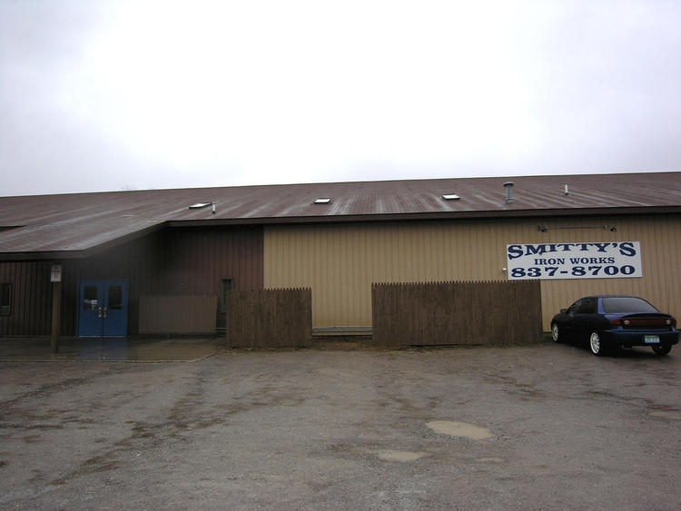
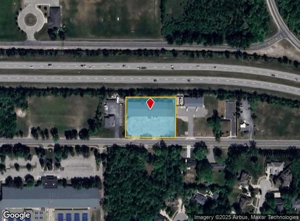
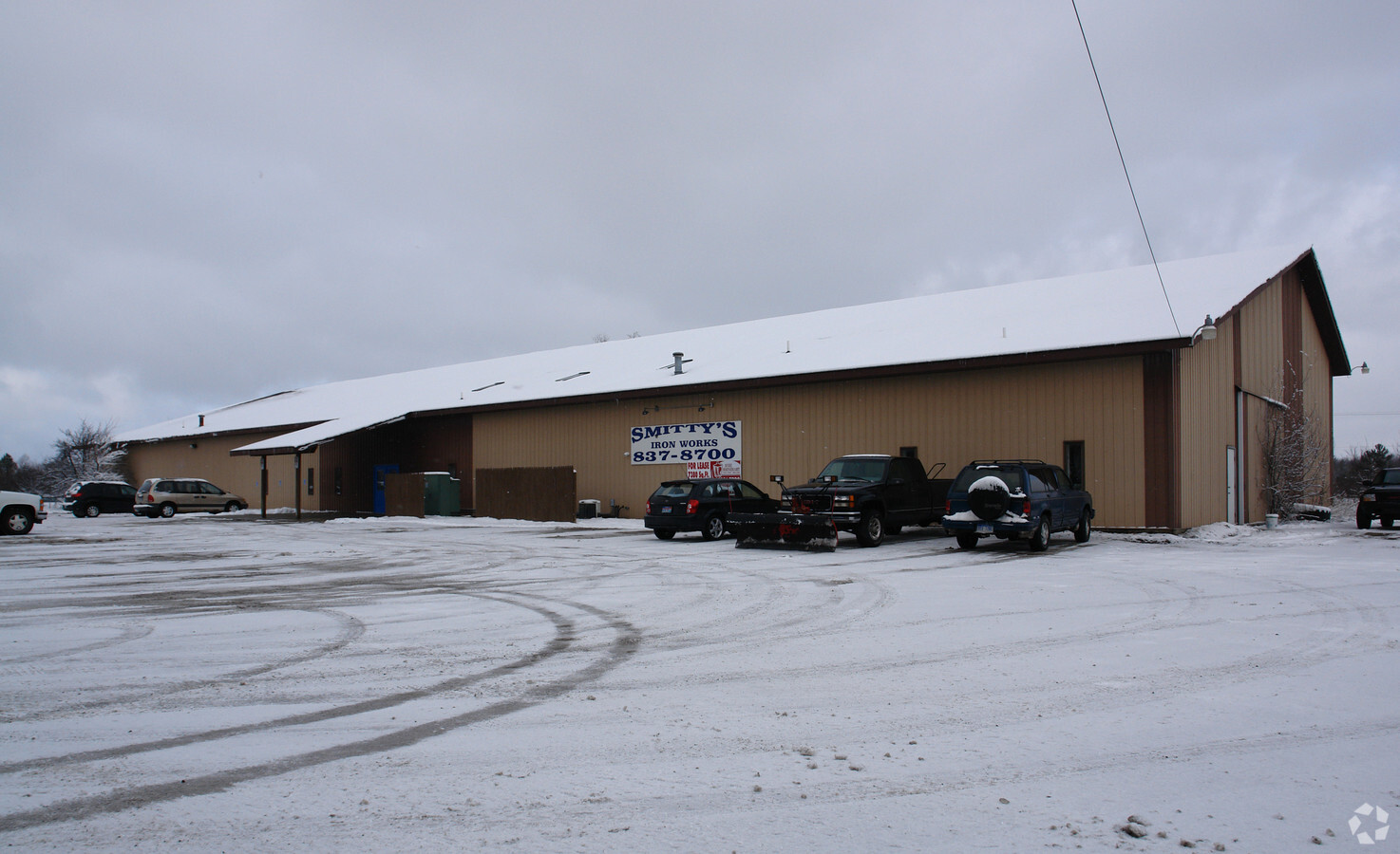
Property Record
1111 E Wackerly St, Midland, MI 48642
NEARBY LISTINGS FOR SALE OR LEASE
Property Detail
1111 E Wackerly St
Commercialnec
BEG 583.52 FT E ALG S SEC LI FR S 1/4 COR OF SEC 34 TH N 272.94 FT E 288 FT S273.06 FT W 288 FT TO BEG T15N R2E
X
Midland
26111C0190E
Michigan
2024
1.59 AC
2024
Other Market Areas
290902
Midland, MI
20,960 SF
11-34-40-022
DEMOGRAPHICS near 1111 E Wackerly St
1 Mile
3 Mile
5 Mile
2024 Total Population
5,569
33,987
49,528
2029 Population
5,534
34,033
49,586
Pop Growth 2024-2029
(0.63%)
+ 0.14%
+ 0.12%
Average Age
40
42
42
2024 Total Households
2,074
14,236
20,686
HH Growth 2024-2029
(0.72%)
+ 0.18%
+ 0.15%
Median Household Inc
$116,982
$72,895
$69,055
Avg Household Size
2.60
2.30
2.30
2024 Avg HH Vehicles
2.00
2.00
2.00
Median Home Value
$253,846
$183,799
$186,155
Median Year Built
1984
1970
1972
Nearby Places
- Restaurants
- Banks
- Shops
- Fitness
- Groceries
PUBLIC TRANSPORTATION
AIRPORT
MBS International
DRIVE
WALK
Distance
MBS International
24 min
16.2 mi
Freight Ports
Port of Toledo
DRIVE
WALK
Distance
Port of Toledo
199 min
174.7 mi
Nearby Properties
Address
Land Use
TOTAL SIZE
Lot Size
Zoning
Address
Land Use
TOTAL SIZE
Lot Size
Zoning
192,945 SF
15.02 AC
LCMR
Address
Land Use
TOTAL SIZE
Lot Size
Zoning
203,835 SF
47.21 AC
LCMR
Address
Land Use
TOTAL SIZE
Lot Size
Zoning
42,647 SF
12.42 AC
RA-4
Address
Land Use
TOTAL SIZE
Lot Size
Zoning
202,789 SF
139.19 AC
NC
Address
Land Use
TOTAL SIZE
Lot Size
Zoning
116,057 SF
120 AC
RA-1
Address
Land Use
TOTAL SIZE
Lot Size
Zoning
252,442 SF
70.03 AC
AG
Address
Land Use
TOTAL SIZE
Lot Size
Zoning
357,933 SF
33.35 AC
RC
Address
Land Use
TOTAL SIZE
Lot Size
Zoning
219,270 SF
20 AC
RB
Address
Land Use
TOTAL SIZE
Lot Size
Zoning
115,878 SF
7.53 AC
RB
Address
Land Use
TOTAL SIZE
Lot Size
Zoning
116,274 SF
4.59 AC
RC
Address
Land Use
TOTAL SIZE
Lot Size
Zoning
83,416 SF
1.21 AC
COM
Address
Land Use
TOTAL SIZE
Lot Size
Zoning
201,174 SF
27.52 AC
RC
Address
Land Use
TOTAL SIZE
Lot Size
Zoning
55,872 SF
3.85 AC
RC
Address
Land Use
TOTAL SIZE
Lot Size
Zoning
200,163 SF
21.12 AC
RC
Address
Land Use
TOTAL SIZE
Lot Size
Zoning
61,516 SF
5.31 AC
RC
Address
Land Use
TOTAL SIZE
Lot Size
Zoning
53,950 SF
16.40 AC
RC
Address
Land Use
TOTAL SIZE
Lot Size
Zoning
76,333 SF
10 AC
RB
Address
Land Use
TOTAL SIZE
Lot Size
Zoning
126,335 SF
11.79 AC
RC
Address
Land Use
TOTAL SIZE
Lot Size
Zoning
81,009 SF
3.33 AC
RC
Address
Land Use
TOTAL SIZE
Lot Size
Zoning
99,327 SF
7.96 AC
RB
Address
Land Use
TOTAL SIZE
Lot Size
Zoning
64,769 SF
3.17 AC
RC
Address
Land Use
TOTAL SIZE
Lot Size
Zoning
143.72 AC
LCMR
Address
Land Use
TOTAL SIZE
Lot Size
Zoning
74,532 SF
6.55 AC
RC
Address
Land Use
TOTAL SIZE
Lot Size
Zoning
88,104 SF
9 AC
RC
Address
Land Use
TOTAL SIZE
Lot Size
Zoning
114,465 SF
12.59 AC
RC
Address
Land Use
TOTAL SIZE
Lot Size
Zoning
62,439 SF
7.34 AC
RC
Address
Land Use
TOTAL SIZE
Lot Size
Zoning
81,373 SF
8.93 AC
RC
Address
Land Use
TOTAL SIZE
Lot Size
Zoning
38,127 SF
9.72 AC
IA
Address
Land Use
TOTAL SIZE
Lot Size
Zoning
40,763 SF
11.33 AC
RB
Address
Land Use
TOTAL SIZE
Lot Size
Zoning
35,826 SF
4.67 AC
RA-1
The World's #1 Commercial Real Estate Marketplace
Connect with us
© 2025 CoStar Group
The information above has been obtained from sources believed reliable. While we do not doubt its accuracy we have not verified it and make no guarantee, warranty or representation about it. It is your responsibility to independently confirm its accuracy and completeness. Any projections, opinions, assumptions, or estimates used are for example only and do not represent the current or future performance of the property. The value of this transaction to you depends on tax and other factors which should be evaluated by your tax, financial, and legal advisors. You and your advisors should conduct a careful, independent investigation of the property to determine to your satisfaction the suitability of the property for your needs.