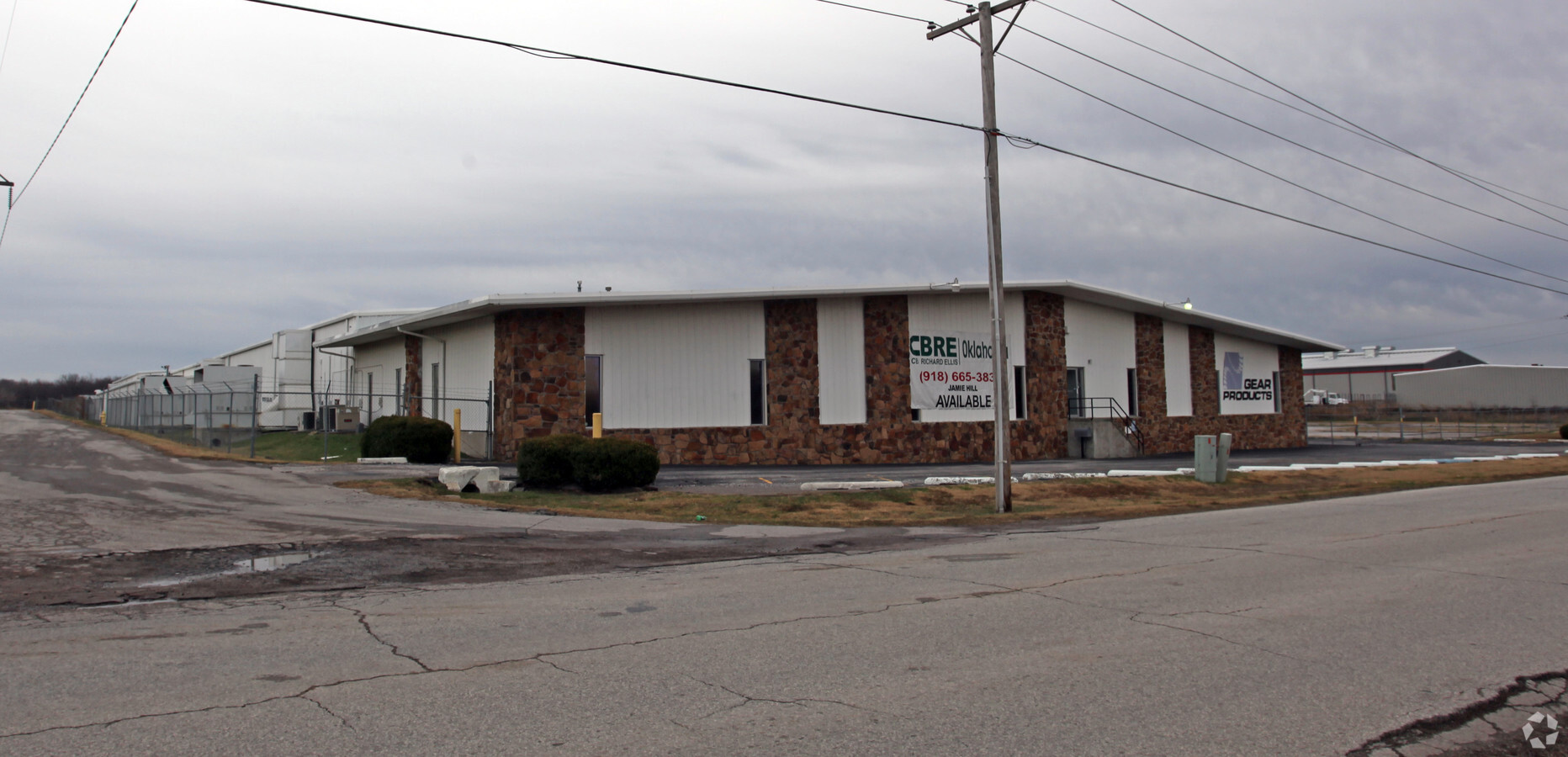
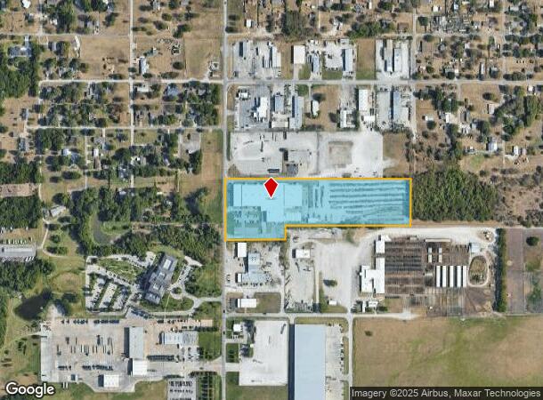
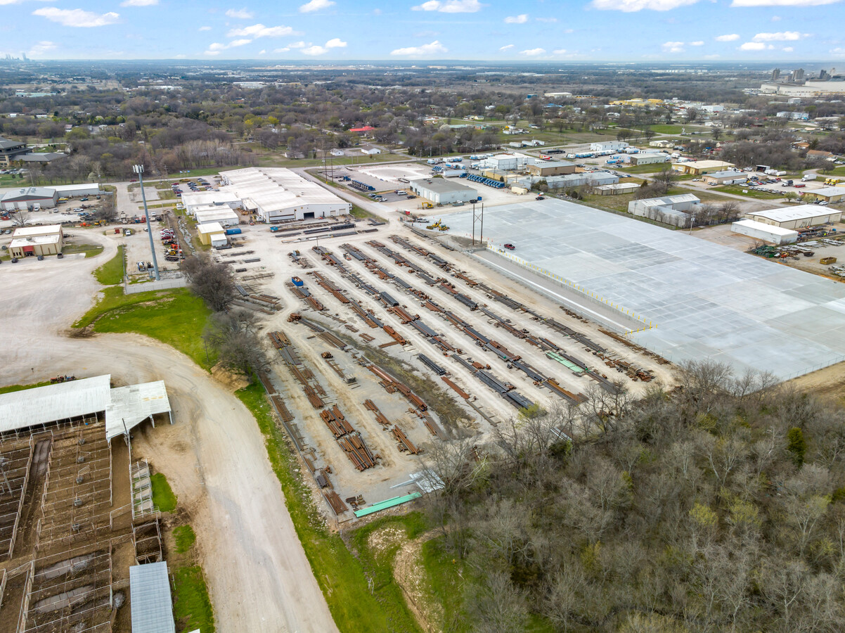
Property Record
1111 N 161St East Ave, Tulsa, OK 74116
NEARBY LISTINGS FOR SALE OR LEASE
Property Detail
1111 N 161St East Ave
660029924
20N-14E
Officebuilding
S2 S2 SW NW & TR IN N2 NW SW BEG NW/C NW SW, S 110', E 427' N 110', W 427' TO POB
X
Rogers
40131C0350J
Oklahoma
2024
10.51 AC
2024
Rogers County
050407
Tulsa
7,500 SF
Tulsa, OK
DEMOGRAPHICS near 1111 N 161St East Ave
1 Mile
3 Mile
5 Mile
2024 Total Population
2,023
14,807
72,260
2029 Population
2,159
15,759
75,854
Pop Growth 2024-2029
+ 6.72%
+ 6.43%
+ 4.97%
Average Age
41
37
35
2024 Total Households
766
5,504
25,943
HH Growth 2024-2029
+ 6.66%
+ 6.67%
+ 5.04%
Median Household Inc
$70,071
$54,830
$52,521
Avg Household Size
2.70
2.60
2.70
2024 Avg HH Vehicles
2.00
2.00
2.00
Median Home Value
$175,305
$140,875
$135,124
Median Year Built
1975
1975
1976
Nearby Places
- Restaurants
- Banks
- Shops
- Fitness
- Groceries
PUBLIC TRANSPORTATION
AIRPORT
Tulsa International
DRIVE
WALK
Distance
Tulsa International
16 min
10.6 mi
Freight Ports
Tulsa Port Of Catoosa
DRIVE
WALK
Distance
Tulsa Port Of Catoosa
12 min
7.3 mi
SALE & LEASE HISTORY
LISTING DATE
SALE/LEASE

Mar 27, 2024
For Sale
Apr 10, 2023
For Sale
Nearby Properties
Address
Land Use
TOTAL SIZE
Lot Size
Zoning
Address
Land Use
TOTAL SIZE
Lot Size
Zoning
349,823 SF
203.39 AC
IL
Address
Land Use
TOTAL SIZE
Lot Size
Zoning
2,689,602 SF
81.80 AC
IH
Address
Land Use
TOTAL SIZE
Lot Size
Zoning
246.16 AC
IM
Address
Land Use
TOTAL SIZE
Lot Size
Zoning
674,500 SF
122.30 AC
IM
Address
Land Use
TOTAL SIZE
Lot Size
Zoning
112,556 SF
11.07 AC
CH
Address
Land Use
TOTAL SIZE
Lot Size
Zoning
11,184 SF
638.56 AC
Address
Land Use
TOTAL SIZE
Lot Size
Zoning
124,648 SF
21.23 AC
IL
Address
Land Use
TOTAL SIZE
Lot Size
Zoning
106,270 SF
9.47 AC
RM0
Address
Land Use
TOTAL SIZE
Lot Size
Zoning
32,370 SF
45.90 AC
AG
Address
Land Use
TOTAL SIZE
Lot Size
Zoning
39,375 SF
70 AC
AG
Address
Land Use
TOTAL SIZE
Lot Size
Zoning
28,465 SF
6.71 AC
RS3
Address
Land Use
TOTAL SIZE
Lot Size
Zoning
498,836 SF
50.22 AC
CS
Address
Land Use
TOTAL SIZE
Lot Size
Zoning
40,202 SF
2.93 AC
RM0
Address
Land Use
TOTAL SIZE
Lot Size
Zoning
492,786 SF
76.58 AC
IL
Address
Land Use
TOTAL SIZE
Lot Size
Zoning
219,538 SF
20.13 AC
IL
Address
Land Use
TOTAL SIZE
Lot Size
Zoning
3,720 SF
158.66 AC
Address
Land Use
TOTAL SIZE
Lot Size
Zoning
6,000 SF
346.13 AC
Address
Land Use
TOTAL SIZE
Lot Size
Zoning
16,250 SF
76.36 AC
AG
Address
Land Use
TOTAL SIZE
Lot Size
Zoning
137,668 SF
13.66 AC
IM
Address
Land Use
TOTAL SIZE
Lot Size
Zoning
20,174 SF
1.12 AC
RS3
Address
Land Use
TOTAL SIZE
Lot Size
Zoning
6,000 SF
1 AC
Address
Land Use
TOTAL SIZE
Lot Size
Zoning
19,800 SF
5.05 AC
RS2
Address
Land Use
TOTAL SIZE
Lot Size
Zoning
64.90 AC
AG
Address
Land Use
TOTAL SIZE
Lot Size
Zoning
2,842 SF
89.24 AC
AG
Address
Land Use
TOTAL SIZE
Lot Size
Zoning
439,510 SF
57.22 AC
IM
Address
Land Use
TOTAL SIZE
Lot Size
Zoning
153,297 SF
16.29 AC
Address
Land Use
TOTAL SIZE
Lot Size
Zoning
62,644 SF
12.38 AC
Address
Land Use
TOTAL SIZE
Lot Size
Zoning
12,404 SF
4.34 AC
RS2
Address
Land Use
TOTAL SIZE
Lot Size
Zoning
7,584 SF
16.13 AC
AG
Address
Land Use
TOTAL SIZE
Lot Size
Zoning
103,820 SF
2.70 AC
The World's #1 Commercial Real Estate Marketplace
Connect with us
© 2025 CoStar Group
The information above has been obtained from sources believed reliable. While we do not doubt its accuracy we have not verified it and make no guarantee, warranty or representation about it. It is your responsibility to independently confirm its accuracy and completeness. Any projections, opinions, assumptions, or estimates used are for example only and do not represent the current or future performance of the property. The value of this transaction to you depends on tax and other factors which should be evaluated by your tax, financial, and legal advisors. You and your advisors should conduct a careful, independent investigation of the property to determine to your satisfaction the suitability of the property for your needs.