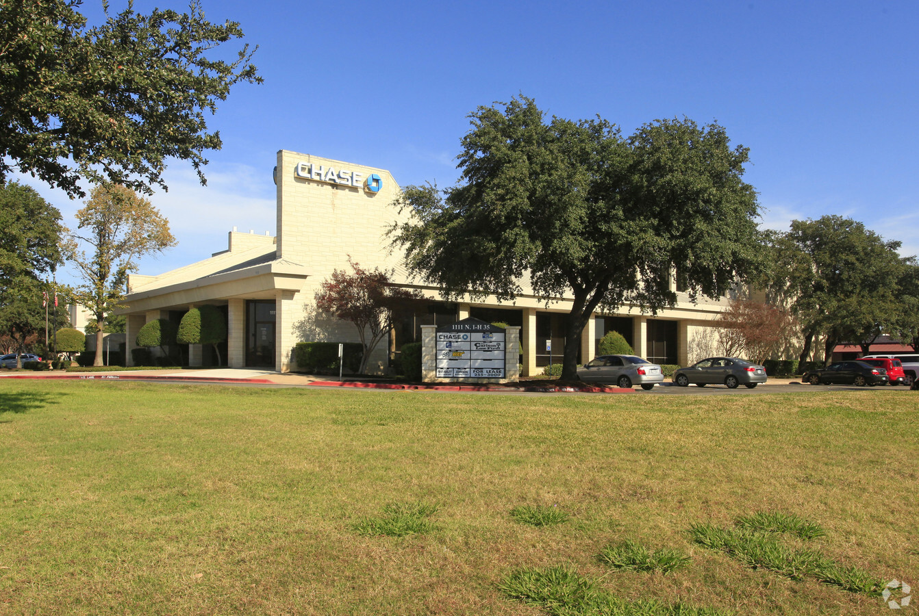
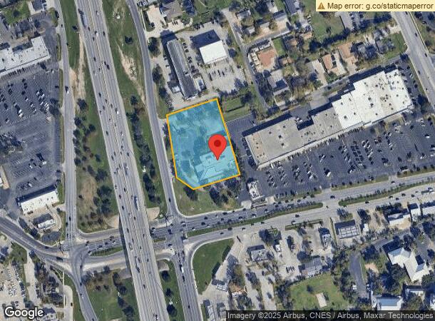
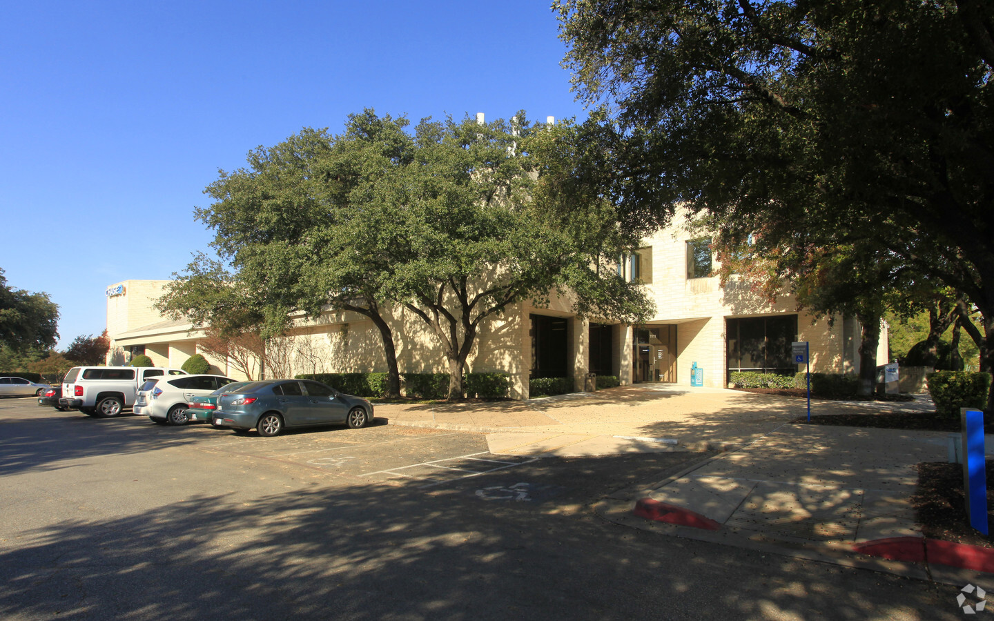
Property Record
1111 N Interstate 35, Round Rock, TX 78664

NEARBY LISTINGS FOR SALE OR LEASE
Property Detail
1111 N Interstate 35
Austin-Round Rock, TX
Round Rock Center Sec 2
R071236
S4495 - ROUND ROCK CENTER SEC 2, LOT 1, ACRES 2.323
Commercialnec
Williamson
X
Texas
48491C0493F
1
2023
2.32 AC
2023
Round Rock
021503
Austin
30,767 SF
DEMOGRAPHICS near 1111 N Interstate 35
1 Mile
3 Mile
5 Mile
2024 Total Population
9,254
104,499
237,088
2029 Population
11,702
131,750
294,036
Pop Growth 2024-2029
+ 26.45%
+ 26.08%
+ 24.02%
Average Age
36
37
36
2024 Total Households
3,386
38,984
85,313
HH Growth 2024-2029
+ 27.05%
+ 26.66%
+ 24.48%
Median Household Inc
$58,344
$82,393
$98,526
Avg Household Size
2.60
2.60
2.70
2024 Avg HH Vehicles
2.00
2.00
2.00
Median Home Value
$277,599
$338,164
$382,913
Median Year Built
1984
1997
2002
Nearby Places
- Restaurants
- Banks
- Shops
- Fitness
- Groceries
PUBLIC TRANSPORTATION
AIRPORT
Austin-Bergstrom International
DRIVE
WALK
Distance
Austin-Bergstrom International
41 min
29.2 mi
Freight Ports
Calhoun Port
DRIVE
WALK
Distance
Calhoun Port
205 min
177.9 mi
SALE & LEASE HISTORY
LISTING DATE
SALE/LEASE

Sep 24, 2016
For Lease
Mar 20, 2019
For Lease
Nearby Properties
Address
Land Use
TOTAL SIZE
Lot Size
Zoning
Address
Land Use
TOTAL SIZE
Lot Size
Zoning
2,089,779 SF
167.48 AC
Address
Land Use
TOTAL SIZE
Lot Size
Zoning
757,866 SF
33.20 AC
Address
Land Use
TOTAL SIZE
Lot Size
Zoning
536,741 SF
80.32 AC
SF2
Address
Land Use
TOTAL SIZE
Lot Size
Zoning
533,151 SF
26.90 AC
PUD
Address
Land Use
TOTAL SIZE
Lot Size
Zoning
470,992 SF
25.92 AC
Address
Land Use
TOTAL SIZE
Lot Size
Zoning
477,454 SF
22.28 AC
Address
Land Use
TOTAL SIZE
Lot Size
Zoning
321,659 SF
14.84 AC
Address
Land Use
TOTAL SIZE
Lot Size
Zoning
411,020 SF
29.91 AC
PUD
Address
Land Use
TOTAL SIZE
Lot Size
Zoning
283,866 SF
12.18 AC
Address
Land Use
TOTAL SIZE
Lot Size
Zoning
364,432 SF
20.56 AC
MF
Address
Land Use
TOTAL SIZE
Lot Size
Zoning
362,216 SF
19.72 AC
Address
Land Use
TOTAL SIZE
Lot Size
Zoning
330,300 SF
18.58 AC
C1
Address
Land Use
TOTAL SIZE
Lot Size
Zoning
330,541 SF
20.90 AC
PUD
Address
Land Use
TOTAL SIZE
Lot Size
Zoning
325,797 SF
36.36 AC
Address
Land Use
TOTAL SIZE
Lot Size
Zoning
378,799 SF
9.03 AC
PUD
Address
Land Use
TOTAL SIZE
Lot Size
Zoning
456,943 SF
66.31 AC
SF2
Address
Land Use
TOTAL SIZE
Lot Size
Zoning
409,875 SF
25.28 AC
MF
Address
Land Use
TOTAL SIZE
Lot Size
Zoning
543,958 SF
60.19 AC
Address
Land Use
TOTAL SIZE
Lot Size
Zoning
379,953 SF
11.74 AC
PUD
Address
Land Use
TOTAL SIZE
Lot Size
Zoning
273,462 SF
47.12 AC
Address
Land Use
TOTAL SIZE
Lot Size
Zoning
299,400 SF
15.91 AC
MF
Address
Land Use
TOTAL SIZE
Lot Size
Zoning
300,061 SF
19.19 AC
Address
Land Use
TOTAL SIZE
Lot Size
Zoning
234,510 SF
19.18 AC
Address
Land Use
TOTAL SIZE
Lot Size
Zoning
140,409 SF
17.15 AC
Address
Land Use
TOTAL SIZE
Lot Size
Zoning
338,958 SF
10.41 AC
PUD
Address
Land Use
TOTAL SIZE
Lot Size
Zoning
446,815 SF
30.55 AC
Address
Land Use
TOTAL SIZE
Lot Size
Zoning
217,260 SF
15.27 AC
Address
Land Use
TOTAL SIZE
Lot Size
Zoning
323,284 SF
14.21 AC
Address
Land Use
TOTAL SIZE
Lot Size
Zoning
220,792 SF
11.31 AC
Address
Land Use
TOTAL SIZE
Lot Size
Zoning
303,414 SF
12 AC
The World's #1 Commercial Real Estate Marketplace
Connect with us
© 2025 CoStar Group
The information above has been obtained from sources believed reliable. While we do not doubt its accuracy we have not verified it and make no guarantee, warranty or representation about it. It is your responsibility to independently confirm its accuracy and completeness. Any projections, opinions, assumptions, or estimates used are for example only and do not represent the current or future performance of the property. The value of this transaction to you depends on tax and other factors which should be evaluated by your tax, financial, and legal advisors. You and your advisors should conduct a careful, independent investigation of the property to determine to your satisfaction the suitability of the property for your needs.