Property Record
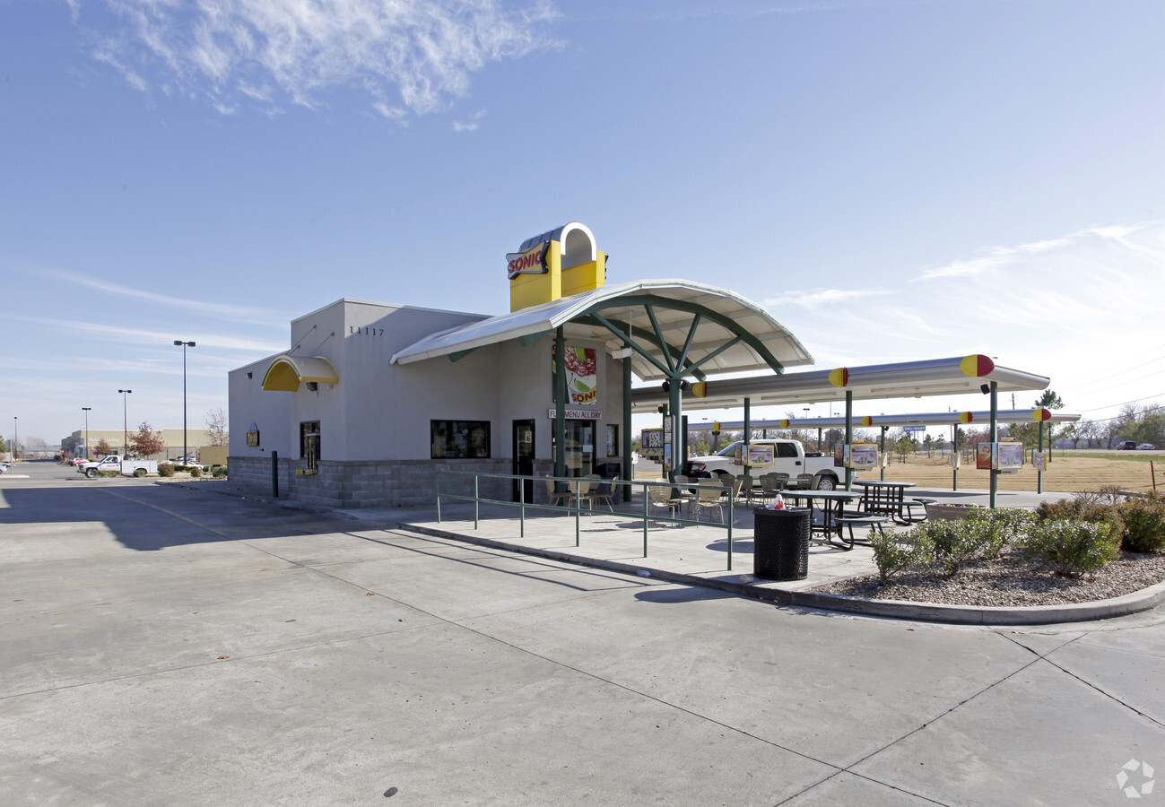
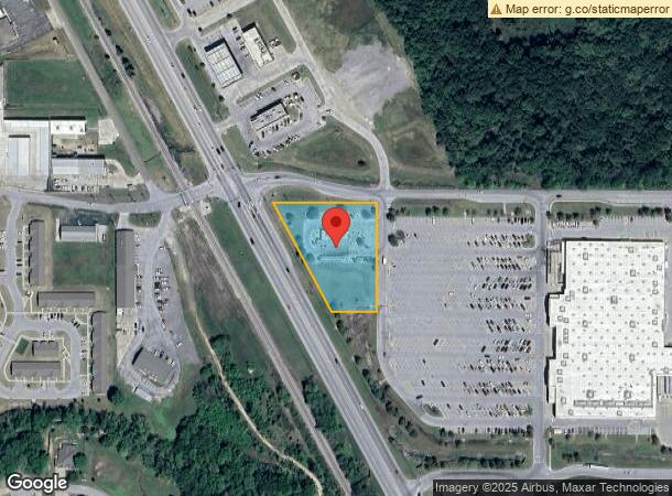
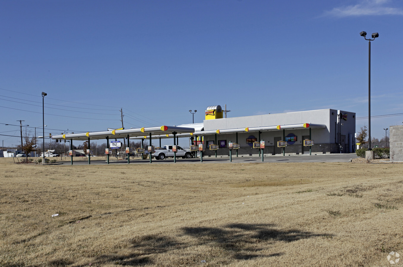
11117 S State Highway 51, Coweta, OK 74429
NEARBY LISTINGS FOR SALE OR LEASE
Property Detail
11117 S State Highway 51
730078808
35-18-15 (TR #2) (OUTER PARKING AREA) COM AT NE COR OF NE OF SD SEC -S01D19'24"E ALNG E LN OF SD NE 1068.27'-S88D48'23"W 1826.41' TO A PT ON E ROW LN ST HWAY 51-N29D47'51"W 863.47" TO POB -CONT N29D47'5 1" W ALNG SD ROW 308.59' TO A PT ON N LN OF SD
Restaurantdrivein
Wagoner
X
Oklahoma
40145C0120H
1.65 AC
2023
Wagoner County
2023
Tulsa
030512
Tulsa, OK
1,620 SF
DEMOGRAPHICS near 11117 S State Highway 51
1 Mile
3 Mile
5 Mile
2024 Total Population
2,782
15,973
38,600
2029 Population
3,284
18,746
45,120
Pop Growth 2024-2029
+ 18.04%
+ 17.36%
+ 16.89%
Average Age
40
39
40
2024 Total Households
995
5,733
14,007
HH Growth 2024-2029
+ 17.79%
+ 17.16%
+ 16.71%
Median Household Inc
$87,839
$88,955
$84,275
Avg Household Size
2.70
2.70
2.70
2024 Avg HH Vehicles
2.00
2.00
2.00
Median Home Value
$272,028
$255,267
$245,822
Median Year Built
2003
2002
1998
Nearby Places
- Restaurants
- Banks
- Shops
- Fitness
- Groceries
PUBLIC TRANSPORTATION
AIRPORT
Tulsa International
DRIVE
WALK
Distance
Tulsa International
33 min
23.4 mi
Freight Ports
Tulsa Port of Inola
DRIVE
WALK
Distance
Tulsa Port of Inola
36 min
23.2 mi
Nearby Properties
Address
Land Use
TOTAL SIZE
Lot Size
Zoning
Address
Land Use
TOTAL SIZE
Lot Size
Zoning
1,936 SF
4.74 AC
Address
Land Use
TOTAL SIZE
Lot Size
Zoning
6,400 SF
14.96 AC
Address
Land Use
TOTAL SIZE
Lot Size
Zoning
5,640 SF
1.20 AC
Address
Land Use
TOTAL SIZE
Lot Size
Zoning
2,000 SF
1.55 AC
Address
Land Use
TOTAL SIZE
Lot Size
Zoning
1,896 SF
2.25 AC
Address
Land Use
TOTAL SIZE
Lot Size
Zoning
9,250 SF
7.46 AC
Address
Land Use
TOTAL SIZE
Lot Size
Zoning
61,167 SF
3.68 AC
Address
Land Use
TOTAL SIZE
Lot Size
Zoning
2,520 SF
132.56 AC
Address
Land Use
TOTAL SIZE
Lot Size
Zoning
154 SF
1.36 AC
Address
Land Use
TOTAL SIZE
Lot Size
Zoning
18,120 SF
2 AC
Address
Land Use
TOTAL SIZE
Lot Size
Zoning
23,865 SF
2.50 AC
Address
Land Use
TOTAL SIZE
Lot Size
Zoning
6,336 SF
3.21 AC
Address
Land Use
TOTAL SIZE
Lot Size
Zoning
8,000 SF
3.91 AC
Address
Land Use
TOTAL SIZE
Lot Size
Zoning
160 AC
TM
Address
Land Use
TOTAL SIZE
Lot Size
Zoning
27,300 SF
5.16 AC
Address
Land Use
TOTAL SIZE
Lot Size
Zoning
18,000 SF
2.38 AC
Address
Land Use
TOTAL SIZE
Lot Size
Zoning
12,544 SF
1.41 AC
Address
Land Use
TOTAL SIZE
Lot Size
Zoning
3,600 SF
3.35 AC
Address
Land Use
TOTAL SIZE
Lot Size
Zoning
3,304 SF
1.84 AC
Address
Land Use
TOTAL SIZE
Lot Size
Zoning
Address
Land Use
TOTAL SIZE
Lot Size
Zoning
6,810 SF
1.37 AC
Address
Land Use
TOTAL SIZE
Lot Size
Zoning
7,800 SF
0.97 AC
Address
Land Use
TOTAL SIZE
Lot Size
Zoning
1,846 SF
0.80 AC
Address
Land Use
TOTAL SIZE
Lot Size
Zoning
2,400 SF
81.08 AC
Address
Land Use
TOTAL SIZE
Lot Size
Zoning
1,800 SF
3.81 AC
Address
Land Use
TOTAL SIZE
Lot Size
Zoning
2,981 SF
2.68 AC
Address
Land Use
TOTAL SIZE
Lot Size
Zoning
Address
Land Use
TOTAL SIZE
Lot Size
Zoning
16,067 SF
1.91 AC
The World's #1 Commercial Real Estate Marketplace
Connect with us
© 2025 CoStar Group
The information above has been obtained from sources believed reliable. While we do not doubt its accuracy we have not verified it and make no guarantee, warranty or representation about it. It is your responsibility to independently confirm its accuracy and completeness. Any projections, opinions, assumptions, or estimates used are for example only and do not represent the current or future performance of the property. The value of this transaction to you depends on tax and other factors which should be evaluated by your tax, financial, and legal advisors. You and your advisors should conduct a careful, independent investigation of the property to determine to your satisfaction the suitability of the property for your needs.