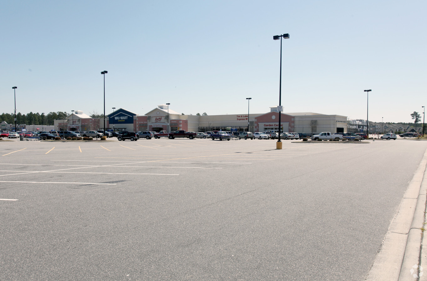
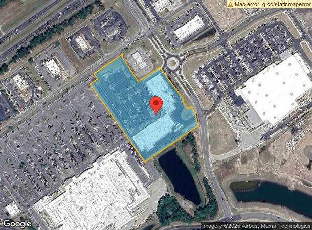
Property Record
1114 New Pointe Blvd, Leland, NC 28451
NEARBY LISTINGS FOR SALE OR LEASE
Property Detail
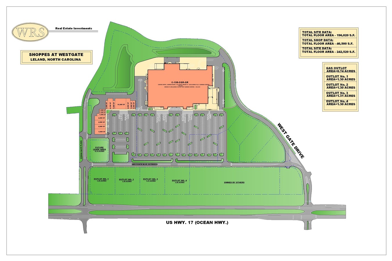
1114 New Pointe Blvd
0470002420
Leland Retail Investment Llc
Stripcommercialcenter
SHOPS 5.48 ACRES PLAT 32/514
X
Brunswick
3720219600K
North Carolina
2023
5.48 AC
2024
Leland
020201
Wilmington
26,960 SF
Myrtle Beach-Conway-North Myrtle Beach, SC-NC
DEMOGRAPHICS near 1114 New Pointe Blvd
1 Mile
3 Mile
5 Mile
2024 Total Population
3,922
28,124
46,901
2029 Population
5,068
36,352
58,495
Pop Growth 2024-2029
+ 29.22%
+ 29.26%
+ 24.72%
Average Age
45
45
44
2024 Total Households
1,798
11,953
20,988
HH Growth 2024-2029
+ 29.03%
+ 29.11%
+ 23.97%
Median Household Inc
$71,574
$75,362
$69,203
Avg Household Size
2.20
2.30
2.20
2024 Avg HH Vehicles
2.00
2.00
2.00
Median Home Value
$320,326
$299,556
$284,940
Median Year Built
2007
2007
2003
Nearby Places
- Restaurants
- Banks
- Shops
- Fitness
- Groceries
PUBLIC TRANSPORTATION
AIRPORT
Wilmington International
DRIVE
WALK
Distance
Wilmington International
24 min
11.9 mi
Freight Ports
Port of Wilmington
DRIVE
WALK
Distance
Port of Wilmington
14 min
7.6 mi
SALE & LEASE HISTORY
LISTING DATE
SALE/LEASE

Sep 27, 2017
For Lease
Jun 18, 2024
For Lease
Nearby Properties
Address
Land Use
TOTAL SIZE
Lot Size
Zoning
Address
Land Use
TOTAL SIZE
Lot Size
Zoning
1,495 SF
22.50 AC
MF
Address
Land Use
TOTAL SIZE
Lot Size
Zoning
6,839 SF
28.63 AC
MF
Address
Land Use
TOTAL SIZE
Lot Size
Zoning
25,392 SF
15.91 AC
MF
Address
Land Use
TOTAL SIZE
Lot Size
Zoning
50,441 SF
19.08 AC
MF
Address
Land Use
TOTAL SIZE
Lot Size
Zoning
23,868 SF
15.20 AC
CLD
Address
Land Use
TOTAL SIZE
Lot Size
Zoning
206,487 SF
10.68 AC
MF
Address
Land Use
TOTAL SIZE
Lot Size
Zoning
16,152 SF
25.44 AC
MF
Address
Land Use
TOTAL SIZE
Lot Size
Zoning
170,188 SF
59.74 AC
OI
Address
Land Use
TOTAL SIZE
Lot Size
Zoning
448.80 AC
MF
Address
Land Use
TOTAL SIZE
Lot Size
Zoning
10,122 SF
8.46 AC
MF
Address
Land Use
TOTAL SIZE
Lot Size
Zoning
207,055 SF
28.96 AC
CBD
Address
Land Use
TOTAL SIZE
Lot Size
Zoning
103,751 SF
26.88 AC
R75
Address
Land Use
TOTAL SIZE
Lot Size
Zoning
11,158 SF
2.47 AC
T5
Address
Land Use
TOTAL SIZE
Lot Size
Zoning
25,098 SF
9.54 AC
T4O
Address
Land Use
TOTAL SIZE
Lot Size
Zoning
28,198 SF
6.50 AC
MF
Address
Land Use
TOTAL SIZE
Lot Size
Zoning
81,572 SF
5.53 AC
MF
Address
Land Use
TOTAL SIZE
Lot Size
Zoning
178,677 SF
23.66 AC
C2
Address
Land Use
TOTAL SIZE
Lot Size
Zoning
48,662 SF
11.45 AC
C2
Address
Land Use
TOTAL SIZE
Lot Size
Zoning
106,450 SF
36.50 AC
OI
Address
Land Use
TOTAL SIZE
Lot Size
Zoning
15,132 SF
3.28 AC
T4O
Address
Land Use
TOTAL SIZE
Lot Size
Zoning
54,900 SF
3.55 AC
C2
Address
Land Use
TOTAL SIZE
Lot Size
Zoning
27,930 SF
2.23 AC
T4O
Address
Land Use
TOTAL SIZE
Lot Size
Zoning
10,154 SF
24.38 AC
IG
Address
Land Use
TOTAL SIZE
Lot Size
Zoning
43,792 SF
2.58 AC
C2
Address
Land Use
TOTAL SIZE
Lot Size
Zoning
56,482 SF
1.68 AC
C2
Address
Land Use
TOTAL SIZE
Lot Size
Zoning
4,525 SF
898.02 AC
PUD
Address
Land Use
TOTAL SIZE
Lot Size
Zoning
1,930 SF
6.16 AC
PUD
Address
Land Use
TOTAL SIZE
Lot Size
Zoning
113,225 SF
12.25 AC
C2
Address
Land Use
TOTAL SIZE
Lot Size
Zoning
204,120 SF
16.56 AC
LI
The World's #1 Commercial Real Estate Marketplace
Connect with us
© 2025 CoStar Group
The information above has been obtained from sources believed reliable. While we do not doubt its accuracy we have not verified it and make no guarantee, warranty or representation about it. It is your responsibility to independently confirm its accuracy and completeness. Any projections, opinions, assumptions, or estimates used are for example only and do not represent the current or future performance of the property. The value of this transaction to you depends on tax and other factors which should be evaluated by your tax, financial, and legal advisors. You and your advisors should conduct a careful, independent investigation of the property to determine to your satisfaction the suitability of the property for your needs.