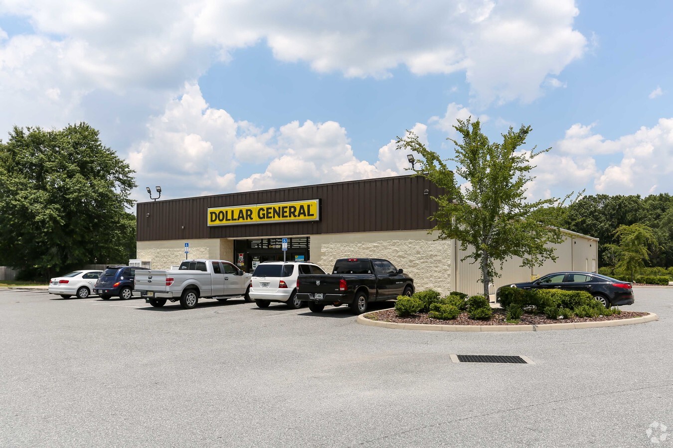
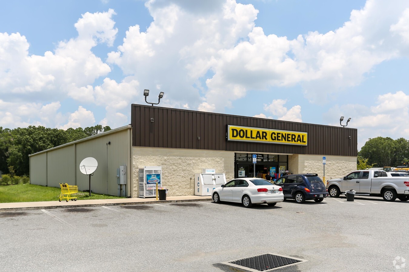
Property Record
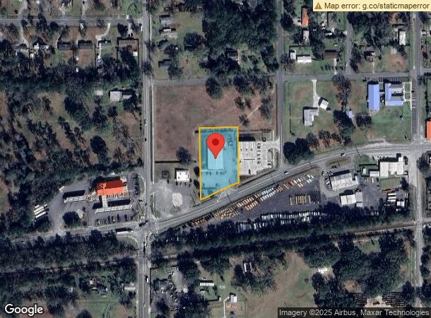
11151 W Beaver St, Jacksonville, FL 32220

NEARBY LISTINGS FOR SALE OR LEASE
-
-
View all Jacksonville listings for sale on LoopNet.com
Property Detail
11151 W Beaver St
Jacksonville, FL
White City S/D
006674-0020
5-71 19-2S-25E 1.3 WHITE CITY SUBDIVISION PT LOTS 15 TO 19 RECD O/R 19914-2489 BLK 17
Storebuilding
Duval
X
Florida
12031C0330H
15-19
2023
1.27 AC
2024
Northwest Jacksonville
011901
Jacksonville (Florida)
9,100 SF
DEMOGRAPHICS near 11151 W Beaver St
1 Mile
3 Mile
5 Mile
2024 Total Population
2,603
23,917
54,721
2029 Population
2,695
25,242
57,522
Pop Growth 2024-2029
+ 3.53%
+ 5.54%
+ 5.12%
Average Age
41
39
38
2024 Total Households
962
8,361
19,636
HH Growth 2024-2029
+ 3.64%
+ 5.56%
+ 5.14%
Median Household Inc
$71,606
$77,107
$68,945
Avg Household Size
2.70
2.80
2.70
2024 Avg HH Vehicles
2.00
2.00
2.00
Median Home Value
$251,456
$243,184
$212,698
Median Year Built
1994
2001
1996
Nearby Places
- Restaurants
- Banks
- Shops
- Fitness
- Groceries
PUBLIC TRANSPORTATION
AIRPORT
Jacksonville International
DRIVE
WALK
Distance
Jacksonville International
33 min
22.5 mi
Freight Ports
Jacksonville Port
DRIVE
WALK
Distance
Jacksonville Port
25 min
16.3 mi
Nearby Properties
Address
Land Use
TOTAL SIZE
Lot Size
Zoning
Address
Land Use
TOTAL SIZE
Lot Size
Zoning
506,876 SF
39.32 AC
IBP
Address
Land Use
TOTAL SIZE
Lot Size
Zoning
421,500 SF
43.21 AC
PUD
Address
Land Use
TOTAL SIZE
Lot Size
Zoning
505,748 SF
94.71 AC
IL
Address
Land Use
TOTAL SIZE
Lot Size
Zoning
509,686 SF
43.32 AC
IL
Address
Land Use
TOTAL SIZE
Lot Size
Zoning
273,608 SF
23.14 AC
PUD
Address
Land Use
TOTAL SIZE
Lot Size
Zoning
480,461 SF
43.54 AC
IL
Address
Land Use
TOTAL SIZE
Lot Size
Zoning
570.50 AC
PUD
Address
Land Use
TOTAL SIZE
Lot Size
Zoning
108,217 SF
178.52 AC
PBF-1
Address
Land Use
TOTAL SIZE
Lot Size
Zoning
2,288 SF
373.54 AC
PBF-1
Address
Land Use
TOTAL SIZE
Lot Size
Zoning
878.69 AC
PUD
Address
Land Use
TOTAL SIZE
Lot Size
Zoning
160,778 SF
25.46 AC
IL
Address
Land Use
TOTAL SIZE
Lot Size
Zoning
30,789 SF
2.10 AC
PUD
Address
Land Use
TOTAL SIZE
Lot Size
Zoning
365.57 AC
PUD
Address
Land Use
TOTAL SIZE
Lot Size
Zoning
307.14 AC
PUD
Address
Land Use
TOTAL SIZE
Lot Size
Zoning
29,022 SF
3.17 AC
PUD
Address
Land Use
TOTAL SIZE
Lot Size
Zoning
171.06 AC
PUD
Address
Land Use
TOTAL SIZE
Lot Size
Zoning
33,424 SF
2.97 AC
PUD
Address
Land Use
TOTAL SIZE
Lot Size
Zoning
76,718 SF
8.89 AC
RR-ACRE
Address
Land Use
TOTAL SIZE
Lot Size
Zoning
53,405 SF
6.04 AC
PUD
Address
Land Use
TOTAL SIZE
Lot Size
Zoning
53,527 SF
10.89 AC
CCG-1
Address
Land Use
TOTAL SIZE
Lot Size
Zoning
602.71 AC
PUD
Address
Land Use
TOTAL SIZE
Lot Size
Zoning
26,961 SF
1.36 AC
PUD
Address
Land Use
TOTAL SIZE
Lot Size
Zoning
36,354 SF
3.72 AC
CCG-1
Address
Land Use
TOTAL SIZE
Lot Size
Zoning
528.99 AC
PUD
Address
Land Use
TOTAL SIZE
Lot Size
Zoning
404.50 AC
PUD
Address
Land Use
TOTAL SIZE
Lot Size
Zoning
153,671 SF
27.09 AC
IL
Address
Land Use
TOTAL SIZE
Lot Size
Zoning
13.29 AC
PUD
Address
Land Use
TOTAL SIZE
Lot Size
Zoning
161.20 AC
PUD
Address
Land Use
TOTAL SIZE
Lot Size
Zoning
43.40 AC
PUD
Address
Land Use
TOTAL SIZE
Lot Size
Zoning
307,732 SF
41.23 AC
IL
The World's #1 Commercial Real Estate Marketplace
Connect with us
© 2025 CoStar Group
The information above has been obtained from sources believed reliable. While we do not doubt its accuracy we have not verified it and make no guarantee, warranty or representation about it. It is your responsibility to independently confirm its accuracy and completeness. Any projections, opinions, assumptions, or estimates used are for example only and do not represent the current or future performance of the property. The value of this transaction to you depends on tax and other factors which should be evaluated by your tax, financial, and legal advisors. You and your advisors should conduct a careful, independent investigation of the property to determine to your satisfaction the suitability of the property for your needs.