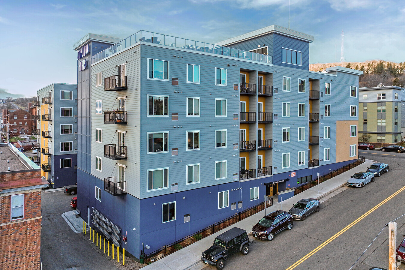
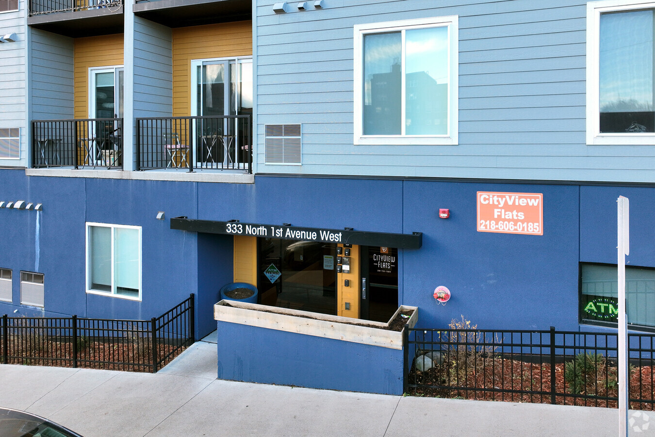
Property Record
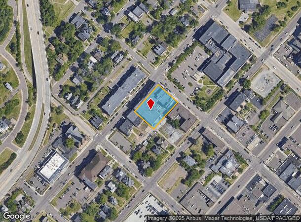
112 W 4Th St W, Duluth, MN 55806
NEARBY LISTINGS FOR SALE OR LEASE
-
-
View all Duluth listings for sale on LoopNet.com
Property Detail
112 W 4Th St W
Duluth
Duluth Proper 1St Div West 4Th
Duluth, MN-WI
LOTS 18, 20, 22 AND THE EASTERLY 46 FEET OFLOT 24 SERIAL #
010100000400
St Louis
Apartment
Minnesota
2024
18,20
2023
0.32 AC
001800
Central Hillside
113,615 SF
DEMOGRAPHICS near 112 W 4Th St W
1 Mile
3 Mile
5 Mile
2024 Total Population
10,431
46,789
79,726
2029 Population
10,407
46,214
78,661
Pop Growth 2024-2029
(0.23%)
(1.23%)
(1.34%)
Average Age
38
37
39
2024 Total Households
5,503
20,154
34,247
HH Growth 2024-2029
0.00%
(1.25%)
(1.38%)
Median Household Inc
$32,876
$49,452
$56,390
Avg Household Size
1.70
2.00
2.10
2024 Avg HH Vehicles
1.00
2.00
2.00
Median Home Value
$173,723
$217,158
$212,533
Median Year Built
1949
1953
1952
Nearby Places
- Restaurants
- Banks
- Shops
- Fitness
- Groceries
PUBLIC TRANSPORTATION
AIRPORT
Duluth International
DRIVE
WALK
Distance
Duluth International
21 min
8.3 mi
Freight Ports
Port Milwaukee
DRIVE
WALK
Distance
Port Milwaukee
453 min
398.9 mi
Nearby Properties
Address
Land Use
TOTAL SIZE
Lot Size
Zoning
Address
Land Use
TOTAL SIZE
Lot Size
Zoning
539,170 SF
0.48 AC
Address
Land Use
TOTAL SIZE
Lot Size
Zoning
129,721 SF
146 AC
Address
Land Use
TOTAL SIZE
Lot Size
Zoning
338,800 SF
0.17 AC
Address
Land Use
TOTAL SIZE
Lot Size
Zoning
549,883 SF
18.72 AC
Address
Land Use
TOTAL SIZE
Lot Size
Zoning
391,335 SF
20 AC
Address
Land Use
TOTAL SIZE
Lot Size
Zoning
524,275 SF
38.23 AC
Address
Land Use
TOTAL SIZE
Lot Size
Zoning
372,356 SF
1.35 AC
Address
Land Use
TOTAL SIZE
Lot Size
Zoning
134,100 SF
0.17 AC
Address
Land Use
TOTAL SIZE
Lot Size
Zoning
148,777 SF
1.19 AC
Address
Land Use
TOTAL SIZE
Lot Size
Zoning
248,716 SF
1.02 AC
Address
Land Use
TOTAL SIZE
Lot Size
Zoning
195,455 SF
54.06 AC
Address
Land Use
TOTAL SIZE
Lot Size
Zoning
143,370 SF
8.69 AC
Address
Land Use
TOTAL SIZE
Lot Size
Zoning
68,296 SF
0.38 AC
Address
Land Use
TOTAL SIZE
Lot Size
Zoning
132,316 SF
2.13 AC
Address
Land Use
TOTAL SIZE
Lot Size
Zoning
40,835 SF
0.33 AC
Address
Land Use
TOTAL SIZE
Lot Size
Zoning
203,540 SF
0.24 AC
Address
Land Use
TOTAL SIZE
Lot Size
Zoning
32,824 SF
117.72 AC
Address
Land Use
TOTAL SIZE
Lot Size
Zoning
178,104 SF
0.95 AC
Address
Land Use
TOTAL SIZE
Lot Size
Zoning
178,184 SF
20 AC
Address
Land Use
TOTAL SIZE
Lot Size
Zoning
232,586 SF
0.16 AC
Address
Land Use
TOTAL SIZE
Lot Size
Zoning
91,053 SF
0.60 AC
Address
Land Use
TOTAL SIZE
Lot Size
Zoning
118,418 SF
13.62 AC
Address
Land Use
TOTAL SIZE
Lot Size
Zoning
175,168 SF
0.16 AC
Address
Land Use
TOTAL SIZE
Lot Size
Zoning
50,132 SF
3.31 AC
R3
Address
Land Use
TOTAL SIZE
Lot Size
Zoning
107,796 SF
9.18 AC
Address
Land Use
TOTAL SIZE
Lot Size
Zoning
144,760 SF
0.56 AC
C4
Address
Land Use
TOTAL SIZE
Lot Size
Zoning
77,816 SF
4.43 AC
Address
Land Use
TOTAL SIZE
Lot Size
Zoning
82,119 SF
5.21 AC
Address
Land Use
TOTAL SIZE
Lot Size
Zoning
102,792 SF
0.80 AC
The World's #1 Commercial Real Estate Marketplace
Connect with us
© 2025 CoStar Group
The information above has been obtained from sources believed reliable. While we do not doubt its accuracy we have not verified it and make no guarantee, warranty or representation about it. It is your responsibility to independently confirm its accuracy and completeness. Any projections, opinions, assumptions, or estimates used are for example only and do not represent the current or future performance of the property. The value of this transaction to you depends on tax and other factors which should be evaluated by your tax, financial, and legal advisors. You and your advisors should conduct a careful, independent investigation of the property to determine to your satisfaction the suitability of the property for your needs.