Property Record
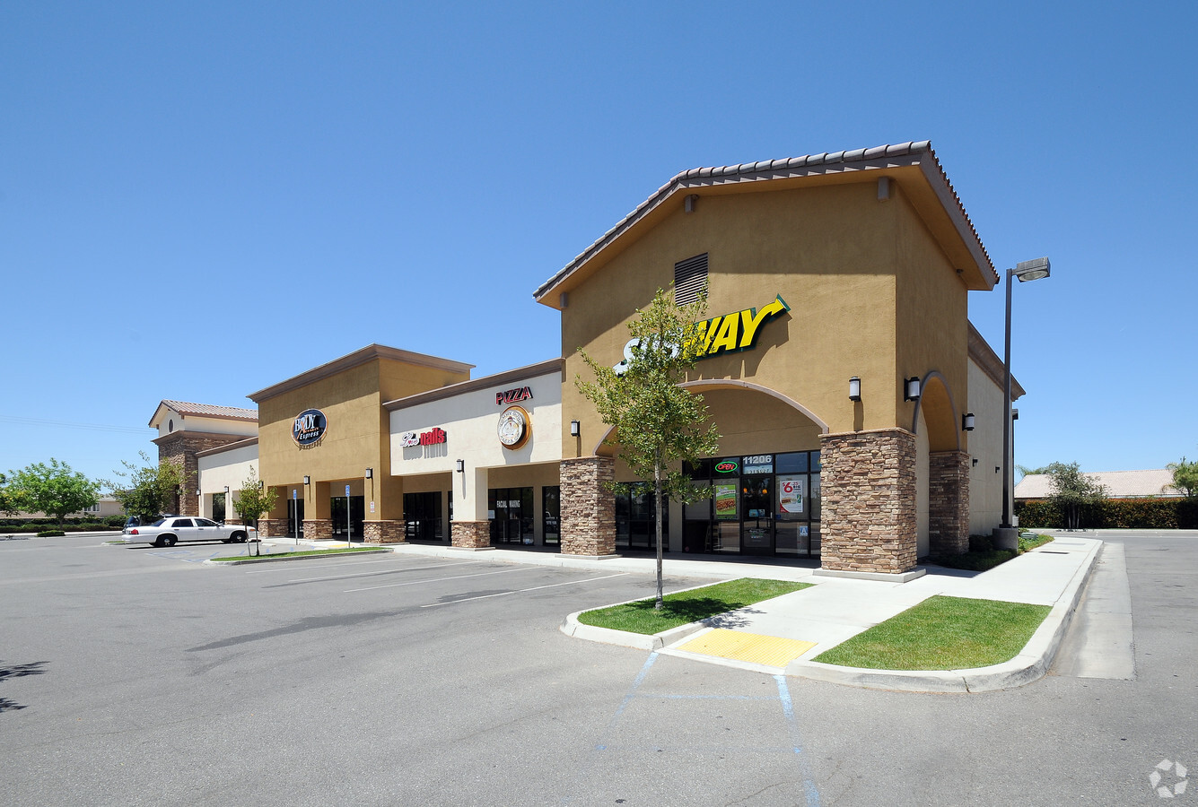
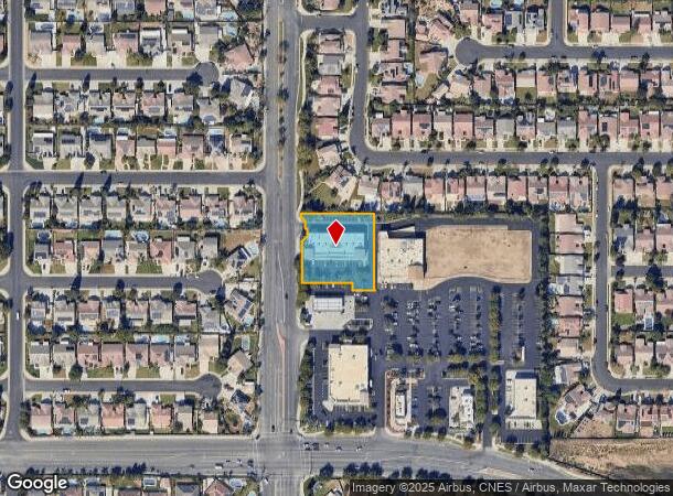
11206 Olive Dr, Bakersfield, CA 93312
NEARBY LISTINGS FOR SALE OR LEASE
Property Detail
11206 Olive Dr
525-610-07-00-4
PARCEL MAP 11729 , LOT 1
Regionalshoppingcenterormallwithanchorstore
Kern
X
California
06029C1800E
1
2023
0.98 AC
2024
Northwest Bakersfield
003818
Bakersfield
9,660 SF
Bakersfield, CA
DEMOGRAPHICS near 11206 Olive Dr
1 Mile
3 Mile
5 Mile
2024 Total Population
14,564
62,418
105,385
2029 Population
14,433
62,177
105,257
Pop Growth 2024-2029
(0.90%)
(0.39%)
(0.12%)
Average Age
34
36
37
2024 Total Households
4,256
20,178
34,809
HH Growth 2024-2029
(1.01%)
(0.48%)
(0.20%)
Median Household Inc
$132,121
$111,435
$103,203
Avg Household Size
3.40
3.10
3.00
2024 Avg HH Vehicles
3.00
2.00
2.00
Median Home Value
$372,934
$367,010
$376,410
Median Year Built
2004
2000
1998
Nearby Places
- Restaurants
- Banks
- Shops
- Fitness
- Groceries
PUBLIC TRANSPORTATION
COMMUTER RAIL
Bakersfield (San Joaquins - Amtrak)
DRIVE
WALK
Distance
Bakersfield (San Joaquins - Amtrak)
15 min
8.7 mi
AIRPORT
Meadows Field
DRIVE
WALK
Distance
Meadows Field
15 min
5.9 mi
Freight Ports
The Port of Hueneme
DRIVE
WALK
Distance
The Port of Hueneme
162 min
129.1 mi
SALE & LEASE HISTORY
LISTING DATE
SALE/LEASE

Aug 03, 2017
For Lease
Nearby Properties
Address
Land Use
TOTAL SIZE
Lot Size
Zoning
Address
Land Use
TOTAL SIZE
Lot Size
Zoning
1 SF
14.26 AC
R-2 PUD
Address
Land Use
TOTAL SIZE
Lot Size
Zoning
386,282 SF
14.05 AC
Address
Land Use
TOTAL SIZE
Lot Size
Zoning
134,728 SF
7.56 AC
R3
Address
Land Use
TOTAL SIZE
Lot Size
Zoning
3,497 SF
31.27 AC
E
Address
Land Use
TOTAL SIZE
Lot Size
Zoning
1,949 SF
6.43 AC
R-2
Address
Land Use
TOTAL SIZE
Lot Size
Zoning
144,414 SF
11.90 AC
PCD
Address
Land Use
TOTAL SIZE
Lot Size
Zoning
92,953 SF
13.59 AC
C2
Address
Land Use
TOTAL SIZE
Lot Size
Zoning
83,650 SF
2.43 AC
C-2
Address
Land Use
TOTAL SIZE
Lot Size
Zoning
50,949 SF
78.05 AC
M-2
Address
Land Use
TOTAL SIZE
Lot Size
Zoning
168,559 SF
5.34 AC
M-2
Address
Land Use
TOTAL SIZE
Lot Size
Zoning
86,729 SF
8.59 AC
C2
Address
Land Use
TOTAL SIZE
Lot Size
Zoning
115,058 SF
10.95 AC
Address
Land Use
TOTAL SIZE
Lot Size
Zoning
1,860 SF
7.86 AC
Address
Land Use
TOTAL SIZE
Lot Size
Zoning
88,255 SF
6.24 AC
C-2
Address
Land Use
TOTAL SIZE
Lot Size
Zoning
57,560 SF
5.53 AC
C1
Address
Land Use
TOTAL SIZE
Lot Size
Zoning
56,750 SF
5.27 AC
C2
Address
Land Use
TOTAL SIZE
Lot Size
Zoning
58,000 SF
1.94 AC
C-2
Address
Land Use
TOTAL SIZE
Lot Size
Zoning
7,500 SF
3.28 AC
M-2 PD
Address
Land Use
TOTAL SIZE
Lot Size
Zoning
43,000 SF
3.18 AC
C2
Address
Land Use
TOTAL SIZE
Lot Size
Zoning
55,042 SF
0.49 AC
M1
Address
Land Use
TOTAL SIZE
Lot Size
Zoning
58,294 SF
5.33 AC
C1
Address
Land Use
TOTAL SIZE
Lot Size
Zoning
41,177 SF
4.59 AC
C-2 PCD
Address
Land Use
TOTAL SIZE
Lot Size
Zoning
3,870 SF
17.53 AC
C-2
Address
Land Use
TOTAL SIZE
Lot Size
Zoning
11,127 SF
2.62 AC
R-2
Address
Land Use
TOTAL SIZE
Lot Size
Zoning
50,547 SF
5.17 AC
C2 PD
Address
Land Use
TOTAL SIZE
Lot Size
Zoning
9,535 SF
2.58 AC
C2
Address
Land Use
TOTAL SIZE
Lot Size
Zoning
8,361 SF
3.42 AC
C2
Address
Land Use
TOTAL SIZE
Lot Size
Zoning
22,290 SF
23.55 AC
E
Address
Land Use
TOTAL SIZE
Lot Size
Zoning
18,954 SF
2.23 AC
R-2
Address
Land Use
TOTAL SIZE
Lot Size
Zoning
47,190 SF
3.61 AC
C2
The World's #1 Commercial Real Estate Marketplace
Connect with us
© 2025 CoStar Group
The information above has been obtained from sources believed reliable. While we do not doubt its accuracy we have not verified it and make no guarantee, warranty or representation about it. It is your responsibility to independently confirm its accuracy and completeness. Any projections, opinions, assumptions, or estimates used are for example only and do not represent the current or future performance of the property. The value of this transaction to you depends on tax and other factors which should be evaluated by your tax, financial, and legal advisors. You and your advisors should conduct a careful, independent investigation of the property to determine to your satisfaction the suitability of the property for your needs.