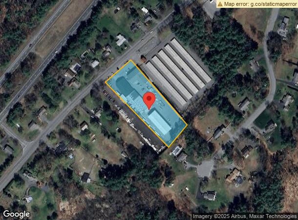
Property Record
1123 Bernardston Rd, Greenfield, MA 01301

NEARBY LISTINGS FOR SALE OR LEASE
Property Detail
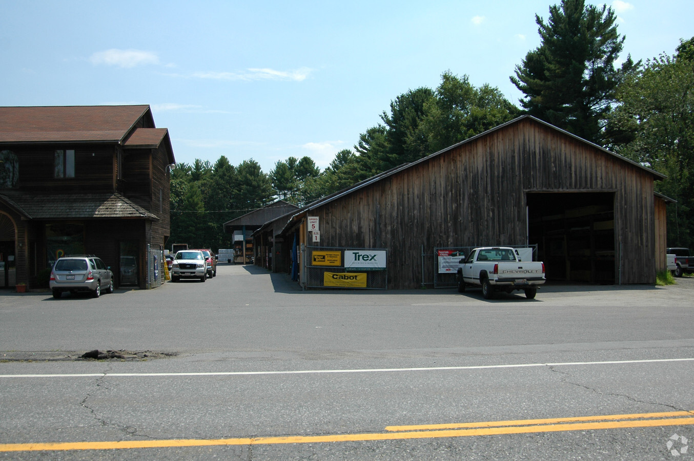
1123 Bernardston Rd
GREE-000011R-000012
Franklin
Lumberyard
Massachusetts
2024
2.10 AC
2024
Franklin County
041100
Hartford
13,188 SF
Greenfield Town, MA
DEMOGRAPHICS near 1123 Bernardston Rd
1 Mile
3 Mile
5 Mile
2024 Total Population
736
10,526
27,356
2029 Population
740
10,463
27,193
Pop Growth 2024-2029
+ 0.54%
(0.60%)
(0.60%)
Average Age
47
45
45
2024 Total Households
317
4,620
12,397
HH Growth 2024-2029
+ 0.63%
(0.61%)
(0.55%)
Median Household Inc
$89,244
$70,763
$62,009
Avg Household Size
2.20
2.20
2.10
2024 Avg HH Vehicles
2.00
2.00
2.00
Median Home Value
$304,032
$269,909
$254,156
Median Year Built
1962
1952
1951
Nearby Places
- Restaurants
- Banks
- Shops
- Fitness
- Groceries
PUBLIC TRANSPORTATION
COMMUTER RAIL
Greenfield Amtrak Station (Valley Flyer - Amtrak, Vermonter - Amtrak)
DRIVE
WALK
Distance
Greenfield Amtrak Station (Valley Flyer - Amtrak, Vermonter - Amtrak)
7 min
4.3 mi
Freight Ports
Albany, NY Port
DRIVE
WALK
Distance
Albany, NY Port
142 min
116.5 mi
Nearby Properties
Address
Land Use
TOTAL SIZE
Lot Size
Zoning
Address
Land Use
TOTAL SIZE
Lot Size
Zoning
160,366 SF
56.38 AC
RB
Address
Land Use
TOTAL SIZE
Lot Size
Zoning
159,991 SF
44 AC
RB
Address
Land Use
TOTAL SIZE
Lot Size
Zoning
173,646 SF
21.77 AC
RA
Address
Land Use
TOTAL SIZE
Lot Size
Zoning
2 AC
R1
Address
Land Use
TOTAL SIZE
Lot Size
Zoning
40.50 AC
ID
Address
Land Use
TOTAL SIZE
Lot Size
Zoning
19,431 SF
15.09 AC
B
Address
Land Use
TOTAL SIZE
Lot Size
Zoning
32,911 SF
10.39 AC
RE
Address
Land Use
TOTAL SIZE
Lot Size
Zoning
60,844 SF
15.31 AC
GC
Address
Land Use
TOTAL SIZE
Lot Size
Zoning
85,138 SF
19.70 AC
PI
Address
Land Use
TOTAL SIZE
Lot Size
Zoning
78,589 SF
15 AC
PI
Address
Land Use
TOTAL SIZE
Lot Size
Zoning
32,409 SF
11.70 AC
RA
Address
Land Use
TOTAL SIZE
Lot Size
Zoning
53,952 SF
5.51 AC
LC
Address
Land Use
TOTAL SIZE
Lot Size
Zoning
74,284 SF
3.77 AC
LC
Address
Land Use
TOTAL SIZE
Lot Size
Zoning
54,340 SF
13.92 AC
PI
Address
Land Use
TOTAL SIZE
Lot Size
Zoning
34,076 SF
10.37 AC
RE
Address
Land Use
TOTAL SIZE
Lot Size
Zoning
54,998 SF
4.84 AC
I
Address
Land Use
TOTAL SIZE
Lot Size
Zoning
25,851 SF
1.92 AC
R1
Address
Land Use
TOTAL SIZE
Lot Size
Zoning
12,258 SF
1.60 AC
CB
Address
Land Use
TOTAL SIZE
Lot Size
Zoning
37,439 SF
10.01 AC
RA
Address
Land Use
TOTAL SIZE
Lot Size
Zoning
50,400 SF
3.23 AC
GC
Address
Land Use
TOTAL SIZE
Lot Size
Zoning
40,120 SF
1.05 AC
CB
Address
Land Use
TOTAL SIZE
Lot Size
Zoning
15,332 SF
3.52 AC
RE
Address
Land Use
TOTAL SIZE
Lot Size
Zoning
41,105 SF
1.03 AC
GC
Address
Land Use
TOTAL SIZE
Lot Size
Zoning
25,384 SF
16.65 AC
PI
Address
Land Use
TOTAL SIZE
Lot Size
Zoning
12,807 SF
1.56 AC
LC
Address
Land Use
TOTAL SIZE
Lot Size
Zoning
24,020 SF
5.04 AC
B
Address
Land Use
TOTAL SIZE
Lot Size
Zoning
35,500 SF
5.06 AC
ID
Address
Land Use
TOTAL SIZE
Lot Size
Zoning
26,604 SF
4.80 AC
PI
Address
Land Use
TOTAL SIZE
Lot Size
Zoning
23,106 SF
0.57 AC
NB
Address
Land Use
TOTAL SIZE
Lot Size
Zoning
3,136 SF
3.04 AC
NB
The World's #1 Commercial Real Estate Marketplace
Connect with us
© 2025 CoStar Group
The information above has been obtained from sources believed reliable. While we do not doubt its accuracy we have not verified it and make no guarantee, warranty or representation about it. It is your responsibility to independently confirm its accuracy and completeness. Any projections, opinions, assumptions, or estimates used are for example only and do not represent the current or future performance of the property. The value of this transaction to you depends on tax and other factors which should be evaluated by your tax, financial, and legal advisors. You and your advisors should conduct a careful, independent investigation of the property to determine to your satisfaction the suitability of the property for your needs.