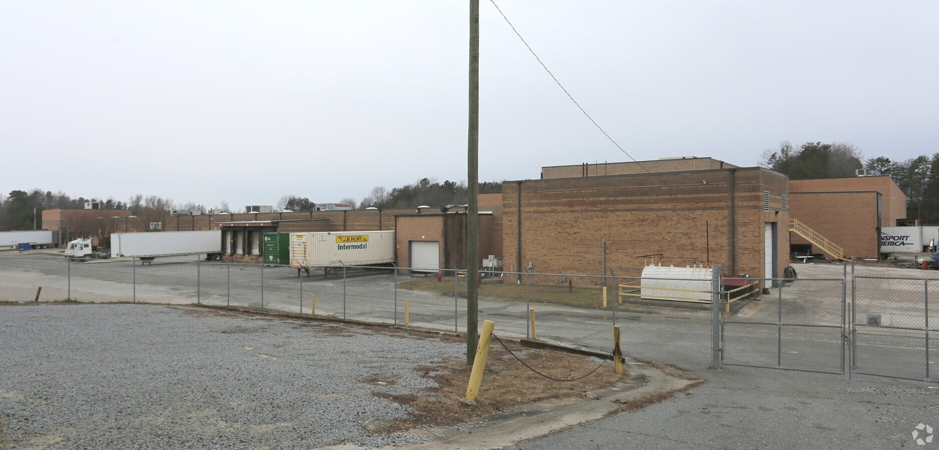
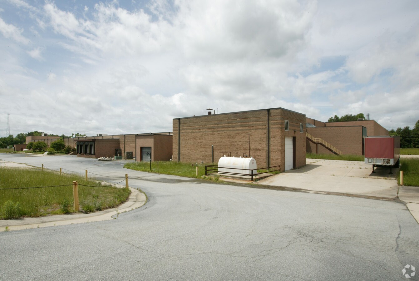
Property Record
1124 Elon Pl, High Point, NC 27260

NEARBY LISTINGS FOR SALE OR LEASE
Property Detail
1124 Elon Pl
Greensboro-High Point, NC
Wayne Mcdonald Contractor
0202922
PT TR A PB50-75 15.32AC
Industrialgeneral
Guilford
X
North Carolina
3710782000J
4
2024
15.32 AC
2023
High Point/SW Guilford Cty
016410
Greensboro/Winston-Salem
146,489 SF
DEMOGRAPHICS near 1124 Elon Pl
1 Mile
3 Mile
5 Mile
2024 Total Population
4,853
35,177
98,416
2029 Population
4,810
35,276
99,065
Pop Growth 2024-2029
(0.89%)
+ 0.28%
+ 0.66%
Average Age
38
39
39
2024 Total Households
1,859
13,440
38,278
HH Growth 2024-2029
(0.86%)
+ 0.28%
+ 0.68%
Median Household Inc
$61,387
$42,168
$50,651
Avg Household Size
2.60
2.50
2.40
2024 Avg HH Vehicles
2.00
2.00
2.00
Median Home Value
$143,545
$129,295
$165,943
Median Year Built
1983
1972
1977
Nearby Places
- Restaurants
- Banks
- Shops
- Fitness
- Groceries
PUBLIC TRANSPORTATION
COMMUTER RAIL
High Point Station (Piedmont - North Carolina by Train (NC Train))
DRIVE
WALK
Distance
High Point Station (Piedmont - North Carolina by Train (NC Train))
9 min
4.2 mi
AIRPORT
Piedmont Triad International
DRIVE
WALK
Distance
Piedmont Triad International
27 min
14.6 mi
Freight Ports
Port of Wilmington
DRIVE
WALK
Distance
Port of Wilmington
251 min
212.3 mi
Nearby Properties
Address
Land Use
TOTAL SIZE
Lot Size
Zoning
Address
Land Use
TOTAL SIZE
Lot Size
Zoning
264,860 SF
62.75 AC
PI
Address
Land Use
TOTAL SIZE
Lot Size
Zoning
419,281 SF
25.12 AC
PI
Address
Land Use
TOTAL SIZE
Lot Size
Zoning
805,958 SF
61.42 AC
CU-LI
Address
Land Use
TOTAL SIZE
Lot Size
Zoning
1,259,149 SF
46.12 AC
CU-HB
Address
Land Use
TOTAL SIZE
Lot Size
Zoning
30,322 SF
964.25 AC
PI
Address
Land Use
TOTAL SIZE
Lot Size
Zoning
299,349 SF
21.76 AC
RM-16
Address
Land Use
TOTAL SIZE
Lot Size
Zoning
403,590 SF
72.06 AC
PI
Address
Land Use
TOTAL SIZE
Lot Size
Zoning
473,040 SF
63.60 AC
AG
Address
Land Use
TOTAL SIZE
Lot Size
Zoning
324,986 SF
24.19 AC
CU-HI
Address
Land Use
TOTAL SIZE
Lot Size
Zoning
72,851 SF
9.13 AC
LI
Address
Land Use
TOTAL SIZE
Lot Size
Zoning
113,866 SF
11.53 AC
CU-LI
Address
Land Use
TOTAL SIZE
Lot Size
Zoning
79,740 SF
24.38 AC
LI
Address
Land Use
TOTAL SIZE
Lot Size
Zoning
89,183 SF
17.12 AC
PI
Address
Land Use
TOTAL SIZE
Lot Size
Zoning
131,516 SF
10.78 AC
RM-16
Address
Land Use
TOTAL SIZE
Lot Size
Zoning
53,652 SF
7.84 AC
LI
Address
Land Use
TOTAL SIZE
Lot Size
Zoning
163,309 SF
36.05 AC
R-5
Address
Land Use
TOTAL SIZE
Lot Size
Zoning
63,326 SF
14.81 AC
RS-15
Address
Land Use
TOTAL SIZE
Lot Size
Zoning
186,419 SF
15.42 AC
GB
Address
Land Use
TOTAL SIZE
Lot Size
Zoning
98,287 SF
14.50 AC
CU-RM-8
Address
Land Use
TOTAL SIZE
Lot Size
Zoning
129,612 SF
11.43 AC
RM-16
Address
Land Use
TOTAL SIZE
Lot Size
Zoning
53,097 SF
6.36 AC
CZ-C
Address
Land Use
TOTAL SIZE
Lot Size
Zoning
105,050 SF
9.58 AC
RM-16
Address
Land Use
TOTAL SIZE
Lot Size
Zoning
97,096 SF
2.47 AC
RM-26
Address
Land Use
TOTAL SIZE
Lot Size
Zoning
37,578 SF
36.11 AC
HI
Address
Land Use
TOTAL SIZE
Lot Size
Zoning
130,599 SF
9.85 AC
RM-16
Address
Land Use
TOTAL SIZE
Lot Size
Zoning
122,514 SF
11.09 AC
RM-16
Address
Land Use
TOTAL SIZE
Lot Size
Zoning
82,476 SF
5.37 AC
RM-8
Address
Land Use
TOTAL SIZE
Lot Size
Zoning
94,731 SF
18.81 AC
RM-16
Address
Land Use
TOTAL SIZE
Lot Size
Zoning
203,556 SF
18.40 AC
CZ-RM-16
Address
Land Use
TOTAL SIZE
Lot Size
Zoning
67,511 SF
12.62 AC
CZ-I
The World's #1 Commercial Real Estate Marketplace
Connect with us
© 2025 CoStar Group
The information above has been obtained from sources believed reliable. While we do not doubt its accuracy we have not verified it and make no guarantee, warranty or representation about it. It is your responsibility to independently confirm its accuracy and completeness. Any projections, opinions, assumptions, or estimates used are for example only and do not represent the current or future performance of the property. The value of this transaction to you depends on tax and other factors which should be evaluated by your tax, financial, and legal advisors. You and your advisors should conduct a careful, independent investigation of the property to determine to your satisfaction the suitability of the property for your needs.