Property Record
1127 Oregon Rd, Cortlandt Manor, NY 10567

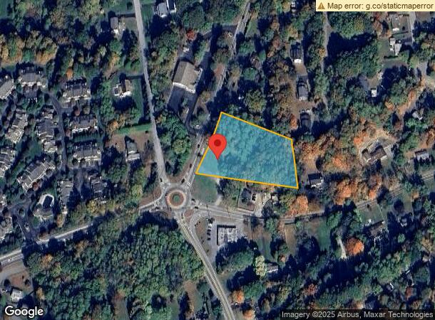
This Property Is For Sale
NEARBY LISTINGS FOR SALE OR LEASE
Property Detail
1127 Oregon Rd
New York-Jersey City-White Plains, NY-NJ
3.00-003-007.01
2289-013-013-00001-000-0024
Westchester
Commercialacreage
New York
X
24.000
36079C0184E
1.89 AC
2023
Northwest
2023
Westchester/So Connecticut
014703
DEMOGRAPHICS near 1127 Oregon Rd
1 Mile
3 Mile
5 Mile
2024 Total Population
6,352
43,499
78,742
2029 Population
6,243
42,509
77,074
Pop Growth 2024-2029
(1.72%)
(2.28%)
(2.12%)
Average Age
42
42
43
2024 Total Households
2,136
15,415
28,488
HH Growth 2024-2029
(1.78%)
(2.47%)
(2.31%)
Median Household Inc
$117,064
$112,528
$113,933
Avg Household Size
2.90
2.70
2.70
2024 Avg HH Vehicles
2.00
2.00
2.00
Median Home Value
$372,172
$386,645
$427,272
Median Year Built
1959
1961
1963
Nearby Places
- Restaurants
- Banks
- Shops
- Fitness
- Groceries
PUBLIC TRANSPORTATION
COMMUTER RAIL
Peekskill Station (Hudson Line - Metro-North Commuter Railroad Company (Metro-North))
DRIVE
WALK
Distance
Peekskill Station (Hudson Line - Metro-North Commuter Railroad Company (Metro-North))
10 min
5.1 mi
Manitou Station (Hudson Line - Metro-North Commuter Railroad Company (Metro-North))
DRIVE
WALK
Distance
Manitou Station (Hudson Line - Metro-North Commuter Railroad Company (Metro-North))
20 min
9.4 mi
AIRPORT
New York Stewart International
DRIVE
WALK
Distance
New York Stewart International
48 min
26.9 mi
Westchester County
DRIVE
WALK
Distance
Westchester County
42 min
29.8 mi
Freight Ports
NY - Red Hook Container Terminal
DRIVE
WALK
Distance
NY - Red Hook Container Terminal
85 min
57.1 mi
Nearby Properties
Address
Land Use
TOTAL SIZE
Lot Size
Zoning
Address
Land Use
TOTAL SIZE
Lot Size
Zoning
10,160 SF
111.83 AC
B2
Address
Land Use
TOTAL SIZE
Lot Size
Zoning
59,267 SF
37.78 AC
R2
Address
Land Use
TOTAL SIZE
Lot Size
Zoning
72,224 SF
34.50 AC
R3
Address
Land Use
TOTAL SIZE
Lot Size
Zoning
41,424 SF
34.56 AC
B2
Address
Land Use
TOTAL SIZE
Lot Size
Zoning
3,854 SF
161.60 AC
PD
Address
Land Use
TOTAL SIZE
Lot Size
Zoning
Address
Land Use
TOTAL SIZE
Lot Size
Zoning
2,809 SF
61.43 AC
PD
Address
Land Use
TOTAL SIZE
Lot Size
Zoning
13,520 SF
1.16 AC
CC1
Address
Land Use
TOTAL SIZE
Lot Size
Zoning
21,466 SF
2.87 AC
CC1
Address
Land Use
TOTAL SIZE
Lot Size
Zoning
13 AC
R1-40
Address
Land Use
TOTAL SIZE
Lot Size
Zoning
4,305 SF
67.05 AC
R3
Address
Land Use
TOTAL SIZE
Lot Size
Zoning
Address
Land Use
TOTAL SIZE
Lot Size
Zoning
5,170 SF
6.60 AC
PD
Address
Land Use
TOTAL SIZE
Lot Size
Zoning
2,616 SF
11 AC
CD
Address
Land Use
TOTAL SIZE
Lot Size
Zoning
2,092 SF
120.03 AC
R3
Address
Land Use
TOTAL SIZE
Lot Size
Zoning
14,058 SF
7.26 AC
PD
Address
Land Use
TOTAL SIZE
Lot Size
Zoning
4,767 SF
179.57 AC
B2
Address
Land Use
TOTAL SIZE
Lot Size
Zoning
Address
Land Use
TOTAL SIZE
Lot Size
Zoning
2,156 SF
25.18 AC
CD
Address
Land Use
TOTAL SIZE
Lot Size
Zoning
18.27 AC
R80
Address
Land Use
TOTAL SIZE
Lot Size
Zoning
4,634 SF
4.82 AC
R2
Address
Land Use
TOTAL SIZE
Lot Size
Zoning
2.70 AC
Address
Land Use
TOTAL SIZE
Lot Size
Zoning
3,957 SF
17.72 AC
R80
Address
Land Use
TOTAL SIZE
Lot Size
Zoning
240.57 AC
CD
Address
Land Use
TOTAL SIZE
Lot Size
Zoning
4,402 SF
5.38 AC
R2
Address
Land Use
TOTAL SIZE
Lot Size
Zoning
9,707 SF
5.51 AC
R80
Address
Land Use
TOTAL SIZE
Lot Size
Zoning
22.61 AC
Address
Land Use
TOTAL SIZE
Lot Size
Zoning
8,834 SF
2.58 AC
CC1
Address
Land Use
TOTAL SIZE
Lot Size
Zoning
4,004 SF
5.79 AC
R2
Address
Land Use
TOTAL SIZE
Lot Size
Zoning
6,186 SF
14.13 AC
R2
The World's #1 Commercial Real Estate Marketplace
Connect with us
© 2025 CoStar Group
The information above has been obtained from sources believed reliable. While we do not doubt its accuracy we have not verified it and make no guarantee, warranty or representation about it. It is your responsibility to independently confirm its accuracy and completeness. Any projections, opinions, assumptions, or estimates used are for example only and do not represent the current or future performance of the property. The value of this transaction to you depends on tax and other factors which should be evaluated by your tax, financial, and legal advisors. You and your advisors should conduct a careful, independent investigation of the property to determine to your satisfaction the suitability of the property for your needs.