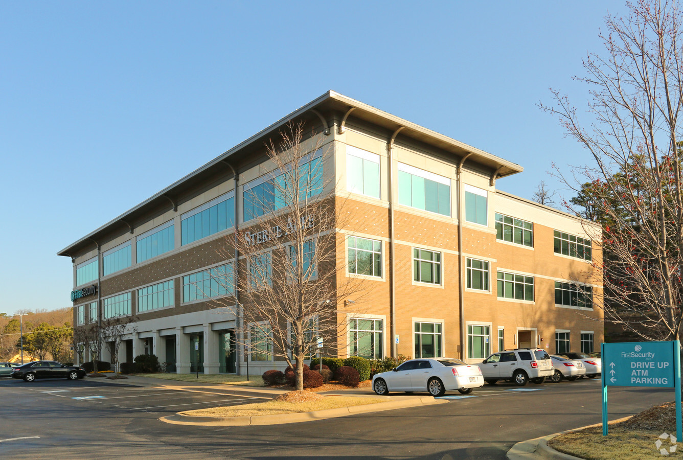
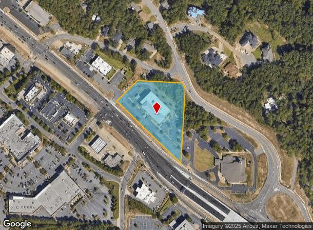
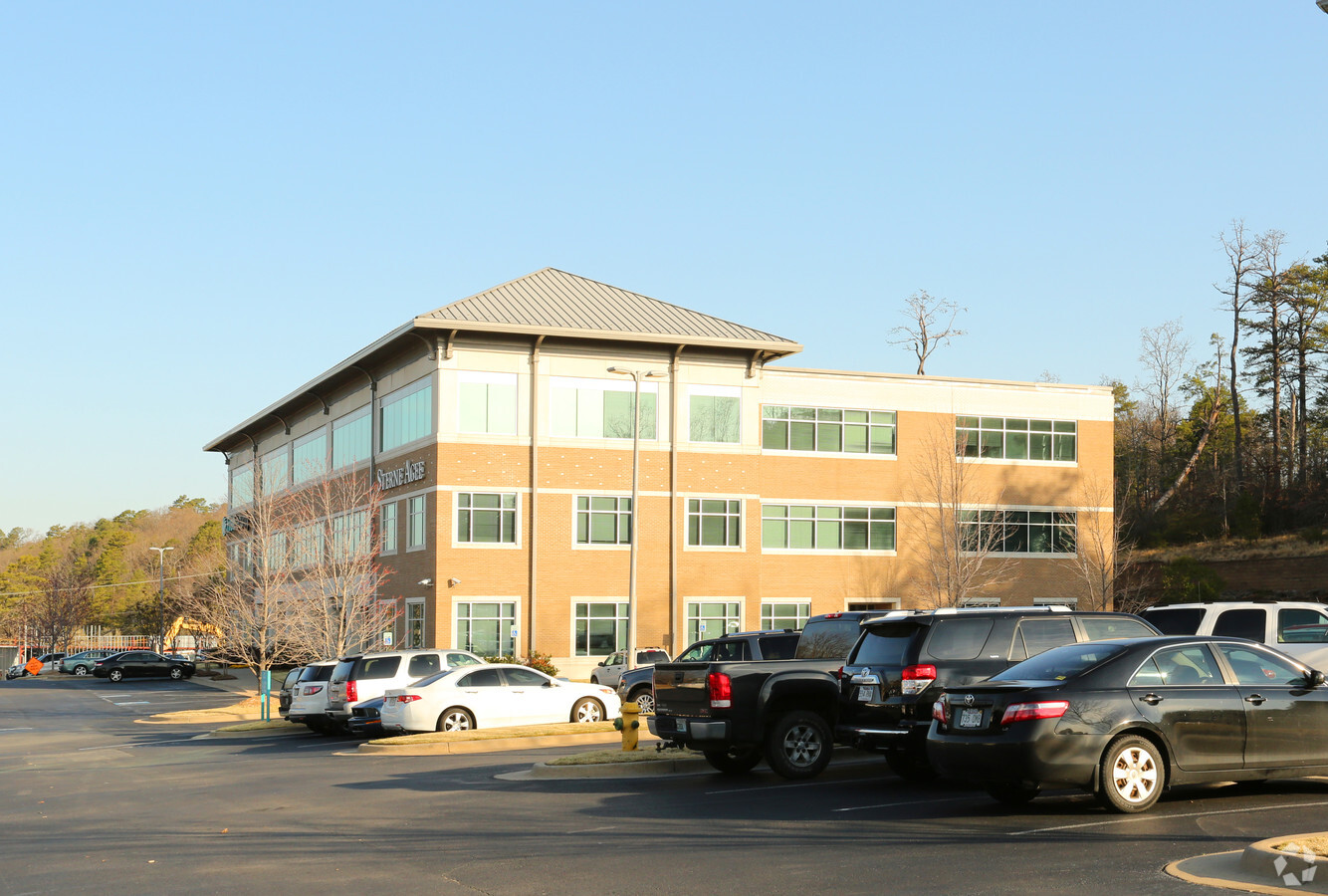
Property Record
11300 Cantrell Rd, Little Rock, AR 72212

Current Lease Availabilities
NEARBY LISTINGS FOR SALE OR LEASE
Property Detail
11300 Cantrell Rd
Little Rock-North Little Rock-Conway, AR
Woodland Hgts
43L-024-00-020-00
PT TR A MPDA COM NE COR TR A N88*20'55"W196' TO POB S03*44'34"W 549.41' TO PT ON N R/W LN HWY 10 (CANTRELL RD) N48*OO'03"W 116.24' N44*00'45"W204.96' N45*15'08"W227.53 N48*24'34"W52.11' N46*41'08"E200.49' S88*20'55"E319.48' TO POB LESS & EXC COM NE C
Officebuilding
Pulaski
X
Arkansas
05119C0317G
a
2023
2.95 AC
2023
West
0042052016
Little Rock/N Little Rock
55,304 SF
DEMOGRAPHICS near 11300 Cantrell Rd
1 Mile
3 Mile
5 Mile
2024 Total Population
4,823
44,710
115,905
2029 Population
4,726
44,206
115,124
Pop Growth 2024-2029
(2.01%)
(1.13%)
(0.67%)
Average Age
39
40
40
2024 Total Households
2,145
20,263
52,507
HH Growth 2024-2029
(2.05%)
(1.11%)
(0.69%)
Median Household Inc
$69,549
$70,009
$72,218
Avg Household Size
2.20
2.20
2.20
2024 Avg HH Vehicles
2.00
2.00
2.00
Median Home Value
$266,311
$258,084
$263,824
Median Year Built
1981
1981
1985
Nearby Places
- Restaurants
- Banks
- Shops
- Fitness
- Groceries
PUBLIC TRANSPORTATION
COMMUTER RAIL
Little Rock Union Station (Texas Eagle - Amtrak)
DRIVE
WALK
Distance
Little Rock Union Station (Texas Eagle - Amtrak)
14 min
8.3 mi
AIRPORT
Bill and Hillary Clinton Ntl/Adams Field
DRIVE
WALK
Distance
Bill and Hillary Clinton Ntl/Adams Field
23 min
14.7 mi
Freight Ports
Port of Shreveport
DRIVE
WALK
Distance
Port of Shreveport
249 min
232.1 mi
Nearby Properties
Address
Land Use
TOTAL SIZE
Lot Size
Zoning
Address
Land Use
TOTAL SIZE
Lot Size
Zoning
286,440 SF
9.98 AC
Address
Land Use
TOTAL SIZE
Lot Size
Zoning
31,596 SF
80.25 AC
Address
Land Use
TOTAL SIZE
Lot Size
Zoning
115,378 SF
30.50 AC
Address
Land Use
TOTAL SIZE
Lot Size
Zoning
124,774 SF
21.05 AC
Address
Land Use
TOTAL SIZE
Lot Size
Zoning
1,974 SF
14.30 AC
Address
Land Use
TOTAL SIZE
Lot Size
Zoning
225,500 SF
18.43 AC
Address
Land Use
TOTAL SIZE
Lot Size
Zoning
80,720 SF
15.39 AC
Address
Land Use
TOTAL SIZE
Lot Size
Zoning
18,749 SF
15.76 AC
Address
Land Use
TOTAL SIZE
Lot Size
Zoning
43,928 SF
26.72 AC
Address
Land Use
TOTAL SIZE
Lot Size
Zoning
102,600 SF
17.29 AC
Address
Land Use
TOTAL SIZE
Lot Size
Zoning
73,197 SF
12.09 AC
Address
Land Use
TOTAL SIZE
Lot Size
Zoning
293,057 SF
20.78 AC
Address
Land Use
TOTAL SIZE
Lot Size
Zoning
114,270 SF
13.51 AC
Address
Land Use
TOTAL SIZE
Lot Size
Zoning
65,208 SF
18.30 AC
Address
Land Use
TOTAL SIZE
Lot Size
Zoning
122,775 SF
9.96 AC
Address
Land Use
TOTAL SIZE
Lot Size
Zoning
155,943 SF
10.59 AC
Address
Land Use
TOTAL SIZE
Lot Size
Zoning
18,904 SF
12.73 AC
Address
Land Use
TOTAL SIZE
Lot Size
Zoning
69,251 SF
24.10 AC
Address
Land Use
TOTAL SIZE
Lot Size
Zoning
33,992 SF
13.15 AC
Address
Land Use
TOTAL SIZE
Lot Size
Zoning
129,239 SF
9.01 AC
Address
Land Use
TOTAL SIZE
Lot Size
Zoning
123,661 SF
14.71 AC
Address
Land Use
TOTAL SIZE
Lot Size
Zoning
19,471 SF
11.29 AC
Address
Land Use
TOTAL SIZE
Lot Size
Zoning
63,140 SF
14.22 AC
Address
Land Use
TOTAL SIZE
Lot Size
Zoning
127,046 SF
5.13 AC
Address
Land Use
TOTAL SIZE
Lot Size
Zoning
93,449 SF
15.21 AC
Address
Land Use
TOTAL SIZE
Lot Size
Zoning
177,410 SF
9.19 AC
Address
Land Use
TOTAL SIZE
Lot Size
Zoning
17,501 SF
15.48 AC
Address
Land Use
TOTAL SIZE
Lot Size
Zoning
93,503 SF
34.50 AC
Address
Land Use
TOTAL SIZE
Lot Size
Zoning
77,018 SF
8.45 AC
Address
Land Use
TOTAL SIZE
Lot Size
Zoning
42,313 SF
5.17 AC
The World's #1 Commercial Real Estate Marketplace
Connect with us
© 2025 CoStar Group
The information above has been obtained from sources believed reliable. While we do not doubt its accuracy we have not verified it and make no guarantee, warranty or representation about it. It is your responsibility to independently confirm its accuracy and completeness. Any projections, opinions, assumptions, or estimates used are for example only and do not represent the current or future performance of the property. The value of this transaction to you depends on tax and other factors which should be evaluated by your tax, financial, and legal advisors. You and your advisors should conduct a careful, independent investigation of the property to determine to your satisfaction the suitability of the property for your needs.