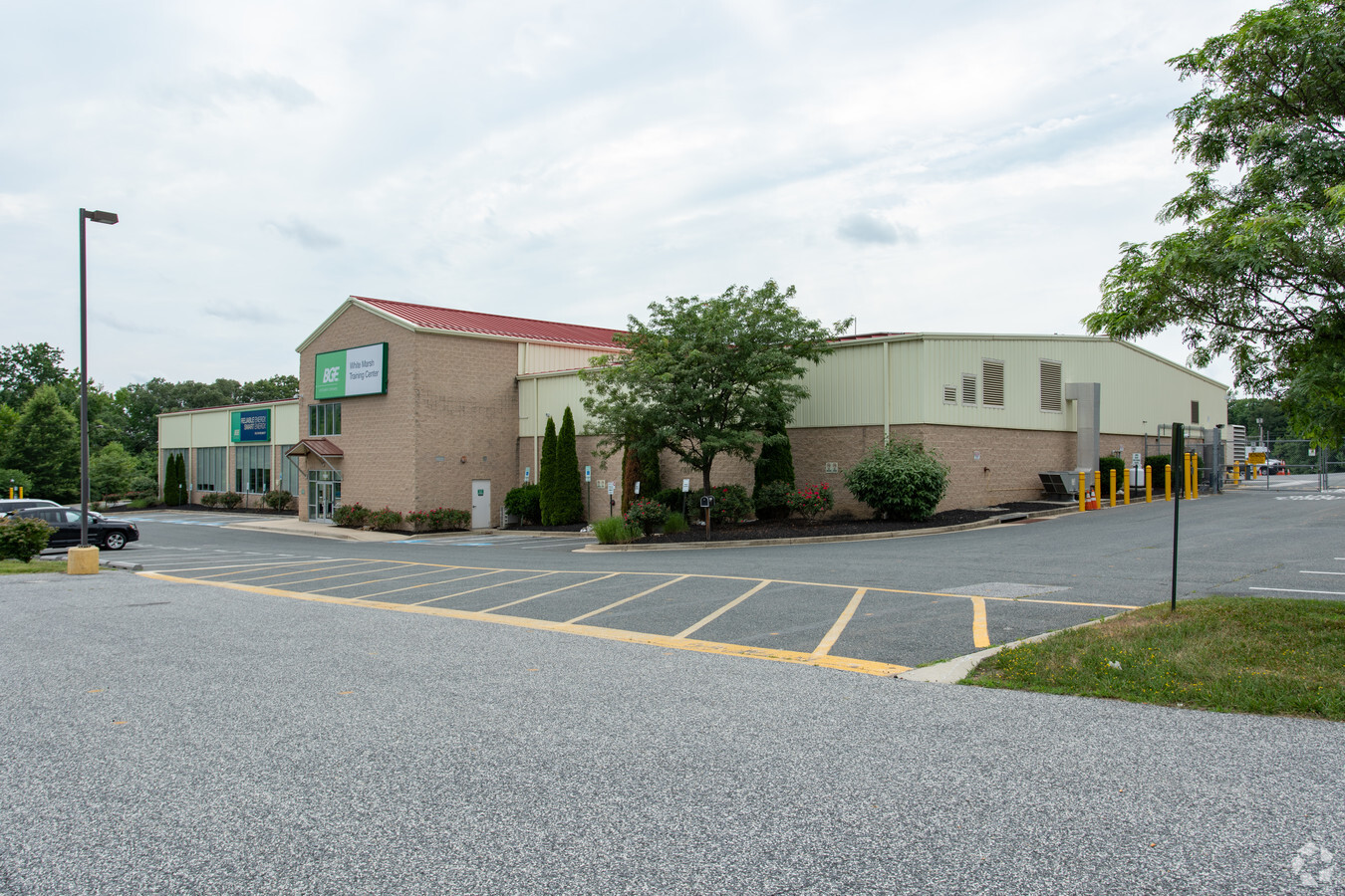
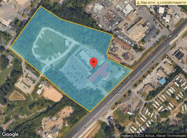
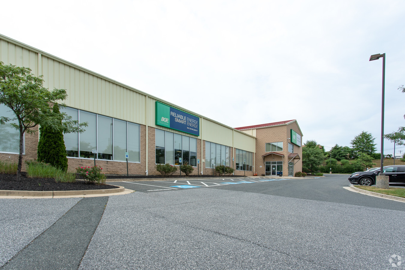
Property Record
11350 Pulaski Hwy, White Marsh, MD 21162
NEARBY LISTINGS FOR SALE OR LEASE
Property Detail
11350 Pulaski Hwy
11-1900006039
15.213 AC
Officebuilding
Baltimore
X
Maryland
2400100295H
15.21 AC
2024
Baltimore County East
2024
Baltimore
411302
Baltimore-Columbia-Towson, MD
52,484 SF
DEMOGRAPHICS near 11350 Pulaski Hwy
1 Mile
3 Mile
5 Mile
2024 Total Population
3,171
32,808
121,218
2029 Population
3,189
32,632
120,470
Pop Growth 2024-2029
+ 0.57%
(0.54%)
(0.62%)
Average Age
38
41
41
2024 Total Households
1,005
12,342
46,134
HH Growth 2024-2029
+ 0.30%
(0.58%)
(0.69%)
Median Household Inc
$140,091
$109,464
$90,616
Avg Household Size
3.10
2.60
2.60
2024 Avg HH Vehicles
2.00
2.00
2.00
Median Home Value
$450,702
$374,711
$317,464
Median Year Built
2003
1993
1985
Nearby Places
- Restaurants
- Banks
- Shops
- Fitness
- Groceries
PUBLIC TRANSPORTATION
COMMUTER RAIL
Martin State Airport (Penn Line - Maryland Area Regional Commuter Trains (The MARC))
DRIVE
WALK
Distance
Martin State Airport (Penn Line - Maryland Area Regional Commuter Trains (The MARC))
10 min
5.9 mi
Edgewood (Penn Line - Maryland Area Regional Commuter Trains (The MARC))
DRIVE
WALK
Distance
Edgewood (Penn Line - Maryland Area Regional Commuter Trains (The MARC))
15 min
8.6 mi
AIRPORT
Baltimore/Washington International Thurgood Marshall
DRIVE
WALK
Distance
Baltimore/Washington International Thurgood Marshall
38 min
25.2 mi
Freight Ports
Port of Baltimore
DRIVE
WALK
Distance
Port of Baltimore
25 min
16.5 mi
Nearby Properties
Address
Land Use
TOTAL SIZE
Lot Size
Zoning
Address
Land Use
TOTAL SIZE
Lot Size
Zoning
504,086 SF
7.48 AC
MH
Address
Land Use
TOTAL SIZE
Lot Size
Zoning
553,984 SF
7.42 AC
Address
Land Use
TOTAL SIZE
Lot Size
Zoning
584,740 SF
32.61 AC
Address
Land Use
TOTAL SIZE
Lot Size
Zoning
225,070 SF
20.65 AC
Address
Land Use
TOTAL SIZE
Lot Size
Zoning
240,121 SF
9.97 AC
Address
Land Use
TOTAL SIZE
Lot Size
Zoning
239,798 SF
11.90 AC
Address
Land Use
TOTAL SIZE
Lot Size
Zoning
222,711 SF
39.21 AC
DR55
Address
Land Use
TOTAL SIZE
Lot Size
Zoning
64,480 SF
20.43 AC
Address
Land Use
TOTAL SIZE
Lot Size
Zoning
12.09 AC
DR5.5
Address
Land Use
TOTAL SIZE
Lot Size
Zoning
9.79 AC
DR5.5
Address
Land Use
TOTAL SIZE
Lot Size
Zoning
100,725 SF
6.30 AC
BL
Address
Land Use
TOTAL SIZE
Lot Size
Zoning
89,522 SF
4.03 AC
Address
Land Use
TOTAL SIZE
Lot Size
Zoning
136,736 SF
9.82 AC
BM
Address
Land Use
TOTAL SIZE
Lot Size
Zoning
59,061 SF
15.68 AC
Address
Land Use
TOTAL SIZE
Lot Size
Zoning
128,400 SF
12.68 AC
Address
Land Use
TOTAL SIZE
Lot Size
Zoning
141,550 SF
23.80 AC
ML
Address
Land Use
TOTAL SIZE
Lot Size
Zoning
103,432 SF
5.53 AC
Address
Land Use
TOTAL SIZE
Lot Size
Zoning
77,574 SF
3.23 AC
Address
Land Use
TOTAL SIZE
Lot Size
Zoning
165,000 SF
13.10 AC
Address
Land Use
TOTAL SIZE
Lot Size
Zoning
136,489 SF
33.41 AC
MLIM
Address
Land Use
TOTAL SIZE
Lot Size
Zoning
69,744 SF
9.19 AC
BL-CS
Address
Land Use
TOTAL SIZE
Lot Size
Zoning
133,775 SF
14.88 AC
BM
Address
Land Use
TOTAL SIZE
Lot Size
Zoning
18,228 SF
2.38 AC
Address
Land Use
TOTAL SIZE
Lot Size
Zoning
50,400 SF
7.13 AC
MH
Address
Land Use
TOTAL SIZE
Lot Size
Zoning
49,704 SF
12.60 AC
Address
Land Use
TOTAL SIZE
Lot Size
Zoning
97,874 SF
3.98 AC
Address
Land Use
TOTAL SIZE
Lot Size
Zoning
35,170 SF
5.50 AC
BM
Address
Land Use
TOTAL SIZE
Lot Size
Zoning
59,400 SF
4.98 AC
MH
Address
Land Use
TOTAL SIZE
Lot Size
Zoning
60,400 SF
6.42 AC
MHIM
Address
Land Use
TOTAL SIZE
Lot Size
Zoning
77,200 SF
13.29 AC
The World's #1 Commercial Real Estate Marketplace
Connect with us
© 2025 CoStar Group
The information above has been obtained from sources believed reliable. While we do not doubt its accuracy we have not verified it and make no guarantee, warranty or representation about it. It is your responsibility to independently confirm its accuracy and completeness. Any projections, opinions, assumptions, or estimates used are for example only and do not represent the current or future performance of the property. The value of this transaction to you depends on tax and other factors which should be evaluated by your tax, financial, and legal advisors. You and your advisors should conduct a careful, independent investigation of the property to determine to your satisfaction the suitability of the property for your needs.