Property Record
114 Smith Rd, Pine City, NY 14871
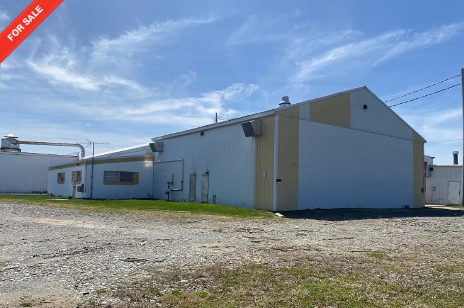

This Property Is For Sale
NEARBY LISTINGS FOR SALE OR LEASE
-
-
View all Pine City listings for sale on LoopNet.com
Property Detail
114 Smith Rd
Elmira, NY
MERGE 30 X 500 FT FROM 29.00-1-2.1
074089-029-000-0001-069-004-0000
Chemung
Manufacturinglight
New York
2023
69.004
2023
6.08 AC
011200
Ithaca/Elmira
13,235 SF
Other Market Areas
DEMOGRAPHICS near 114 Smith Rd
1 Mile
3 Mile
5 Mile
2024 Total Population
868
4,336
17,726
2029 Population
861
4,207
17,060
Pop Growth 2024-2029
(0.81%)
(2.98%)
(3.76%)
Average Age
42
43
45
2024 Total Households
354
1,774
7,470
HH Growth 2024-2029
(1.13%)
(3.16%)
(3.71%)
Median Household Inc
$64,230
$62,108
$68,370
Avg Household Size
2.40
2.40
2.30
2024 Avg HH Vehicles
2.00
2.00
2.00
Median Home Value
$164,835
$173,649
$166,958
Median Year Built
1966
1968
1970
Nearby Places
- Restaurants
- Banks
- Shops
- Fitness
- Groceries
PUBLIC TRANSPORTATION
AIRPORT
Elmira/Corning Regional
DRIVE
WALK
Distance
Elmira/Corning Regional
16 min
10.6 mi
Ithaca Tompkins International
DRIVE
WALK
Distance
Ithaca Tompkins International
53 min
36.4 mi
Freight Ports
Albany, NY Port
DRIVE
WALK
Distance
Albany, NY Port
245 min
204.5 mi
Nearby Properties
Address
Land Use
TOTAL SIZE
Lot Size
Zoning
Address
Land Use
TOTAL SIZE
Lot Size
Zoning
Address
Land Use
TOTAL SIZE
Lot Size
Zoning
128,744 SF
41.25 AC
02 - SINGL
Address
Land Use
TOTAL SIZE
Lot Size
Zoning
24.90 AC
02 - SINGL
Address
Land Use
TOTAL SIZE
Lot Size
Zoning
49,565 SF
15.30 AC
VH02
Address
Land Use
TOTAL SIZE
Lot Size
Zoning
5,387 SF
3.42 AC
TH04
Address
Land Use
TOTAL SIZE
Lot Size
Zoning
9,675 SF
45.93 AC
VH08
Address
Land Use
TOTAL SIZE
Lot Size
Zoning
6,311 SF
223.80 AC
02 - SINGL
Address
Land Use
TOTAL SIZE
Lot Size
Zoning
101,373 SF
6.09 AC
VH08
Address
Land Use
TOTAL SIZE
Lot Size
Zoning
8,968 SF
4.68 AC
02 - SINGL
Address
Land Use
TOTAL SIZE
Lot Size
Zoning
20,000 SF
2.95 AC
VH04
Address
Land Use
TOTAL SIZE
Lot Size
Zoning
9,100 SF
1.61 AC
02 - SINGL
Address
Land Use
TOTAL SIZE
Lot Size
Zoning
560 SF
12.29 AC
02 - SINGL
Address
Land Use
TOTAL SIZE
Lot Size
Zoning
9,306 SF
17.80 AC
03 - MULTI
Address
Land Use
TOTAL SIZE
Lot Size
Zoning
18,432 SF
1.40 AC
VH04
Address
Land Use
TOTAL SIZE
Lot Size
Zoning
9,856 SF
3.50 AC
02 - SINGL
Address
Land Use
TOTAL SIZE
Lot Size
Zoning
3,665 SF
2.20 AC
TH04
Address
Land Use
TOTAL SIZE
Lot Size
Zoning
3,904 SF
11.83 AC
VH08
Address
Land Use
TOTAL SIZE
Lot Size
Zoning
30.76 AC
TH02
Address
Land Use
TOTAL SIZE
Lot Size
Zoning
19,408 SF
2.50 AC
VH08
Address
Land Use
TOTAL SIZE
Lot Size
Zoning
300.90 AC
02 - SINGL
Address
Land Use
TOTAL SIZE
Lot Size
Zoning
30.76 AC
TH02
Address
Land Use
TOTAL SIZE
Lot Size
Zoning
5,688 SF
2.29 AC
TH02
Address
Land Use
TOTAL SIZE
Lot Size
Zoning
304 SF
1.97 AC
02 - SINGL
Address
Land Use
TOTAL SIZE
Lot Size
Zoning
9,088 SF
2.83 AC
02 - SINGL
Address
Land Use
TOTAL SIZE
Lot Size
Zoning
4,298 SF
1.60 AC
TH02
Address
Land Use
TOTAL SIZE
Lot Size
Zoning
0.80 AC
TH08
Address
Land Use
TOTAL SIZE
Lot Size
Zoning
0.80 AC
TH08
Address
Land Use
TOTAL SIZE
Lot Size
Zoning
6,240 SF
3.60 AC
VH04
Address
Land Use
TOTAL SIZE
Lot Size
Zoning
194.60 AC
02 - SINGL
The World's #1 Commercial Real Estate Marketplace
Connect with us
© 2025 CoStar Group
The information above has been obtained from sources believed reliable. While we do not doubt its accuracy we have not verified it and make no guarantee, warranty or representation about it. It is your responsibility to independently confirm its accuracy and completeness. Any projections, opinions, assumptions, or estimates used are for example only and do not represent the current or future performance of the property. The value of this transaction to you depends on tax and other factors which should be evaluated by your tax, financial, and legal advisors. You and your advisors should conduct a careful, independent investigation of the property to determine to your satisfaction the suitability of the property for your needs.